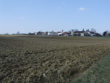
Langensallach
|
Langensallach
Municipality Schernfeld
|
||
|---|---|---|
| Coordinates: 48 ° 55 ′ 32 " N , 11 ° 10 ′ 4" E | ||
| Height : | 539 (535-550) m | |
| Residents : | 83 (2003) | |
| Postal code : | 85132 | |
| Area code : | 08421 | |
|
Location of Langensallach in Bavaria |
||
Langensallach ( Bavarian Soola ) is a district of the Upper Bavarian municipality of Schernfeld in the district of Eichstätt .
Geographical location
Langensallach is located north of the district town of Eichstätt on the plateau of the Franconian Alb at the intersection of the roads Wintershof - Weigersdorf and Workerszell - Preith .
Surrounding places are Seuversholz in the north, Weigersdorf in the north-east, Preith in the east, Lüften in the south-east, Wintershof in the south, Wegscheid in the south-west, Workerszell in the west and Sperberslohe in the north-west .
Place name
The place name is derived from the Middle High German word "salhe" for " Salweide ". Langensallach is therefore the long settlement on a willow bush.
history
A Roman road leading from Pfünz to Weißenburg is visible north of Langensallach as a dirt road.
In a papal confirmation of ownership from 1239 (copy from the 18th century), “Sallhach” is first mentioned as the property of the Rebdorf monastery . After the Hirschberg bailiffs died out in 1305, under Bishop Konrad II von Pfeffenhausen the village court, but not the manor “Salhach”, went to the Eichstätt monastery. In 1448, for example, four farms are listed as part of "Langen Salach" in a Salbuch of the Eichstätt office and the Landvogtei; one belonged to the provost of Rebborf, one to the Heilig-Geist-Spital zu Eichstätt, one to the pastors of Eichstätt (later the Collegiate Foundation "Our Lady") and one was his own. Additional farmsteads were assigned to these (large) farms, so that the village consisted of 16 farms in total. The core floor was 108 hectares . Forest use (wood removal and grazing rights) took place in the Erlingshofer Hut or in the Schernfelder Forest, for which - as in 1506 - Reich maintenance taxes, the so-called Vogthaber (= oats), had to be paid to the Weißenburg office .
During the witch persecution in the Eichstätt monastery , at least one woman from Langensallach was accused as an alleged witch and sentenced to death in 1617.
Around 1800 the Rebdorf Monastery, the Heilig-Geist-Spital Eichstätt, the Collegiatestift ULF Eichstätt, the Hofkastenamt Eichstätt, 1 owner and the community (chapel and shepherd's house) were landlords in the village. Until the end of the Holy Roman Empire , the municipal judge or vice cathedral office exercised the bailiwick as well as the village and community rule over Langensallach with its 17 properties. In 1802 Langensallach fell to the Grand Duchy of Tuscany and in 1806 to the Kingdom of Bavaria and there to the Regional Court of Rent Office Eichstätt. In 1808 the village was added to the Workerszell tax district. By Gemeindeedikt of 1818 the community Langensallach was composed, formed only from the village Langensallach. In 1830 the community was integrated into the Workerszell community. In 1830 the village consisted of 16 properties with 72 inhabitants.
The agriculturally oriented village on the Alb plateau had 121 inhabitants in 19 properties in 1950. In 1984 there were five full-time and 7 part-time farms in the village. Color tests carried out in 1979 on a sinkhole in Langensallach showed that the water needed three and a half days to emerge from the Edelbach cave about 130 m below in the area of the St. Walburg monastery in Eichstätt.
Catholic branch church "Maria, Mother Thrice Admirable"
Langensallach has belonged to St. Michael in Rupertsbuch since time immemorial, which was a branch of the Eichstätter collegiate parish of Our Lady until 1749 and then became an independent parish.
In 1802 a village chapel was built, which was expanded in 1860. It was a rectangular room with a flat ceiling and a four-sided roof turret with a helmet over the west gable. In 1949 a new church was built under the architect Friedrich Haindl , Munich. It is dedicated to the "Mother Thrice Admirable" ( Mater Ter Admirabilis ).
See also
literature
- Gerhard Hirschmann: Historical Atlas of Bavaria. Part Franconia, series I, booklet 6 (Eichstätt). Munich 1959.
- The Eichstätter area past and present. 2nd edition, Eichstätt: Sparkasse 1984.
- Friedrich Eigler : The early and high medieval settlement of the Altmühl-Rezat-Rednitz area. Vienna: Profile 2000.
- Festschrift of the rifle club "Jura-Höhe" Rupertsbuch for the 50th anniversary of the club in 2003.
Individual evidence
- ↑ Eigler, p. 217
- ^ K. Ried: The Roman roads in the Eichstätter area. In: Historical sheets for the city and district of Eichstätt 1 (1952), No. 1, p. 3
- ↑ Eigler, pp. 216, 298
- ↑ Eigler, pp. 298-300
- ↑ Eigler, pp. 335-337
- ↑ Eigler, p. 300
- ↑ Historical Atlas, pp. 56, 121
- ↑ a b Historical Atlas . S. 201 ( digitized version ).
- ↑ Eichstätter Raum, p. 236
- ^ Peter Timer: The Edelbach Cave in Eichstätt. In: Collective sheet Historischer Verein Eichstätt 94 (2001), p. 73
- ^ Felix Mader : Art monuments of Bavaria, administrative region Middle Franconia, II. District Office Eichstätt. Munich 1928, p. 200
- ↑ Eichstätter Raum, p. 236


