
Langenstüttig and a sea of basalt blocks on the Buchschirmküppel near Batten
|
NSG Langenstüttig and Basaltblockmeer at the Buchschirmküppel near Batten
|
||
.jpg) |
||
| location | Hilders , Hessen , Germany | |
| surface | 0.9745 | |
| Identifier | 1631046 | |
| WDPA ID | 555560675 | |
| Natura 2000 ID | DE-5425-401 | |
| FFH area | 48.0962 | |
| Bird sanctuary | 360.8012 | |
| Geographical location | 50 ° 34 ' N , 10 ° 2' E | |
|
||
| Setup date | 2013 | |
| particularities | About half of the area has been designated as NSG since 1970 and the other half since 1985. | |

The Langenstüttig and Basalt Blockmeer at Buchschirmküppel near Batten is a nature reserve of around 97½ hectares in the Hessian community of Hilders in the Fulda district . Most of the area is designated as a core zone in the Rhön Biosphere Reserve . In addition, the nature reserve lies within the much larger EU bird sanctuary Hessische Rhön (identifier DE-5425-401). As a result, the areas are part of the European Natura 2000 network of protected areas .
Location and dates
The nature reserve Langenstüttig and Basaltblockmeer at Buchschirmküppel near Batten is located on both sides of the state road 3176 which connects the Hessian community Hilders with the Thuringian community Frankenheim roughly in the middle between the two places. It was created in 2013 when the Basalt Boulder Sea Protected Area on Buchschirmküppel, which was designated in 1970, north-west of the state road, and the Langenstüttig protected area near Batten, which was designated in 1985, were combined to form a common protected area. Of the total area of 97.45 hectares , 88.48 hectares belong to the core zone and 7.97 hectares to the maintenance zone in the Rhön Biosphere Reserve .
It has been designated as a nature reserve since 2013 with the identification number 1631046 in the Hessian directory. and since then has had the WDPA number 555560675.
The area is not directly accessible to tourists by hiking trails, but it can be hiked around from several sides. The sights on the book screen are directly adjacent.
In addition to the preservation of the existing flora, protection goals are in particular the research and documentation of succession and the animal and plant populations that develop from it.
History, flora and fauna
The basalt rock heaps in the area are of particular interest . Not only geologically, but also because of the lichens and mosses growing on it. The core zone is characterized by hilly forest complexes, near-natural wet forests and in some places by springs with spring and swamp bogs . There is a wide variety of plant species to be found there. The forest forms include tooth root beech forest, sycamore-ash forest, summer linden-mountain elm forest and Hainmieren-alder forest.
"Sea of basalt blocks on the book screen" area
This part, which has been designated since 1970, is located at altitudes between 630 and 725 m above sea level . Historically, from the 11th century on, the highlands of the Rhön began to be farmed and even arable . the damp, wet and shallow area around the book screen interspersed with many basalt stones was only used as a guard . After the mechanization of agriculture in the period after the Second World War required ever more effective cultivation, such areas were at best still extensively grazed. The pastures around the bookshade were communal communal pastures and were recently only rarely grazed with sheep, which led to increasing bush encroachment . In the sub-area there is a pasture area with a variety of hat trees on the lower elevations and nebulized grass lawns on higher areas .
In addition to some species-rich spring and swamp areas, various orchid species are native to dry fallow oats in the nature reserve . Other plant species, some of which are rare, that grow here in a protected place are bristle grass , marsh marigold , marsh blood-eye , marsh violets , cottongrass , various orchids , avian bird and the two cowslips that occur in the Rhön, forest and meadow. Cowslip . The area is now shaped by various forest communities. A toothroot beech forest has largely developed from the former hut forest.
"Langenstüttig near Batten" area
This sub-area lies at altitudes between 540 and 635 m above sea level. This part of the nature reserve with a size of 47 hectares, which was designated for the first time in 1985, is naturally located in the border area between Kuppenrhön and Hoher Rhön . The wooded area is characterized by rubble heaps and slopes overrun with basat, in which only smaller areas of red sandstone and limestone can be found.
The toothroot beech forest also dominates here among the various forest communities that are distributed over a small area. In its lush herbaceous layer are particularly Windflower , Großblütiges balsam , onion Toothwort , witches herb, daphne and in some places also lush wild garlic stocks to find. In soaky places with boulder-rich subsoil there is the sycamore-ash forest, which develops slowly there, in whose herb layer celandine , woodland barkweed , larkspur and wood ziest grow preferentially . Small islands can be found in the summer linden, sycamore and rubble forest with the characteristic tree species sycamore maple, sycamore elm, ash, Norway maple and summer linden. In addition, there are grove and alder forests along some streams and springs.
At the edge of the protection zone, 2.5 hectares of meadows are included. These are cranesbill gold oat meadows with the formative plant species gold oats and forest cranesbill and meadow knotweed . Other species that are characteristic of this type of meadow such as spiked devil's claw , nodular saxifrage and meadow pippau can also be found.
The fauna in the area with around 40,000 native animal species has been intensively recorded and documented by employees of the Senckenberg Society for Nature Research since the late 1990s .
photos
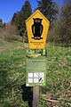
information sign
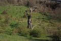
Almost dead hat tree in a bushy landscape

Mosses and lichens

Shrubby willow

.jpg)
.jpg)
.jpg)
See also
Web links
Individual evidence
- ↑ a b c core zone Langenstüttig and Buchschirmküppel near Batten on biosphaerenreservat-rhoen.de; Retrieved May 3, 2016
- ↑ Hessian Nature Conservation Information System (NATUREG) ( Memento of the original from April 7, 2016 in the Internet Archive ) Info: The archive link has been inserted automatically and has not yet been checked. Please check the original and archive link according to the instructions and then remove this notice. , accessed May 5, 2016
- ↑ Amendment of the ordinance “Langenstüttig and Basalt Blockmeer on Buchschirmküppel near Batten” ( Memento of the original from May 3, 2016 in the Internet Archive ) Info: The archive link was inserted automatically and has not yet been checked. Please check the original and archive link according to the instructions and then remove this notice. dated August 27, 2013; pdf
- ↑ a b nature reserve “Basaltblockmeer am Buchschirmküppel” on osthessen-zeitung.de from April 27, 2015; Retrieved May 3, 2016
- ↑ a b c Langenstüttig nature reserve - ecologically valuable biotope with botanical features on osthessen-news from August 9, 2014; Retrieved May 3, 2016
- ↑ "Langenstüttig" nature reserve - a core zone in the Rhön biosphere reserve on biosphaerenreservat-rhoen.de; accessed on May 4, 2016