Laseschchyna
| Laseschchyna | ||
| Лазещина | ||

|
|
|
| Basic data | ||
|---|---|---|
| Oblast : | Zakarpattia Oblast | |
| Rajon : | Rakhiv Raion | |
| Height : | 706 m | |
| Area : | 10.78 km² | |
| Residents : | 4,174 (2004) | |
| Population density : | 387 inhabitants per km² | |
| Postcodes : | 90633 | |
| Area code : | +380 3132 | |
| Geographic location : | 48 ° 16 ' N , 24 ° 25' E | |
| KOATUU : | 2123684501 | |
| Administrative structure : | 1 village | |
| Address: | 90633 с. Лазеина 928 | |
| Statistical information | ||
|
|
||
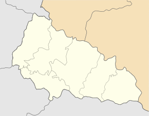
Laseschtschyna ( Ukrainian Лазещина ; Russian Лазещина Laseschtschina , Slovak Lazeština or Lazešcina , Hungarian Mezőhát ) is a village in the east of the Ukrainian Transcarpathian Oblast with about 4100 inhabitants. The village forms its own district council in the north of the Rajon Rakhiv .
The village, founded in 1947, is located in the Forest Carpathians at an altitude of 706 m on the bank of the Laseschtschyna river , a 21 km long tributary of the Black Tisza (Ukrainian: Чорна Тиса Tschorna Tyssa) , which in turn is a source river of the Tisza .
The N 09 national road runs through the village, leading west to the neighboring urban-type settlement of Yasinja and the Rajon center of Rakhiv and to the northeast to the Yablunyzkyj pass and further on to Tatariv and the city of Yaremche in Ivano-Frankivsk Oblast .
In Laseschchyna there is the Church of the Transfiguration, a wooden church from 1780. The village also has a train station on the Sighetu Marmației – Ivano-Frankivsk railway line , built in the 1890s, and direct access to the Hoverla and Petros mountains .
Web links
Individual evidence
- ^ Website of the village Laseschchyna on the website of the Verkhovna Rada ; Retrieved April 18, 2017
- ↑ Laseschchyna - Church of the Transfiguration on derev.org.ua ; accessed on April 18, 2017 (Ukrainian)


