Lengeler
| Lengeler | ||
|---|---|---|
|
|
||
| State : |
|
|
| Region : | Wallonia | |
| Province : | Liege | |
| District : | Verviers | |
| Coordinates : | 50 ° 11 ' N , 6 ° 3' E | |
| Residents: | 160 pop. | |
| Height: | 470 m | |
Lengeler is a village in the Belgian Eifel with 160 inhabitants, which belongs to the municipality of Burg-Reuland in the German-speaking community .
geography
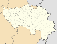
Lengeler is around 14 kilometers south of the city of Sankt Vith and only around 1.5 kilometers north of the Luxembourg state border. The place lies in the valley of the Walhauserbach, a tributary in the river system of the Ulf .
history
The name of the village is probably derived from the Latin longus or the German word lang, possibly due to its location in the elongated valley floor. Lengeler belonged to Hof Thommen until the end of the 18th century .
Individual evidence
- ^ Population statistics
- ↑ Information on the Lengeler district on the municipality's website

