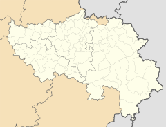
Maspelt
| Maspelt | ||
|---|---|---|
|
|
||
| State : |
|
|
| Region : | Wallonia | |
| Province : | Liege | |
| District : | Verviers | |
| Coordinates : | 50 ° 14 ' N , 6 ° 9' E | |
| Residents: | 96 pop. | |
| Height: | 515 m | |
Maspelt is a village in the Belgian Eifel with 96 inhabitants, which belongs to the municipality of Burg-Reuland in the German-speaking community .
description
Maspelt lies above the Ourtal at an altitude of over 500 m . Mentioned for the first time in 1495 and belonged to the Thommen farm. The tithe was due to Herr von Reuland. A chapel built in 1736 was replaced in 1930 by a new church building with an octagonal tower by the regional architect Henri Cunibert . The high altar from the 18th century was taken over.
Maspelt was incorporated into the municipality of Burg-Reuland when the municipalities were merged in 1977 , as part of the former municipality of Thommen .
Maspelt was the location of the film Winterspelt 1944 by director Eberhard Fechner based on the novel by Alfred Andersch in 1977 . The film with Claus Theo Gärtner and Olli Maier was shot for the most part in East Belgium, because in the 1970s many places there were still in a wartime state.
Individual evidence
- ↑ burg-reuland.be: Statistics of the population ( Memento of the original from January 16, 2005 in the Internet Archive ) Info: The archive link was inserted automatically and has not yet been checked. Please check the original and archive link according to the instructions and then remove this notice.
- ^ Description on the website of the Burg-Reuland Parish Association

