Liptowskie Mury
| Liptowskie Mury | ||
|---|---|---|
|
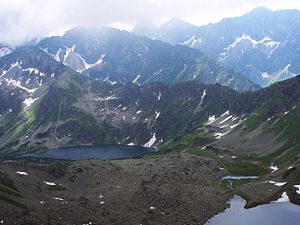
View from the Dolina pod Kołem valley , in front of the mountain lake Czarny Staw Polski |
||
| height | 2172 m npm | |
| location | Poland , Slovakia | |
| Mountains | High Tatras , Carpathian Mountains | |
| Coordinates | 49 ° 12 '4 " N , 20 ° 1' 25" E | |
|
|
||
The Liptowskie Mury are a mountain range in the Polish High Tatras in the Lesser Poland Voivodeship and the Bukowina Tatrzańska municipality with a maximum altitude of 2172 m npm in Szpiglasowy Wierch . The Polish- Slovak border runs along the ridge, which is part of the main Tatra ridge .
Location and surroundings
Below the massif lie the Dolina Ciemnosmreczyńska and Dolina Pięciu Stawów Polskich valleys . The massif is bordered to the summit Szpiglasowy Wierch on the massif of Szpiglasowa Grań to the east and over the mountain pass gładka Przełęcz to the massif of Świnica , specifically the Walentkowa Grań , in the West. In older literature, the entire ridge from Cubryna in the east to Świnica in the west was called Liptowskie Mury .
The ridge of the massif runs from east to west as follows:
- Szpiglasowy Wierch peak - 2172 m
- Wyżnia Liptowska Ławka - przełęcz mountain pass , 2055 m
- Wyżni Kostur peak - 2083 m
- Niżnia Liptowska Ławka - przełęcz mountain pass , 2035 m
- Niżni Kostur peak - 2055 m
- Czarna Ławka - przełęcz mountain pass , 1968 m
- Kotelnica ridge :
- Summit Czarna Kotelnica - 1963 m
- Niżnia Czarna Ławka mountain pass - 1950 m
- Summit Mała Kotelnica - 1974 m
- Niżnia Kotelnicowa Ławka mountain pass - 1955 m
- Summit Pośrednia Kotelnica - 1980 m
- Pośrednia Kotelnicowa Ławka mountain pass - 1965 m
- Wielka Kotelnica summit - 1987 m
- Wyżnia Kotelnicowa Ławka mountain pass - 1975 m
- Summit gładka Kotelnica - 1990 m
- Gładka Ławka mountain pass - 1965 m
- Gładki Wierch peak - 2065 m
- Gładka Przełęcz mountain pass - 1994 m
etymology
The name Liptowskie Mury can be translated as Liptowskie Walls or Liptov Walls . The name is derived from the Liptov region , to which the southern slopes of the massif belong.
Flora and fauna
The Liptowskie Mury are a retreat for chamois, marmots and golden eagles. You can find alpine vegetation on them.
tourism
A yellow-marked hiking trail leads to the summit of Szpiglasowy Wierch as a junction of the yellow-marked Ceprostrada hiking trail from the Schronisko PTTK nad Morskim Okiem mountain lake Meerauge . The Gładka Przełęcz mountain pass can be reached from the Polish side via an unmarked hiking trail from the Dolina Pięciu Stawów Polskich valley and via a marked path from the Slovak side. There is currently no hiking trail on the ridge itself. It may not be used without the permission of one of the national park administrations . In the 1930s there were plans to extend the Ceprostrada over the ridge of the Liptowskie Mury and the massif of the Świnica . Aleksander Bobkowski in particular has advocated the extension. However, only the first section of the Ceprostrada was completed by 1937. Finally, the outbreak of World War II finally ruined the plans. After that, they were no longer picked up.
Left
supporting documents
- Zofia Radwańska-Paryska, Witold Henryk Paryski, Wielka encyklopedia tatrzańska, Poronin, Wyd. Górskie, 2004, ISBN 83-7104-009-1 .
- Tatry Wysokie słowackie i polskie. Mapa turystyczna 1: 25.000, Warszawa, 2005/06, Polkart, ISBN 83-87873-26-8 .

