List of architectural monuments in Weilheim in Upper Bavaria
The monuments of the Upper Bavarian town of Weilheim are compiled on this page . This table is a partial list of the list of architectural monuments in Bavaria . The basis is the Bavarian Monument List , which was first drawn up on the basis of the Bavarian Monument Protection Act of October 1, 1973 and has since been managed by the Bavarian State Office for Monument Preservation . The following information does not replace the legally binding information from the monument protection authority.
Architectural monuments according to districts
Ensembles in Weilheim
Ensemble Admiral-Hipper-Straße (former Obertorgasse)
File number: E-1-90-157-1
The ensemble includes the former Obertorgasse, one of the three main axes of the city, which was planned in the 13th century. It leads from the east side of Marienplatz, the old Hauptplatz and Schrannenplatz, eastwards to the Obertor, which was laid down in 1872 and where the new town hall has been rising since 1936. The street widens in a funnel shape towards the city center; In the western part of this square-like opening and additional market area, however, the free-standing block of the four town houses on Apothekergasse is set, which divides the axis on the one hand towards Marienplatz and on the other hand to the former care lock in Hofgasse.
The closed development of the ensemble has mostly three-storey bourgeois gabled houses from the mid-19th century, most of which have been converted into commercial buildings; the plaster facades are often structured. Buildings 9, 11, 13 form a group of eaves houses, which is characterized by flat bay windows; 11 is also in place of the oldest town hall, which was closed in 1538.
File number: E-1-90-157-6
The ensemble encompasses the Upper City, stretching east in front of the former Obertor, in a west-east direction in the 600 m long area between Schleifermühle and Bärenmühle. The emergence of this artisan and arable suburb on both sides of the city stream and in an elongated meadow shape goes back to the 15th century. Between four mills that were about 300 m apart and built over the brook, which belonged to the old property of the Ettal and Habach founders and to the old Weilheimer Spital, there was a closed development with mostly low houses (the area between Bärenmühle and Zotzenmühle in the east does not belong to the ensemble). A fire in 1810 caused a reorganization and regulation, in particular the row of houses to the left of the stream was set back further south.
Most of the buildings in the ensemble are from the reconstruction after 1810; In the western part, two-storey plastered eaves side buildings predominate, in the eastern part gabled buildings with flat gable roofs, under which the closed row No. 117 to No. 137 (odd numbers) particularly protrudes. Corner buildings often have hipped roofs, as do the three large structures of the mills that dominate the central axis of the ensemble and the Ettaler tithe box, which was formerly part of the central Feyerabendmühle, and was a district office after 1862. The stream, dammed up in the western part, is accompanied by a double row of trees.
File number: E-1-90-157-5
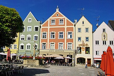
The almost rectangular Marienplatz is the old Hauptplatz and Schrannenplatz, the center of the city that was first mentioned as an oppidum in 1238 and was probably founded according to plan by Duke Otto II of Bavaria. When it was founded, not far from the older village of Weilheim , which was first mentioned in 1010 and south-west of the church of St. Pölten on the old thoroughfare, a new fortified base was created against the Counts of Andechs, the main square of which is also assigned to the old street.
As Schmiedstrasse it enters the square from the north and from the former Schmiedtor, offset to the east it leaves it in a southerly direction as Kirchstrasse, then as Pöltner Strasse. Admiral-Hipper-Strasse is the third axis leading to the less important eastern exit of the city. The dominant building on the square is the parish church of the Assumption of the Virgin, which is positioned lengthways on the south side and whose basement tower still belongs to the early 14th century, while the nave and choir were rebuilt in 1624 ff. According to the plan by Hans Krumpper . The cemetery to the north in front of the church, which was abandoned in 1521, gave way to the old town hall (now a museum) built in 1538 ff., Which, after being enlarged and redesigned in 1788 ff., Gave the east side of Marienplatz a late baroque prospectus-like finish.
Three, sometimes four-storey bourgeois houses from the 18th, more often the 19th century, now mostly commercial buildings, form closed plaza walls: on the north side almost uniformly on the eaves, on the west side uniformly gable, in the south-west in alternating positions and at the confluence of Kreuzgasse Setbacks of the fronts. Since 1698, the Marian column and the former Steingaden monastery fountain, which was moved here after secularization, have been adding a baroque accent to the square, which was largely redesigned in the 19th century, but whose basic structures belong to the Renaissance.
File number: E-1-90-157-2
The narrow street leads south from the church square to the former seat of the district judge in the south-east corner of the old town, the later rent office and today's tax office. The building group located directly on the city wall is very likely to be the castle seat of the noble free von Weilheim in the 11th / 12th. Century.
The partly very high development of the two street lines with town houses from the 18th and 19th centuries. Century, in essence also older buildings, creates a street scene with a strong spatial effect. Narrow gabled houses alternate with wider eaves side buildings, the plastered facades are often structured. The east side of the street is characterized by a remarkable series of staggered gables.
The street in the south was closed by the city wall until 1909.
File number: E-1-90-157-3
The square in front of the south side of the parish church and touched by Hofstrasse and Pöltner Strasse was created after the old hospital and its church, founded around 1320/30, were demolished in 1826. It is dominated by the church; The west, south and north sides are enclosed by bourgeois residential and commercial buildings from the 19th century and some new buildings. Some of these buildings or their predecessors belonged to the old hospital courtyard, the extent of which can still be seen in the square.
File number: E-1-90-157-4
Handwerkerstraße in the old town, which on the north side is a closed group of two to four-story gable-independent houses from the 18th and 19th centuries. Century with protruding flat gable roofs, on the south side a line of largely uniform three-storey eaves side buildings from the 17th to 19th centuries.
File number: E-1-90-157-8
Since the late Middle Ages, the narrow Kreuzgasse in the old town originally led from Marienplatz to the western exit of the city, the so-called Schergentürl, which was demolished in 1837 and replaced by the building of the judicial prison. On both sides there are short, closed rows of mostly gable-independent houses from the 18th and 19th centuries. Century.
File number: E-1-90-157-7
The ensemble encompasses the main axis of the old town towards the south between Kirchplatz and Greitherstraße, i.e. across the southern old town border and the square of the Pöltner Tor, which was laid down in 1874, into the old Pölten suburb, which was developed in this part in the second half of the 19th Century has been adapted to the character of the old town part of the ensemble and has won a prospectus with the former Gasthaus Gattinger, which is essentially older and decorated with facade paintings. Three- to four-storey town houses from the 16th to 19th centuries with plastered facades, often narrow gabled buildings, frame the west and east sides of the ensemble. The open spaces in the middle part indicate the old extension of the moat in front of the city wall that is still preserved at this point.
File number: E-1-90-157-9
The ensemble includes Schmiedstrasse, which begins northwest of the market square and ends at the area of the Schmiedtor, which was demolished in 1873. This street was the main northern axis to and from the center of the city.
Three to four-story town houses from the 16th to 19th centuries shape the character of the ensemble with their contrast between the eaves and gable fronts. Shops have mostly been installed on the ground floor, and their large shop windows disrupt the street scene. A reference to the former function of the street as a regional connection route was the former inn "Bräuwastl", which was built around 1840/50 with its broad facade. A hotel extension (no. 19) that became necessary at the beginning of the 20th century is noticeable among the otherwise simply designed houses due to its representative character in the shapes of the geometric Art Nouveau. Opposite the former tavern, a series of simple houses that were built after the fire of 1834 rises up in the eaves and storey heights as well as the exterior design. A group of four gable-facing buildings opposite the confluence with Eisenkramergasse deserves special mention, the oldest of which dates from the second half of the 16th century.
Architectural monuments in Weilheim by streets
| location | object | description | File no. | image |
|---|---|---|---|---|
| Old town Hofstraße 23, Kreuzgasse 10 |
City fortifications | The first simple reinforcement from 1236 was replaced between 1320 and 1360 by a massive wall ring made of tuff stone blocks, modernization of defense technology in the 1st half of the 15th century. Some of the outer walls on the field side are still preserved. The four gate towers with Vorwerk and Zwinger (Schmiedtor, Oberes Tor, Pöltner Tor and Schörgerlturm) were demolished in 1872/73. | D-1-90-157-211 |
 more pictures |
| Admiral-Hipper-Strasse 2 ( location ) |
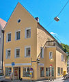
Residential and commercial building | three-storey plastered gable building with a steep pitched roof, the core of the 3rd quarter of the 19th century, modernized | D-1-90-157-2 |
|
| Admiral-Hipper-Strasse 4 ( location ) |
Residential and commercial building | three-storey plastered gable building with a steep pitched roof, the core of the 3rd quarter of the 19th century, modernized | D-1-90-157-4 |

|
| Admiral-Hipper-Strasse 6 ( location ) |
Formerly a bathhouse, now a pharmacy | three-storey plastered eaves side building with mansard hipped roof, essentially late Middle Ages, extensive renovation in 1930 | D-1-90-157-6 |

|
| Admiral-Hipper-Strasse 7 ( location ) |
Residential and commercial building | three-storey gable building with gable roof and plaster frames, mid-19th century | D-1-90-157-7 |
 more pictures |
| Admiral-Hipper-Strasse 9 ( location ) |
Formerly the pub to the three Moors | three-storey eaves side building with mezzanine and gable roof, around 1850/60;
Former inn, two-storey solid building made of tuff blocks and brick, with hipped roof and ramp, around 1800 |
D-1-90-157-9 |
 more pictures |
| Admiral-Hipper-Strasse 10 ( location ) |
Residential and commercial building, so-called preacher's house | two-storey plastered eaves building with box cornice and gable roof, mid-19th century | D-1-90-157-10 | |
| Admiral-Hipper-Strasse 11 ( location ) |
Formerly patrician house, so-called Neuchinger house | Three-storey plastered eaves side building with flat bay windows and old snow guard, largely rebuilt over the late medieval core in 1867 | D-1-90-157-11 |
 more pictures |
| Admiral-Hipper-Strasse 14 ( location ) |
Residential and commercial building | three-storey plastered eaves side building with rosette frieze on the box cornice, mid-19th century | D-1-90-157-14 |

|
| Admiral-Hipper-Strasse 13 ( location ) |
Catholic rectory | three-storey eaves side building with plastered rustics, flat bay window and relief doo with Mother of God, the core of the mid-19th century | D-1-90-157-13 |
 more pictures |
| Admiral-Hipper-Strasse 16 ( location ) |
Residential and commercial building | three-storey plastered gable building with neo-baroque facade structure and steep pitched roof, dendrochronologically dated 1612, changed around 1862 | D-1-90-157-16 |

|
| Admiral-Hipper-Strasse 19 ( location ) |
Residential and commercial building | narrow four-storey hipped roof building with flat central bay and gable roof, mid-19th century | D-1-90-157-18 |
 more pictures |
| Andreas-Schmidtner-Strasse 21 ( location ) |
Wayside shrine, so-called Eisvoglkapelle | massive niche construction with pent roof, 2nd half of the 18th century | D-1-90-157-155 | |
| Augsburger Strasse 4 ( location ) |
villa | Historicizing two-storey group building on a high basement with plastered structure, hip and crooked roof and polygonal corner tower with onion dome, around 1900 | D-1-90-157-22 | |
| Deutenhauser Straße 14 ( location ) |
Formerly a watermill, the so-called Zotzenmühle | Elongated two-storey plastered building with high tennis court and half-hip, around 1840 | D-1-90-157-25 |

|
| Eisenkramergasse 13 ( location ) |
Garden pavilion | small baroque plastered building with curved gable and wall breakthrough, end of the 18th century; associated section of the city wall | D-1-90-157-189 | |
| Fischergasse or Eisenkramergasse? (Marienplatz 14 is wrong!) ( Location ) |
Formerly a residential building | two-storey plastered eaves side building with gable roof, around 1840/50 | D-1-90-157-26 | |
| Fischergasse 5 ( location ) |
Chapel of the Holy Cross | Baroque hall building with blind arcades, three-sided choir closure and facade tower with onion dome, new building 1638; with equipment | D-1-90-157-27 |

|
| Geistbühelstraße 3 ( location ) |
villa | two-storey plastered solid building with flat gable roof, ornamental framework, bay windows and gables, in the local style, 1900;
Enclosure, pillars made of stamped concrete, at the same time |
D-1-90-157-191 | |
| Greitherstraße 3 ( location ) |
Residential and commercial building | two-storey plastered ashlar building with hipped roof, 2nd quarter of the 19th century, later changed | D-1-90-157-29 | |
| Greitherstraße 7 ( location ) |
Formerly a stable house | two-storey plastered gable building with half-hipped roof, in the first half of the 19th century, later changed | D-1-90-157-30 | |
| Greitherstraße 10 ( location ) |
Farmhouse | Former farmhouse, two-storey plastered ridge courtyard with gable roof, after 1793;
Enclosure, wrought iron, around 1900 |
D-1-90-157-31 | |
| Greitherstraße 19 ( location ) |
Formerly the Catholic rectory of St. Hippolyt in Pölten | two-storey plastered building with a steep pitched roof, after 1793;
Outbuilding, ground floor saddle roof building with brick and wooden cladding, 2nd half of the 19th century |
D-1-90-157-33 | |
| Herzog-Albrecht-Platz 2 ( location ) |
Formerly judicial prison | Originally a three-storey exposed brick building with corner blocks and a gate-tower-like passage, 1838/40, raised by a mezzanine and flat hipped roof in 1857/58, profound changes from 1998 | D-1-90-157-53 |

|
| Hofstrasse 3 ( location ) |
Formerly the early measuring house | two-storey eaves side building with floor structure, painting of St. Joseph and one-sided hipped roof, 1st half of the 19th century | D-1-90-157-36 |

|
| Hofstrasse 5 ( location ) |
Residential and commercial building | two-storey eaves side building with historicizing plaster structure, 2nd quarter of the 19th century | D-1-90-157-38 |

|
| Hofstrasse 11 ( location ) |
Community center | Three-storey pitched roof structure, in the core 15th century, reconstruction and extension in 1611 (dendrochronologically dated), reconstruction in the 18th century and mid-19th century | D-1-90-157-280 | |
| Hofstrasse 12 ( location ) |
Inn | two-storey cubic corner building with hipped roof, the core of the 2nd half of the 18th century, later changed | D-1-90-157-40 |

|
| Hofstraße 19/21 ( location ) |
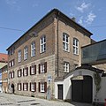
Former district court, now tax office | three-storey unplastered brick and tuff stone building with mezzanine and hipped roof, 1857;
Former district court, now surveying office, four-storey saddle roof building with plaster structure, 1857 |
D-1-90-157-42 |
|
| Hofstrasse 23 ( location ) |
Former rent office instead of the care lock, now tax office | Castle-like three-storey group building with three or four storeys with saddle and hipped roof, flat bay window and neo-classical portal, eastern section 1857, western section 1909;
Archway, plastered, probably from 1857 |
D-1-90-157-43 |
 more pictures |
| Johann-Baur-Straße 57 ( location ) |
Way chapel Christ at rest, so-called rest chapel | small gable roof building with a slightly retracted apse and plaster structure, 1650, extended in 1724 and partially renewed in 1791; with equipment | D-1-90-157-45 |

|
| Kaltenmoserstraße 34 ( location ) |
Country house, so-called Nerbl villa | Two-storey plastered building with all-round eaves and gable arbors, corner bay windows and flat saddle roof, in the local style by Joseph Pemler, 1937, facade paintings by Heinrich Bickel | D-1-90-157-201 | |
| Kirchplatz 9 ( location ) |
Residential and commercial building | two-storey plastered eaves side building with flat gable roof, mid-19th century | D-1-90-157-47 | |
| Kirchplatz 11 ( location ) |
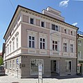
Residential and commercial building | two-storey corner building with mezzanine, flat hipped roof and rich neo-classical structure, by Leopold Eberhard, inscribed in the courtyard in 1876 | D-1-90-157-49 |
 more pictures |
| Kreuzgasse 1 ( location ) |
Residential and commercial building | three-storey gable-independent plastered building with saddle roof, 18th century core, 19th century changes | D-1-90-157-50 |

|
| Kreuzgasse 6 ( location ) |
Residential building | three-storey, narrow gable building with a steep pitched roof, the core of the 18th century, modified at the end of the 19th and 20th centuries | D-1-90-157-51 |

|
| Ledererstraße 7 ( location ) |
Residential and commercial building, so-called Watsackerhaus | three-storey plastered eaves side building with a steep pitched roof and Krangaube, the core of the 16th century | D-1-90-157-58 |
 more pictures |
| Marienplatz, Reinhard-Schmid-Platz ( location ) |
Marian column | Figure of Mary on a high column with a double pedestal, marked 1698, added in 1857 | D-1-90-157-86 |
 more pictures |
| Marienplatz, Reinhard-Schmid-Platz ( location ) |
City fountain | Square fountain basin with corner figures and classicist fountain column, sandstone, assembled from parts of the Steingaden monastery fountain from 1791, 1828/29 | D-1-90-157-87 |
 more pictures |
| Marienplatz 1 ( location ) |
Formerly town hall, school, Schranne and bread house, now the town museum, so-called old town hall | three-storey elongated and narrow building with mansard hipped roof, roof turret and outside staircase, largely new building 1788/90, neo-baroque facade design 1876, in the 19th and 20th Century rebuilt several times inside | D-1-90-157-63 |
 more pictures |
| Marienplatz 2 and 4 ( location ) |
Formerly the judge's house, then a residential and commercial building, the so-called Pollinger or Hagerhaus | three-storey gable building with plaster structure and saddle roof, 17th century core, later changed several times. | D-1-90-157-64 |
 more pictures |
| Marienplatz 3 ( location ) |
Catholic parish church of the Assumption | plastered wall pillar construction with retracted polygonal choir, blind arch and stepped gable, new building by Hans Krumpper 1624/31, Gothic tower substructure of the previous building in the early 14th century, upper floors of the tower 1573; with equipment | D-1-90-157-65 |
 more pictures |
| Marienplatz 4 ( location ) |
Residential and commercial building | three-storey plastered eaves side building with saddle roof and polygonal bay window, in the middle of the 19th century | D-1-90-157-66 |

|
| Marienplatz 5 ( location ) |
Residential and commercial building, so-called goldsmith | four-storey plastered corner building with a flattened mansard hipped roof, 1st half of the 19th century | D-1-90-157-67 |

|
| Marienplatz 7 ( location ) |
Residential and commercial building, so-called Sattler | three-storey plastered gable building with gable roof, in the core 18th century, rebuilt at the end of the 19th century | D-1-90-157-69 |

|
| Marienplatz 8 ( location ) |
Residential and commercial building | three-storey plastered eaves side building with saddle roof, in the historicizing style, mid-19th century, ground floor heavily changed | D-1-90-157-70 | |
| Marienplatz 9 ( location ) |
Residential and commercial building, so-called red tanner | three-storey plastered gable building with a steep pitched roof, around 1860, in essence probably older | D-1-90-157-71 |

|
| Marienplatz 10 ( location ) |
Residential and commercial building, so-called Dirhansel | three-storey eaves side building with gable roof, balustrade and arched frieze, mid-19th century | D-1-90-157-72 |

|
| Marienplatz 12 ( location ) |
Hotel Vollmann | Elongated three-storey side eaves building with saddle roof and historicizing facade design, in the middle of the 19th century | D-1-90-157-74 |

|
| Marienplatz 13 ( location ) |
Residential and commercial building, so-called Kistler | three-storey plastered eaves side building with a hipped roof on one side, 3rd quarter of the 19th century | D-1-90-157-75 | |
| Marienplatz 14 ( location ) |
Residential and commercial building, so-called Michalot | three-storey eaves side building with saddle roof and facade design in the neo-renaissance style, mid-19th century | D-1-90-157-76 | |
| Marienplatz 15 ( location ) |
Residential and commercial building, so-called Peißenberger | four-storey corner building with plaster strips and flat hipped roof, in the core 17th / 18th. Century, later changed | D-1-90-157-77 |

|
| Marienplatz 17 ( location ) |
Gasthaus, so-called Nudl | three-storey plastered gable building with a steep pitched roof, the core probably 18th century, later changed;
Rear building, two-storey house with a gable roof, the core of the 2nd half of the 18th century |
D-1-90-157-79 | |
| Marienplatz 18, Schmiedstraße 2 ( location ) |
Residential and commercial building, so-called Pähler Kramer | narrow three-storey corner building with drilled gable and steep pitched roof, 18th century core, modified 3rd quarter 19th century | D-1-90-157-157 |

|
| Marienplatz 19 ( location ) |
Residential and commercial building, so-called grinder | three-storey plastered building with a steep pitched roof and rusticated ground floor, essentially at the end of the 17th century, later changed | D-1-90-157-80 | |
| Marienplatz 21 ( location ) |
Residential and commercial building, so-called Kipfingerhaus | Three-storey plastered building with a gable roof on the eaves, the core of the 19th century, neo-baroque tail gable and flat bay window after 1909, modernly painted | D-1-90-157-81 |
 more pictures |
| Marienplatz 23 ( location ) |
Residential and commercial building, so-called Lebzelter | four-storey plastered building with a steep pitched roof and drilled triangular gable, in the core 17th / 18th. Century, remodeling at the beginning of the 20th century and later | D-1-90-157-82 |
 more pictures |
| Marienplatz 25 ( location ) |
Formerly an inn, so-called Lupolhansel | Three-storey gable building with a gable roof, the core of the 18th century, facade design with plaster strips and rough plaster from the early 20th century | D-1-90-157-83 |
 more pictures |
| Marienplatz 27 ( location ) |
Residential and commercial building, so-called Kirchner | narrow four-storey gable building with gable roof, mid-19th century, changed in the 20th century | D-1-90-157-84 |
 more pictures |
| Marienplatz 29 ( location ) |
Residential and commercial building | three-storey plastered gable building with saddle roof and Marian fresco, 1st half of the 19th century | D-1-90-157-85 |

|
| Münchener Strasse 2 ( location ) |
Formerly Heilig-Geist-Spital, Catholic hospital church for the Holy Trinity | Classicist hall building with a strongly drawn-in apse, portico in front and facade turret, by Leonhard Schmidtner , 1826; with equipment;
Former Heilig-Geist-Spital, now urban community center, elongated formerly two-story hipped roof building with flat risalits, jointed corner pilasters and rough plaster ground floor, 1826, extension to the north in 1887, floor elevation and redesign of the facade in 1902; Former garden house, two-story tent roof construction with late Baroque plaster structure, around 1800 |
D-1-90-157-89 |

|
| Münchener Strasse 19 ( location ) |
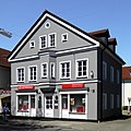
Residential and commercial building | two-storey plastered gable building with flat saddle roof and polygonal bay window, 3rd quarter of the 19th century | D-1-90-157-91 |
|
| Münchener Strasse 29 ( location ) |
Country house | Two-storey neo-baroque hipped roof building with bay window, corner cuboid and ornamental gable, around 1900 | D-1-90-157-92 |

|
| Murnauer Straße 3 ( location ) |
Residential building | Two-storey plastered building on a high basement with a mansard roof with a crooked hip, 2nd quarter of the 19th century | D-1-90-157-94 |

|
| Murnauer Straße 6 ( location ) |
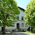
Residential building | Two-storey gable building with a flat saddle roof and historicizing plaster structure, around 1860/70 | D-1-90-157-95 |
|
| Murnauer Straße 7 ( location ) |
Villa Kremer | two-storey group building with hipped mansard roof, belt cornice and window grilles, end of the 18th century, probably extended and modified in neo-baroque style at the end of the 19th century;
Garden house, small plastered building on the ground floor with a central projection and mansard hipped roof, end of the 19th century |
D-1-90-157-96 |

|
| Murnauer Straße 12 ( location ) |
Formerly secondary school boarding school, now grammar school | three-storey three-wing complex with hipped roof, dormers and rich neo-baroque plaster structure, 1897/98 | D-1-90-157-97 |
 more pictures |
| Near Angerkapellenstrasse ( location ) |
Chapel of Our Lady of Sorrows on the Anger | small plastered hall building with three-sided choir closure, profiled eaves cornice and hipped roof, 1661, remodeled 1761; with equipment | D-1-90-157-20 | |
| Near Friedhofweg ( location ) |
Catholic cemetery church of St. Salvator and Sebastian | Catholic cemetery church St. Salvator and Sebastian, undivided late Gothic central building on eight sides with tent roof, 1449, polygonal choir extension with sacristy 1481, vestibule and tower substructure 1526, upper part of the tower by Hans Guggemoos 1583, Spitzhelm 1852; with equipment;
Cemetery with grave monuments and memorial stones from the 15th to 19th centuries and the early 20th century, partially embedded in the cemetery wall; Funeral hall with morgue, historicizing saddle roof building with neo-Romanesque arcades and wing structures, 1876; War memorial chapel, small neo-baroque cube with portico and mansard hipped roof, around 1920 |
D-1-90-157-28 |
 more pictures |
| Near Upper City, An der Bärenmühle ( location ) |
Wayside chapel | small plastered niche with a flat gable roof, 1693, extended in 1862; with equipment. | D-1-90-157-23 |

|
| Upper City 10 ( location ) |
Formerly a stable house | two-storey saddle roof building with a crooked hip, mid-19th century, baroque plaster structure at the end of the 19th century | D-1-90-157-99 |

|
| Upper City 19 ( location ) |
Residential and commercial building | narrow two-storey corner building with hipped roof, 3rd quarter of the 19th century | D-1-90-157-101 | |
| Upper City 31/33 ( location ) |
Gasthaus zum Oberbräu | Elongated two-storey side eaves building with a flat hip roof and plaster structure, 2nd quarter of the 19th century | D-1-90-157-104 |

|
| Upper City 47 ( location ) |
Formerly a stable house, so-called building toaster | two-storey plastered corner building of a row house development, with hipped roof and former entrance gate, after 1810 | D-1-90-157-106 |

|
| Upper City 53 ( location ) |
Formerly a stable house, so-called Awarzer | two-storey terraced house with entrance gate and gable roof, after 1810 | D-1-90-157-108 |

|
| Upper City 66 ( location ) |
Formerly a watermill, so-called Mittermühle or Seemüller | three-storey plastered building with hipped roof and profiled eaves cornice, 18th century core | D-1-90-157-110 |
 more pictures |
| Upper City 67 ( location ) |
Formerly a stable house | two-storey plastered corner building with hipped roof and eaves cornice, after 1810 | D-1-90-157-111 | |
| Upper City 71 ( location ) |
Formerly the tithe box of the Ettal monastery, after 1855 the district office building | Broad, three-storey plastered building with hipped roof, dwarf house and profiled eaves cornice, in the core 17th / 18th. century | D-1-90-157-113 |

|
| Upper City 73/75 ( location ) |
Residential part of the former double stable house, so-called Hammerl | wide two-storey gable building with a flat gable roof, essentially after 1810. | D-1-90-157-115 |

|
| Upper City 98 ( location ) |
Einfirsthof | Two-storey, massive saddle roof construction in corner position, in the core 18th century, reconstruction after 1810, roof structure from 1852 (dendrochronologically dated), renovation around 1900, business section later extended to the south | D-1-90-157-210 | |
| Upper City 106 ( location ) |
Bear Mill | elongated, two-storey building with a half-hip, 2nd quarter of the 19th century;
Water wheel, undershot and iron with wooden shovels, around 1874 |
D-1-90-157-119 |

|
| Upper City 111 ( location ) |
Residential part of the former stable house | two-storey gable building with a flat gable roof and plaster structure, mid-19th century | D-1-90-157-121 | |
| Upper town 119 and 121 ( location ) |
Formerly a double farmhouse | two-storey plastered building with a flat gable roof, after 1810 | D-1-90-157-124 |

|
| Upper town 123 ( location ) |
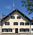
Formerly a stable house | two-storey plastered gable building with a flat gable roof, after 1810 | D-1-90-157-125 |
|
| Upper town 133 and 135 ( location ) |
Formerly a double farmhouse | Broad, two-storey plastered building with a flat gable roof, essentially after 1810 | D-1-90-157-127 |

|
| Upper City 137 ( location ) |
Formerly a farm | Two-storey stable house with a bent facade, essentially after 1810, later saddle roof | D-1-90-157-128 |

|
| Petelgasse 6 ( location ) |
villa | two-storey corner building with a crooked roof, corner bay tower and ornamental gable, expanded in historicizing forms by Josef Oswald, 1899, 1909;
Former stable building, two-storey plastered saddle roof construction, at the same time; Enclosure, piers made of stamped concrete with massive infill, around 1909 |
D-1-90-157-44 | |
| Pollinger Straße 4 ( location ) |
Formerly the barn of the Pollinger Schwaige | two-storey plastered building with a steep pitched roof and high stalls, end of the 18th century | D-1-90-157-145 | |
| Pöltnerstraße 4 ( location ) |
Formerly an outbuilding, then a residential and commercial building | three-storey plastered gable building with a steep pitched roof, in the core probably 1st half of the 16th century, remodeling after 1811 | D-1-90-157-131 | |
| Pöltnerstraße 5 ( location ) |
Residential and commercial building | three-storey plastered gable building with a steep pitched roof, the core of the 18th century | D-1-90-157-132 |

|
| Pöltnerstraße 6 ( location ) |
Residential and commercial building | three-storey plastered gable building with a steep pitched roof, the core of the 1st half of the 16th century, later changed | D-1-90-157-198 | |
| Pöltnerstraße 7 ( location ) |
Residential and commercial building | three-storey gable building with an advance wall and gable roof, mid-19th century, plaster structure around 1925 | D-1-90-157-133 |

|
| Pöltnerstraße 8 ( location ) |
Residential and commercial building | three-storey plastered building with late Gothic stepped gable, arched panels and flat gable roof, in the core 1st quarter of the 16th century, later changed | D-1-90-157-134 |

|
| Pöltnerstraße 9 ( location ) |
Residential and commercial building, so-called tin foundry house | three-storey gable building with a steep gable roof, plaster structure and neo-Gothic stepped gable, mid-19th century, with an older core | D-1-90-157-135 |

|
| Pöltnerstraße 10 ( location ) |
Residential and commercial building, so-called coppersmith's house | three-storey gable building with gable roof, formerly courtyard passage and plaster structure, in the core 16th century, in the 18th / 19th century Century and modern changed | D-1-90-157-136 |

|
| Pöltnerstraße 16 ( location ) |
Residential and commercial building | three-storey eaves side building with historicizing plaster frame and saddle roof, 3rd quarter of the 19th century | D-1-90-157-138 | |
| Pöltnerstraße 18 ( location ) |
Residential and commercial building | two-storey corner building with mezzanine, neo-baroque facade design and hipped roof, 1896/98 | D-1-90-157-197 |

|
| Pöltnerstraße 20 ( location ) |
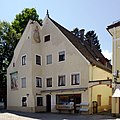
Residential and commercial building | two-storey plastered corner building with retracted gable half and steep pitched roof, probably 2nd half of the 17th century, facade painting with a picture of the Pölten Gate from 1932, which was broken off in 1874; associated city wall | D-1-90-157-140 |
|
| Pöltnerstraße 28 ( location ) |
Residential and commercial building | Two-storey plastered gable building with a steep pitched roof, around 1860/70 | D-1-90-157-142 |

|
| Pöltnerstraße 32 ( location ) |
Formerly Gasthaus zum Gattinger | high three-storey plastered building with pitched roof, in the core 17th / 18th century Century, group of crosses 1st half of the 17th century, two-wing carved front door around 1840, facade painting by Heinrich Bickel 1951 | D-1-90-157-144 |

|
| Prälatenweg 2 ( location ) |
Residential building | Broad plastered building with a sloping roof and corner bay window with onion hood, largely new building around 1870/80 on older foundations | D-1-90-157-146 |

|
| Pütrichstrasse 6 ( location ) |
Summer cellar of the former post brewery | several cellars lined up in a row, brick barrel vault over sandstone masonry, in the
Core 18th century, with extensions 19th century |
D-1-90-157-204 | |
| Rathausplatz 15 ( location ) |
crucifix | Baroque body on the cross with housing, wood, 2nd half of the 17th century | D-1-90-157-153 |

|
| Rathausplatz 13 ( location ) |
Residential part of the former farm house | two-storey gable building with a crooked roof and plaster structure, the core of the 18th century | D-1-90-157-150 |
 more pictures |
| Schmiedstrasse 9 ( location ) |
Residential and commercial building | four-storey plastered building with a steep gable roof and baroque style tail gable, 17th century core, later changed | D-1-90-157-158 |

|
| Schmiedstrasse 11 ( location ) |
Residential and commercial building | four-storey plastered building with a steep gable roof, gable knob and arched elevator opening, the core of the 2nd half of the 16th century, later modified | D-1-90-157-160 |

|
| Schmiedstrasse 13 ( location ) |
Residential and commercial building | three-storey plastered gable building with a steep pitched roof, the core of the 2nd half of the 16th century, changed around 1860/70 | D-1-90-157-162 |

|
| Unterer Graben 1 ( location ) |
Residential building | two-storey, cubic plastered building with hipped roof, semicircular window crowns and saddle roof extension, around 1830/40;
Former brewery barn, so-called Bräuwastlstadel, broad plastered building with facade structure and crooked roof, 2nd quarter of the 19th century |
D-1-90-157-167 | |
| Unterer Graben 48 ( location ) |
Catholic parish church St. Hippolyt in St. Pölten | Elongated hall building with polygonal choir closure, sacristy added to the south with former chapel and northern flank tower with pointed helmet, Romanesque core, baroque in 1782, tower elevation in 1793 and 1844; with equipment;
New church, added round central building with rectangular extensions, by Hans Strobel, 1968; with equipment; Chapel of St. Agatha, a small plastered hall with a choir closing on three sides and structure of pilasters, 1511, redesigned in baroque style in 1674; with equipment; Parts of the cemetery wall, east and south section with old grave monuments, north section with former Karner and Scourge Heiland, 17th / 18th centuries century |
D-1-90-157-168 |
 more pictures |
| Wessobrunner Strasse 10; 18 ( location ) |
Cattle auction hall, highland hall | Solid construction with a flat gable roof protruding far and a wooden entrance portal with an elevated arbor, by Moritz Glück, inscribed 1937; with simultaneous fencing | D-1-90-157-279 |
Unterhausen
| location | object | description | File no. | image |
|---|---|---|---|---|
| Dorfstrasse 11 ( location ) |
Former rectory | Two-storey ridge courtyard with flat gable roof and boarded gable, 1841 | D-1-90-157-183 |

|
| Dorfstrasse 13 ( location ) |
Grain boxes of the so-called Baur-Hof | ground floor block construction, 1st half of the 17th century | D-1-90-157-179 |
 more pictures |
| Im Kirchwinkl 6 ( location ) |
Catholic Parish Church of the Visitation of the Virgin Mary | Hall building with slightly retracted polygonal choir, added sacristy and southern flank tower, redesigned around 1350, choir 1487, tower octagon with double hood in 1608, including the former Trinity Chapel in 1621, 1657 and 1773; with equipment | D-1-90-157-178 |
 more pictures |
| Kapellenstrasse ( location ) |
Wayside chapel | plastered niche with gable roof, mid-17th century; with equipment | D-1-90-157-185 |
 more pictures |
| Raistinger Straße 4 ( location ) |
Formerly a farm, known as the Schahl or Deininger | Two-storey ridge courtyard with eaves framing, gable arbor and flat gable roof, early 19th century, roof structure in the 2nd half of the 19th century | D-1-90-157-180 |

|
| Near Schlossengriesstraße ( location ) |
Grain bin | on the ground floor, marked 1565, with a new roof | D-1-90-157-212 |
 more pictures |
| Near Weilheimer Straße ( location ) |
Atonement Cross | Tufa, marked 1442 | D-1-90-157-186 |
 more pictures |
Other districts
| location | object | description | File no. | image |
|---|---|---|---|---|
| Deutenhausen Burgweg 1 ( location ) |
Stone cross made of tuff | 17./18. Century; at the east end of the Burgweg in the garden of the so-called Angerer Villa | D-1-90-157-192 | |
| Deutenhausen Von-Tuto-Straße 2 ( location ) |
Catholic branch church of St. John the Baptist | Hall building with retracted polygonal choir, added sacristy and northern choir flank tower, Romanesque core, changes around 1500, 1668 and 1709, raised tower and onion dome 1788; with equipment;
Eastern section of the cemetery wall with tuff stone cover plates, 18th / 19th centuries century |
D-1-90-157-169 |
 more pictures |
| Deutenhausen Von-Tuto-Straße 6 ( location ) |
Grain bin | Ground floor block building, marked 1720, modern gable roof | D-1-90-157-170 |
 more pictures |
| Dietlhofen Small parts, on the west bank of the Dietlhofer See ( location ) |
Formerly court chapel, so-called lake chapel | plastered niche with pent roof, 1650; with equipment | D-1-90-157-171 |
 more pictures |
| Gossenhofen Gossenhofen 1 ( location ) |
St. Augustine's Court Chapel | small hall building with five-sided choir closure, plaster structure and roof turret with onion dome, by Caspar Feichtmayr , 1689; with equipment | D-1-90-157-172 |
 more pictures |
| Gossenhofen near the chapel ( location ) |
Tufa cross | 17./18. century | D-1-90-157-173 |

|
| Hirschberg Hirschberg a.Haarsee 1 ( location ) |
Hirschberg am Haarsee Castle | three-storey hipped roof building with corner projections, portico and stair tower as a connection to the lower economic section, in neo-baroque forms with Art Nouveau elements, by Karl Hocheder , 1907/09;
Gate entrance, in baroque forms made of tuff with wrought iron grating in Art Nouveau style, at the same time; Former stable and coach house with administrators' house and riding arena, elongated plastered building with two-storey front building with mansard hipped roof and transept with half hipped roof, in baroque forms, after 1907; Former gardener's house with attached greenhouse, ground floor plastered building with half-hipped roof or glass roof, 1909 |
D-1-90-157-187 |
 more pictures
|
|
Marnbach Auchtweide ( location ) |
Field Chapel St. Michael | small, plastered hall building with saddle roof and oculi, 1717, straight choir added 1900; with equipment | D-1-90-157-175 |
 more pictures |
| Marnbach Kirchstrasse 2 ( location ) |
Catholic Parish Church of St. Michael | simple hall building with strongly recessed polygonal choir, attached two-storey sacristy and northern choir flank tower, tower 1324, renovation of the choir 1514, baroque nave 1673/86; with equipment;
Eastern move of the cemetery wall, 18th and late 19th centuries; Lourdes Grotto, 1907 |
D-1-90-157-174 |
 more pictures |
| Marnbach bei Kirschbaumstraße 2 ( location ) |
Stone cross made of tuff | 17./18. century | D-1-90-157-193 |

|
| Rothsee In Rothsee ( location ) |
St. Margaretha Court Chapel | simple short hall building with retracted apse and facade tower with onion dome, 1780; with equipment | D-1-90-157-176 |
 more pictures |
| Rothsee Rothsee 1 ( location ) |
Formerly Pollinger Schwaighof | two-storey, cubic plastered building with tent roof and lantern, 2nd half of the 18th century | D-1-90-157-177 |
 more pictures |
| Rothsee Rothsee 1, next to the chapel ( location ) |
Atonement cross made of tuff | late medieval. | D-1-90-157-188 |

|
| Töllern In Töllern ( location ) |
Catholic branch church of St. John the Baptist | simple hall construction with five-sided choir closure and southern flank tower with onion dome, around 1400, choir probably added in 1490, elevation of the tower in 1583; with equipment;
Cemetery wall with three pillar-framed passages, 17th century |
D-1-90-157-166 |
 more pictures |
| Töllern Töllern 3 ( location ) |
Former leper house | two-storey solid building with pitched roof, core 1568 (dendrochronologically dated), remodeling 1692 (dendrochronologically dated) | D-1-90-157-207 |

|
| Waitzacker Waitzacker 1 ( location ) |
Waitzacker manor | four-wing system in neo-baroque style arranged around a wide courtyard, by Alwin Seifert , 1923, using older parts:
Manor house, three-storey residential building with a half-hip roof and facade tower with onion dome; Gate tower, three-story plastered building with mezzanine and tent roof, marked 1923; Former machine hall, ground floor saddle roof construction with segmented arched windows; Former stable house with forge and servants' quarters, two-story north wing with hipped mansard roof and numerous dormers; Stable with riding arena, massive plastered ground floor, above that riding arena under a wide-span wooden construction in the so-called Zollinger style; Salettl, a small formerly open pavilion with a hipped roof; Chapel, compact building integrated into the east wall with a steep pitched roof, hip foot and profiled eaves cornice; Parts of the enclosure with entrance gate, massive; Avenue of trees as access from the north |
D-1-90-157-190 | |
| Zotzenmühle near Deutenhausener Straße ( location ) |
Marian column | Stone figure on a high column with a pedestal, inscribed 1883. | D-1-90-157-200 |
 more pictures |
Architectural monuments of the city fortifications
These formerly listed monuments of the city fortifications were summarized by the BLfD under the file number D-1-90-157-211.
| location | object | description | File no. | image |
|---|---|---|---|---|
| Weilheim Cavaliergasse 4 ( location ) |
City wall section | Corresponding section of the western city wall, 1st half of the 14th century | D-1-90-157-194 |

|
| Weilheim Herzog-Christoph-Straße 1, 3, 5, 7 ( location ) |
city wall | Corresponding sections of the western city wall, first half of the 14th century | D-1-90-157-34 | |
| Weilheim Mittlerer Graben ( location ) |
city wall | Sections of the northern city wall, first half of the 14th century, partially built over | D-1-90-157-88 |

|
| Weilheim Oberer Graben ( location ) |
city wall | Section of the southern city wall, first half of the 14th century; between Pöltner Strasse and Hofstrasse. | D-1-90-157-196 | |
| Weilheim Pütrichstraße 3, 5, 5a ( location ) |
City wall section | Associated sections of the eastern city wall, 1st half of the 14th century | D-1-90-157-147 |

|
| Weilheim Theatergasse ( location ) |
city wall | Eastern section of the southern city wall, 1st half of the 14th century; see Pöltner Straße 20 | D-1-90-157-165 | |
| Weilheim Theaterplatz ( location ) |
city wall | Western section of the southern city wall, 1st half of the 14th century | D-1-90-157-203 |

|
| Weilheim Unterer Graben ( location ) |
city wall | Sections of the western city wall; see Cavaliergasse 4, Herzog-Christoph-Straße 1, 3, 5, 7 and Kreuzgasse 10 | D-1-90-157-199 |
Former architectural monuments
This section lists objects that were previously entered in the list of monuments.
| location | object | description | File no. | image |
|---|---|---|---|---|
| Unterhausen Im Kirchwinkl 3 ( location ) |
Eaves truss | on the business part of the so-called Seiler-Hof, two-zone, marked 1828 | D-1-90-157-184 | |
| Weilheim Kreuzgasse 10 ( location ) |
Residential and commercial building, so-called Türschäfflerhaus | two-storey corner building with plaster structure, polygonal corner bay window and steep pitched roof, after the middle of the 19th century; associated city wall | D-1-90-157-54 |
 more pictures |
| Weilheim Ledererstraße 5 ( location ) |
Former semi-detached house | narrow three-storey plastered building with pent roof, the core of the 18th century | D-1-90-157-56 |
 more pictures |
| Weilheim Ledererstraße 14 ( location ) |
Inn | Stately, four-storey corner house with flat gable roof, second half of the 19th century (with Kreuzgasse 7). | D-1-90-157-61 | |
| Weilheim Münchener Strasse 30 ( location ) |
Residential building | Two-storey saddle roof construction with plastered structure, gable and balcony grille, around 1890 | D-1-90-157-93 |

|
| Weilheim Obere Stadt 97/99 ( location ) |
Formerly a double farmhouse | Two-storey, gable-independent residential stable with a flat gable roof, essentially after 1810 | D-1-90-157-117 |

|
| Weilheim Obere Stadt 113 ( location ) |
Residential building | narrow three-storey plastered building with hipped roof, mid-19th century | D-1-90-157-122 | |
| Weilheim Schmiedstraße 10 ( location ) |
Corner house | Two-storey corner house with hipped roof, after fire in 1834. | D-1-90-157-159 |
See also
Remarks
- ↑ This list may not correspond to the current status of the official list of monuments. The latter can be viewed on the Internet as a PDF using the link given under web links and is also mapped in the Bavarian Monument Atlas . Even these representations, although they are updated daily by the Bavarian State Office for Monument Preservation , do not always and everywhere reflect the current status. Therefore, the presence or absence of an object in this list or in the Bavarian Monument Atlas does not guarantee that it is currently a registered monument or not. The Bavarian List of Monuments is also an information directory. The monument property - and thus the legal protection - is defined in Art. 1 of the Bavarian Monument Protection Act (BayDSchG) and does not depend on the mapping in the monument atlas or the entry in the Bavarian monument list. Objects that are not listed in the Bavarian Monument List can also be monuments if they meet the criteria according to Art. 1 BayDSchG. Early involvement of the Bavarian State Office for Monument Preservation according to Art. 6 BayDSchG is therefore necessary in all projects.
literature
- Georg Paula , Stefanie Berg-Hobohm : District Weilheim-Schongau (= Bavarian State Office for Monument Preservation [Hrsg.]: Monuments in Bavaria . Volume I.23 ). Lipp, Munich 2003, ISBN 3-87490-585-3 , pp. 528-613 .
Web links
- List of monuments for Weilheim (PDF) at the Bavarian State Office for Monument Preservation
- Bavarian Monument Atlas (cartographic representation of the Bavarian architectural and ground monuments by the Bavarian State Office for Monument Preservation (BLfD) )
