List of cultural monuments in Neuwied (outdoor areas)
The list of cultural monuments in Neuwied (outer areas) includes all cultural monuments in the districts of the Rhineland-Palatinate city of Neuwied that do not belong to the core city . There are no cultural monuments in the Block and Torney districts . The basis is the list of monuments of the state of Rhineland-Palatinate (as of June 5, 2018).
For the cultural monuments in the core town of Neuwied and in Heddesdorf see the list of cultural monuments in Neuwied .
Altwied
Individual monuments
| designation | location | Construction year | description | image |
|---|---|---|---|---|
| Altwied castle ruins | Schloßweg location |
12th and 13th centuries | elongated castle complex from the 12th and 13th centuries; Keep first half of the 13th century, enclosing walls of the former women's shelter from the 13th century, remains of several buildings, including a late Gothic stair tower, 16th century, four-part outer bailey |
 more pictures more pictures
|
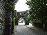
| Site fortification | Burgtorstrasse and Oberstrasse, each behind the development location |
almost completely preserved defense with rectangular and round towers |
|
|
| Road bridge | At the bridge stone location |
19th century | Road bridge, two-arched, quarry stone, 19th century | |
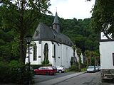
| Evangelical parish church | Burgtorstrasse location |
third quarter of the 15th century | Hall construction; Choir from the third quarter of the 15th century, nave, portal and porch from 1689; Complete complex with rectory (Burgtorstraße 9): five-axis plastered building, first half of the 19th century |
|
| Residential building | Burgtorstrasse 2 location |
18th century | Half-timbered house, partly massive, 18th century |

|
| school | Burgtorstrasse 3 location |
1886/87 | former school, 1886/87 | |
| Residential building | Burgtorstrasse 4 location |
17th or 18th century | Half-timbered house, partly massive, 17th or 18th century |

|
| Residential building | Burgtorstrasse 6 location |
17th or 18th century | Half-timbered house, partly massive, clad, probably from the 17th or 18th century |

|
| Residential building | Oberstrasse 3 location |
late 19th century | Residential house with a right-angled half-timbered wing, late 19th century | |
| Meinhof | north of the village location |
between 1859 and 1869 | princely wied tenant farm; three-winged courtyard in half-timbered construction, alpine style, built between 1859 and 1869; Related: Ottoquelle, shell-shaped fountain bowl, marked 1863 |
Narrower
Monument zones
| designation | location | Construction year | description | image |
|---|---|---|---|---|
| Monument zone of the former electoral palace | Alte Schloßstraße 2 location |
1759-1762 | two-and-a-half-storey, seventeen-axis mansard roof building, three-axis side wings, central projection, 1759–1762, court architect Johannes Seiz ; Court of honor with wrought iron bars, sandstone pillars based on a Seiz design, sandstone sculptures by Johann Feill ; two sentry boxes |
 more pictures more pictures
|
Individual monuments
| designation | location | Construction year | description | image |
|---|---|---|---|---|
| City fortifications | around 1370 | around 1370, in the substructure of the houses; so-called Gray Tower (next to Alte Schloßstraße 1); former defense tower (at Jakobstrasse 15); so-called Duckesje (between Klosterstrasse 2a and 2d) | ||
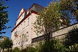
| From Speesche's house | Alte Schloßstraße 1 location |
around 1770 | also Heinrich House ; Mansard roof building, seven to seven axes, around 1770, architect probably Nikolaus Lauxen |
|
| Gray tower | Alte Schloßstraße, next to No. 1 location |
around 1370 | Quarry stone round tower of the local fortification built around 1370, renovated and redesigned in the 19th century |

|
| town hall | Alte Schloßstraße 3 location |
1642 | former town hall; Half-hipped roof building, partly half-timbered, 1642 |

|
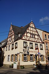
| Gasthaus Schloßschenke | Alte Schloßstraße 5 location |
1691 | partly half-timbered, supposedly from 1621, more from 1691 |
|
| Residential and guest house | Alte Schloßstraße 27 location |
first quarter of the 19th century | representative two-wing plastered building, in the core probably from the first quarter of the 19th century | |
| Residential building | At the old town hall 1 location |
1756 | Half-timbered house, partly massive, half-hip roof, marked 1756 | |
| Master House | At Heinrichhaus 2 location |
around 1902-1903 | Seat of the Landesmusikakademie Rheinland-Pfalz ; representative three-storey plastered baroque building, around 1905/10 |

|
| Residential building | Am Heinrichhaus 9, Helle 2 location |
1617 | residential building consisting of two structures; gabled half-timbered house, 17th century (Am Heinrichhaus 9), remains of the city wall and a city wall tower (Rheintor) around 1370 in the basement area and ground floor; Rear component (light 2): probably older, partly massively renewed, partly boarded-up framework, partly slated |

|
| Residential building | Bendorfer Strasse 32 location |
1900 | Row house, clinker brick facade, shortly after 1900 | |
| St. Sebastian plague chapel | Bendorfer Strasse at the corner of Kapellenstrasse Lage |
1662 | Pestkapelle St. Sebastian, marked 1662, originally located outside the city wall |

|
| Evangelical parish church | Dietrich-Bonhoeffer-Strasse location |
1900/02 | New late Gothic building, 1900/02 |
 more pictures more pictures
|
| Residential building | Falksgasse 5/7 location |
late 16th century | Half-timbered house, partly solid and plastered, in the core probably from the 16th century | |
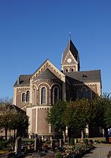
| Catholic parish church of St. Martin | Jakobstrasse location |
neo-Romanesque column basilica, brick and tuff, 1897/98; War memorial in the cemetery 1870/71, marked 1897; Former defense tower of the city fortifications on the northern edge of the cemetery (see Jakobstrasse, at no. 15) |
 more pictures more pictures
|
|
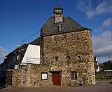
| Defense tower | Jakobstrasse, at No. 15 location |
around 1370 | Defense tower of the fortification built around 1370, three-storey quarry stone building on a trapezoidal floor plan, the roof with a bell ridge allegedly from 1778 |
|
| Duckesje | Klosterstrasse, between No. 2a and 2d location |
around 1370 | Part of the fortification built around 1370, today a two-storey round tower with a conical roof |

|
| villa | Klosterstrasse 17a location |
around 1860 | late classicist villa, around 1860 | |
| Engers station | Mühlhofener Straße 31 location |
around 1860/70 | late classicist type construction, around 1860/70 |

|
| Residential building | Sayner Landstrasse 20 location |
around 1900 | villa-like house; single-storey mansard roof building, two-tone clinker facade, around 1900 | |
| Water tower | Weiser Strasse 1 location |
1900 | Water tower, marked 1900 |
 more pictures more pictures
|
| Residential building | Weiser Strasse 18 location |
around 1920 | Apartment building, representative sixteen-axis plastered building, reform architecture, around 1920 | |
| Railway bridge | west of the village location |
1918 | bridgehead on the right bank of the Rhine; double-towered basalt bridge gate of the Kronprinz-Wilhelm-Brücke, 1918; four-arched section on three land pillars, half-timbered construction from 1954 |
 more pictures more pictures
|
Feldkirchen
Monument zones
| designation | location | Construction year | description | image |
|---|---|---|---|---|
| Historic center of Fahr |
Fahr , Linzer Strasse 27–32, Kleine Brunnengasse 3–10, Große Brunnengasse 1–4, Driver Strasse 69–81 Lage |
17th and 18th centuries | dense, almost urban-looking development with half-timbered houses, mostly from the 17th and 18th centuries |
Individual monuments
| designation | location | Construction year | description | image |
|---|---|---|---|---|
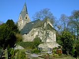
| Evangelical parish church | Feldkircher Strasse location |
first half of the 13th century | formerly St. Martin; late Romanesque pillar construction, first half of the 13th century, converted into a stepped gallery around 1500; Romanesque font, early 12th century; Complete complex with rectory: quarry stone building, second half of the 19th century, and former courtroom |
 more pictures more pictures
|
| Residential building | Fahr, driver street 77 location |
1682 | elongated half-timbered house, partly massive, marked 1682 |
 more pictures more pictures
|
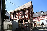
| Lower mill | Fahr, driver street 79 location |
1686 | Half-timbered house, partly massive, marked 1686 |
 more pictures more pictures
|
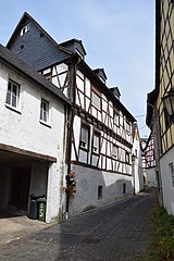
| Residential building | Fahr, Große Brunnengasse 1 location |
17th century | Half-timbered house on a high basement, probably from the 17th century |
|
| Residential building | Fahr, Große Brunnengasse 3/4 position |
17th or 18th century | Half-timbered house, 17th or 18th century |

|
| Residential building | Fahr, Kleine Brunnengasse 3 location |
18th century | Half-timbered house, partly massive, 18th century | |
| Residential building | Fahr, Kleine Brunnengasse 7 location |
Half-timbered house, partly massive | ||
| Residential building | Fahr, Kleine Brunnengasse 10 location |
second half of the 18th century | stately half-timbered house, mansard roof, second half of the 18th century | |
| Residential building | Fahr, Linzer Straße 28 location |
18th century | Half-timbered house, partly massive, 18th century | |
| Rhenish house | Fahr, Linzer Straße 30 location |
1584 | Multi-part half-timbered house, partly massive, middle section marked 1584, transverse building from the 17th or 18th century, extension under a mansard roof in the second half of the 18th century |
 more pictures more pictures
|
| Villa Roentgen | Fahr, Thomas-Mann-Straße 10 location |
1847 | Hipped roof building on a staggered floor plan, 1847; Overall structure with park and garden area including arch bridge, marked 1897 |

|
| Residential building | Gönnersdorf, An der Linde 15 location |
17th century | Half-timbered house, 17th century | |
| Residential building | Gönnersdorf, An der Linde 28 location |
Half-timbered house | ||
| Residential building | Gönnersdorf, An der Linde 32 location |
17th century | Half-timbered house, partly massive, 17th century, half-timbered porch probably a bit more recent | |
| Rockenfeld desert |
Rockenfeld location |
Deserted town, memorial stone from 1962/62 | ||
| Wollendorf Castle | Wollendorf, Karl-Marx-Strasse 39a / 41, Von-Ebner-Eschenbach-Strasse 11, location |
Stump of a medieval round tower; Complete system with half-timbered barn |
 more pictures more pictures
|
|
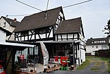
| Residential building | Wollendorf, Karl-Marx-Straße 44 location |
17th century | Half-timbered house, partly massive, possibly from the 17th century |
|
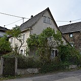
| Residential building | Wollendorf, Karl-Marx-Straße 49 location |
17th or 18th century | Half-timbered house, partly solid, plastered, probably from the 17th or 18th century |
|
| Residential building | Wollendorf, Rockenfelder Straße 5 location |
around or after 1800 | Half-timbered house, around or after 1800 |
Gladbach
Individual monuments
| designation | location | Construction year | description | image |
|---|---|---|---|---|
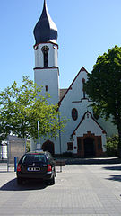
| Catholic parish church Maria Himmelfahrt | At the Marienkirche location |
1914 | two-aisled vaulted step hall, post-Gothic forms, 1914 |
|
| War memorial | Hans-Thoma-Strasse, in the cemetery location |
around 1920 | War memorial 1914/18, display wall | |
| Wülfersberg Chapel | northeast of the town of Lage |
12th Century | Romanesque chapel of a former Premonstratensian monastery with a baroque roof turret |
 more pictures more pictures
|
| Wayside chapel | northeast of the town of Lage |
18th or 19th century | Wayside chapel; small open plastered building, 18th or 19th century | |
| Holy House | east of the village on Rommersdorfer Straße location |
18th or 19th century | Holy house; Round closed, plastered wall block, 18th or 19th century |
Heimbach-Weis
Monument zones
| designation | location | Construction year | description | image |
|---|---|---|---|---|
| Monument zone of the former Premonstratensian Abbey in Rommersdorf | Rommersdorfer Weg 2 location |
before 1125 | originally three-aisled pillar basilica, probably started before 1125, completed before 1179; 1202 / 04-10 conversion of the south transept; New choir built in 1347 / 49–51, 1478 extension of the Anna chapel; 1559/76, 1671, 1698 partial demolition; Monastery building, begun between 1135 and 1145, dormitory, north and east wings of the cloister and chapter house between 1214 and 1233; Monastery buildings, 18th century, including nine-axis abbot's house, baroque mansard roof, convent building, marked 1708, farm building, some with mansard roofs; stately courtyard entrance, 1777, building director Nikolaus Lauxen , Koblenz; park |
 more pictures more pictures
|
Individual monuments
| designation | location | Construction year | description | image |
|---|---|---|---|---|
| Residential building | Blocker Strasse 11 location |
1677 | Half-timbered house, partly massive, supposedly from 1677, more likely from the 18th century; younger single-storey porch | |
| Courtyard | Blocker Strasse 22 location |
18th century | Streckhof; Grauwacke house / half-timbered house, 18th century; former stable part of the 19th century | |
| Courtyard | Well ring 18 position |
18th century | Courtyard with half-timbered house from the 18th century, quarry stone barn and courtyard wall from the 19th century | |
| Residential building | Bungartstrasse 16 location |
18th century | Half-timbered house, partly quarry stone, 18th century | |
| Rectory | Burghofstrasse 1 location |
1791 | Rectory; cubic mansard roof, 1791; Courtyard wall with baroque gate pillars | |
| Catholic parish church St. Margaretha | Main street location |
1772 | Hall building, 1772, architect Johannes Seiz, basilically extended in 1891, three-storey Romanesque tower |
 more pictures more pictures
|
| Trinity Chapel | Hauptstrasse, at No. 3a location |
1711 ff. | Baroque plastered building, buttresses, 1711 ff., reconstruction after fire in 1799 |
 more pictures more pictures
|
| Inn | Hauptstrasse 8 location |
after 1900 | Inn; Baroque stucco and plaster decoration, probably shortly after 1900 |

|
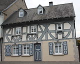
| Residential building | Hauptstrasse 111 location |
17th century | Half-timbered house, partly massive, 17th century, gable triangle renewed around 1900 |
 more pictures more pictures
|
| Residential building | Hauptstrasse 131 location |
in the middle of the 19th century | Half-timbered house; Eaves part with knee stick, mid-19th century, gable part around 1900 | |
| Residential building | Hauptstrasse 133 location |
late 19th century | Half-timbered house, late 19th century | |
| Wayside cross | Hauptstrasse, corner of Abteistrasse Lage |
16th or 17th century | Wayside cross, 16th or 17th century; Relief cross in a gable-shaped, closed niche | |
| Wayside cross | Lindenstrasse, in front of No. 83 Lage |
1742 | Wayside cross, marked 1742 | |
| War memorial | Sayner Strasse, corner of Obere Görgengasse Lage |
around 1920 | War memorial 1914/18 | |
| Wayside cross | Sayner Strasse, corner of Otzbachweg location |
1814 | Shank cross, marked 1814 | |
| Krupp's holy house | northeast of the village in the forest location |
1785 | small plastered building, marked 1785 |
Really
Individual monuments
| designation | location | Construction year | description | image |
|---|---|---|---|---|
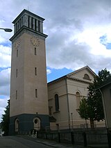
| Catholic parish church of St. Peter and Paul | Apostelstrasse location |
1831-1835 | late classical hall building, 1831–1835 |
 more pictures more pictures
|
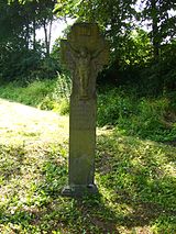
| Wayside cross | Kurtrierer Straße, at No. 26 Lage |
1825 | Shank cross, basalt, marked 1825 |
|
| Zehnthof | Rodenbacher Strasse 12 location |
17th century | Zehnthof; towering solid construction, today's appearance from the 17th century, possibly older in the core |

|
| Wayside cross | Talweg, at No. 63 location |
18th or 19th century | Shank cross, basalt, 18th or 19th century |

|
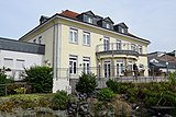
| Villa Selter | Wollendorfer Strasse 88 location |
1923 | Neoclassical building with a hipped roof, 1923 |
|
Niederbieber
Monument zones
| designation | location | Construction year | description | image |
|---|---|---|---|---|
| Jewish cemetery monument zone | Kurt-Schumacher-Strasse, Von Stauffenberg-Strasse location |
17th century | Founded in the 17th century, more than 600 tombstones |
 more pictures more pictures
|
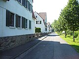
| Monument zone Rasselsteiner Kolonie | Stahlwerkstrasse 2–20 and 9a – 12a, Gettelborn 1–19, Nordsteg 1–5, Marienborn 1–13a, Wiedufer 1–10, In den Akazien 1–3, 6 and 7 Lage |
after 1918 | Rasselstein factory settlement, laid out after the First World War and unusually completely preserved |
|
Individual monuments
| designation | location | Construction year | description | image |
|---|---|---|---|---|
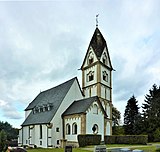
| Evangelical parish church | At the Kirchberg location |
Late 15th century | Choir and tower of the late Romanesque predecessor, three-aisled nave from the end of the 15th century |
 more pictures more pictures
|
| villa | Aubachstrasse 119 location |
at the end of the 19th century | representative villa, brick structure, end of the 19th century |

|
| House Weyerwoog | Augustenthaler Strasse 86 location |
third quarter of the 19th century | late classical solid building, third quarter of the 19th century |

|
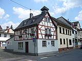
| Council and bakery | Backhausgasse 1 location |
1736 | former council and bakery; Half-timbered house, partly massive, supposedly from 1736 |
|
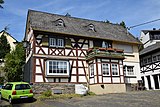
| Residential building | Backhausgasse 4 location |
18th century | Half-timbered house, partly massive, 18th century |
|
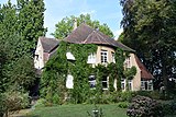
| villa | Burgstrasse 76 location |
around 1910/20 | stately villa, reform architecture, around 1910/20 |
|
| painting | Kurt-Schumacher-Strasse / Von-Stauffenberg-Strasse location |
Early 16th century | In the new building of the Catholic parish church St. Bonifatius from 1961 ff. two Middle Rhine paintings, beginning of the 16th century |

|
| villa | Neuer Weg 26 location |
around 1920 | Mansard roof villa, around 1920 |

|
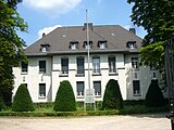
| Villas | Weißer Berg 3, 5 and 7, Hans-Böckler-Straße 26, Weißer Berg 7 location |
around 1910 | three former director's villas of the Rasselstein company, Art Nouveau forms, around 1910; Entire facility with gatehouse (Weißer Berg 7) |
|
| Mill | Wiedbachstrasse 58 location |
18th century | former mill; Half-hip roof building, 18th century |

|
| Nodhausen farm | southwest of the place (Nodhausen 1) location |
1901 | richly staggered building, Swiss country house style, 1901; on the site probably remains of the pleasure park of the Wiedschen Hof Nodhausen, which was laid out in 1742; Carlsaal, a pavilion-like classicist building |

|
Oberbieber
Individual monuments
| designation | location | Construction year | description | image |
|---|---|---|---|---|
| Road bridge | Braunsbergstrasse / Löhstrasse location |
19th century | Road bridge over the Aubach, single arch, quarry stone, 19th century |

|
| Residential building | Braunsbergstrasse 18 location |
1768 | two-winged house, partly plastered, supposedly from 1768; Quarry stone ground floor, half-timbering on the rear wing from around 1700, on the street-side wing from the 19th century | |
| Courtyard | Braunsbergstrasse 36 location |
around 1800 | Three-wing system, around 1800; Half-hipped roof building, quarry stone ground floor, half-timbered structure, partially plastered, around 1800; Complete system with farm buildings | |
| villa | Friedrich-Rech-Straße 71 location |
at the end of the 19th century | Villa; multi-part structure, end of the 19th century |

|
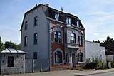
| Residential and commercial building | Friedrich-Rech-Straße 136 location |
1905 | stately Wilhelminian style residential and commercial building, 1905 |
|
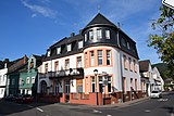
| Hotel Wiedscher Hof | Friedrich-Rech-Strasse 168 location |
around 1910 | Mansard roof building, around 1910 |
|
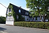
| Paper mill of the Neuwied Brethren | Heimstrasse 35–39 location |
18th century | former paper mill of the Neuwied Brethren, half-timbered building, partly massive, 18th century and around 1800 or from the beginning of the 19th century |
|
| Evangelical parish church | Pfarrer-Herbert-Köhler-Strasse location |
11th or 12th century | lower part of the apse of the Nikolauskapelle, 11th or 12th century, south tower from the second quarter of the 13th century, single nave nave, 1751–1790 |
 more pictures more pictures
|
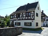
| Residential building | Above the Aubach 11 location |
Half-timbered house, partly massive |
|
Former cultural monuments
| designation | location | Construction year | description | image |
|---|---|---|---|---|
| Road bridge | Friedrich-Rech-Strasse location |
19th century | Road bridge over the Aubach, single arch, quarry stone, 19th century; deleted from list of monuments |
Rodenbach
Individual monuments
| designation | location | Construction year | description | image |
|---|---|---|---|---|
| Residential building | At Rast 6 location |
18th century | Half-timbered house, partly solid and slated, half-hip roof, 18th century |

|
| Residential building | Niederbieberer Strasse 2 location |
in the middle of the 19th century | former school (?); Classical quarry stone building, tent roof, mid-19th century |

|
| Residential building | Oberdorfstrasse 15 location |
around 1800 | Residential house, quarry stone construction, partially plastered, half-timbered gable, around 1800; overbuilt well |

|
| Residential building | Oberdorfstrasse 34 location |
around 1800 | Residential house, quarry stone construction, partly half-timbered, around 1800 |

|
Segendorf
Individual monuments
| designation | location | Construction year | description | image |
|---|---|---|---|---|
| Residential building | Dorfstrasse 13 location |
around 1700 | Half-timbered house, partly massive, around 1700 |

|
| Residential building | Dorfstrasse 14 location |
late 17th century | Half-timbered house, partly massive, from the 17th century |

|
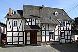
| Residential building | Dorfstrasse 19 location |
around 1700 | Half-timbered house, around 1700 |
|
| Fountain | Nodhausener Strasse, corner of Am Reichelbach Lage |
1868 | Running fountain, neo-Gothic, marked 1868 |
 more pictures more pictures
|
| Outbuilding of Monrepos Castle | northwest of the village (Monreposstraße 2, 4, 6, 10, 12, 15) location |
from 1899 | Adjoining building of the Monrepos Castle of the Princes von Wied, which was removed in 1969, complete complex;
|
 more pictures more pictures
|
Soil monuments
As part of the UNESCO World Heritage Site Upper German-Raetian Limes , the remains and reconstructions of the Niederbieber fort are in the Niederbieber district and the remains of the Anhausen fort in the Heimbach-Weis district . The so-called Heidenmäuerchen in Engers in the area of the property at Klosterstrasse 12 is also protected as a ground monument; no remains of the Roman Burgus have survived.
literature
- General Directorate for Cultural Heritage Rhineland-Palatinate (Ed.): Informational directory of cultural monuments: District of Neuwied (PDF; 6.4 MB). Mainz 2018.
