List of cultural monuments in Bad Berka
The list of cultural monuments in Bad Berka contains all the cultural monuments of the Thuringian city of Bad Berka ( Weimarer Land district ) and its districts (as of April 26, 2012).
Bad Berka
Monument ensembles
| image | location | Official name | description |
|---|---|---|---|

|
Kurpark 50 ° 53 ′ 55 ″ N, 11 ° 17 ′ 19 ″ E |
Spa gardens and spa facilities with included objects:
|
|

|
Klosterberg 50 ° 54 ′ 3 ″ N, 11 ° 17 ′ 4 ″ E |
Klosterberg with included objects:
|
|

|
Market 50 ° 54 ′ 1 ″ N, 11 ° 16 ′ 59 ″ E |
City center with the following properties included:
|
Individual monuments
| image | location | Official name | description |
|---|---|---|---|
 more pictures more pictures
|
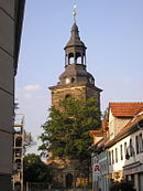
Klosterberg 50 ° 54 ′ 2 ″ N, 11 ° 17 ′ 5 ″ E |
Parish church of St. Marien with churchyard | |
|
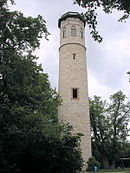
Adelsberg 50 ° 54 ′ 8 ″ N, 11 ° 18 ′ 0 ″ E |
Paulinenturm | |

|
Am Goethehaus 1 50 ° 54 ′ 1 ″ N, 11 ° 17 ′ 2 ″ E |
Goethe House | |

|
Am Zeughausplatz 11 50 ° 53 ′ 59 ″ N, 11 ° 16 ′ 49 ″ E |
formerly hunting arsenal | |

|
Brühl 3 50 ° 53 ′ 55 "N, 11 ° 17 ′ 0" E |
Homestead | |

|
Friedensplatz 50 ° 54 ′ 2 ″ N, 11 ° 17 ′ 4 ″ E |
Memorial for the fallen of the First World War, sculpture by Adolf Brütt | |

|
graveyard | Cemetery chapel 50 ° 54 ′ 8 ″ N, 11 ° 16 ′ 54 ″ E |
|

|
10 tombs 50 ° 54 ′ 8 ″ N, 11 ° 16 ′ 57 ″ E |
||

|
Fountain (on the market until the beginning of the 20th century as "Apothekenbrunnen") 50 ° 54 ′ 8 ″ N, 11 ° 16 ′ 54 ″ E |
||

|
Memorial to Victims of Fascism 50 ° 54 ′ 8 ″ N, 11 ° 16 ′ 57 ″ E |
||

|
Cemetery wall 50 ° 54 ′ 9 ″ N, 11 ° 16 ′ 53 ″ E |
||
| Harthallee 50 ° 53 ′ 14 ″ N, 11 ° 15 ′ 41 ″ E |
Forest division stone (forest path from the central clinic to Munich, halfway on the right side of a fork in the road) | ||

|
Heinrich-Heine-Allee 2 50 ° 53 ′ 40 ″ N, 11 ° 16 ′ 46 ″ E |
Residential building with outdoor facilities (Villa "Alice") | |

|
Heinrich-Heine-Allee 4 50 ° 53 ′ 39 ″ N, 11 ° 16 ′ 43 ″ E |
former "Starcksches Sanatorium" | |

|
Heinrich-Heine-Allee 6 50 ° 53 ′ 35 ″ N, 11 ° 16 ′ 41 ″ E |
Residential building | |

|
Hinterm Forste 50 ° 53 ′ 22 ″ N, 11 ° 16 ′ 51 ″ E |
Control room of the waterworks Fl. 13, Flst. 1612 | |

|
Ilmstrasse 1 50 ° 54 ′ 0 ″ N, 11 ° 17 ′ 12 ″ E |
Farm building and enclosure (so-called "Edelhof") | |

|
Klosterberg 50 ° 54 ′ 3 ″ N, 11 ° 17 ′ 3 ″ E |
Klosterberg School | |

|
Market 50 ° 54 ′ 1 ″ N, 11 ° 16 ′ 59 ″ E |
Fountain | |
 more pictures more pictures
|
Market 10 50 ° 54 ′ 0 ″ N, 11 ° 17 ′ 1 ″ E |
town hall | |

|
Mühlgraben 50 ° 53 ′ 59 ″ N, 11 ° 17 ′ 5 ″ E |
||

|
Pfarrgasse 1 50 ° 54 ′ 2 ″ N, 11 ° 17 ′ 7 ″ E |
Rectory, 7 tombstones in the cemetery | |

|
Pfarrgasse 6 50 ° 54 ′ 2 ″ N, 11 ° 17 ′ 8 ″ E |
Bridge and Mühlgraben | |

|
Pfarrgasse / Ilmstraße (extension of Pfarrgasse) 50 ° 54 ′ 2 ″ N, 11 ° 17 ′ 9 ″ E |
Bridge ("parish bridge") | |

|
Parkstrasse 8 50 ° 54 ′ 3 ″ N, 11 ° 17 ′ 29 ″ E |
sanatorium | |

|
Parkstrasse 14 50 ° 54 ′ 12 ″ N, 11 ° 17 ′ 30 ″ E |
Kurhaus Am Adelsberg | |

|
Parkstrasse 16 50 ° 54 ′ 14 ″ N, 11 ° 17 ′ 28 ″ E |
Bath and society house (Coudrayhaus) | |

|
Robert-Koch-Strasse 9 50 ° 53 ′ 22 ″ N, 11 ° 16 ′ 3 ″ E |
Central Clinic | |

|
Robert-Koch-Strasse 9 50 ° 53 ′ 21 ″ N, 11 ° 15 ′ 57 ″ E |
former culture house | |
| Stone trench 6a 50 ° 53 ′ 49 "N, 11 ° 16 ′ 10" O |
Summer house | ||
 more pictures more pictures
|
Tannrodaer Strasse 13.15 50 ° 53 ′ 1 ″ N, 11 ° 15 ′ 57 ″ E |
Martinswerk | |

|
Tannrodaer Strasse 34 50 ° 53 ′ 25 ″ N, 11 ° 16 ′ 20 ″ E |
Sanatorium "Schloß Gutenberg" with ancillary facilities and park | |

|
Tiefengrubener Strasse 15, 17 50 ° 53 ′ 56 ″ N, 11 ° 16 ′ 54 ″ E |
closed courtyard (homestead) | |

|
Tiefengrubener Strasse 19 50 ° 53 ′ 55 ″ N, 11 ° 16 ′ 53 ″ E |
Door frames | |

|
Treben 50 ° 53 ′ 11 ″ N, 11 ° 17 ′ 16 ″ E |
Waterworks | |

|
Troistedter Strasse 50 ° 54 ′ 50 ″ N, 11 ° 15 ′ 52 ″ E |
Forsthaus Tiefborn | |

|
Weimar Straße 2 50 ° 54 ′ 1 ″ N, 11 ° 16 ′ 58 ″ E |
formerly the judicial office | |

|
Weimar Straße 7 50 ° 54 ′ 3 ″ N, 11 ° 16 ′ 53 ″ E |
formerly movie theater | |

|
Weimar Straße 16 50 ° 54 ′ 7 ″ N, 11 ° 16 ′ 51 ″ E |
formerly customs house |
Ground monument
| image | location | Official name | description |
|---|---|---|---|

|
1.4 km north of the village, medieval castle ruins, so-called “castle” in the spur of the river Ilm 50 ° 54 ′ 41 ″ N, 11 ° 17 ′ 7 ″ E |
Wall with moat, building site for the castle ruins |
Bergern
Monument ensemble
| image | location | Official name | description |
|---|---|---|---|

|
Ferdinand-Staatz-Strasse 1 50 ° 55 ′ 7 ″ N, 11 ° 16 ′ 53 ″ E |
former estate and estate park with:
|
Single monument
| image | location | Official name | description |
|---|---|---|---|
|
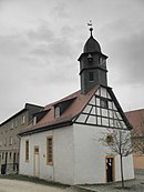
Kirchgasse 50 ° 55 ′ 6 ″ N, 11 ° 16 ′ 53 ″ E |
church |
Gutendorf
Single monument
| image | location | Official name | description |
|---|---|---|---|

|
Kirchgasse 50 ° 55 ′ 11 ″ N, 11 ° 12 ′ 41 ″ E |
Church with a churchyard | |

|
Gutendorfer Strasse No. 13 50 ° 55 ′ 13 ″ N, 11 ° 12 ′ 38 ″ E |
Portal parts | |

|
Gutendorfer Strasse No. 35 50 ° 55 ′ 13 ″ N, 11 ° 12 ′ 39 ″ E |
Gate and portal | |

|
Gutendorfer Strasse No. 44 50 ° 55 ′ 11 ″ N, 11 ° 12 ′ 49 ″ E |
Residential building | |

|
Gutendorfer Strasse in front of house No. 35 50 ° 55 ′ 13 ″ N, 11 ° 12 ′ 39 ″ E |
Waidmühlstein |
Meckfeld near Bad Berka
Single monument
| image | location | Official name | description |
|---|---|---|---|

|
In the village 50 ° 54 ′ 58 ″ N, 11 ° 11 ′ 22 ″ E |
Church with a churchyard |
Munich near Bad Berka
Single monument
| image | location | Official name | description |
|---|---|---|---|

|
Tonndorfer Strasse 3/4 50 ° 52 ′ 15 ″ N, 11 ° 15 ′ 14 ″ E |
former manor | |

|
Tonndorfer Strasse 50 ° 52 ′ 22 ″ N, 11 ° 15 ′ 4 ″ E |
Residential building (former waterworks) | |

|
Adolf-Tegtmeier-Allee 16 former Sophienheilstätte Munich 50 ° 52 ′ 29 ″ N, 11 ° 15 ′ 19 ″ E |
former Sophienheilstätte Munich |
Schoppendorf
Single monument
| image | location | Official name | description |
|---|---|---|---|

|
Am Teiche 1 50 ° 55 ′ 43 ″ N, 11 ° 16 ′ 7 ″ E |
church | |

|
At pond 1 by the church 50 ° 55 ′ 42 ″ N, 11 ° 16 ′ 7 ″ E |
Waidmühlstein | |

|
At pond 1 by the church 50 ° 55 ′ 42 ″ N, 11 ° 16 ′ 7 ″ E |
Waidmühlstein with anchoring | |

|
south of the location 50 ° 55 ′ 40 ″ N, 11 ° 16 ′ 15 ″ E |
Spring vault |
Ground monument
| image | location | Official name | description |
|---|---|---|---|

|
At the eastern entrance to the village, turn left on the road under the linden tree 50 ° 55 ′ 47 ″ N, 11 ° 16 ′ 7 ″ E |
Stone cross "Schwedenstein" |
Tannroda
Monument ensemble
| image | location | Official name | description |
|---|---|---|---|

|
Markt and Marktstrasse 50 ° 51 ′ 34 ″ N, 11 ° 14 ′ 48 ″ E |
Markt and Marktstrasse with:
|
Single monument
| image | location | Official name | description |
|---|---|---|---|

|
Lindenberg 50 ° 51 ′ 30 ″ N, 11 ° 14 ′ 41 ″ E |
church | |

|
Cemetery 50 ° 51 ′ 24 ″ N, 11 ° 15 ′ 18 ″ E |
Grave site for 6 unknown concentration camp inmates | |

|
At trench 50 ° 51 ′ 39 ″ N, 11 ° 14 ′ 51 ″ E |
Under mill | |

|
Braugasse 1 50 ° 51 ′ 37 ″ N, 11 ° 14 ′ 44 ″ E |
former brewery | |

|
Harthstrasse 50 ° 51 ′ 47 ″ N, 11 ° 14 ′ 39 ″ E |
Rock cellar | |

|
Kranichfelder Strasse / Bahnhofstrasse 50 ° 51 ′ 40 ″ N, 11 ° 14 ′ 40 ″ E |
Memorial death march stele | |

|
Lindenberg 50 ° 51 ′ 32 "N, 11 ° 14 ′ 40" E |
Castle and castle ruins | |

|
Lindenberg 2 50 ° 51 '35 "N, 11 ° 14' 44" E |
Schützenkeller | |

|
Lindenberg 4 50 ° 51 ′ 34 "N, 11 ° 14 ′ 44" E |
Rectory | |

|
Lindenberg 12 50 ° 51 '28 "N, 11 ° 14' 44" E |
Homestead (former forestry office) |
Ground monument
| image | location | Official name | description |
|---|---|---|---|

|
Ridge protruding to the southwest immediately west of the city Auf dem Schlossberg 50 ° 51 ′ 31 ″ N, 11 ° 14 ′ 37 ″ E |
Wall and moat, castle, red castle, Hainwiese |
Deep pits
Monument ensemble
| image | location | Official name | description |
|---|---|---|---|

|
Location 50 ° 53 ′ 51 ″ N, 11 ° 13 ′ 53 ″ E |
Location as a Rundlingsdorf |
Single monument
| image | location | Official name | description |
|---|---|---|---|
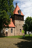
|
Dorfstrasse 50 ° 53 ′ 51 ″ N, 11 ° 13 ′ 52 ″ E |
church | |

|
Cemetery 50 ° 53 ′ 44 ″ N, 11 ° 13 ′ 50 ″ E |
Gravestone from 1852 | |

|
Dorfstrasse 50 ° 53 ′ 50 ″ N, 11 ° 13 ′ 52 ″ E |
Fallen memorial at the village pond | |

|
Dorfstrasse 31 50 ° 53 ′ 49 ″ N, 11 ° 13 ′ 50 ″ E |
Residential building | |

|
Dorfstrasse 61 50 ° 53 ′ 54 ″ N, 11 ° 13 ′ 52 ″ E |
House, gate and gate | |

|
K 311 50 ° 53 ′ 33 ″ N, 11 ° 14 ′ 6 ″ E |
Water treatment plant building | |

|
On the Angerborne 50 ° 53 ′ 54 ″ N, 11 ° 13 ′ 51 ″ E |
Water pumping station |
source
Commons : Cultural monuments in Bad Berka - collection of images, videos and audio files
- Thuringian State Office for Monument Preservation: List of monuments in the district of Weimarer Land (PDF file; 420 kB)

