from Wikipedia, the free encyclopedia
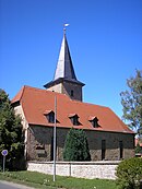
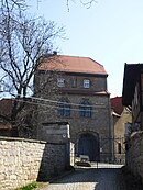
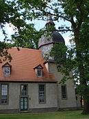
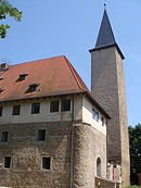
In the list of cultural monuments in Ilmtal-Weinstrasse , all cultural monuments of the districts of the Thuringian community of Ilmtal-Weinstrasse (district of Weimarer Land) are listed (as of April 26, 2012).
Cultural monuments according to districts Denstedt Monument ensemble Individual monuments
image
location
Official name
description
Church with a churchyard
The organ in Denstedt Church was designed by Johann Gottlob Töpfer and built in 1859/60.
graveyard
Memorial stone for 22 anti-fascists
Karl-Marx-Strasse 1F
lock
Karl-Marx-Strasse 2
Mill farm with mill technology
Karl-Marx-Strasse 23, 23a, 23b, 23c
Residential house with gate and outbuildings
Linkershof
Heraldic panel
northeast exit of the village
Ilm Bridge
Ground monument
image
location
Official name
description
Flat spur protruding to the northwest, south of the Ilm and west of Denstedt
Moat and inner courtyard of the castle, castle, building site
Goldbach Individual monuments
image
location
Official name
description
church
Kromsdorf North / Großkromsdorf
Individual monuments
image
location
Official name
description
church
Democracy Square 43
Residential house with enclosure (former rectory)
Democracy Square
lock
Village street
Belfry
graveyard
Memorial stone for 18 unknown concentration camp prisoners
No. 13
Gate and gate
No. 51
Outbuilding and portal (former village tavern)
Monument ensembles
Kromsdorf South / Kleinkromsdorf
Individual monuments
image
location
Official name
description
Church with a churchyard
At the church 5
former school and courtyard wall
At the bakery 9
Homestead
Leutenthal Individual monuments
image
location
Official name
description
Church with a churchyard
In the village 2
Components of the former office building: cellar with fountain and coat of arms
In the village 13
Residential building
opposite house number 35
Waidmühlstein
Liebstedt Monument ensemble
image
location
Official name
description
Berggasse 95, 95b and 96
Wasserburg and Gut
Individual monuments
image
location
Official name
description
Church with a churchyard
Berggasse 95
Moated castle
Berggasse 100
Homestead
Long Street 9
Residential building
Long Street 19
Residential building
Long Street 31
Residential house (rectory) and vaulted cellar of the former barn (and inscription panel)
Long Street 32
Gate and portal
Ground monument
image
location
Official name
description
Slightly elevated terrain at the south-east corner of the village, gradually rising towards the south
Moated castle, castle, commandery
Mattstedt Individual monuments
image
location
Official name
description
church
Lower Village 112
Residential building
Suburb 113
Residential house, barn building
Suburb 115
Homestead and bridge (former mill homestead)
Suburb 117
Courtyard
Suburb 122
Rectory
Suburb 134
Residential building
between Mattstedt and B 87
Ilm Bridge
Tear down
Individual monuments
image
location
Official name
description
church
The core of the Romanesque building, from the 12th century, is the nave, other parts of the church date from the 18th century
Niederroßla
Monument ensemble
image
location
Official name
description
Moated castle, manor, mill, bridge and homestead as well as included street space with paving
Apoldaer Strasse No. 1, 3, 4, 5, 6, 7, 8, 9
Buttstädter Strasse No. 2
Mühlgasse No. 1, 2, 3, 8, 9, 10, 11
Castle courtyard No. 1, 2, 8, 9, 10, 11, 12
Individual monuments
image
location
Official name
description
Church and churchyard
Castle courtyard 8
Moated castle
Niederroßla Castle
Arno-Müller-Strasse
Street pavement and bounding courtyard walls
Arno-Müller-Strasse 12
Portal of the residential building
Buttstädter Strasse (town center)
Ilm Bridge
Mühlgasse 3
Mill homestead including grinding technology
Mühlgasse 8
front door
Mühlgasse 9
Homestead
Apoldaer Strasse
signpost
Buttstädter Strasse
signpost
Nirmsdorf Individual monuments
Tearing over
Individual monuments
image
location
Official name
description
church
Tower windmill
Oßmannstedt
Individual monuments
image
location
Official name
description
church
Good with buildings, structures, gardens and parks ("Wielandgut")
Jahnplatz 7
Residential building
Karl-Liebknecht-Strasse 13
Homestead
Karl-Liebknecht-Strasse 14
Residential building
Wielandstrasse 3
Homestead
Ground monument
image
location
Official name
description
About 1700 m west of the village, on the western edge of an erosion channel overgrown with bushes and trees, 300 m north of the Weimar - Apolda railway line
Stone cross
Pfiffelbach Individual monuments
image
location
Official name
description
church
on the road to Buttstädt
obelisk
Rohrbach Monument ensemble
image
location
Official name
description
In village 35 and 36
Former property with “castle”, farm building and park
Individual monuments
image
location
Official name
description
Church with churchyard with: churchyard wall, memorial for fallen soldiers with enclosure, tombstone (obelisk approx. 1.20 m high, end of 18th century), tombstone (female figure, approx. 1.50 m high)
In the village
Fuhrwerkswaage (north of the church on a square-like widening at the intersection of several village streets)
Ground monument
image
location
Official name
description
On the north-eastern outskirts, 9 m east of the road to Oberreißen. In front of the garden fence on the Reinhardt property. Way to Oberreißen and Pfiffelbach
Stone cross
Ulrichshalben Individual monuments
image
location
Official name
description
church
Grosse Kirchgasse 17
former manor house
Ground monument
image
location
Official name
description
On the northern edge of the village, close to the northeast of the church, already in the Ilm lowlands from 1.5 m high
Former estate, moated castle, flat moth with remains of buildings, partially filled moat
Wersdorf Individual monuments
image
location
Official name
description
church
Location, in front of the restaurant
Waidmühlstein
Willerstedt Individual monuments
image
location
Official name
description
church
Buttstädter Strasse
Transformer house
Franz-Magnus-Böhme-Strasse 7
Gate and portal
Kirchberg 13
Homestead
Old Market 11
Residential building
old market
Waidmühlstein
Ground monument
image
location
Official name
description
Marshy meadow in the southeast - part of the village location, 100 m east of the church
Motte, the castle, the meal
source Individual evidence
↑ See information on the church and the town of Niederreißen ( memento of original Internet Archive Info: The archive link was inserted automatically and has not yet been checked. Please check the original and archive link according to the instructions and then remove this notice. @1 @ 2 Template: Webachiv / IABot / vg-ilmtal-weinstrasse.de
<img src="https://de.wikipedia.org//de.wikipedia.org/wiki/Special:CentralAutoLogin/start?type=1x1" alt="" title="" width="1" height="1" style="border: none; position: absolute;">


