List of cultural monuments in Blankenhain
The list of cultural monuments in Blankenhain includes all cultural monuments of the Thuringian city of Blankenhain (Weimarer Land district) and its districts (as of April 26, 2012).
Blankenhain
- Monument ensembles
- Single monument
| image | location | Official name | description |
|---|---|---|---|

|
Brauhausstrasse 11 |
Residential building | |

|
Christian-Speck-Strasse 2 |
State school | |

|
Christian-Speck-Strasse 4 |
Special school for people with learning disabilities (Villa Vogt) | |

|
Christian-Speck-Strasse 7 |
Residence "Villa Fasoldt" | |

|
Old graveyard: |
Memorial stone for those who fell in World War I. | |

|
GCF Wirth tomb, 1817 | ||

|
Fasolt tomb, 1906 | ||

|
Hindersin tomb, 1909 | ||

|
Tomb, weathered inscription, 18th century (approx. 190 cm high, with cartouches set in rocailles) | ||
| Tomb, weathered inscription, 18th century (approx. 60 cm high, with putti head in clouds) | |||

|
Tomb Günter, Ida and Oskar Wagner, (with relief figure of a people's policeman) | ||
| Area of the cemetery wall with the following tombs: |
Dr. Hugo Werner, around 1900 | ||

|
Otto Eiermann, 1876 | ||

|
Martha Wittig et al., 1908 | ||
| Else Wuttke (secondary use), around 1900 | |||

|
Albert Bogenhard, 1908 | ||
|
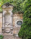
Hössel (secondary use), end of the 19th century | ||

|
Tomb without inscription (to the right of Hössel tomb), around 1900 | ||
|
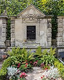
Ernst Müller, 1903 | ||
|
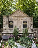
Wanda Geißler, around 1900 | ||

|
Gutheil, 1914 | ||

|
graveyard |
5 gravestones of 8 Italian forced laborers | |

|
graveyard |
soviet cemetery of honor | |

|
graveyard |
VVN cemetery | |

|
graveyard |
Konrad Fuß's grave site | |

|
Great Nonnengasse |
Catholic Church of St. Anna | |

|
Grosse Nonnengasse 4 |
Homestead | |

|
Karlstrasse 8 |
Residential building | |

|
Karl-Liebknecht-Strasse 34 |
Krakow Manor | |

|
Church square 1 |
Residential and commercial building | |

|
Kirchstrasse 8/10 |
Rectory | |
|
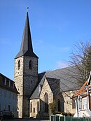
Kirchstrasse 12 |
City Church of St. Severi | |

|
Market 1 |
town hall | |
 |
Market street |
lock | |

|
Market street |
Friedrich-Lessner memorial stone | |

|
Marktstrasse 4 |
former office building | |

|
Marktstrasse 7 |
Inn and farm building | |
 |
Rudolf-Breitscheid-Str. 2 |
"Zum Güldenen Zopf" inn | |

|
Rudolf-Breitscheid-Strasse 12 |
Rococo door | |

|
Rudolstädter Strasse 8 |
arched doorway with farm building |
Altdörnfeld
- Single monument
| image | location | Official name | description |
|---|---|---|---|

|
At the Anger |
Church with a churchyard | |

|
Am Anger 4 |
Homestead | |

|
Am Anger 5 |
Residential building |
Drößnitz
- Single monument
| image | location | Official name | description |
|---|---|---|---|

|
At the Angerberg |
church | |

|
graveyard |
Selma Loch tomb | |
|
graveyard |
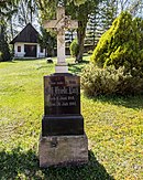
Tomb of Joh. Friedr. hole | |

|
graveyard |
Grave of Aug. Minna Morgenroth, b. Loch (high iron cross on a stone base, 19th century) | |

|
graveyard |
Tomb (low stone as a rock imitation with an open book) | |

|
No. 5 |
Courtyard with passage and outbuildings | |

|
No. 16 |
Old school | |

|
No. 22 |
Homestead | |

|
No. 23 |
Outbuilding on the village square | |

|
in front of No. 27 |
Well with pump | |

|
No. 33 |
Homestead (rectory) | |

|
Center 50 ° 49 ′ 43 ″ N, 11 ° 25 ′ 11 ″ E |
Cattle scale | |
| Location
|
Waidmühlstein | Object can no longer be found on site, location unknown. | |
| Exit at the Wittersroda / Drößnitz fork in the road
|
signpost | Object cannot be found on site, location unknown. |
Egendorf
- Single monument
| image | location | Official name | description |
|---|---|---|---|

|
No. 1, 1a and 1b |
former state educational home |
Great lohma
- Single monument
| image | location | Official name | description |
|---|---|---|---|
|
On the Holzberg |
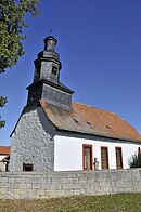
Church with a churchyard |
Hochdorf
- Single monument
| image | location | Official name | description |
|---|---|---|---|

|
August-Ludwig-Strasse |
Church with a churchyard |
Keßlar
- Single monument
| image | location | Official name | description |
|---|---|---|---|

|
Kesselstrasse |
Church with a churchyard | |

|
Kesselstrasse 4 |
Residential building (southern part of the kindergarten) | |

|
Kesselstrasse 12 |
Homestead |
Little lohma
- Single monument
| image | location | Official name | description |
|---|---|---|---|

|
Anger |
Bell house with bell |
Kottenhain
- Single monument
| image | location | Official name | description |
|---|---|---|---|

|
Kottenhain No. 2,3,4,6 |
former property |
Krakendorf
- Single monument
| image | location | Official name | description |
|---|---|---|---|

|
Under the Bornberg |
church | |

|
House number 18 |
barn | |

|
House number 19 |
Homestead | |

|
House number 36 |
Homestead |
Lengefeld
- Single monument
| image | location | Official name | description |
|---|---|---|---|

|
Kirchgasse |
Church with a churchyard |
Lotschen
- Single monument
| image | location | Official name | description |
|---|---|---|---|
|
At the river |
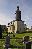
Church with a churchyard | |

|
out of town |
Water pumping system (wind turbine) |
Meckfeld
- Single monument
| image | location | Official name | description |
|---|---|---|---|

|
Village green |
Church with a churchyard |
Neckeroda
- Monument ensemble
| image | location | Official name | description |
|---|---|---|---|

|
Location |
Location with: Rundling with ramparts, barn ring, courtyards |
- Single monument
| image | location | Official name | description |
|---|---|---|---|

|
Local road |
church | |

|
Local road |
Cemetery and enclosure | |

|
Local road 19 |
Courtyard | |

|
Local road 20 |
Courtyard | |

|
Local road 50 |
Homestead | |

|
On the B 85, near the church |
Waidmühlstein | |
| Park at the entrance to the village |
Waidmühlstein | ||

|
on the B 85 towards Teichel |
Border stone, shield-holding lion on base |
- Ground monument
| image | location | Official name | description |
|---|---|---|---|

|
Runs around the place, the east side is the street area |
Village fortification |
Neudörnfeld
- Single monument
| image | location | Official name | description |
|---|---|---|---|

|
Hauptstrasse 2 |
former manor |
Niedersynderstedt
- Single monument
| image | location | Official name | description |
|---|---|---|---|

|
On the linden trees |
Church with a churchyard | |

|
On the linden trees |
Rectory | |

|
House No. 2 |
Homestead | |

|
House number 19 |
Homestead |
Obersynderstedt
- Single monument
| image | location | Official name | description |
|---|---|---|---|

|
Lohmaer Strasse |
Church with a churchyard |
Pfarrkeßlar
- Single monument
| image | location | Official name | description |
|---|---|---|---|

|
At Angerberg 35 |
Components of the former church | With the kind support of the owner |
Rettwitz
- Single monument
| image | location | Official name | description |
|---|---|---|---|

|
Above the Hayn |
Church with a churchyard | |

|
House number 3 |
Residential house, gate | |

|
House number 4 |
Homestead | Former location, on the left the remains of house no.4 |

|
Above the grove 12 50 ° 49 ′ 55 ″ N, 11 ° 18 ′ 9 ″ E |
Homestead | |

|
Over the grove 13 |
Homestead |
Rottdorf
- Monument ensemble
| image | location | Official name | description |
|---|---|---|---|

|
Location |
Location with house No. 1 - 9, 13 - 16, 18 - 20, 22 - 29, 32 - 36, 42 and 43 |
- Single monument
| image | location | Official name | description |
|---|---|---|---|

|
Bachstrasse |
Church with a churchyard | |

|
House number 6 |
goal | |

|
House number 19 |
Homestead | |

|
House number 32 |
Homestead | |

|
House No. 33 50 ° 51 ′ 10 ″ N, 11 ° 21 ′ 42 ″ E |
Homestead |
Saalborn
- Monument ensemble
| image | location | Official name | description |
|---|---|---|---|

|
In the village |
Church, rectory, school and poor house |
- Single monument
| image | location | Official name | description |
|---|---|---|---|
|
In the village |
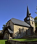
Church with a churchyard | |

|
House number 24 |
Gate and portal | |

|
House number 31 |
Residential house with outbuildings, well and enclosure (former parish) |
Schwarza
- Single monument
| image | location | Official name | description |
|---|---|---|---|

|
At the Schwarza |
Church with a churchyard |
- Ground monument
| image | location | Official name | description |
|---|---|---|---|

|
At the Schwarza 18 |
Stone cross |
Söllnitz
- Single monument
| image | location | Official name | description |
|---|---|---|---|

|
At the maid |
Church with a churchyard | |

|
House number 19 |
Homestead | |

|
At the Magdel, near the bridge |
Waidmühlstein |
Thangelstedt
- Single monument
| image | location | Official name | description |
|---|---|---|---|
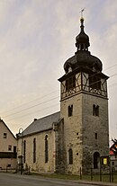
|
Village street |
Church with a churchyard | |

|
Village street |
Manor house (former noble farm) |
Tromlitz
- Single monument
| image | location | Official name | description |
|---|---|---|---|

|
Village square |
Church with a churchyard | |

|
graveyard |
Grave site for a slave laborer and a prisoner of war | |
| Anger |
Grave site for a concentration camp inmate | ||
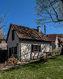
|
Village square |
Bakehouse | |
|
|
Garden house of the former Good |
Wittersroda
- Single monument
| image | location | Official name | description |
|---|---|---|---|

|
At the Reinstädter Bach |
church | |

|
At Reinstädter Bach No. 13 |
farm |
source
Commons : Kulturdenkmale in Blankenhain - Collection of pictures, videos and audio files
- Thuringian State Office for Monument Preservation: List of monuments in the district of Weimarer Land (PDF file; 420 kB)


