List of cultural monuments in Cavertitz
The list of cultural monuments in Cavertitz contains the cultural monuments of the municipality of Cavertitz that were recorded by the State Office for Monument Preservation of Saxony until March 2020 (excluding archaeological cultural monuments). The notes are to be observed.
This list is a subset of the list of cultural monuments in the district of North Saxony .
Cavertitz
| image | designation | location | Dating | description | ID |
|---|---|---|---|---|---|
 |
Stone cross | Hauptstraße (at the end of the village, direction Laas) (map) |
15th century, 16th century | On the occasion of the death of a person by manslaughter or an accident, a cross-shaped memorial made of sandstone, known as the Murder and Atonement Cross, of local historical significance, of particular value due to its advanced age |
08972539 |
 |
Road bridge over the Dahle | Main street (map) |
1st half of the 20th century | High-quality, largely original bridge construction made of gray granite, of importance in terms of building history and traffic history |
08972536 |
 |
Waystone | Hauptstraße (at the end of the village, direction Laas) (map) |
Around 1850 | Significant in terms of traffic history, obelisk-like sandstone path stone |
08972540 |
| Servants' house and side building | Hauptstrasse 35 (map) |
2nd half of the 18th century | As the servants' house of the manor, which has largely been preserved in its original form, it is of local and socio-historical importance and, because of its location at the entrance to the town, has a defining effect on the townscape.
|
08972537 |
|
| Servants' house, side building and enclosure | Hauptstrasse 36 (map) |
2nd half of the 18th century | As the servants' house of the manor, which has largely been preserved in its original form, it is of local and socio-historical importance and, because of its location at the entrance to the town, has a defining effect on the townscape.
|
08972538 |
|
 |
Waystone | Kirchstrasse (map) |
Mid 19th century | Significant in traffic history. Path stone made of sandstone, stele with a pyramid-like finish. |
08972542 |
 More pictures |
Church with furnishings, cemetery with enclosure, three tombs, memorial for those who fell in World War I, two ice cellars, outbuildings and Luther oak (garden monument) | Kirchstrasse (map) |
Before 1200 (church); marked 1588 (eastern ice cellar); Mid-18th century (sandstone grave); 1st half of the 19th century (outbuilding and sandstone grave); around 1850 (sandstone tomb); after 1918; 1st half of the 20th century (western ice cellar) | Romanesque hall church with west tower, of architectural and local significance.
|
08972534 |
 |
Parsonage with parsonage, barn, side building, gate post, wall between courtyard and garden and cattle trough | Kirchstrasse 6 (map) |
1st half of the 18th century and later (side building); around 1780 (parsonage and parish barn) | Rectory, largely preserved in its original state, in a location that characterizes the street scene, of architectural and local significance.
|
08972535 |
| Former school, with sundial | Kirchstrasse 8 (map) |
Around 1860 | Most of the originally preserved plastered building, as a former church school of architectural and local historical importance. Two-storey massive building, half-hipped roof with beaver tail covering, old front door with skylight and sandstone walls, windows with plastered walls, some with sandstone walls, windows renewed in accordance with monument regulations, window openings on the ground floor partly enlarged later. |
08972533 |
|
 More pictures |
Former castle (school yard 2), farm building (school yard 1) and gatehouse | Schoolyard 1, 2 (map) |
1906 (New Castle); marked 1906 (gatehouse) | Castle (today school), a plastered building with reform style elements from around 1910, farm building (today a kindergarten) a plastered building with ornamental framework in the jamb area, as a former manor of architectural and local historical importance.
|
08972543 |
 |
Former country warehouse with stairs and gate posts | Treptitzer Strasse 1 (map) |
1956 | Country store of the consumer cooperative Oschatz, importance for the history of the GDR, good original condition, historically important. Two-storey, massive building, original scratch plaster (painted over), plinth veneered with quarry stone, plaster flaps, mostly original windows, gable roof with hipped dormers, brick roofing, sills made of dark gray terrazzo, original front door, other entrance doors renewed. Five-step staircase made of natural stone in sloping terrain, simple banisters, west porch 1989. |
08972541 |
Outside
| image | designation | location | Dating | description | ID |
|---|---|---|---|---|---|
 |
Transformer station | Mühlberger Strasse (map) |
Around 1915 | As the first transformer house in Außenig, it was of importance in terms of local history, supply history and technology history. Brick building (plastered) with a steep pitched roof, covered with roof tiles and a wooden top (ventilation tower). |
08972565 |
 |
Guest house with hall extension | Mühlberger Strasse 15 (map) |
Around 1780 (inn); around 1880 (hall) | Broad plastered building with a striking effect on the street scene, one of the oldest buildings in the village, of architectural and local significance.
|
08972561 |
 |
House and enclosure of a farm | Mühlberger Strasse 22 (map) |
Around 1750 | One of the few preserved half-timbered houses in the village, of importance in terms of architectural history and the appearance of the street.
|
08972562 |
 |
Side building (with Kumthalle) | Mühlberger Strasse 23 (map) |
Marked 1912 | Most of the original preserved evidence of rural life, of architectural and socio-historical importance. Two-storey quarry stone building, partly brick, sandstone walls, original plaster structure, original windows. |
08972563 |
Bucha
| image | designation | location | Dating | description | ID |
|---|---|---|---|---|---|
| Moving house of a farm | August-Bebel-Strasse 3a (map) |
Around 1840 | Most of the original preserved building in a rare mud brick construction, historically important. One-storey, cleaned, original plaster structure, windows renewed, flat sloping pitched roof with brim tile covering, original front door with skylight. |
08972553 |
|
| Memorial to the fallen of the First World War | Unity Street (map) |
1918 | Of local historical importance, obelisk made of reddish artificial stone in the form of a stele on a pedestal |
08972555 |
|
 More pictures |
Church with furnishings and sundial, churchyard with enclosure and a tomb | Unity Street (map) |
1868/1869 and later (church); around 1910 (tomb) | Hall church in the arched style, of architectural and local significance. Quarry stone masonry, plastered, elongated hall with arched windows, set west tower with pyramid roof, tomb A. Silze with life-size figure of Christ, demolition wooden pump. |
08972556 |
 |
Residential stable house | Unit 17 Street (Map) |
Marked 1877 | Most of the original preserved building of a former three-sided courtyard in typical forms of its construction time, historically important. Broken and brick masonry, largely original plaster structure, sandstone sills on the ground floor and upper floor (younger on the upper floor), original front door with skylight and sandstone walls, gable roof with roofing felt, window renewed. Inside: original staircase, some original interior doors. |
08972554 |
Blade Grove
| image | designation | location | Dating | description | ID |
|---|---|---|---|---|---|
 |
Arch bridge | (west of Klingenhain, parcel 181/1) (map) |
19th century | Characterizes the earlier course of the old mill ditch, of architectural significance. Hay bridge, an arch made of granite slabs (roughly hewn), consisting exclusively of radial slabs. |
08973376 |
 |
Road bridge over the Dahle (towards Mark) | At the Dahle (map) |
Around 1845 | Three-arched round arch bridge with three arches over the Dahle , well-preserved and rare evidence of traffic engineering with an impact on the landscape and the image of the village, of architectural significance. Wall on the street, rubble stone grouted, supporting pillars replaced. |
08972433 |
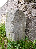 |
Waystone | At the Dahle (opposite No. 7 at the bridge) (map) |
2nd half of the 19th century | Significant in terms of traffic history, sandstone scratched, writing washed out |
08972432 |
 More pictures |
Residential mill house and side building of a former mill property (Obermühle) | At the Dahle 2 (map) |
Around 1840 | Characteristic of the streetscape due to its location at the entrance to the village, of architectural and local significance.
|
08972434 |
 |
Moving out house (with Kumthalle) of a three-sided courtyard | At Dahle 8 (map) |
Marked 1882 | Plastered quarry stone building, evidence of rural life, of architectural significance. The plaster is partly chipped, partly a simple structure (strip pilasters) is still preserved, the ratio of wall area to openings has been changed (four windows have been added, two windows and door new), Kumthalle partly still with sandstone walls, roof covering with roofing felt. |
08972431 |
 |
Residential stable house, barn and enclosure with gate entrance to a three-sided courtyard | At Dahle 13, 13a (map) |
Around 1800 (stable house); around 1900 (barn) | Largely originally preserved, typical for the region and already rare, half-timbered house, massive barn construction, of importance in terms of building history, local history and shaping the townscape.
|
08972429 |
 |
Residential stable house, pull-out house and enclosure of a three-sided courtyard | At Dahle 22 (map) |
Around 1820 and later | As a half-timbered house that has largely been preserved in its original form, it is of architectural and local significance, and together with the side building it has a significant impact on the street scene.
|
08972427 |
 |
Residential mill building with mill technology, side building and courtyard paving of a mill property (Harzbeckermühle) | Mühlenweg 1 (map) |
Marked 1906 (in the gable of the residential wing); marked 1921 (cowshed) | Mill ensemble, largely preserved in its original state, of importance in terms of architectural, local and technical history. The mill building consists of a two-storey residential wing with a gable roof with the gable facing the street and the actual mill building with four storeys and a flat gable roof adjoining it at the rear. Both buildings are different. There is an inscription on the gable with the date 1906. With their historicizing design, the two parts of the mill could also have been built before 1900. The mill wing, originally a water mill, appears as a plastered building with clinker brick dividing elements. The facades show artificial stone walls in the original plaster. The front residential house with beaver tail covering is enlivened by artificial stone walls, plaster structures, arched curtain windows on the first floor and plaster reliefs (female heads) on the gable. The latter is lavishly designed in the neo-Gothic style. The stable designated 1921, side building, originally probably a dairy cattle stable, is a single-storey plastered building with a pronounced mansard roof (Eternit above) with a plain tile roof. The front is structured by plastered ribbons, bezels and mirror surfaces. The basket arch portal consists of natural stone walls. The actual mill wing shows the usual structure of a grain mill with a floor for the main transmission on the ground floor, grinding floor or roller mill floor, tube floor and classifier floor. Only part of the technology has survived. The main transmission on the ground floor is no longer available. On the floor of the roller mill stands a roller mill from the year 1936 from the company Gebrüder Bühler Dresden. There is also a mixing machine here. The tube sheet (second floor) shows various mixing machines / silos. An aspirator (cleaning) from the Bühler company, probably also from the 1930s, a semolina cleaning machine from the Jehmlich Nossen company and a filter cabinet stand on the plan sifter floor. Apart from that, elevators, augers, the brake elevator with elevator winch (around 1935) and other technology can be found on the various floors. The mill was used privately until 1960, after which it came to the LPG (according to the 1999 survey) and was a compound feed plant for a long time (compound feed plant Klingenhain-Oschatz, name on an iron girder in the mill). |
08972428 |
Lampertswalde
| image | designation | location | Dating | description | ID |
|---|---|---|---|---|---|
 More pictures |
Manor and Castle Park Lampertswalde (entity) | At Winkel 1, 2, 3, 5, 9 (map) |
18th century, older in core (manor); around 1700 (castle park); 1st half of the 19th century (manor barn); around 1850 (distillery) | Subject aggregate of the manor and castle park Lampertswalde, with the following individual monuments: gatehouse with angled farm building and temple in the garden (individual monument 08972571, Am Winkel 1), gardener's house with sundial (individual monument 08972571, Am Winkel 2), former estate administrator's house (individual monument 08972569, Am Winkel 3), So-called tenant house, two arched bridges and grotto in the castle park as well as the enclosure walls of the farm yard and the castle park with two gate pillars (individual monument 08972568, Am Winkel 5), the castle park (garden monument) and the following parts: barn (parcel 73, opposite Am Winkel 3), former Distillery building (Am Winkel 9), remains of the wall of the former orangery and pond with a fountain and two ponds to the north and northwest with causeways and avenues (the buildings and outbuildings at Am Winkel 4, 6, 7, 8 and 10 are not of monumental value); Plant of particular importance in terms of building history, local history and garden art |
08972572 |
 |
Gatehouse with angled farm building and temple in the garden (individual monuments to ID no. 08972572) | Am Winkel 1 (map) |
Inscribed with 1824 (temple); marked 1912, older in the core (gatehouse) | Individual features of the aggregate manor and Castle Park Lampertswalde; as a structural part of the former manor of architectural and local significance.
|
08972571 |
 |
Gardener's house with sundial (individual monument for ID no. 08972572) | Am Winkel 2 (map) |
15th century and later (gardener's house); marked 1778 (sundial) | Individual monument belonging to the manor and Castle Park Lampertswalde; In its cubature, the plastered building is exceptionally broadly based with a high hipped roof, very old structure, as part of the castle ensemble of architectural, house history, local history and townscape-defining importance. Broadly mounted, two-storey plastered building (quarry stone and brick masonry, sandstone walls) with two large gate openings on the west side, three oval window openings on the south side, hipped roof with two rows of bat dormers, on the south side changed by roof pike, original front door, windows that have been renewed in accordance with listed buildings Beaver tail tiles, sundial. |
08972570 |
| Former estate manager's house (individual monument for ID no. 08972572) | Am Winkel 3 (map) |
Around 1855 | Individual monument belonging to the manor and Castle Park Lampertswalde; As far as possible originally preserved, as part of the farmyard of architectural and local historical importance. Two-storey, massive plastered building with a half-hipped roof, intact wall opening ratio, northern half of the building (now number 4) heavily redesigned. |
08972569 |
|
 |
So-called tenant house, two arched bridges and grotto in the castle park as well as the enclosure walls of the farm yard and the castle park with two gate pillars (individual memorials for ID no. 08972572) | Am Winkel 5 (map) |
Around 1770 (tenant house); 18th century and older (arch bridge); around 1850 (grotto) | Individual features of the aggregate manor and Castle Park Lampertswalde; Stately plastered building with a distinctive mansard hipped roof, historically, characterizing the townscape and of importance in terms of local history.
|
08972568 |
 More pictures |
Residential house, flour mill, sawmill and courtyard paving of a mill property (flour mill) | Malsener Strasse 1 (map) |
Marked 1833, in the core probably older (Müllerwohnhaus); marked 1919 (flour mill) | As a former watermill with a late baroque miller's house, largely preserved in its original form, of architectural, local and technical historical importance.
|
08972579 |
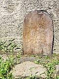 |
Waystone | Sommerseite (corner of Sörnewitzer Strasse) (map) |
2nd half of the 19th century | Of importance for the history of traffic. Granite, formerly black inscription (illegible). |
08972586 |
 More pictures |
Atonement Cross | Summer page 28 (next to) (map) |
15./16. century | Significant in local history. Atonement cross made of sandstone, cross arms broken off, moved to its current location in the 1960s. |
08972574 |
| Residential stable house (without extension) | Summer page 38 (map) |
Around 1800 | Rural house with plastered half-timbered upper floor, of architectural significance. Two-storey plastered building, ground floor massively driven under, upper storey mostly half-timbered, windows renewed, two-storey boarded extension, gable roof covered with roof tiles, steep roof pitch. |
08972577 |
|
| Side building of a three-sided courtyard | Sommerseite 42 (map) |
Around 1800 | Most of the original preserved building in half-timbered construction (St. Andrew's cross), historically important. One storey, sword ribbons, courtyard side gable side partly solid, wide compartments, gable roof. |
08972576 |
|
| Residential stable house, barn and enclosure of a former three-sided courtyard | Summer page 56 (map) |
Around 1800 (stable house); around 1900 (barn) | Architecturally important, three-sided courtyard that was previously closed.
|
08972578 |
|
 More pictures |
Church with furnishings, cemetery with enclosure and churchyard gate, prison, memorial for the fallen of the First World War, memorial stone for the victims of fascism, memorial stone German / French. War and four tombs | Soernewitzer Strasse (map) |
13th century and later (church); 18th and 19th centuries (tomb); 18th century (prison); around 1871 (memorial plaque); after 1918 (war memorial) | Of importance in terms of building history, local history and the appearance of the town.
|
08972585 |
| Pavement | Sörnewitzer Strasse (between Sommerseite and Zeuckritzer Strasse) (map) |
1st half of the 20th century | Pavement of Sörnewitzer Strasse between the summer side and Zeuckritzer Strasse, of importance for the townscape. Stones of gray granite, partly over-tarred. |
08972583 |
|
 |
Inn with equipment, barn and stone path | Soernewitzer Strasse 1 (map) |
2nd half of the 18th century (barn); Early 19th century (inn); Mid 19th century (Wegestein); 1918 (catering equipment) | Plastered building with a dining room from 1918 that has largely been preserved in its original form, of importance in terms of building history, local history and the appearance of the street, road stone with importance for the history of traffic.
|
08972589 |
 More pictures |
Mill with equipment, side building and barn as well as mill wheel, mill ditch and courtyard pavement (Niedermühle, Dörfchenmühle) | Sörnewitzer Strasse 3 (next to) (map) |
Marked 1822 and later (Mühle); Mid 19th century (side building); 2nd half of the 19th century (barn) | Largely original, stately mill complex of architectural, local and technical historical importance.
|
08972588 |
 More pictures |
Parsonage, side building and barn of a parsonage as well as enclosure with gate entrance | Soernewitzer Strasse 5 (map) |
Marked 1748 (at the courtyard gate) | Rectory stately, baroque plastered building with a high hipped roof, of importance in terms of architectural history, local history and character of the townscape.
|
08972587 |
| House and courtyard building | Winter page 11 (map) |
1789 | Residential house in largely original, preserved half-timbered construction, of importance in terms of building history and the street scene.
|
08972580 |
|
| Residential building (without recent additions) | Zeuckritzer Strasse 5 (map) |
2nd half of the 18th century | One of the last evidences of smallholder life in Lampertswalde from the later 18th century in half-timbered construction, historically important. Two-storey plastered building, ground floor massive undercuts, upper floor half-timbered, on the ground floor wooden walls, front door and floor tiles from around 1910, old windows, gable roof covered with roof tiles. |
08972566 |
Olganitz
| image | designation | location | Dating | description | ID |
|---|---|---|---|---|---|
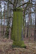 |
Totality of Royal Saxon Triangulation (" European degree measurement in the Kingdom of Saxony "); Station 106, Olganitz | (Parcel 324a) (map) |
Marked 1873 | Triangulation column; Second order station, significant testimony to geodesy of the 19th century, of significance in terms of surveying history. Triangulation column consisting of a flat base, offset column end, column shaft and slightly protruding end, height 2.4 m, Pirna sandstone, inscription "Station / OLGANITZ / der / Königl: Sächs. / Triangulirung / 1873", cover plate missing. |
09286950 |
| Church with furnishings, churchyard and enclosure wall | Am Anger (map) |
Around 1200 | Picturesque, small hall church, of architectural and local significance.
|
08972550 |
|
| Residential stable house of a homestead | Neue Strasse 25 (map) |
Around 1880 | The plastered building, largely preserved in its original form, testimony to the peasant way of life in the second half of the 19th century, has a significant architectural history. Massive building (broken stone and brick), original plaster, plaster walls, old windows, gable roof with renewed brick roofing, front door renewed. |
08972551 |
Reudnitz
| image | designation | location | Dating | description | ID |
|---|---|---|---|---|---|
 |
Forester's house and barn of a former forester's yard | Bockwitzer Strasse 42 (map) |
Around 1850 (barn); 2nd half of the 19th century (forester's house) | Both buildings in half-timbered construction, striking building ensemble of architectural and local historical importance.
|
08972557 |
Umbrella seat
| image | designation | location | Dating | description | ID |
|---|---|---|---|---|---|
 More pictures |
Saxon-Prussian boundary stone : Pilar No. 5 (left Elbe) as well as a runner stone | (Parcel 823) (map) |
After 1828 | See also population 09305644; In terms of surveying history and regional history, it is of importance as a contemporary document of the historical demarcation between Saxony and Prussia after the Congress of Vienna in 1815. Truncated pyramid made of sandstone with plinth directly on the boundary line, number 5 chiseled on the opposite side and the country code KP / KS, (at least) one corresponding running stone on the boundary line. |
08973377 |
 |
Saxon-Prussian boundary stone: Pilar No. 6 (left Elbe) and 42 runner stones | (Parcel 327) (map) |
After 1828 | See also population 09305644; In terms of surveying history and regional history, it is important as a contemporary document of the historical demarcation between Saxony and Prussia after the Congress of Vienna in 1815. Truncated pyramid made of sandstone with plinth directly on the boundary line, number 6 carved on the opposite side and the country code KP / KS, associated with 42 running stones at irregular intervals on the boundary line, nine running stones were moved and placed around the Pilar. |
08973379 |
 More pictures |
Rectory | Pfarrweg 1 (map) |
Marked 1729 (sandstone portal) | As a former parsonage of local historical importance, as a successor to the accommodation of Emperor Charles V during the Battle of Mühlberg of regional historical importance. Two-storey plastered building, upper storey partially half-timbered (mounted, original below), windows and front door renewed, mansard roof with a crooked hip. |
08973369 |
 More pictures |
Church with furnishings and cemetery with enclosure wall | Pfarrweg 2 (map) |
13th century and later | Hall building with a transverse rectangular tower, of architectural and local significance. Tower gable with pilaster strips, tower with roof turret and weather vane, enclosure: quarry stone masonry with sandstone cover, brick masonry with cover made of sandstone slabs (younger part), quarry stone masonry (plastered) with beaver tail crowning, three goal posts with remnants of a crowning made of sandstone blocks (plastered brick wall section of rubble stone blocks) . |
08972559 |
Nice
| image | designation | location | Dating | description | ID |
|---|---|---|---|---|---|
 |
Waystone | Friedensstrasse 17 (opposite) (map) |
Mid 19th century | Significant in traffic history. Sandstone, low stone on a triangular plan. |
08972590 |
 |
Residential house with stable extension of a three-sided courtyard | Friedensstrasse 20 (map) |
Around 1880 | Residential house of a former village smithy, plastered building with a simple structure, of architectural significance. Two-storey massive building, original plaster structure, original front door with old sandstone walls, old windows, winter windows on the ground floor, sills added later, gable roof (roof tiles). |
08972593 |
 |
Waystone | Olganitzer Strasse (corner of Weinbergstrasse) (map) |
19th century | Of importance in terms of transport history, sandstone stele on a square floor plan |
08972592 |
Soernewitz
| image | designation | location | Dating | description | ID |
|---|---|---|---|---|---|
 More pictures |
Church with furnishings, cemetery with enclosure and memorial for those who died in the First World War | Dorfstrasse (map) |
Around 1200 (church); after 1918 (war memorial) | Hall church of Romanesque origin, of architectural and local significance.
|
08972545 |
| Moving out house of a former three-sided farm | Dorfstrasse 8 (map) |
Around 1800 | Architecturally important. Gable walls, ground floor massive and heavily changed, upper floor facing away from the courtyard massive, courtyard-facing upper floor half-timbered, the only unplastered half-timbered structure in town. |
08972549 |
|
| Residential stable house and barn of a former three-sided courtyard and gate entrance | Dorfstrasse 18 (map) |
1860 (stable house); around 1900 (barn) | Typical regional courtyard complex with architectural history and street picture-defining importance |
08972547 |
|
| Residential house of a three-sided courtyard and courtyard paving | Möhlaer Strasse 11 (map) |
Marked 1864 | Nice example of rural architecture typical of the region from the 2nd half of the 19th century, of architectural significance.
|
08972548 |
Treptitz
| image | designation | location | Dating | description | ID |
|---|---|---|---|---|---|
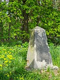 |
Saxon-Prussian boundary stone : Pilar No. 7 (left Elbe) and 20 runner stones | (Parcel 618) (map) |
After 1828 | See also population 09305644; In terms of surveying history and regional history, it is of importance as a contemporary document of the historical demarcation between Saxony and Prussia after the Congress of Vienna in 1815. Scratched sandstone pyramid stump with plinth directly on the borderline, number 7 chiseled on the opposite side and the country code KP / KS, associated with 20 runner stones at irregular intervals on the borderline , Stone very well preserved. |
08972532 |
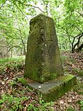 |
Saxon-Prussian boundary stone: Pilar No. 8 (left Elbe) and five runner stones | (Parcel 813) (map) |
After 1828 | See also population 09305644; In terms of surveying history and regional history, it is of importance as a contemporary document of the historical demarcation between Saxony and Prussia after the Congress of Vienna in 1815. Scratched pyramid stump made of sandstone with plinth directly on the boundary line, number 8 chiselled opposite and country code KP / KS, associated with five runner stones at irregular intervals on the boundary line . Inscription barely legible due to weathering. |
08973380 |
 |
Saxon-Prussian boundary stone: Pilar No. 9 (left Elbe) and 67 runner stones | (Parcel 872) (map) |
After 1828 | See also population 09305644; In terms of surveying and regional history, it is of importance as a contemporary document of the historical demarcation between Saxony and Prussia after the Congress of Vienna in 1815. Scratched sandstone pyramid stump with plinth directly on the boundary line, on the opposite side carved number and country code KP / KS, associated with 67 running stones at irregular intervals on the boundary line. Number and inscription subsequently processed and made unrecognizable, Pilar is torn on one side, weathered and covered with biogenic vegetation. |
08973381 |
 |
Atonement Cross | (Parcel 938/2) (map) |
15./16. century | On the occasion of the death of a person by manslaughter or an accident, a cross-shaped memorial, known as the Murder and Atonement Cross, has a significant local history, is of particular value because of its old age, compact sandstone cross |
08973412 |
| Pavement | Heidestraße (between Heidestraße 10 and Neuer Weg) (map) |
1st half of the 20th century | Due to its well-preserved original condition, which runs through almost the entire village, it is of particular relevance to the local image. Granite stones diagonally across the entire width of the street, gutter stones separated from the pavement by laying them across the width. |
08972441 |
|
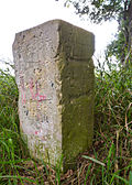 |
Waystone | Heidestrasse (Heidestrasse, junction of the road to Wohlau) (map) |
Around 1900 | High sandstone stele with a prismatic end as part of a garden fence, signposts in the direction of Dahlen and Belgern, of significance in terms of traffic history |
08973411 |
Zeuckritz
| image | designation | location | Dating | description | ID |
|---|---|---|---|---|---|
 |
Residential stable house | Klein-Thiem 1 (map) |
Around 1820 | Stately building with a plastered half-timbered upper floor, due to its original function as a forester's house of local historical importance, due to its large dimensions, as well as its location on the street in largely preserved original condition of structural history and street picture-defining importance.
|
08972702 |
| Pavement | Reudnitzer Strasse (map) |
1st half of the 20th century | Due to its largely original condition, it is a traffic-technical certificate with a character that defines the street scene. Gray granite blocks, irregularly carved. |
08972511 |
|
 More pictures |
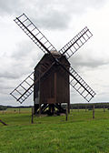
Post mill with technical equipment | Reudnitzer Strasse (map) |
1864 | Mill with equipment, partly renewed, of technical historical importance and extraordinarily important for the landscape. Erected after the fire of the previous mill in 1864, originally belonging to the Lampertswalde manor, Vorwerk Zeuckritz, electric drive (wings 1959 therefore desolate), decommissioned in 1959 (year of collection), in the windmill original comb wheel and grinding stones or grinder, house tree, grinding tree, grinding machines, shafts and transmissions installed in the mill on the house, 1996 restoration and reconstruction. |
08972440 |
Remarks
- This list is not suitable for deriving binding statements on the monument status of an object. As far as a legally binding determination of the listed property of an object is desired, the owner can apply to the responsible lower monument protection authority for a notice.
- The official list of cultural monuments is never closed. It is permanently changed through clarifications, new additions or deletions. A transfer of such changes to this list is not guaranteed at the moment.
- The monument quality of an object does not depend on its entry in this or the official list. Objects that are not listed can also be monuments.
- Basically, the property of a monument extends to the substance and appearance as a whole, including the interior. Deviating applies if only parts are expressly protected (e.g. the facade).
Detailed memorial texts
-
↑ Rittergut and Schlosspark Lampertswalde:
History (Sources: Hugo Koch: "Sächsische Gartenkunst". 1910. P. 45f. / Bormann: "Schlosspark Lampertswalde - Monument Preservation Concept.", Grimma 2004.):- 13th century first documentary mention of the manor
- 1698 Construction of the moated castle and construction of a baroque garden under Hans Gottlieb von Thielau (1662–1723)
- Around 1820 the garden was transformed into a landscape park
- 1824 Construction of the garden pavilion
- At the end of the 19th century, a rock walkway was built with a neo-Gothic entrance gate
- 1949 Demolition of the undestroyed castle and the orangery
- Building:
- Gatehouse with angled farm building (individual monument)
- Gardener's house with sundial (individual monument)
- former estate manager's house (individual monument)
- so-called tenant house (individual monument)
- Barn (entity part)
- former distillery building (entity part)
- Enclosure: Enclosure wall of the farm yard, in the north, east and south the garden is bounded by a plastered quarry stone wall
- Access: Access from the west between the gardener's house and the former orangery over one of the bridges to the island, access to the west of the former orangery, access from the south with a round arched gate and two pillars with vase-like attachments (after 2004, formerly with a garden gate), two that were added later as wall openings Entrances in the northern garden wall, the rock passage that used to function as an entrance is now walled up, path system: landscaped curved path system with a water-bound ceiling
- Horticultural structures: Remnants of the wall of the former orangery (part of the whole), temple-like garden pavilion in the west of the garden (individual monument), a second pavilion in the east, which functions as a point-de-vue, was modeled on the building that was formerly here in the 1990s (no monument), cave rock walk with neo-Gothic portal in the south of the garden (individual monument)
- Garden equipment: two arched bridges over the castle pond, remains of former garden sculptures such as pedestals or wall attachments, the sculptures of the four seasons, which were moved here from the castle park of Leuben in 1894, probably stood on the island until the castle was blown up (1949), according to the statement of the owner they are currently in storage
- Water elements: the castle moat extended to the pond and enclosed with a natural stone wall with the castle island (subject totality part), the island also enclosed with a natural stone wall and equipped with a small staircase in the former main axis of the castle, a well set into the pond wall with a fountain rounded at the top and crowned by two vases Shield wall, gargoyle and two shell-shaped fountain bowls, next to the fountain there is a small staircase to the water, also equipped with vases, another small sandstone fountain basin on the eastern bank of the castle island, two more ponds north and northwest of the estate with surrounding dam paths, northern pond with island
- Alleys and rows of trees: cut rows of linden trees on the island, an avenue made of spherical maple (replanted a few years ago), avenues made of linden trees (Tilia spec.) And oak trees (Quercus robur) along the northern and eastern embankments of the northern pond, The eastern avenue leads to the pavilion, a row of horse chestnut trees (Aesculus hippocastanum) and a loose population of English oaks (Quercus robur) along the western dam on the northwestern dam
- Individual trees: dominant mature trees, including sycamore maple (Acer pseudoplatanus), English oak (Quercus robur), locust trees (Robinia pseudoacacia), ash trees (Fraxinus excelsior), isolated linden trees (Tilia spec.) And Norway maple (Acer platanoides), Special features include a mighty plane tree (Platanus x hispanica) and two tulip trees (Liriodendron tulipifera), a pyramid oak (Quercus robur 'fastigiata') and an old field maple (Acer campestre)
- Hedges and bushes: Hornbeam hedge walkway (Carpinus betulus, renewed a few years ago based on the historical model)
- Geophytes: Crocus (Crocus albiflorus)
swell
- Monument map of Saxony. Retrieved March 24, 2020 .
- Geoportal of the district of North Saxony. Retrieved March 24, 2020 .
Web links
Commons : Cultural monuments in Cavertitz - Collection of images