List of cultural monuments in Walldürn
The list of cultural monuments in Walldürn contains immovable architectural and art monuments from all parts of Walldürn . The basis for this list is the list of architectural and art monuments published by the Karlsruhe Regional Council as of February 15, 2012.
This list is not legally binding. Legally binding information is only available on request from the Lower Monument Protection Authority of Walldürn.
Architectural and cultural monuments of the city of Walldürn
Walldürn (core city)
Architectural, art and cultural monuments in the core town of Walldürn (with the residential area in the Rippberger Tal am Marsbach):
![]() Map with all coordinates of the cultural monuments on the district of the core city Walldürn: OSM
Map with all coordinates of the cultural monuments on the district of the core city Walldürn: OSM
| image | designation | location | Dating | description |
|---|---|---|---|---|
 |
St. Kilian Children's and Youth Home | Adolf-Kolping-Strasse 29 (map) |
1858 | Archbishop's Children's and Youth Home St. Kilian Walldürn.
|
 |
Schreinerskapelle or Laurentiuskapelle |
Boschstrasse (map) |
1726 | Chapel, “Schreinerskapelle”, “Laurentiuskapelle”, 1726, plastered masonry, sandstone, small, accessible building, rectangular floor plan, gable roof, holy blood, inscription: (around the round window) GOTT VND DEM HEILDEN BLVDT ZV LOB VND EHR THESEN KABELEN AVFF / RICHTEN LASEN ANNA MARIA KVHNIN HANS ADAM KUHN WIDIBS / AO 1726 (lintel) RENOVAT ARD SPIES ET IV KVHN ADO 1764 (altar) That holy blood / Lord Jesus Christ zu / Waltürn in corperal / is AMK .; ZEEK no. 6968-60-035.
|
 |
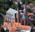
Moated castle | Burgstrasse 3 (map) |
13th century | Former Moated castle (today tax office), horseshoe-shaped, four-storey plastered building with corner blocks under a hipped or half-hipped roof, east side staircase with massive parapet, south remains of the former castle keep, in the core 13th century, in the 15th / 16th. Century (including 1492) expanded, trenches filled in in 1865, surroundings and construction changed, wall included.
|
 More pictures |
Pilgrimage Basilica of St. George | Burgstrasse 13, 15 Kirchenstieg 8 (map) |
14th century - 15th Century | Catholic pilgrimage and parish church of St. Georg, single-aisle room with transept, side chapels, galleries and polygonal choir, the latter flanked by two east towers, extremely rich and high-quality furnishings (including Holy Blood altar), choir and parts of the transept 14th / 15th century. Century or early 17th century, nave with west facade late 17th and early 18th century, churchyard with staircases, terraces and enclosing walls (material assembly with retaining wall, high cross, memorial stone and Lourdes chapel).
|
 |
chapel | Burgstrasse 15 (map) |
19th century | Lourdes chapel, grotto, wooden statues, lime u. Tufa wall, sandstone masonry, slate roof, hall-like, open, spacious superstructure, statue of the Virgin Mary, statue of Bernadette, six knee benches, votive tablet, 19th century; ZEEK no. 6968-60-079.
|
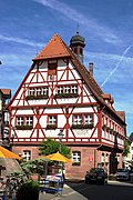 |
town hall | Hauptstrasse 27 (map) |
17th century | Town hall, two-storey, half-timbered eaves house with half-hipped roof and six-sided roof turret (bell tower), ground floor in ashlar, gables protruding on both sides on both sides, ground floor and back rebuilt in the middle of the 19th century, upper floor with loft extension probably originally from the 17th century.
|
 |
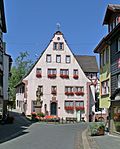
Schalkbrunnen | Hauptstrasse 27 (map) |
Schalkbrunnen
|
|
 More pictures |
Walldürn City and Pilgrimage Museum ("Goldener Engel" inn) |
Hauptstrasse 39 (map) |
1588 | Former Gasthaus Zum Güldenen Engel, later Ehmann wax drawing works, today local history museum (city and pilgrimage museum), two-storey, plastered late Renaissance building with high pitched roof and corner cuboid, eaves side extension with half-timbered construction, two round cellar arches, gable side massive door frame with segment arch, inscribed on the panel above the lintel 1588.
|
| Wayside shrine | Hauptstrasse 39 | 1563 | 1/8 wayside shrine kept in the museum. Niche shrine, 1563 (marked on the lower edge of the niche), red sandstone, remnants of a square shaft with niche head, crucifixus.
|
|
| Wayside shrine | Hauptstrasse 39 | 16th century | Wayside shrine 2/8 kept in the museum. Fragment of a niche shrine, 16th century, red sandstone, niche head part, cruzifixus.
|
|
| Wayside shrine | Hauptstrasse 39 | around 1600 | 3/8 wayside shrine kept in the museum. Niche shrine, around 1600, yellow sandstone, square shaft, niche head part, crucifix with adorant.
|
|
| Wayside shrine | Hauptstrasse 39 | 18th century | 4/8 wayside shrine kept in the museum. Fragment of a niche shrine, 1st half of the 18th century, red sandstone, remainder of the shaft with niche head part, crucifix.
|
|
| Wayside shrine | Hauptstrasse 39 | 18th century | Wayside shrine 5/8 kept in the museum. Fragment of a cruciform roof picture cane, 2nd quarter of the 18th century, red sandstone, headboard, pieta (front), bishop Valentinus (left), saint with cross (right).
|
|
| Wayside shrine | Hauptstrasse 39 | 18th century | 6/8 wayside shrine kept in the museum. Fragment of a relief tablet, 18th century, light sandstone, crucifix.
|
|
| Wayside shrine | Hauptstrasse 39 | 18th century | 7/8 wayside shrine kept in the museum. Fragment of a relief tablet, 18th century, red sandstone, two remnants, Holy Blood.
|
|
| Wayside shrine | Hauptstrasse 39 | 1851 | 8/8 wayside shrine kept in the museum. Fragment of a picture stick “Schwobebild”, 1851, light sandstone, relief tabletop, Holy Blood, inscription: (on the now no longer present base) Donated in 1851 by the Swabians flowing here from the offices of Ellwangen, Aalen and Schwäbisch Gemünd.
|
|
 |
Gaukels Kapellchen | Hornbacher Strasse 1 (map) |
1866 | Chapel, "Gaukels Kapellchen", 1866, plastered masonry, small, accessible building with a rectangular floor plan, with a tent roof; ZEEK no. 6968-60-067.
|
 |
school | Keimstrasse 18 (map) |
around 1910 | School, today elementary school, music school and VHS, three-storey, L-shaped stone building with central projection, hip roof and roof turret, around 1910, walling.
|
| Walldürn Capuchin Monastery | Klosterstrasse 14 (map) |
1628/1655 | The foundation stone of the monastery was laid in the 17th century. Most of the buildings were demolished in 1842; a small part of the complex still exists today as a residential building.
|
|
 |
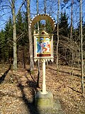
Fiegerskapelle | L 577 (at) (card) |
1882 | Chapel, "Fiegerskapelle", 1882, red sandstone, sandstone masonry, small, accessible building with a rectangular floor plan, with a gable roof, Pieta statue, statue of St. Anthony of Padua, inscription (lintel); ZEEK no. 6968-60-072.
|
 More pictures |
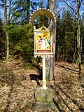
1st station of the cross | Märzenbrünnlein (card) |
Stations of the Cross 01/14: 1st station of the cross of the fourteen stations of the cross to the “Chapel at the Märzenbrünnlein”.
|
|
 More pictures |
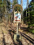
2nd station of the cross | Märzenbrünnlein (card) |
Stations of the Cross 02/14: 2nd station of the cross of the fourteen stations of the cross to the “Chapel at Märzenbrünnlein”.
|
|
 More pictures |
3rd station of the cross | Märzenbrünnlein (card) |
Stations of the Cross 03/14: 3rd station of the cross of the fourteen stations of the cross to the “Chapel at the Märzenbrünnlein”.
|
|
 More pictures |
4th station of the cross | Märzenbrünnlein (card) |
Stations of the Cross 04/14: 4th station of the cross of the fourteen stations of the cross to the “Chapel at the Märzenbrünnlein”.
|
|
 More pictures |
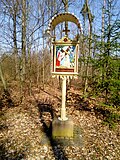
5th station of the cross | Märzenbrünnlein (card) |
Stations of the Cross 05/14: 5th station of the cross of the fourteen stations of the cross to the “Chapel at the Märzenbrünnlein”.
|
|
 More pictures |
6. Stations of the Cross | Märzenbrünnlein (card) |
Station of the Cross 06/14: 6th station of the cross of the fourteen stations of the cross to the “Chapel at the Märzenbrünnlein”.
|
|
 More pictures |
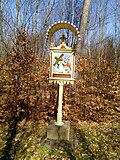
7th station of the cross | Märzenbrünnlein (card) |
Stations of the Cross 07/14: 7th station of the cross of the fourteen stations of the cross to the “Chapel at the Märzenbrünnlein”.
|
|
 More pictures |
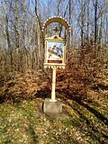
8. Station of the Cross | Märzenbrünnlein (card) |
Stations of the Cross 08/14: 8th station of the cross of the fourteen stations of the cross to the “Chapel at the Märzenbrünnlein”.
|
|
 More pictures |
9. Stations of the Cross | Märzenbrünnlein (card) |
Station of the Cross 09/14: 9th Station of the Cross of the fourteen stations of the Cross to the “Chapel at the Märzenbrünnlein”.
|
|
 More pictures |
10th station of the cross | Märzenbrünnlein (card) |
Stations of the Cross 10/14: 10th station of the cross of the fourteen stations of the cross to the “Chapel at Märzenbrünnlein”.
|
|
 More pictures |
11. Stations of the Cross | Märzenbrünnlein (card) |
Stations of the Cross 11/14: 11th station of the cross of the fourteen stations of the cross to the “Chapel at the Märzenbrünnlein”.
|
|
 More pictures |
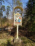
12. Stations of the Cross | Märzenbrünnlein (card) |
Stations of the Cross 12/14: 12th Stations of the Cross of the fourteen Stations of the Cross to the “Chapel at the Märzenbrünnlein”.
|
|
 More pictures |
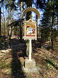
13. Stations of the Cross | Märzenbrünnlein (card) |
Stations of the Cross 13/14: 13th station of the cross of the fourteen stations of the cross to the “Chapel at the Märzenbrünnlein”.
|
|
 More pictures |
14. Station of the Cross | Märzenbrünnlein (card) |
Stations of the Cross 14/14: 14th Station of the Cross of the fourteen stations of the Cross to the “Chapel at the Märzenbrünnlein”.
|
|
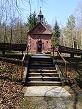 |
Chapel at the Märzenbrünnlein | Märzenbrünnlein (card) |
1899-1900 | Chapel, "Kapelle am Märzenbrünnlein", 1899/1900, sandstone masonry, accessible building, rectangular floor plan with a round apse, gable roof, roof turret, altar, arched door, four arched windows, Pieta, angel with Veronica face, angel with crown of thorns, statue of Mary, images of Christ and Mary ; ZEEK no. 6968-60-074.
|
 |
Maria Rast Chapel | Pater-Josef-Eckstein-Strasse 21 (map) |
Maria Rast Chapel
|
|
 |
Peace Chapel | Würzburger Strasse 19 (map) |
1919 | "Friedenskapelle", 1919 (inscribed above the door), plastered brickwork, slate roof, red sandstone, accessible building, octagonal floor plan, round apse, roof turret, altar with crucifix, four arched windows, arched door, crucifix with halo, inscription: (right at the back on the red sandstone edge) On July 9, 1953 / this chapel / was transferred to the archbishopric / St. Kilian's children's home / for care for eternity / built / v. Oskar Stalf and sr. Wife Emmy / 1919 (window) FX Zeitler, Munich; ZEEK no. 6968-60-075.
|
 |
Deportation memorial | (Map) | Memorial for the Jews from Walldürn who were deported to the Gurs concentration camp on October 22, 1940 . A copy can be found at the Neckarzimmern Central Memorial
|
Altheim
Architectural, artistic and cultural monuments in Altheim (with the village of Altheim, the Dörntal and Kudach farms and the Untermühle residential area):
![]() Map with all coordinates of the cultural monuments in the district of Altheim: OSM
Map with all coordinates of the cultural monuments in the district of Altheim: OSM
| image | designation | location | Dating | description |
|---|---|---|---|---|
 |
Valentinus shrine | Baulandstrasse 12 (map) |
Valentinus shrine
|
|
 |
Wayside shrine | Baulandstrasse 15-17 (map) |
Wayside shrine
|
|
 |
Wayside shrine | Baulandstrasse 47 (map) |
Wayside shrine
|
|
 |
Wayside shrine | Baulandstrasse 58 (map) |
Wayside shrine
|
|
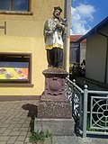 |
Wayside shrine | Baulandstrasse 71 (map) |
Wayside shrine
|
|
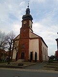 |
St. Valentine | Baulandstraße 77 (map) |
1826 | Catholic parish church St. Valentin, late baroque building with a semicircular choir and west tower facade, built in 1826, furnishings worth preserving, partly from the previous building (entity with walled cemetery, sandstone cross from 1853 and wayside shrine from 1827).
|
 |
Marian column | Baulandstraße 77 (map) |
1827 | Marian column on base, red sandstone, base with cover plate, column with plinth and capital, statue of Maria Immaculata, inscription, 1827; ZEEK no. 6968-61-032.
|
| Stone cross | Baulandstrasse 77 | 1853 | Large sandstone cross from 1853.
|
|
 |
Wayside shrine | Baulandstrasse 89 (map) |
Wayside shrine
|
|
 |
Wayside shrine | Baulandstrasse 101 (map) |
Wayside shrine
|
|
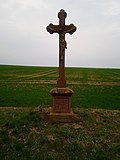 |
crossroads | Dörntal (map) |
crossroads
|
|
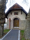 |
Lady Chapel | Erfelder Strasse 1 (map) |
19th century | Chapel, Marienkapelle, limestone masonry, accessible building, rectangular floor plan, merging into an octagonal apse, Pieta, crucifix and two angels (altar), St. Francis, St. John of Nepomuk on consoles, 19th century; ZEEK no. 6968-61-044.
|
 |
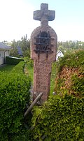
Wayside shrine | Richtstetter Strasse 7 (map) |
Wayside shrine
|
|
 |
Wayside shrine | Richtstetter Strasse 13 (map) |
Wayside shrine
|
|
 |
chapel | Kudacher Hof 3 a (map) |
1797 | Chapel, 1797, masonry made of sandstone and limestone, wooden roof turrets, rectangular floor plan with octagonal apse and corresponding roof, a turret turret flush with the front, windows unfortunately renewed, inscription over the lintel 1/7/9/7 / +, on the south side still flat base as Property delimitation preserved; ZEEK no. 6968-61-025.
|
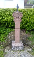 |
Wayside shrine | Rinschheimer Strasse 4 (map) |
Wayside shrine
|
|
 |
Wayside shrine | Rinschheimer Strasse 10 (map) |
Wayside shrine
|
|
 |
Wayside shrine | Schafäcker (Gewann) (card) |
Wayside shrine
|
|
 |
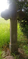
Wayside shrine | Schafäcker (Gewann) (card) |
Wayside shrine
|
|
 |
crossroads | Schafäcker (Gewann) (card) |
crossroads
|
|
 |
crossroads | Schaltalweg 38 (map) |
crossroads
|
|
 |
Wayside shrine | Potion (Won) (Card) |
Wayside shrine
|
Gerolzahn
Architectural, artistic and cultural monuments in Gerolzahn (with the village of Gerolzahn, the Kummershof homestead and the residential area at the Gerolzahn train station):
![]() Map with all coordinates of the cultural monuments in the district of Gerolzahn: OSM
Map with all coordinates of the cultural monuments in the district of Gerolzahn: OSM
| image | designation | location | Dating | description |
|---|---|---|---|---|
 |
Wayside shrine | L 518 (at) (card) |
Wayside shrine
|
|
 |
Wayside shrine | Lindenstrasse 10 (to) (map) |
Wayside shrine after the house at Lindenstrasse 10 in the direction of Reinhardsachsen.
|
|
 |
Sacrifice of the Virgin | Lindenstrasse 12 (map) |
1879 | Catholic branch church of the Sacrifice of Mary, longitudinal hall building with retracted choir and roof turret from 1879, 1977 and 1998 modernized, inside coffered ceiling, choir window designed in 1974 by Valentin Feuerstein.
|
 |
monument | Lindenstrasse 12 (near) (map) |
monument
|
|
 |
Wayside shrine | Lindenstrasse 22 (map) |
Wayside shrine
|
|
 |
Wayside shrine | Lindenstrasse (K 3913) (map) |
Wayside shrine on the K 3913 (Lindenstraße) after leaving Gerolzahn in the direction of Glashofen.
|
|
 |
Wayside shrine | Lindenstrasse (K 3913) (map) |
Wayside shrine on the K 3913 (Lindenstraße) after leaving Gerolzahn in the direction of Glashofen.
|
|
 |
Wayside shrine | Lindenstrasse (K 3913) (map) |
Wayside shrine on the K 3913 (Lindenstraße) after leaving Gerolzahn in the direction of Glashofen.
|
|
| school | Schloßgartenstrasse 8 (map) |
1912 | Former school house with teacher's apartment, courtyard and garden bordered by a wooden fence over base masonry; Eaves, two-storey plastered building with sandstone structures, wide gable dormer on the hipped roof, marked 1912 above the school entrance; For the most part original building details such as windows, doors with frames, the staircase with wooden stairs and wall covering, terrazzo and wooden floors, etc. have been preserved (totality).
|
|
 |
Wayside shrine | Tannenwald ((forest) district) / Totenweg (map) |
Wayside shrine
|
Glass furnace
Architectural, artistic and cultural monuments in Glashofen (with the village of Glashofen and the Waldhufensiedlung Neusaß):
![]() Map with all coordinates of the cultural monuments in the district of Glashofen: OSM
Map with all coordinates of the cultural monuments in the district of Glashofen: OSM
| image | designation | location | Dating | description |
|---|---|---|---|---|
 |
War memorial | Gerolzahner Strasse (map) |
War memorial
|
|
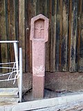 |
Wayside shrine | Gerolzahner Strasse (map) |
Wayside shrine
|
|
 |
crossroads | Gerolzahner Strasse (map) |
crossroads
|
|
 |
Aschaffenburg Chapel | L 518 (at) (card) |
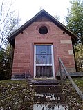
1656 | Aschaffenburg Chapel, 1656, 1892, masonry, red sandstone, wood, brick, sandstone altar, small, accessible building, rectangular floor plan, saddle roof, round window in the gable, rectangular door, Holy Blood, inscription: (altar) AVS GEMEINEM ANDAECHTIGEM / VICTIM DERO FROM VND VMB / ASHENBVRG HERKOMENDER / WALFAHRT WIDER AVFGEFVRT / A ° 1656 (arched window) From the Marian citizens = Sodality Aschafenburg to honor / God and His purest mother Maria rebuilt. / anno Domini / 1892; ZEEK no. 6968-63-008.
|
 |
Mainz chapel | L 518 (at) (card) |
1715 | Mainz Chapel, 1715, e.g. T. quarry stone masonry, red sandstone, brick, wood, metal door, small, accessible building, rectangular floor plan, saddle roof, round window, rectangular door, altar, holy blood (God the Father with holy blood corporals), inscription: (arched window) I Ferdinand mardin citizens of meintz and my former house Mrs. AnnA / margaretha mardinin had this chapel built for the consolation of the holy ember christ and the poor selenium in purgatory. // 1715; ZEEK no. 6968-63-010.
|
 |
Wayside shrine | Mühlweg / Neusasser Strasse (map) |
Wayside shrine
|
|
 |
crossroads | Neusasser Strasse (K 3913) (map) |
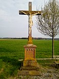
Crossroads on Neusasser Straße (after the end of Glashofen as K 3913) in the direction of Wettersdorf.
|
|
 |
Wayside shrine | Neusasser Strasse 1 (map) |
Wayside shrine
|
|
 |
Wayside shrine | Neusasser Strasse 2 (map) |
Wayside shrine
|
|
 |
School and town hall | Neusasser Strasse 10 (map) |
1902 | Former school and town hall, today a kindergarten, two-storey solid sandstone building, boss base, skylight portal, all-round cornice, window gable roofing, tooth frieze below the eaves, hipped roof, side flight of stairs, original entrance door leaves, interior fittings, inscribed in the foundation stone in 1902.
|
 |
War memorial | Neusasser Straße 10 (near) (map) |
War memorial
|
|
 |
crossroads | Neusasser Straße 10 (near) (map) |
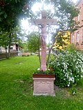
crossroads
|
|
 |
St. Wendelin | Neusasser Strasse 13 (map) |
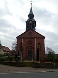
1920 | Catholic Church of St. Wendelin, hall church, sandstone building, surrounding cornice, arched window, entrance portal with architrave, figure niches with sculptures, depiction of Saint Rita on the left, St. Wendelin on the right, bell tower slated, built in 1920, wall remains of a possibly former enclosure.
|
 |
Wayside shrine | Neusasser Straße 13 (near) (map) |
Wayside shrine
|
|
 |
Wayside shrine | Neusasser Straße 13 (near) (map) |
Wayside shrine
|
|
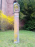 |
Wayside shrine | Neusasser Straße 13 (near) (map) |
Wayside shrine
|
|
 |
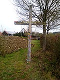
Wayside shrine | Reinhardsachsen Strasse 17 (map) |
Wayside shrine
|
|
 |
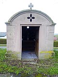
crossroads | Reinhardsachsen Strasse 19 (opposite) (map) |
crossroads
|
|
 |
chapel | Reinhardsachsen Strasse (map) |
1843 | Marienkapelle, 1869/1843, red sandstone, wood, small, walkable building, rectangular floor plan with arched vaults, two round windows, rectangular door, wooden altar, statue of the Heart of Mary, inscription: (altar base) St. Mary pray for us / who we ours Take refuge in yourself. // 1869; ZEEK no. 6968-63-022.
|
Gottersdorf
Architectural, artistic and cultural monuments in Gottersdorf (with the village of Gottersdorf):
![]() Map with all coordinates of the cultural monuments in the district of Gottersdorf: OSM
Map with all coordinates of the cultural monuments in the district of Gottersdorf: OSM
| image | designation | location | Dating | description |
|---|---|---|---|---|
 |
Schuessler farm | Hainbergweg 2 | 1725 | Hof Schüßler, today consisting of a residential house and barn and the associated courtyard area with garden, the residential house dendrodated in 1725, originally a residential stable house, which was converted and expanded into a pure residential house from 1832-1855, stable barn dendrodated in 1832, various associated outbuildings of the property that was developing into a heap Demolished in 1975, the residential house plastered half-timbered construction over a solid ground floor and basement with a gable roof, the southern gable cladding, original wall paintings and fittings inside, the stable barn unplastered half-timbered construction over sandstone masonry, also a gable roof (totality).
|
 |
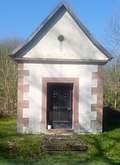
chapel | Hainbergweg 6 (opposite) | around 1850 | Chapel, small solid building with a rectangular floor plan, red sandstone, plastered, saddle roof, wooden door, ceramic statues (crucifix, Heart of Jesus, Heart of Mary), altar, approx. 1850; ZEEK no. 6968-64-009.
|
 |
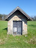
Erasmus Chapel | L 518 (at) | 1727 | Erasmus Chapel, formerly Valentine's Chapel, plastered building over a rectangular floor plan and three-sided choir closure with saddle roof, high rectangular entrance and 2 side windows, inscribed on the lintel “ANNO / 1727 / ZV DER EHR / GOTTES HAT / VALENTINUS MÜSIG VNDÖR / MARGARETHA SEINER HAVSFRA MÜSIG Z SOHN / ZV REINHAT / SACHSEN DIESE CAPPEL / MACHEN / LASEN “, above the altar block copies of the reredos with depictions from the life of Saints Stephen, Valentinus, Laurentius and Erasmus, the originals in the Walldürner Pilgrimage Museum; ZEEK no. 6968-67-024.
|
 |
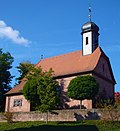
Schuessler's chapel | L 518 (at) | 1819 | Schüßler's Chapel, 1819, sandstone masonry, red and white banded, gable roof, small, accessible building, rectangular floor plan, gable roof, double-leaf glass lattice door, narrow altar, inside a relief of a Pieta after Riemenschneider, on the altar a relief of Our Lady with Child, inscribed on the keystone of the upright rectangular entrance "MS / VG / 1819"; ZEEK no. 6968-64-008.
|
 |
St. Michael | Rathausplatz 6 (map) |
1752 | Kath. Filialkirche St. Michael with walled former cemetery and memorial for fallen soldiers and two sandstone crosses; the church built in 1921 on the site of the former St. Josef chapel from 1752 with older individual components according to plans by the archbishop's building inspector Strobl in neo-baroque style, particularly noteworthy is the sculpture of Our Lady from the early 16th century, the ceiling painting by the painter Josef Wagenschwender from 1826 with the Representation of the fight of Archangel Michael against Ezekiel 2001 reconstructed (factual entirety with monument to the fallen and two stone crosses from the 15th / 16th century).
|
 |
Wayside shrine | Wayside shrine
|
Hornbach
Architectural, art and cultural monuments in Hornbach (with the villages of Großhornbach and Kleinhornbach):
![]() Map with all coordinates of the cultural monuments in the district of Hornbach: OSM
Map with all coordinates of the cultural monuments in the district of Hornbach: OSM
| image | designation | location | Dating | description |
|---|---|---|---|---|
 |
Elevated water tank | Hambrunner Strasse 12 A (map) |
1900 | Elevated water tank, sandstone facade, marked 1900, two shade-giving chestnuts.
|
 |
St. Valentine | Kirchenstrasse 22 (map) |
1780 | Catholic Church of St. Valentin, built in 1921 in neo-Romanesque form with stately walling, stairs and fountain (interior late baroque furnishings), lintel below the entrance dated 1780, figure niche above portal with sculpture of St. Valentine.
|
 |
School and town hall | Kirchenstrasse 24 (map) |
1930 | Former school and town hall, built in 1930, three-storey sandstone building with hipped roof and gable, round arched gate, enclosure, side staircase.
|
Kaltenbrunn
Architectural, artistic and cultural monuments in Kaltenbrunn (with the village of Kaltenbrunn and the Spritzenmühle residential area):
![]() Map with all coordinates of the cultural monuments in the Kaltenbrunn district: OSM
Map with all coordinates of the cultural monuments in the Kaltenbrunn district: OSM
| image | designation | location | Dating | description |
|---|---|---|---|---|
 |
Wayside shrine | Jägerstrasse 1 / Mühlenstrasse (map) |
Wayside shrine at the corner of Jägerstrasse 1 and Mühlenstrasse.
|
|
 |
Wayside shrine | Jägerstrasse 1 / Mühlenstrasse (opposite) (map) |
Wayside shrine at the corner of Jägerstrasse 1 and Mühlenstrasse (after leaving town as K 3914).
|
|
 |
Wayside shrine | Jägerstrasse 2 (map) |
Wayside shrine on Jägerstrasse.
|
|
 |
Wayside shrine | Jägerstrasse (near) (map) |
Wayside shrine on Jägerstraße after leaving Kaltenbrunn in the direction of Wettersdorf.
|
|
 |
crossroads | Mühlenstrasse (map) |
Wayside cross on Mühlenstraße.
|
|
 |
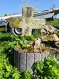
Wayside shrine | Mühlenstraße (K 3914) (near) (map) |
Wayside shrine on the K 3914 after the end of Kaltenbrunn (where this is called Mühlenstraße) in the direction of Reinhardsachsen.
|
|
 |
crossroads | Steingasse (map) |
Wayside cross on Steingasse.
|
Reinhard Saxony
Architectural, art and cultural monuments in Reinhardsachsen (with the village of Reinhardsachsen):
![]() Map with all the coordinates of the cultural monuments in the district of Reinhardsachsen: OSM
Map with all the coordinates of the cultural monuments in the district of Reinhardsachsen: OSM
| image | designation | location | Dating | description |
|---|---|---|---|---|
 |
Wayside shrine | Am Kaltenbach 3a (opposite) (map) |
Wayside shrine. The first of two wayside shrines at this point, on a footpath towards St. James' Church.
|
|
 |
Wayside shrine | Am Kaltenbach 3a (opposite) (map) |
Wayside shrine. The second of two wayside shrines at this point, on a footpath towards St. James' Church.
|
|
 |
Wayside shrine | Am Kaltenbach 8 (map) |
Wayside shrine
|
|
 |
Wayside shrine | Bergstrasse 6 (opposite) (map) |
Wayside shrine
|
|
 |
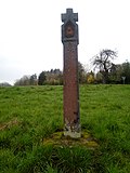
Wayside shrine | Bergstrasse 12 (opposite) (map) |
Wayside shrine
|
|
 |
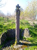
Wayside shrine | Bergstrasse (map) |
Wayside shrine, on Bergstrasse, after leaving Reinhardsachsen shortly before the Madonnenländchen recreation area
|
|
 |
Wayside shrine | Eckäcker (Gewann) (map) |
Wayside shrine
|
|
 |
crossroads | Haselburgstrasse 1 (K 3914) (map) |
crossroads
|
|
 |
Wayside shrine | Haselburgstraße 3-5 (K 3914) (map) |
Wayside shrine
|
|
 |
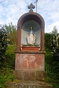
crossroads | Haselburgstrasse 4 (K 3914) (map) |
crossroads
|
|
 |
Wayside shrine | Haselburgstraße 5 (K 3914) (opposite) (map) |
Wayside shrine
|
|
 |
Wayside shrine | Haselburgstrasse 6 (K 3914) (map) |
Wayside shrine
|
|
 |
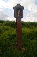
Wayside shrine | K 3914 (at) (card) |
Wayside shrine on the K 3914, after leaving the village in the direction of Kaltenbrunn.
|
|
 |
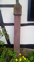
Wayside shrine | K 3914 (at) (card) |
Wayside shrine on the K 3914, after leaving the village in the direction of Gerolzahn, just before the small fort Haselburg
|
|
 |
Wayside shrine | Schwarzbauerstraße 1 (map) |
Wayside shrine
|
|
 |
St. Jacob | Schwarzbauerstraße 3 (map) |
1725-1726 | Catholic branch church St. Jakob, with a walled former cemetery, sandstone building, bell tower with clock, marked 1726 on the portal (material entity).
|
 |
crossroads | Schwarzbauerstraße 3 (map) |
crossroads
|
|
 |
Wayside shrine | Schwarzbauerstraße (map) |
Wayside shrine
|
Rippberg
Architectural, artistic and cultural monuments in Rippberg (with the village of Rippberg, the Waldfrieden settlement and the Linkenmühle residential area):
![]() Map with all coordinates of the cultural monuments in the Rippberg district: OSM
Map with all coordinates of the cultural monuments in the Rippberg district: OSM
| image | designation | location | Dating | description |
|---|---|---|---|---|
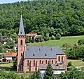 |
St. Sebastian | Amorbacher Strasse 16 (map) |
19th century | Catholic parish church St. Sebastian, neo-Gothic stone building with west tower facade, statue of St. Sebastian above the west portal, marked 1906, staircase and enclosure.
|
| chapel | Friedhofweg 3 (map) |
1591 | Cemetery chapel (former Catholic parish church of St. Sebastian), single-aisled building with polygonal choir and roof turret, high-quality furnishings, inscribed on the west gate 1591, wall; see aggregate Catholic parish church St. Sebastian with churchyard.
|
Wettersdorf
Architectural, artistic and cultural monuments in Wettersdorf (with the village of Wettersdorf):
![]() Map with all coordinates of the cultural monuments in the suburb of Wettersdorf: OSM
Map with all coordinates of the cultural monuments in the suburb of Wettersdorf: OSM
| image | designation | location | Dating | description |
|---|---|---|---|---|
 |
St. Mary | Kirchenweg 4 (map) |
1953-1954 | Catholic Church of St. Maria, built in 1953/54, stepped hall church with a western tower and south-facing sacristy, reinforced concrete, partly clad with red sandstone.
|
 |
school | Odenwaldstrasse 4 (map) |
1922 | Former School, built in 1922 with an auxiliary building, today a light museum, two-story plastered building under a hipped roof with sandstone structures, characteristic two entrances to the classrooms and the teacher's apartment; Outbuildings substantially renewed.
|
See also
Web links
- Sights in Walldürn on the website www.leo-bw.de
Individual evidence
- ↑ a b c d e f g h i j The state of Baden-Württemberg. Official description by district and municipality. Volume V: Karlsruhe District Kohlhammer, Stuttgart 1976, ISBN 3-17-002542-2 . Pp. 270-275
Remarks
- ↑ This list may not correspond to the current status of the official list of monuments. This can be viewed by the responsible authorities. Therefore, the presence or absence of a structure or ensemble on this list does not guarantee that it is or is not a registered monument at the present time. The State Office for Monument Preservation Baden-Württemberg provides binding information .