List of the districts of Rostock
The 31 districts of the city of Rostock with their associated historically and commonly used place and area names:

Local offices: Northwest 1 : Warnemünde , Diedrichshagen, Markgrafenheide , Hohe Düne , Hinrichshagen , Wiethagen , Torfbrücke, Groß Klein , Schmarl , Northwest 2 : Lichtenhagen , Lütten Klein , Evershagen , West : Reutershagen , Hansaviertel , Gartenstadt / Stadtweide , center : Kröpeliner-Tor -Vorstadt , city center , Brinckmansdorf ,Südstadt , Biestow , East : Dierkow-Neu , Dierkow-Ost , Dierkow-West , Toitenwinkel , Gehlsdorf , Hinrichsdorf, Krummendorf, Nienhagen, Peez , Stuthof, Jürgeshof
| District | Urban area |
Local office | Area (km²) |
Population as of December 31, 2011 |
Population density (inhabitants / km²) |
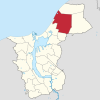
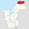
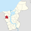
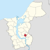
map |
|---|---|---|---|---|---|---|
| Warnemünde seaside resort | A. | Northwest 1 | 5.9 | 5,937 | 1.006 |

|
| Diedrichshagen | A. | Northwest 1 | 4.4 | 2.168 | 493 |

|
| Markgrafenheide (forest settlement) | B. | Northwest 1 | 6.5 | 585 | 90 |

|
| Hohe Düne (at the lake, marina) | B. | Northwest 1 | 5.2 | 686 | 132 |

|
| Hinrichshagen (Erich-Weinert-Siedlung, Wallensteinslager) | B. | Northwest 1 | 15.9 | 198 | 12 |

|
| Wiethagen ( Meyershausstelle ) | B. | Northwest 1 | 16.8 | 83 | 5 |

|
| Peat bridge | B. | Northwest 1 | 11.0 | 53 | 5 |

|
| Lichtenhagen (Klein Lichtenhagen, Ostseewelle, Möhlenkamp, Grabower Str.) | C. | Northwest 2 | 5.9 | 14,338 | 2,430 |

|
| Groß Klein (Lütten Klein-Dorf, Dänenberg, Groß Klein-Dorf) | D. | Northwest 1 | 2.8 | 13,509 | 4,825 |

|
| Lütten Klein | E. | Northwest 2 | 3.6 | 17,234 | 4,787 |

|
| Evershagen (Evershagen-Süd, Evershagen-Dorf, orchard, Schutow) | F. | Northwest 2 | 7.0 | 16,847 | 2,407 |

|
| Schmarl ( Marienehe , Schmarl-Dorf) | G | Northwest 1 | 5.8 | 8,756 | 1,510 |

|
| Reutershagen (Reutershagen I, Reutershagen II, Composers Quarter, Vorweden, Schutow) | H | west | 5.7 | 17,978 | 3,154 |

|
| Hansaviertel | I. | west | 2.0 | 8,465 | 4.233 |

|
| Garden city / city pasture | J | west | 4.8 | 3,312 | 690 |

|
| Kröpeliner-Tor-Vorstadt (Bramow) | K | center | 3.7 | 19,342 | 5,228 |

|
| Südstadt | L. | center | 5.6 | 14,998 | 2,678 |

|
| Biestow | M. | center | 3.8 | 2,753 | 724 |

|
| City center ( northern old town , Steintor-Vorstadt , Dalwitzhof, city harbor ) | N | center | 5.3 | 19,986 | 3,771 |

|
| Brinckmansdorf (Alt Bartelsdorf, Riekdahl, Osthafen, White Cross, Waldeslust, Kassebohm) | O | center | 10.3 | 8,317 | 807 |

|
| Dierkow-Neu (Dierkower Höhe) | P | east | 2.2 | 10,916 | 4,962 |

|
| Dierkow-Ost | Q | east | 0.5 | 1,058 | 2.116 |

|
| Dierkow-West | R. | east | 1.0 | 1,141 | 1,141 |

|
| Toitenwinkel | S. | east | 3.7 | 14,010 | 3,786 |

|
| Gehlsdorf (Langenort) | T | east | 6.5 | 4,662 | 717 |

|
| Hinrichsdorf | U | east | 3.5 | 218 | 62 |

|
| Krummendorf (Oldendorf, Warnowrande) | U | east | 6.0 | 264 | 44 |

|
| Nienhagen | U | east | 5.2 | 599 | 115 |

|
| Peez | U | east | 11.8 | 10 | 1 |

|
| Stuthof | U | east | 5.7 | 74 | 13 |

|
| Juergeshof | U | east | 3.2 | 19th | 6th |

|
In statistical publications of the Hanseatic city, a distinction is made between 21 urban areas , which predominantly correspond to the 31 districts. These are in detail:
- A: Warnemünde (including Diedrichshagen)
- B: Rostock-Heide (Markgrafenheide, Hohe Düne, Hinrichshagen, Wiethagen, Torfbrücke)
- C: Lichtenhagen
- D: Big Small
- E: Lütten Klein
- Q: Evershagen
- G: Schmarl
- H: Reutershagen
- I: Hansaviertel
- J: garden city / city pasture
- K: Kröpeliner-Tor-Vorstadt
- L: Südstadt
- M: Biestow
- N: city center
- O: Brinckmansdorf
- P: Dierkow-Neu
- Q: Dierkow-Ost
- R: Dierkow-West
- S: Toitenwinkel
- T: Gehlsdorf
- U: Rostock-Ost (Hinrichsdorf, Krummendorf, Nienhagen, Peez, Stuthof, Jürgeshof)
The assignment of the 19 village representatives (local councils) to the five local authority districts:
- Local office northwest 1:
- 1. Warnemünde seaside resort, Diedrichshagen
- 2. Markgrafenheide, Hohe Düne, Hinrichshagen, Wiethagen, Torfbrücke
- 3. Big small
- 4. Schmarl
- Local office northwest 2:
- 5. Lichtenhagen
- 6. Lütten Klein
- 7. Evershagen
- Local office west:
- 8. Reutershagen
- 9. Hansaviertel
- 10. Garden city / city pasture
- Local office center:
- 11. Kröpeliner-Tor-Vorstadt
- 12. Südstadt
- 13. Biestow
- 14. City center
- 15. Brinckmansdorf
- Local office east:
- 16. Dierkow (New)
- 17. Dierkow (east), Dierkow (west)
- 18. Toitenwinkel
- 19. Gehlsdorf, Hinrichsdorf, Krummendorf, Nienhagen, Peez, Stuthof, Juergeshof
source
- Statistical News "Urban Areas 2017"
- Statistics office of the city of Rostock: Population with main residence in the Hanseatic and university city of Rostock by district - as of December 31, 2017