
Dierkow
|
Dierkow (New, West, East)
City of Rostock
Coordinates: 54 ° 6 ′ 13 ″ N , 12 ° 9 ′ 53 ″ E
|
|
|---|---|
| Height : | 15 m above sea level NN |
| Area : | 3.7 km² |
| Residents : | 13,115 (Dec 2017) |
| Population density : | 3,545 inhabitants / km² |
| Incorporation : | January 1, 1913 |
| Postal code : | 18146 |
| Area code : | 0381 |
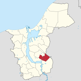  Location of Dierkow (New, West, East) in Rostock
|
|
| Basic data | |
|---|---|
|
Founding years of Dierkow-Neu: Dierkow-Ost: Dierkow-West: |
built 1984–1987 ... mentioned in 1320 |
|
Areas Dierkow-Neu: Dierkow-East: Dierkow-West: |
2.2 km² 0.5 km² 1.0 km² |
|
Residents (status) : Dierkow-Neu: Dierkow-Ost: Dierkow-West: |
10,916 (2017) 1058 (2017) 1141 (2017) |

Dierkow is a district of Rostock and consists of the districts Dierkow-West (west of Hinrichsdorfer Straße), Dierkow-Ost (south of Gutenbergstraße) and Dierkow-Neu ( prefabricated building area ). The village of Dierkow was originally located around what is now Hinrichsdorfer Straße and was first mentioned in a document in 1320 as Derekowe and is therefore only 100 years younger than Rostock itself. Derekowe is an old Slavic word and means "place of Derek". The village was incorporated on January 1, 1913.
Early history
In the vicinity of the Dierkower Damm, at the tip of the Unterwarnow estuary , surface finds of remains of a West Slavic settlement have been made since 1856 . In 1963 a Slavic boardwalk was found , from which about 20 meters could still be exposed. Targeted excavations revealed a large amount of Slavic pottery in 1966 and the remains of small houses, workshops and wells in the 1980s. In the run-up to the 800th city anniversary of Rostock, there was a joint research project between the Lower Saxony Institute for Historical Coastal Research , the German Archaeological Institute and the University of Rostock on the site from 2013 to 2017 . In the anniversary year of 2018, the city of Rostock provided 55,000 euros for further research, so that a total of around a quarter of the estimated 3,500 square meters of settlement area have already been randomly excavated. The settlement area in a peat area was previously covered with wickerwork mats two by two meters made of willow and hazelnut wood , on which a thick layer of sand was applied. The finds from u. a. Pearls , amber , bones and shards showed that Scandinavians also lived here and that Saxons and Frisians at least traded. Was digging a Holzspant as in an early medieval was built ship. The corresponding ship could have been around three to four meters wide and up to 15 meters long . An aerial photo of the area from 2006 and lighter grass cover suggest a former fortification of the trading settlement. A horseshoe-shaped floor plan, typical of castle walls, is more than 100 meters high. The typical northeast orientation of the fortification also suggests a cultic significance of the place.
Dierkow-West and -Est

The need for living space for the employees of the expanding arms industry (shipyard, aircraft factories ) required an expansion of the residential areas in Rostock. Dierkow-West was built as a planned settlement from 1934. The construction of Dierkow-Ost began in 1935. Single-family and semi-detached houses were mainly made of brick on generously dimensioned parcels that enabled self-sufficiency with fruit, vegetables and small cattle . The street names in Dierkow-Ost mostly have Low German animal names, those in Dierkow-West are named after German writers.
Dierkow-Neu
Due to the increasing decay of the old town and the constant influx of foreigners, there was a large demand for housing in the 1980s, which was to be satisfied by further prefabricated housing estates ( large housing estates) . In the northeast of Rostock, east of the Dierkow settlement, a prefabricated building area was developed and mainly six-story blocks were built from 1983 to 1987. The “trick” of designating the first floor as the zero floor made it possible to do without elevators, which were actually required from the sixth floor.

The conception of the residential area from 1979 provided for some deviations contrary to the actually implemented development. A central development on Hannes-Meyer- Platz was planned, which was only realized in a different form after the fall of the Wall. In the planning at that time, considerations were also made, at least at times, of creating makeshift shelters in the cellars in the event of war. A smaller section to the south-east of Rövershäger Chaussee (today about the street "Am Stadtblick") was not built.
The Rostock housing association had developed the WBR 83 type, which can be recognized from the outside by the curved side walls of the balconies. The window area in the facade elements is smaller than in the previously erected prefabricated buildings (e.g. in large and small). In Dierkow you can also find clinker-clad panels on facades and gable walls, which was a trademark for the buildings of the Rostock housing association and which created a reference to regional building traditions. Residential houses of the Dierkow variant of the type WBR 83 can also be found in other districts of Rostock, where they were built in the course of redensification . In addition, these houses were built on a larger scale by the same construction company in Berlin-Hohenschönhausen . In addition, in the northern old town of Rostock, a variant of the WBR 83 type was built into a residential area that definitely set standards in panel construction. The district heating supply, including hot water supply, was and is standard in all Rostock prefabricated building areas . For this purpose, a district heating pipeline of around 10 km had to be built by Dierkow-Neu before the start of construction, which crosses the Warnow at about the level of the Bramow S-Bahn station, for which the shipping channel to the city harbor, which was 7.3 m deep at the time, had to be driven under.
In addition to the residential development, kindergartens, schools and department stores were also built. Overall, however, the equipment in the residential area was more spartan than that of the prefabricated building areas that were built earlier. However, the residents of Dierkow-Neu were able to fall back on some retail stores and dining facilities in Dierkow-West and Dierkow-East. Some facilities were temporarily housed in barracks or apartments. When designing the green space, efforts were made to preserve larger trees. The avenue on Gutenbergstrasse, for example, dates back to before the construction of the tram and the prefabricated building area.
In contrast to most of the Rostock urban area, Dierkow is relatively high at around 13 m above sea level . As a result, the houses on the southern edge of Dierkow offer a sometimes very attractive view of the city's panorama. It can be assumed that this fact was taken into account in the planning.
After 2000, schools and apartments (377 apartments by the end of 2015) were demolished or partially dismantled after only 30 years of inactivity, as well as extensive renovations and modernizations, both of the buildings and the open spaces, courtyards, sidewalks, street lighting and parking lots. One of the few Rostock police stations was built in 2011 in the residential area.
Thanks to the green space that has now been developed, the upper floors that have been partially dismantled and the loosened block development, the residential area looks more attractive today than it did when it was built.
economy
An obstacle to the development of the northeast of Rostock was the location across the Warnow and also the fact that large parts of this area did not belong to the city. A plan for a comprehensive expansion of the city harbor with a freight station dates from 1907 , the facilities of which would have extended directly in front of the Dierkower Höhe. Although these plans were significantly reduced, the industrial area of the Osthafen was created at the same time as the construction of the Dierkow-Ost residential estate, which is nominally not part of Dierkow, but is only a few hundred meters away. Before Dierkow-Neu was built, there were a few retail stores, and initially they were also used for agriculture. The prefabricated building area built during the GDR era also required corresponding supply facilities, so the first department store opened in December 1983. After the monetary union , new, initially provisional sales areas in tents and the apparitions of that time, such as video rental shops and mail order agencies , also appeared very quickly Representation of insurance companies and bank branches.
The economic focus within the borders of Dierkow is on the north-west edge (Hinrichsdorfer Straße). Mainly trading companies (motor vehicles, supermarkets, furniture - including production) and some smaller catering establishments (bakeries, etc.) are located here. Dierkow has a hotel and two petrol stations within its borders, in the immediately adjacent districts of Toitenwinkel and Brinckmansdorf there are further petrol stations, car dealerships, hardware stores, gardeners, etc. a. Again in Dierkow there is also a medical center with different specialties.
Social and Religion
In addition to two schools (elementary school and grammar school) and kindergartens, the Evangelical Lutheran congregation " Slüterhaus ", the Diakonisches Werk, a small private theater are represented. In 2016, a newly built district meeting center opened, in which, among other things, the People's Solidarity is based. There are also various advice centers and a social department store .
traffic
railroad
In 1987 Dierkow received a train station, the former Dierkow West stop was renamed Hinrichsdorfer Straße. The trains between Rostock Hbf and Rostock Seehafen Nord were connected Rostock S-Bahn trains from Warnemünde . This was also the case before the line was officially included in the S-Bahn tariff in 1988. Only after the fall of the Wall did shorter trains run on the route than on the connection to Warnemünde. The S-Bahn traffic was discontinued in 2012.
tram
In 1948 Dierkow-West was connected to the tram network. This line was replaced by buses in 1974. When the first residents moved in in May 1984, Dierkow-Neu was connected to the city bus network. The main load of the traffic between the then new development area Dierkow and the city center should be carried by the tram. The tram network was expanded for the first time since the old Steintor - Gehlsdorf line was closed. In order to be able to use Reichsbahn vehicles for track construction, there was a siding between the Rostock-Seehafen freight station and the tram network during the construction period and a few years afterwards . The tram route, which opened on April 21, 1987 (extended on December 15, 1988) and leads to Dierkow, divides into two branches that almost completely enclose the residential area, so that there are relatively short distances to the stops. During the development planning at the end of the 1970s, it was still planned to use the railway line that had begun in the 1930s from Dierkower Damm under the Gutenbergstrasse bridge for trams. In 1997, the Dierkower Kreuz junction was extensively expanded (platform roofing, platform-level transfers between bus and tram)
Street
Thanks to Hinrichsdorfer Straße and Rövershäger Chaussee (L22, formerly B105 ), Dierkow is very conveniently located for local and long-distance transport. The A 19 motorway can be reached in a few minutes, as well as the port and a larger shopping center on the outskirts of the city. The Baltic Sea beach of Markgrafenheide and the Rostocker Heide as local recreation areas can be reached in about half an hour. The Dierkower Allee (L22), which runs along the northern edge of Dierkow, was originally planned as a four-lane road that was not free of intersections, but was only built as a simple road. The Hinrichsdorfer Straße was also to be re-routed within Dierkow roughly in the axis of today's tram route and expanded to four lanes. As in many cases of traffic planning in the GDR, only a fraction of the planning was implemented, presumably due to a lack of economic opportunities.
Individual evidence
- ↑ Statistics office of the city of Rostock: Population with main residence of the Hanseatic and university city of Rostock by district - as of December 31, 2017
- ↑ Hanseatic City of Rostock, main administrative office, municipal statistics office, August 28, 2013.
- ↑ a b c Karsten Schröder: Rostock's city history . Ed .: Karsten Schröder. Hinstorff, Rostock 2013, p. 255, 327, 424 .
- ↑ 75 meters from the “Schenkendorfweg” bus stop.
- ^ Slavic wooden frame excavated in Dierkow. Archaeologists are also on the trail of the early medieval trading center on Primelberg in 2018. In: Rostock-Heute from August 15, 2018, accessed on October 22, 2018.
- ^ Slavic castle complexes in the Hanseatic city of Rostock (5). Dierkow. From: Slavic castles in Germany (private website), accessed on October 22, 2018.
- ^ Siegfried Wittenburg : Happy in the plate. In: one day mirror online. June 23, 2014, accessed September 17, 2016 .
- ↑ a b Institute for Urban Development and Architecture of the Building Academy of the GDR, Office for Urban Planning Rostock (ed.): Development plan Dierkow . Plan drawings, signature A_05_13_14-01 ( digipeer.de ).
- ^ Building Academy of the GDR, Institute for Project Planning and Standardization (ed.): Directory Z9020 . Berlin 1990 ( bbr-server.de [PDF]).
- ↑ Wiro currently . In: WIRO Wohnen in Rostock GmbH (Hrsg.): Customer newspaper . No. 02/2014 . Rostock 2014, p. 9 .
- ↑ GICON Großmann Ingenieur Consult GmbH: Result report for the analysis of the current situation, master plan 100% climate protection for the Hanseatic city of Rostock . Ed .: Hanseatic City of Rostock. Rostock 2013, p. 15 ( rostock.de [PDF]).
- ^ Hanseatic City of Rostock (ed.): Draft of the general traffic plan 1992 of the Hanseatic city of Rostock . Rostock 1992 (Plan 11 "Auquatorium Rostock").
- ↑ GeoPortal.MV. Coordination Office for Geoinformation (KGeo) State Office for Internal Administration Mecklenburg-Western Pomerania, accessed on September 16, 2016 .
- ↑ a b c Hanseatic City of Rostock, Rostock Society for Urban Renewal (ed.): 25 Years of Urban Renewal Rostock, 1990 - 2015 . Rostock September 2015, p. 79 ff., 82, 84 ( rgs-rostock.de [PDF]). 25 years of urban renewal in Rostock, 1990 - 2015 ( Memento of the original from February 19, 2016 in the Internet Archive ) Info: The archive link was inserted automatically and has not yet been checked. Please check the original and archive link according to the instructions and then remove this notice.
- ↑ Rostock-Heute.de. NOGETEC GmbH (operator), February 15, 2011, accessed on September 16, 2016 .
- ↑ a b , Lothar Schultz, Klaus Pfafferott, Hans-Gorg-Tack: The railway in the Rostock city harbor . Neddermeyer, Berlin 2008, p. 34, 125 .
- ↑ Karsten Schröder, Ingo Koch: Rostocker Chronik . Ed .: Ingo Koch. Neuer Hochschulschriftenverlag, Rostock 1999, p. 380 .
- ↑ Hagen Seidel: For Rewe, the East was a gold mine. In: www.welt.de. Retrieved September 16, 2016 .
- ↑ The Dierkower. (PDF) (No longer available online.) Interest group Der Dierkower, March 2015, formerly in the original ; accessed on September 16, 2016 . ( Page no longer available , search in web archives )
- ^ Google Inc .: Google Maps. Google Inc., accessed September 16, 2016 .
- ^ Volkssolidarität KV Rostock-Stadt eV - District and meeting center. In: www.vs-hro.de. Volksolidaritaet Kreisverband Rostock-Stadt eV, April 2017, accessed on April 9, 2017 .
- ↑ Lothar Schulz, Josef Temmen: S-Bahn Rostock . Neddermeyer, Berlin 2014, p. 68 .
- ↑ a b Rostocker Straßenbahn AG (ed.): People, technology, episodes . Redieck & Schade, Rostock 2001, ISBN 3-934116-11-6 (rear mirror (last page) without number, time table).
Web links

Biestow | Brinckmansdorf | Diedrichshagen | Dierkow-Neu | Dierkow-Ost | Dierkow-West | Evershagen | Garden city / city pasture | Gehlsdorf | Big small | Hansaviertel | Hinrichsdorf | Hinrichshagen | High dune | Jürgeshof | Kröpeliner-Tor-Vorstadt | Krummendorf | Lichtenhagen | Lütten Klein | Markgrafenheide | Nienhagen | Peez | Reutershagen | Schmarl | City center | Stuthof | Südstadt | Toitenwinkel | Peat bridge | Warnemünde | Wiethagen .