List of listed objects in Pernegg an der Mur
The list of listed objects in Pernegg an der Mur contains the 15 listed , immovable objects of the Austrian municipality of Pernegg an der Mur in the Styrian district of Bruck-Mürzzuschlag .
Monuments
| photo | monument | Location | description | Metadata |
|---|---|---|---|---|

|
Zlatten weir system ObjectID : 21471 |
Location KG: Gabraun |
The weir system spans the Mur between the cadastral communities of Gabraun (in the northeast) and Zlatten (in the southwest). |
ObjectID : 21471 Status : Notification Status of the BDA list: 2020-02-29 Name: Zlatten weir system GstNr .: .86 Zlatten weir system |
|
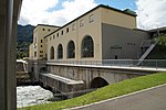
Pernegg power plant ObjectID : 21470 |
E-Werkstrasse 1 location KG: Kirchdorf |
The Pernegg power plant was created in 1925–1927 by the hydraulic engineer Hermann Grengg together with the architect Fritz Haas and operated by STEWEAG . At the beginning of the 21st century, the power plant was taken over by Verbund and reopened on September 13, 2013 after a renovation phase lasting several years (2008 to 2013). The weir in Zlatten , with a tower and the shingle-roofed weir bridge, directs the water through a canal to the power station. |
ObjectID : 21470 Status : Notification Status of the BDA list: 2020-02-29 Name: Pernegg power plant GstNr .: .68 Pernegg power plant |

|
Parsonage Object ID: 107332 |
Pfarrweg 7 KG location : Kirchdorf |
ObjectID : 107332 Status: § 2a Status of the BDA list: 2020-02-29 Name: Pfarrhof GstNr .: .2 |
|
|
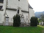
Kirchhof, former cemetery ObjectID : 107265 |
Pfarrweg 9 KG location : Kirchdorf |
ObjektID : 107265 Status: § 2a Status of the BDA list: 2020-02-29 Name: Kirchhof, former cemetery GstNr .: .1 Parish church hl. Maximilian, Pernegg |
|
|
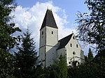
Catholic parish church hl. Maximilian ObjectID : 57264 |
Pfarrweg 9 KG location : Kirchdorf |
The parish church stands on a hill above the village. The core of the nave is Romanesque, the choir with ribbed vault dates from the 14th century. The mighty late Gothic tower is attached to the north of the nave. The high altar dates from around 1770–1780. |
ObjectID : 57264 Status: § 2a Status of the BDA list: 2020-02-29 Name: Catholic parish church hl. Maximilian GstNr .: .1 parish church hl. Maximilian, Pernegg |

|
Dragon's Cave ObjectID : 107514 |
Drachenhöhle location KG: Mixnitz |
Finds of Paleolithic stone tools from the Aurignacia and remains of fireplaces from the warm phase of the Würm Ice Age between 65,000 and 31,000 BC BC document an early visit to the cave by humans. There are around 800 artifacts from the main cultural layer . |
ObjektID : 107514 Status : Notification Status of the BDA list: 2020-02-29 Name: Drachenhöhle GstNr .: 427/1 Drachenhöhle near Mixnitz |

|
Shrine Object ID: 107453 |
at Grazer Straße 4, KG location : Mixnitz |
ObjectID : 107453 Status: § 2a Status of the BDA list: 2020-02-29 Name: wayside shrine GstNr .: 463 |
|
|
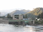
Mixnitz weir ObjectID : 107432 |
KG location : Mixnitz |
The weir system spans the Mur between the cadastral communities of Traföß on the right and Mixnitz on the left, northeast bank. |
ObjectID : 107432 Status: § 2a Status of the BDA list: 2020-02-29 Name: Wehr Mixnitz GstNr .: .100; 482/2; 482/1 |

|
Catholic branch and pilgrimage church hl. Maria / Klein-Mariazell / Frauenkirche and former cemetery ObjectID : 57472 |
Pernegg 7 KG location : Pernegg |
The stately late Gothic hall church has a three-aisled nave and a narrow west tower. The interior was probably redesigned in Baroque style by Josef Hueber in 1774–1775. The vaults show wall paintings by Josef Adam Mölck. |
ObjectID : 57472 Status: § 2a Status of the BDA list: 2020-02-29 Name: Kath. Filial- und Pilgrimage Church hl. Maria / Klein-Mariazell / Frauenkirche and former cemetery GstNr .: .19; 426 Frauenkirche Pernegg |

|
Pernegg Castle ObjectID : 107395 |
Schloßberg 1 KG location : Pernegg |
The castle dates from the 16th century. |
ObjectID : 107395 Status : Notification Status of the BDA list: 2020-02-29 Name: Schloss Pernegg GstNr .: .7 / 2 Schloss Pernegg |
|
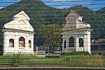
Way chapels, so-called. Court crosses ObjectID: 12067 |
KG location : Pernegg |
The two convex curved niche chapels with volute gables are decorated with wall paintings by Josef Adam Mölck from around 1775. Today they are a bit hidden behind the noise protection wall of the railway line. |
ObjectID: 12067 Status: Notification Status of the BDA list: 2020-02-29 Name: Wegkapellen, so-called. Court crosses GstNr .: 427 Wegkapellen Pernegg |
| Plant Gut Schafferwerke ObjectID : 131443 since 2019 |
Schafferwerke 4 location KG: Roßgraben |
ObjectID : 131443 Status : Notification Status of the BDA list: 2020-02-29 Name: Plant Gut Schafferwerke GstNr .: 30 |
||

|
Mixnitz weir ObjectID : 107435 |
Location KG: Traföß |
The weir system spans the Mur between the cadastral communities of Traföß and Mixnitz (see there). |
ObjektID : 107435 Status: § 2a Status of the BDA list: 2020-02-29 Name: Wehr Mixnitz GstNr .: .97; 880/1; 880/2 |

|
Desert and Altweg Zlattengraben ObjectID : 122789 |
Location KG: Zlatten |
ObjectID : 122789 Status: § 2a Status of the BDA list: 2020-02-29 Name: Wüstung und Altweg Zlattengraben GstNr .: 985; 992 Zlattengraben |
|

|
Zlatten weir system ObjectID : 21472 |
Location KG: Zlatten |
The weir system spans the Mur between the cadastral communities of Zlatten and Gabraun (see there). |
ObjectID : 21472 Status : Notification Status of the BDA list: 2020-02-29 Name: Zlatten weir system GstNr .: .123 Zlatten weir system |
literature
- Kurt Woisetschläger , Peter Krenn : The art monuments of Austria. Dehio-Handbuch Steiermark: (excluding Graz) . Anton Schroll & Co, Vienna, 1982, published by the Federal Monuments Office , ISBN 3-7031-0532-1
Web links
Commons : Listed objects in Pernegg an der Mur - collection of images, videos and audio files
Individual evidence
- ↑ a b Styria - immovable and archaeological monuments under monument protection. (PDF), ( CSV ). Federal Monuments Office , as of February 18, 2020.
- ↑ Kleine Zeitung of September 12, 2013, page 24
- ↑ § 2a Monument Protection Act in the legal information system of the Republic of Austria .
