List of bridges in Hamburg / E
E.
| photo | Name, brief description | use | (First) construction | District, location |
|---|---|---|---|---|

|
Eggers Mindt Bridge leads along the Heinrich-Stubbe-Weg over the Dove Elbe. The bridge was named after the Curslacker and Neuengammer parish chairmen Caesar Eggers and Nikolaus Mindt. |
Street |
Curslack , Neuengamme ( 53 ° 26 ′ 49 ″ N, 10 ° 13 ′ 48 ″ E ) |
|

|
Eichbaum Bridge leads with the Hans-Duncker-Straße over the federal highway 25 |
Street |
Allermöhe ( 53 ° 29 ′ 12 ″ N, 10 ° 6 ′ 56 ″ E ) |
|

|
Eilbeker Bridge leads with the road Eilbektal over the Eilbek |
Street |
Barmbek-Süd ( 53 ° 34 ′ 29 ″ N, 10 ° 3 ′ 20 ″ E ) |
|

|
Eilbekwiesenbrücke leads south of the former porter's house of the Eilbek hospital across the Eilbek |
Footpath |
Barmbek-Süd ( 53 ° 34 ′ 27 ″ N, 10 ° 3 ′ 10 ″ E ) |
|

|
Eimsbütteler Bridge this bridge leads between the federal highway and Osterstraße over the Isebek Canal . The bridge is a listed building. |
Street |
Eimsbüttel ( 53 ° 34 ′ 24 ″ N, 9 ° 57 ′ 50 ″ E ) |
|

|
Railway bridges Norderelbe |
railroad | (1872) / 1927 |
Hamburg-Altstadt , HafenCity , Kleiner Grasbrook ( 53 ° 31 ′ 59 ″ N, 10 ° 1 ′ 22 ″ E ) |

|
Elbberg Bridge leads over the tracks of the Altona harbor railway . The bridge is a listed building. |
Street |
Altona old town ( 53 ° 32 ′ 43 ″ N, 9 ° 55 ′ 55 ″ E ) |
|

|
Ellerholzbrücke (E297) leads between the Reiherstieg Bridge and the Argentina Bridge over the Reiherstieg |
Street |
Kleiner Grasbrook , Steinwerder , Wilhelmsburg ( 53 ° 31 ′ 39 ″ N, 9 ° 58 ′ 36 ″ E ) |
|

|
Ellerholzschleusenbrücke crosses the Ellerholzschleuse in the course of the Ellerholzbrücke road; two single bridges for the two lock chambers |
Street |
Steinwerder ( 53 ° 31 ′ 35 ″ N, 9 ° 58 ′ 24 ″ E ) |
|

|
Ellerntorsbrücke (E161) crosses the Herrengrabenfleet between Düsterstraße and Admiralitätstraße . The bridge is a listed building. |
Street | 1530 |
Neustadt ( 53 ° 33 ′ 0 ″ N, 9 ° 59 ′ 6 ″ E ) |

|
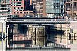
Eppendorfer Bridge leads over the Isebek Canal in the course of the Eppendorfer Baum . The bridge is a listed building. |
Street | 1927 |
Harvestehude ( 53 ° 35 ′ 1 ″ N, 9 ° 59 ′ 3 ″ E ) |
|
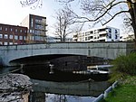
Ericus Bridge leads over the Ericusgraben / Brooktorhafen. The bridge is a listed building. |
Footpath |
HafenCity ( 53 ° 32 ′ 40 ″ N, 10 ° 0 ′ 11 ″ E ) |
|
|
Ernst-Mantius-Brücke leads with Ernst-Mantius-Straße over the Bille. Ernst Mantius (1838–1897) was Bergedorf's mayor. |
Street |
Bergedorf ( 53 ° 29 ′ 27 ″ N, 10 ° 12 ′ 41 ″ E ) |
|

|
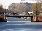
Ernst-Merck-Brücke leads with Ernst-Merck-Straße over the tracks of the main train station. Ernst Merck (1811–1863) was a Hamburg politician. |
Street | 1988 |
Hamburg-Altstadt , St. Georg ( 53 ° 33 ′ 17 ″ N, 10 ° 0 ′ 20 ″ E ) |
|
First breakout bridge leads in the course of the Ausschläger way over the middle canal (see also the second Ausschläger bridge over the south canal) |
Street |
Hammerbrook , Borgfelde ( 53 ° 33 ′ 3 ″ N, 10 ° 2 ′ 9 ″ E ) |
|

|
First Bank Bridge leads with Banksstraße over the lock canal (extension of the central canal). The Second Banks Bridge no longer exists. In the further course of the street it led over the southern canal (today the wholesale market area). |
Street |
Hammerbrook ( 53 ° 32 ′ 40 ″ N, 10 ° 0 ′ 48 ″ E ) |
|

|
First Borstelmann Bridge crosses the central canal with the Borstelmannsweg between Eiffestrasse and Wendenstrasse |
Street |
Hamm ( 53 ° 33 ′ 3 ″ N, 10 ° 3 ′ 12 ″ E ) |
|

|
First diagonal bridge crosses the central canal |
Street |
Hamm ( 53 ° 33 ′ 0 ″ N, 10 ° 3 ′ 33 ″ E ) |
|

|
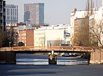
First Greven Bridge crosses the Mittelkanal in the course of the Grevenweg |
Street |
Hammerbrook , Borgfelde , Hamm ( 53 ° 33 ′ 6 ″ N, 10 ° 2 ′ 28 ″ E ) |
|
|
First Luisenbrücke leads along the Luisenweg over the Mittelkanal |
Street |
Hamm ( 53 ° 33 ′ 5 ″ N, 10 ° 2 ′ 54 ″ E ) |
|

|
First Osterbrook Bridge crosses the Mittelkanal with the street Osterbrook between Eiffestraße and Wendenstraße. Formerly a road bridge, only rebuilt as a pedestrian bridge after the war. |
Footpath and bike path |
Hamm ( 53 ° 33 ′ 1 ″ N, 10 ° 3 ′ 24 ″ E ) |
|

|
First Peuter Bridge is the northern of the two Peuter bridges and leads with the Peutestrasse over the Peutekanal . The original bridge from 1912 ( photo ), which was replaced by a new building in 2014–2014, was a listed building. |
Street |
Veddel ( 53 ° 31 ′ 34 ″ N, 10 ° 1 ′ 49 ″ E ) |
|

|
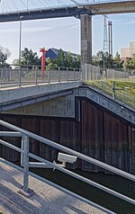
First cross channel bridge is the western of the two cross channel bridges and leads over the cross channel in the course of Stillhorner Damm. |
Road, railroad |
Kleiner Grasbrook , Steinwerder ( 53 ° 31 ′ 57 ″ N, 9 ° 58 ′ 43 ″ E ) |
|
|
The first Rugenberger Schleusenbrücke leads along the Rugenberger Damm over the northern chamber of the Rugenberger Schleuse |
Street |
Waltershof ( 53 ° 31 ′ 24 ″ N, 9 ° 56 ′ 4 ″ E ) |
|

|
First city dike bridge leads in the train of the street Stadtdeich over the lock canal (extension of the central canal). The second Stadtdeichbrücke no longer exists. In the further course of the street it led over the southern canal (today the wholesale market area). |
Street |
Hammerbrook ( 53 ° 32 ′ 38 ″ N, 10 ° 0 ′ 38 ″ E ) |
|

|
Eschenhof Bridge (E300) leads in the course of the street Pollhof over the federal highway 25 |
Street |
Bergedorf ( 53 ° 28 ′ 36 ″ N, 10 ° 13 ′ 53 ″ E ) |
|
|
|
Europe bridge (E308) crosses the Süderelbe in the course of the Wilhelmsburger Reichstraße and lies between the bridge of June 17th and the Harburg railway bridge |
Street / Elbe bridge |
Wilhelmsburg , Harburg ( 53 ° 28 ′ 25 ″ N, 9 ° 59 ′ 45 ″ E ) |
|
|
Europastraßenbrücke is in the street directory of Hamburg, but does not exist |
Wilhelmsburg |
Individual evidence
- ^ Sven Bardua: Bridge metropolis Hamburg. Architecture - Technology - History up to 1945. Dölling and Galitz Verlag, Hamburg 2009, ISBN 978-3-937904-88-7 , p. 101 f.
- ↑ Geoportal Hamburg
