Llamellín district
| Llamellín district | |
|---|---|
 The Llamellín district (marked in yellow) is located in the northeast of the Antonio Raymondi province |
|
| Basic data | |
| Country | Peru |
| region | Ancash |
| province | Antonio Raymondi |
| Seat | Llamellín |
| surface | 96 km² |
| Residents | 3457 (2017) |
| density | 36 inhabitants per km² |
| ISO 3166-2 | PE-ANC |
| politics | |
| Alcalde Provincial | Félix Sandoval Díaz (2019-2022) |
| Political party | Movimiento Acción Nacionalista Peruano |
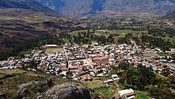
| View of Llamellín | |
Coordinates: 9 ° 6 ′ S , 77 ° 1 ′ W
The Llamellín district is located in the Antonio Raymondi province in the Ancash region in western Peru . The district has an area of 96 km². The 2017 census counted 3457 inhabitants. In 1993 the population was 4382, in 2007 it was 3849. The district administration is located in the provincial capital Llamellín, at an altitude of 3384 m , with 1888 inhabitants (as of 2017).
Geographical location
The Llamellín district is located east of the Cordillera Blanca in the northeast of the Antonio Raymondi province. It stretches along the west bank of the Río Puchca and Río Marañón .
The Llamellín district is bordered to the south by the district Chingas , the west by the district Mirgas , in the northwest on the district Chaccho , in the northeast on the district Huacaybamba and southern east on the district Paucas (the latter two districts belong to the province Huacaybamba ).
Web links
- Peru: Region Ancash (provinces and districts) at www.citypopulation.de
