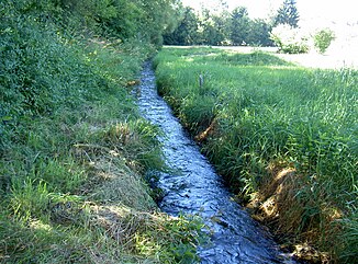
Loisbach (Pfreimd)
| Loisbach | ||
|
Loisbach in Eslarn |
||
| Data | ||
| Water code | EN : 1448 | |
| location |
Upper Palatinate Forest
|
|
| River system | Danube | |
| Drain over | Pfreimd → Naab → Danube → Black Sea | |
| source | at the Heckermühle 49 ° 33 '59 " N , 12 ° 30' 53" E |
|
| Source height | approx. 527 m | |
| muzzle | at the Hechtlmühle in the Pfreimd coordinates: 49 ° 36 '27 " N , 12 ° 25' 30" E 49 ° 36 '27 " N , 12 ° 25' 30" E |
|
| Mouth height | approx. 481 m | |
| Height difference | approx. 46 m | |
| Bottom slope | approx. 3 ‰ | |
| length | 15.2 km | |
| Catchment area | 45.06 km² | |
| Communities | Eslarn , Moosbach | |
The Loisbach is a 15 km long, left tributary of the Pfreimd in the district of Neustadt an der Waldnaab in the Upper Palatinate in Bavaria .
course
The Loisbach is formed from the union of numerous brooks that arise on the northern slopes of the Stückberg and the Stangenberg. This entire system of brooks, including the Ödbach and Thalerwiesbach and their tributaries, is summarized in the register of brook and river areas in Bavaria, Naab river area, as of 2012, under the area code 1448 and the area name Loisbach - Mühlbach - Ödbach. The actual Loisbach does not begin until the Thalerwiesbach joins the Ödbach at Heckermühle .
Source streams of the Loisbach
Numerous springs arise on the northern slopes of the Stückberg and the Stangenberg. They form many streams that seep away, reappear, branch out in many ways and reunite. The overview is made more difficult by the fact that on the one hand these brooks change their names several times over a short course and on the other hand different brooks have the same name and are viewed as the same brook. All these brooks flow northwards in the direction of Eslarn from the slopes and merge to the Heckermühle to the Loisbach.
Ödbach
One of the source streams of the Loisbach is the Ödbach. The Ödbach in turn is formed from two streams, both of which are known as Ödbach. The western of these rises on the north and north-east slopes of the Stangenberg west of Oberlangau . The eastern one rises on the northern slopes of the Stückberg. He picks up the Steinbach from the right. Both arms unite north of Premhof and immediately split again into a western and an eastern arm. The western arm takes the Thalerwiesbach from the left at Heckermühle and is called Loisbach from here on. 200 m further on, the eastern arm of the Ödbach flows into the Loisbach from the right.
Thalerwiesbach
The Thalerwiesbach rises from the iron fountain on the northern slope of the Stangenberg. It is called Eisenbrunnenbach for the first 500 m after the source, then Wolfslohbach for another kilometer and finally the last kilometer to its confluence with the Ödbach Thalerwiesbach.
Loisbach from Heckermühle
At the Heckermühle, the waters of the Thalerwiesbach and the Ödbach are dammed up to form a small pond from which they continue to flow as the Loisbach to the northeast. After 580 m the Lindauer Bach flows into the Stockwiese from the right. The Loisbach makes a sharp bend to the north and after another 800 m it reaches Eslarn. It flows through Eslarn from south to north, first through the Eslarner Stadtpark, then parallel to the Bockl cycle path to the north-western outskirts of Eslarn. Here he turns west. After 500 m it takes up the Grellenbach from the left, turns for 500 m to the northeast and then resumes its northwest direction. 3.7 km after the mouth of the Grellenbach, the Eiterbach also flows from the left. After a further 12.66 km, the Loisbach flows into the Pfreimd at Hechtlmühle .
Tributaries
- Thalerwiesbach, Quellbach, confluence from the left with Ödbach near the Heckermühle
- Ödbach, Quellbach, confluence from the right with Thalerwiesbach near the Heckermühle
- Lindauer Bach from the right
- Grellenbach from the left
- Eiterbach from the left
natural reserve
The area around Pfreimd and Loisbach is designated as an FFH area and Natura 2000 area with area number 6340-371. The habitat types represented in this area are: Moist tall herbaceous vegetation, lean lowland hay meadows, alder-ash and softwood floodplain forests, flowing waters with flooding aquatic vegetation. There are: otters , bullheads , brook lamprey , green mermaid .
Individual evidence
- ↑ a b Course and catchment area of the Loisbach
- ↑ a b Length and catchment area according to: Directory of stream and river areas in Bavaria - Naab river area, page 95 of the Bavarian State Office for the Environment, as of 2016 (PDF; 4.0 MB)
- ↑ 6340-371 Pfreimd and Lois-Bach (FFH area) in www.bfn.de, profiles of the Natura 2000 areas. Retrieved October 1, 2018.
