Mürringen
| Mürringen | ||
|---|---|---|
|
|
||
| State : |
|
|
| Region : | Wallonia | |
| Province : | Liege | |
| District : | Verviers | |
| Municipality : | Büllingen | |
| Coordinates : | 50 ° 24 ' N , 6 ° 18' E | |
| Residents: | 668 pop. | |
| Height: | 655 m | |
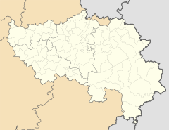
Mürringen is a village in the municipality of Büllingen in the German-speaking Community of Belgium . The place has 668 inhabitants (2013). Mürringen is located around two kilometers east of Büllingen at an altitude of around 655 m and is the highest village in Belgium, roughly on a par with the neighboring village of Rocherath . The White Stone , which is located in the Mürringer area, is the second highest point in Belgium.
The village has various infrastructure facilities (church, kindergarten, primary school, club house, playground and football field). Some hiking trails are among the tourist attractions in the rural area.
history
The ending -ingen indicates a Franconian foundation from the 5th century. In 1301, the aristocrat Arnold von Reuland sold the village of Mürringen and the associated forest to Friedrich von Schleiden. From that moment on, the baronial rule Moerungen or Moyryngen belonged to Schleiden County until the end of the 18th century .
Web links
Individual evidence
- ↑ Mürringen. Büllingen municipality, January 1, 2013, accessed July 22, 2014 .
- ↑ Büllingen: Nature and cutting-edge technology made in East Belgium. In: dg.be. Ministry of the German-speaking Community of Belgium, accessed September 24, 2019 .
- ↑ buellingen.be: History of Mürringen , accessed on February 5, 2017

