Manderfeld
| Manderfeld | ||
|---|---|---|
|
|
||
| State : |
|
|
| Region : | Wallonia | |
| Province : | Liege | |
| District : | Verviers | |
| Municipality : | Büllingen | |
| Coordinates : | 50 ° 20 ′ N , 6 ° 20 ′ E | |
| Residents: | 407 pop. | |
| Height: | 540 m | |
| Post Code: | 4760 | |
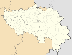
Manderfeld is a place in Belgium with almost 500 inhabitants . The place has belonged to the large community of Büllingen since January 1st, 1977 and is located in the southeast on the border with Germany .
In the center of the village is the St. Lambertus parish church from the 14th century. Next to the church there is a Way of the Cross from 1765.
geography
Manderfeld is located at 540 to 670 m OP in the Eifel on the Our , which rises in the old municipal area, and is part of the Hohes-Venn-Eifel nature park .
The former community of Manderfeld included the villages and hamlets Afst, Allmuthen, Berterath , Buchholz , Hasenvenn, Hergersberg , Holzheim , Hüllscheid, Igelmonder Hof, Igelmondermühle, Kehr , Krewinkel , Lanzerath , Losheimergraben , Merlscheid and Weckerath . Today the region is also known as Manderfelder Land or Treeschland (Trier Land, part of the Diocese of Trier).
history
The first written mention of the place can be found in a document from the year 854 when Emperor Lothar I signed an act on site in his palatium.
literature
- Johann Friedrich Schannat: The cities and towns of the Eifel and their surroundings . tape 3 . Published by Jacob Anton Mayer, Aachen and Leipzig 1852.
- Petra Juling, Ulrich Berger: Eifel travel guide, Aachen, Trier . 2nd Edition. Dumont Reiseverlag, ISBN 978-3-7701-7396-9 .
Web links
- Manderfeld (accessed January 6, 2016)

