Marajó
| Marajó | ||
|---|---|---|
| Satellite image of the Amazon estuary | ||
| Waters | Amazon , Rio Pará | |
| Geographical location | 0 ° 59 ′ S , 49 ° 35 ′ W | |
|
|
||
| length | 297 km | |
| width | 204 km | |
| surface | 40,100 km² | |
| Highest elevation | Breves (city) 40 m |
|
| Residents | 250,000 6.2 inhabitants / km² |
|
| main place | Breves | |
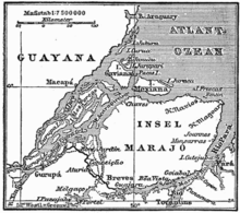
| Detailed map with Marajó | ||
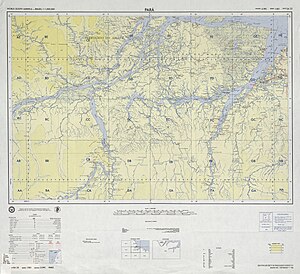
Marajó ( Portuguese: Ilha de Marajó ) is by far the largest island in Brazil and is located in the mouth of the Amazon in the north of the country.
About 250,000 people live on the island.
geography
size
The actual island of Marajó is around 40,100 km² and about the same size as Switzerland . Together with neighboring islands, mostly only separated from the Marajó by rivers, it forms the Marajó Archipelago, the total area of which is given as 49,602 km².
Marajó is sometimes considered the largest river island on earth. This is contradicted by the fact that the eastern parts of the island also touch the sea ( Atlantic Ocean , Rio Pará bay ) and the island is bounded by the estuaries of two rivers, the Amazon and the Tocantins ; as a result, Ilha do Bananal, also located in Brazil and completely enclosed by the Rio Araguaia, is the largest river island.
Inner structure
The island is crossed by 20 independent larger rivers.
Savanna vegetation predominates in the east of the island . In these areas, livestock is mainly farmed on large fazendas . There is also the 400 km² rainwater-fed Lago Arari , which shrinks by 80% during the dry season. Today the island is home to large herds of domesticated water buffalo . The west of the island, on the other hand, is dominated by Várzea forests.
To the north of the large savannah areas, palm swamps can be found, which are dominated by Buriti palms ( Mauritia flexuosa ) and cabbage palms ( Euterpe oleracea ). During the rainy season, these swamps are flooded about one meter high. The ecological structure of these swamps is practically unknown.
Large parts of the island are flooded during the rainy season . The high water levels of the Amazon contribute to this in the coastal area and the heavy rainfall in the interior of the island. Due to the regular flooding, many of the settlements are built on stilts ( Palafitas ).
The most important localities are in the southeast of the island: Soure and Salvaterra . They have a simple tourist infrastructure and are popular because of the lonely and spacious beaches.
Surrounding waters
The island archipelago is bounded in the northwest by the southern branch of the Amazon (Canal do Sul), on the other side, in the southeast, by the over 200 kilometers inland, around 20 kilometers wide Rio Pará Bay with the mouth of the Rio Tocantins, which opens as Baja de Marajó to the South Atlantic. In between, in the southwest, the archipelago is bounded by a network of channel-like tidal waters with alternating flow directions (Rio de Breves, Furo dos Macacos, Rio Jacaré with Baia do Vieira Grande to the north and numerous tributaries). Via these waters, especially during floods, Amazon water also reaches the Rio Pará, on average about 3%. In the northeast, finally, the open Atlantic limits the island coast.
Marajó County
The administrative district of Marajó ( Mesorregião do Marajó , i.e .: region of medium order ) with 481,000 inhabitants (as of 2010) is more than twice the size of the island itself. It extends beyond the island as most of the 16 associated municipalities (Municípios ) also include areas on the opposite mainland. All 16 municipalities have a share in the island of Marajó:
| local community | Residents | local community | Residents | ||
|---|---|---|---|---|---|
| 1 | Afuá | 34,707 | 9 | Melgaço | 24,526 |
| 2 | Anajás | 24,332 | 10 | Muaná | 33,979 |
| 3 | Bagre | 23,820 | 11 | Ponta de Pedras | 25,838 |
| 4th | Breves | 92.283 | 12 | Portel | 52.121 |
| 5 | Cachoeira do Arari | 20,311 | 13 | Salvaterra | 20,027 |
| 6th | Chaves | 18,242 | 14th | Santa Cruz do Arari | 8,115 |
| 7th | Curralinho | 28,343 | 15th | Sao Sebastiao da Boa Vista | 22,758 |
| 8th | Gurupá | 29,017 | 16 | Soure | 22,849 |
| Source: Instituto Brasileiro de Geografia e Estatística : Unidade Federal: Pará (results of the 2010 census). | |||||
The 16 municipalities are assigned to the three microrregiões Arari, Breves and Portel:
| Arari microregion | Furos de Breves microregion | Portel microregion |
|---|---|---|
history
3000 year old ceramic finds indicate an early high culture (the Marajoara culture, a pre-Columbian culture ), which, however, had already perished at the time of the conquest. Today finds of the Marajoara culture can be viewed in the Museu Goeldi in Belém .
Most of the current residents are descendants of the Nheengaíba Indians, who were pacified by the priest António Vieira in 1659 and who later mixed with African slaves and Portuguese immigrants. Their ceramic art - from the pre-Columbian Marajoara culture - still lives on with them in an old tradition.
The Nheengaíba were a tribe that belonged to the Aruã people and came from the West Indies , where they had been displaced by the Caribs . Its dialect diversity initially led to the assumption that there were many independent tribes, such as the Aruaque , Mapuá, Anajá, Guajará, Mamaiauá, Sacará and Juruna.
The Aruaque were skilled potters. In addition to commodities such as pots, they also made vases, funeral urns, children's toys and other things. Their ceramics were mostly decorated in three colors: red, black and white. They lived on heaped mounds of earth, the sambaquis , which also served as burial places for their relatives, who were buried there in decorated urns. Like many Brazilian Indian tribes and peoples with an estimated 4 million members, the last Aruaque disappeared in the 18th century and with them their languages.
fauna
Marajó has a diverse fauna. The birds in particular are easy to watch on the unforested campos alagados (floodplains). The red scarlet ibis are particularly characteristic representatives of the bird world of Marajó. There are also alligators , piranhas and many species of snakes .
When a ship from Asia was shipwrecked off the coast of Brazil in 1920 and sank, a small herd of water buffalo was able to save itself and swim to the island. The herd survived and spread over the whole island, the current number of about half a ton of animals is estimated at 3 million.
economy
Marajó's economy is mainly based on buffalo and cattle breeding and fishing. For the island's residents, the domesticated water buffalo are the most important livestock . The figures for this vary between half a million and 3 million copies. The buffaloes are mostly on fazendas , only a few live wild. They are extremely frugal and feed on wild grasses that they can find everywhere.
The animals provide high quality, unpolluted meat and leather . In addition, the labor of the animals is used for the transport of goods or garbage, for rides by tourists and for the police. In the police service, the animals remain in an age range of 2 to 20, maximum 28 years. The buffalo swim very persistently even when mounted. (The buffalo are ridden with the help of a shift in weight and a rope in the nose ring.) In contrast to horses and off-road vehicles, the buffalo have no difficulties with the partly swampy terrain with mangrove forests . When the land is flooded during the rainy season and the villages are isolated, animals are often the only means of transport left.
In addition to cattle breeding, pigs are also farmed, with around 200,000 animals.
The west of the island with the Várzea forests is populated by small farmers who, in addition to the timber industry, also harvest the fruits of the cabbage palm ( Açaí ) and extract rubber .
religion
79% of the population are Catholic. The parishes of the island belong to the territorial prelature of Marajó .
Web links
- geo
- Brazil - Buffalo on patrol ( Memento of November 3, 2007 in the Internet Archive )
- marajo
Individual evidence
- ↑ Ilha de Marajó ( Memento of March 7, 2010 in the Internet Archive )
- ↑ List of the largest islands
- ↑ Development plan for Marajo, Brazilian administrative document ( Memento of July 6, 2011 in the Internet Archive )
- ↑ Antecedentes: a Amazônia paraense antes dos europeus ( Memento of May 29, 2014 in the Internet Archive )
- ↑ Jacques Callède et al .: Les apports en eau de l'Amazone à l'Océan Atlantique , Revue des sciences de l'eau / Journal of Water Science, Vol. 23, No. 3, Montreal 2010, pp. 247-273 (accessed on August 19, 2013)
- ↑ a b c d Brazil portal
- ↑ Calculated from the information on the denomination in the 2010 census, see the Censo Demográfico 2010 table available for each município : Resultados da Amostra - Religião des Instituto Brasileiro de Geografia e Estatística, accessed on June 8, 2014.


