Master stone
| Master stone | ||
|---|---|---|
|
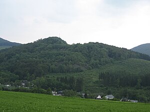
View southwest over Siedlinghausen to the Meisterstein |
||
| height | 636.4 m above sea level NHN | |
| location | near Siedlinghausen ; Hochsauerlandkreis , North Rhine-Westphalia ( Germany ) | |
| Mountains | Rothaar Mountains | |
| Dominance | 0.91 km → Hillkopf | |
| Notch height | 68 m ↓ to the Hillkopf | |
| Coordinates | 51 ° 14 '30 " N , 8 ° 28' 39" E | |
|
|
||

The master stone at Siedlinghausen in the North Rhine-Westphalian Hochsauerlandkreis is 636.4 m above sea level. NHN high mountain of the Rothaargebirge .
geography
location
The Meisterstein is located in the Sauerland in the north of the Rothaar Mountains and in the Sauerland-Rothaar Mountains Nature Park . Its summit rises about 1.3 km south-southeast of the center of the village of Siedlinghausen , a district of 6.5 km (as the crow flies ) southeast of the summit, located at the confluence of the nameless stream flowing east of the mountain into the Neger to the west of it Winterberg . While the north flank drops in the direction of the Negertal, the Iberg ( 703.7 m ) rises beyond and thus east of the nameless valley, to the south the landscape leads over to the Hillkopf ( 717.4 m ) and in the west lies beyond the Negertal the Hömberg ( 715 m ).
Natural allocation
The Meisterstein belongs to the natural area main unit group Süderbergland (No. 33) in the main unit Rothaargebirge (with Hochsauerland ) (333) and in the subunit Winterberger Hochland (333.5) to the natural area Nordheller Heights (333.57). Its landscape falls north to Siedlinghausen in the sub -natural area of Assinghauser Grund of the Bödefelder Mulde (333.80), which is part of the Hochsauerländer Schluchtgebirge sub-unit .
Mountain lake
A striking remnant of the former diabase mining is the mountain lake of the Meisterstein. In this former open-cast mine , which extends westwards below the current mountain peak, a 7 to 9 m deep lake has formed due to precipitation , the water surface of which is 557.3 m above sea level. Today the still water is used for diving and the steep walls for mountain climbing.
Somewhat south-south-west of the mountain peak and south-east above the lake there is a transmission tower at a height of about 630 m .
Protection expulsions
In the course of time, three different protective designations from the authorities can be proven for the Meisterstein area. First, the district of Brilon put the area under protection as a Meisterstein natural monument . The time of the protection is unclear; the district of Brilon went on in 1975 in the Hochsauerlandkreis. In 1983, the Hochsauerlandkreis then designated the area with a size of 3.7 hectares in the Winterberger Plateau landscape plan as a protected landscape component (LB), which replaced the natural monument status. The protection designation as LB was made because of the formative and invigorating function of the area for the landscape. In the new Winterberg landscape plan , however, the area became part of the Winterberg landscape protection area of 8.786 hectares in 2008 . The Winterberg landscape protection area belongs to type A, general landscape protection , in which only the construction of structures is prohibited.
Traffic and walking
To the east and north, past the Meisterstein, the Nuttlar – Winterberg railway and the 740 road run between Silbach and Siedlinghausen , the latter crossing the L 742 in Siedlinghausen, which comes from Rehsiepen and runs past the former Siedlinghausen hunting lodge . For example, starting on these roads, the mountain can be hiked on forest paths and paths, among other things.
Meisterstein climbing area
The Meisterstein quarry has been owned by the Dutch outdoor company Nijssen Management & Team Training BV since around the year 2000. Since then, people have been climbing and diving in the quarry. Military units from the Netherlands and Germany also use the break for exercises more often. In 2006 and 2007 members of the German Alpine Association (DAV) and IG Climbing were also involved in the development of climbing routes . In addition to participants in events organized by Nijssen Management & Team Training BV, members of DAV and IG Climbing in the Bruch are also allowed to climb. In Bruch there are the climbing areas Big Wall, Big Slab, Practice Wall, Sporn and Black Wall. To protect the local eagle owl occurrence there is a climbing ban in the breeding area from February 1st to July 31st.
Web links
Individual evidence
- ↑ a b c d Topographical Information Management, Cologne District Government, Department GEObasis NRW ( information )
- ↑ Martin Bürgener: Geographical Land Survey: The natural spatial units on sheet 111 Arolsen. Federal Institute for Regional Studies, Bad Godesberg 1963. → Online map (PDF; 4.1 MB)
- ^ Office for Land Care of the Regional Association of Westphalia-Lippe on behalf of the Hochsauerlandkreis (ed.): Landscape plan Winterberger Hochfläche , Meschede 1983, p. 95
- ↑ Hochsauerlandkreis - Lower Landscape Authority (ed.): Landscape plan Winterberg , Meschede 1993, pp. 119–120
- ↑ Fritz Blach: Land of a Thousand Mountains . Sauerland climbing guide. Geoquest, hall. Chapter Meisterstein near Siedlinghausen, pp. 146–158.
- ↑ Meisterstein between Silbach and Siedlinghausen , u. a. with information on blocking situations, on kletterarena.info


