Mewasseret Zion
| Mewasseret Zion | ||
|---|---|---|

|
||
| Basic data | ||
| hebrew : | מְבַשֶּׂרֶת צִיּוֹן | |
| State : |
|
|
| District : | Jerusalem | |
| Founded : | 1951 | |
| Coordinates : | 31 ° 49 ' N , 35 ° 9' E | |
| Height : | 750 m | |
| Area : | 6.390 km² | |
| Residents : | 23,962 (as of 2018) | |
| Population density : | 3,750 inhabitants per km² | |
| Community code : | 1015 | |
| Time zone : | UTC + 2 | |
| Community type: | Local government | |
| Mayor : | Yoram Shimon | |
| Website : | ||
|
|
||
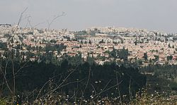
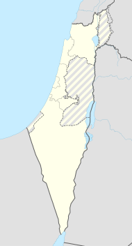
Mewasseret Zion (מְבַשֶּׂרֶת צִיּוֹן Məvasseret Zijjōn , German: 'Zion, Freudenbotin') is a suburb of Jerusalem in Israel . It is about 10 km from Jerusalem. It was founded from the merger of two places - Maoz Zion and Mevaseret Yerushalayim - to form a local government . Mevaseret Zion lies on a mountain ridge at an altitude of 750 m . It is located on both sides of Highway 1 from Jerusalem to Tel Aviv .
history
Because of its strategically important location, the area of today's Mevaseret Zion was settled in ancient times. Various historians identify this area with the biblical Efron (e.g. Joshua 15.9), a border town on the territory of the tribe of Judah .
The Romans set up a fortified military camp called Castellum. From here the road to Jerusalem could be controlled. On the ruins of this fort, the crusaders built the Castellum Belveer castle , the remains of which can still be seen today. An Arab village, Coloniya, was later built around the castle. The Muhktar house was built on the ruins of the crusader castle.
Only towards the end of the British mandate in Palestine did the hill regain importance. When the hostilities between Arabs and Jews increased after the UN partition resolution for Palestine in November 1947, the road to Jerusalem was blocked by Arab rioters for the supply convoys for the besieged Jewish part of Jerusalem. The Arab village and the remains of the crusader castle were of great strategic importance. In connection with Operation Nachshon , bloody fighting took place between April 2, 1948 and April 9, 1948 for the place, in which the Israeli armed forces of the Hagana and the Palmach were ultimately victorious. This was the first Jewish military conquest in the Israeli War of Independence . The Arab residents fled the fighting.
In 1951, Ma'oz Zion was founded on the area of the former village and was home to new immigrants from Iraq , Kurdistan , North Africa and Iran .
Mevaseret Yerushalayim was founded east of Ma'oz Zion in 1956 by Jewish immigrants from North Africa .
In 1963 Ma'oz Zion and Mevaseret formed a joint local government . The new common name Mewasseret Zion goes back to Isaiah 40: 9.
In the following period, many Jerusalemites moved to Mewasseret Zion in search of larger housing or the quieter suburban atmosphere. The embassies of Paraguay and Bolivia are also based here.
In 1995 the world's first kosher McDonald’s restaurant opened.
Residents
The Israeli Central Statistical Office gives the following population figures for the regional administration in the censuses of May 22, 1961, May 19, 1972, June 4, 1983, November 4, 1995 and December 28, 2008:
| Year of the census | 1961 | 1972 | 1983 | 1995 | 2008 |
| Number of inhabitants | 3,911 | 4,694 | 8,074 | 16,592 | 23,650 |
mayor
- Dani Azriel
- Yoram Shimon
Town twinning
-
 Sankt Augustin , North Rhine-Westphalia , Germany since 2001
 -
 White Plains , New York , United States since 2004
 -
 Épinay-sur-Seine , Île-de-France , France since 2013
See also
Web links
- crwflags.com (English). Retrieved June 19, 2011
Individual evidence
- ↑ אוכלוסייה ביישובים 2018 (population of the settlements 2018). (XLSX; 0.13 MB) Israel Central Bureau of Statistics , August 25, 2019, accessed May 11, 2020 .
- ↑ Observant have little appetite for Israel's kosher McDonald’s , English
- ^ Israel Central Bureau of Statistics
- ↑ Everything will work out for the better In: Kölner Stadt-Anzeiger .de, October 18, 2001, accessed on August 4, 2018.
