Morales del Rey
| Morales del Rey municipality | ||
|---|---|---|
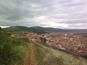
 Morales del Rey in the Sierra de Carpurias
|
||
| coat of arms | Map of Spain | |

|
|
|
| Basic data | ||
| Autonomous Community : |
|
|
| Province : | Zamora | |
| Comarca : | Benavente y Los Valles | |
| Coordinates | 42 ° 4 ′ N , 5 ° 47 ′ W | |
| Height : | 722 msnm | |
| Area : | 20.14 km² | |
| Residents : | 577 (Jan. 1, 2019) | |
| Population density : | 28.65 inhabitants / km² | |
| Postal code : | 49693 | |
| Municipality number ( INE ): | 49128 | |
| administration | ||
| Website : | Morales del Rey | |
Morales del Rey is a northern Spanish town and municipality ( municipio ) with 577 inhabitants (as of January 1, 2019) in the province of Zamora in the autonomous community of Castile-Leon .
location
The place Morales del Rey is at the foot of the Sierra de Carpurias in a loop of the Eria river at an altitude of about 720 meters above sea level. d. M. The distance to Benavente is about 20 kilometers (driving distance) in a south-easterly direction; the city of Astorga is about 60 kilometers northwest. The village of Vecilla de la Polvorosa , which has around 150 inhabitants, also belongs to the municipality .
Population development
| year | 1960 | 1970 | 1981 | 1991 | 2000 | 2014 |
| Residents | 1,278 | 1,116 | 915 | 828 | 729 | 636 |
Since the middle of the 19th century, the population of the municipality was well over 1,000 people; at the beginning of the 20th century there were even more than 1,800. Due to the increasing mechanization of agriculture , however, there was a lack of jobs afterwards, which triggered an ongoing rural exodus.
economy
Until the mid-20th century, most inhabitants lived the community as self by the field economy and some livestock. Today many empty houses are rented out as holiday apartments ( casas rurales ).
history
The remains of a megalithic stone grave from around 3500 to 4000 BC can be found in the municipality . On the basis of ceramic shards (including fragments of terra sigillata ) the existence of a Roman country estate ( villa rustica ) near the dolmen is probable, but so far no excavations have been carried out at the site; Another such site near the confluence of the Río Eria in the Río Órbigo was excavated in 1998. Celts , Visigoths and Moors were probably also in the area, but left no archaeologically usable traces.
Attractions
- The remains of the El Tesoro called dolmens are located approximately one kilometer northwest of the town. The cap stones of the round burial chamber and the mound of earth above ( tumulus ) have long since disappeared. As usual, the corridor faces southeast, i.e. in the direction of sunrise at the time of the winter solstice . The monument is one of the few testimonies from the time of the megalithic cultures in the province of Zamora; the others can also be found in the Carpurias hills (e.g. Casetón de los Moros near Arrabalde ). At the end of the 20th century, a replica of the original large stone grave was placed right next to the remains of the old one.
- The former school of the town was converted into an information center for the Neolithic in the region ( Aula arqueológica ).
- The parish church of San Pelayo is a simple, single-nave building from the 16th century with a small porch ( portico ) on the west, resting on wooden supports . Above is a three-part bell gable ( espadaña ).
Personalities
- Damián Yáñez Neira (born December 12, 1916 in Morales del Rey, † May 27, 2015 in San Cristovo de Cea, Ourense Province ) was a Spanish Trappist and religious historian.
Web links
Individual evidence
- ↑ Cifras oficiales de población resultantes de la revisión del Padrón municipal a 1 de enero . Population statistics from the Instituto Nacional de Estadística (population update).
