
Morsum (Sylt)
|
Morsum
Sylt municipality
Coordinates: 54 ° 52 ′ 9 ″ N , 8 ° 25 ′ 53 ″ E
|
||
|---|---|---|
| Height : | 8 m above sea level NHN | |
| Area : | 11.62 km² | |
| Residents : | 1100 | |
| Population density : | 95 inhabitants / km² | |
| Incorporation : | January 1, 1970 | |
| Incorporated into: | Sylt-East | |
| Postal code : | 25980 | |
| Area code : | 04651 | |
Location of Morsum in Schleswig-Holstein |
||

Morsum ( North Frisian Muasem ) is a district of the municipality of Sylt on the North Sea island of Sylt in the district of North Friesland in Schleswig-Holstein . It is located in the east of the island in a heather landscape . The Schleswig-Holstein Wadden Sea National Park lies on both sides of the village . The Hindenburg dam , which connects the island of Sylt with the mainland , begins near Morsum .
The districts of Abort (north of Abuurt ), Großmorsum (north of Guart Muasem , Danish Store Morsum ), Kleinmorsum (north of Litj Muasem , Danish Lille Morsum ), Holm (north of Holerem ) belonged to the municipality of Morsum, which was independent until 1970 . Klampshörn (northern Klampshörn , Danish Klaphjørne ), Nöse (northern Nösi , Danish Næsodde ), Osterende (northern Uasterjen , Danish Østerende ), Schellinghörn (northern Skelinghörn , Danish Skellinghjørne ) and Wall (northern Wal , Danish Vold ).
Geology at the Morsum cliff


The Morsum cliff is on the wadden side of the island. The cliff has been a nature reserve since 1923 . The Ice Age glaciers compressed many layers of earth, including mica clay , limonite sandstone and kaolin sand, into a small space. The sea washed them clear again so that they can be seen in the cliff in sloping color gradations from white to brown. There are also foundlings in the mudflats in front of the cliff that were carried to Sylt by the Ice Age glaciers. The cliff is rich in fossils . The steadily increasing tourism in the last decades led to the fact that many beaten paths were created and, as a result, entire dunes were partially destroyed. This repeatedly resulted in path delimitations and walking bans.
There are regular guided tours on the Morsum cliff. The association responsible for the nature reserve Morsum-Kliff is the Naturschutzgemeinschaft Sylt eV based in Braderup. She organizes guided tours here every day.
History and present

The place, inhabited by about 1,100 inhabitants, was one of the first settlement areas of the Frisians on Sylt in the 9th century and the largest village on the island until the end of the 17th century. The place was first mentioned in 1462. In 1970 Morsum was combined with Archsum, Keitum and Tinnum to form the municipality of Sylt-Ost . In 2009 Sylt-Ost again became part of the municipality of Sylt.
The village church of St. Martin probably dates from the 12th century and, together with the Keitum church, is the oldest church on the island. The meter-thick walls consist of boulders and granite blocks.
In Morsum, Frisian street names are more common than in other island towns. B. Dikwai (Deichweg), Sērkwai (Kirchweg), Gurtmuasem (Großmorsum) or Däälgung / Deelgung (Talacker). The street Zum Wäldchen is an exception . The Agriculture shapes the appearance of the village next to the tourism still largely.
Sölring , the Frisian dialect of the island of Sylt, is still spoken in Morsum. However, its use is falling sharply.
Transport links

On Sylt - as on the neighboring North Frisian islands - motorized individual traffic is permitted. Morsum can be reached via a well-developed road network . The train station in Morsum is a stopping point for local and regional transport on the Nord-Ostsee-Bahn . The regular buses of the Sylter Verkehrsgesellschaft connect the place with the island metropolis Westerland .
school
Morsum had its own elementary school until 2014, but it was closed due to a lack of demand.
See also
Web links
- Morsum on the website of Insel Sylt Tourismus-Service GmbH
- Historical photos from Morsum
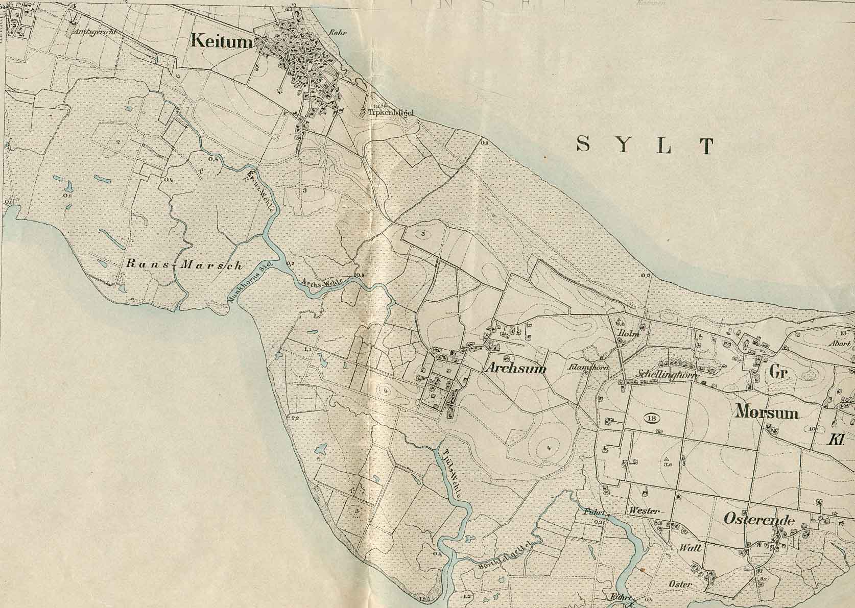
- Historical map 1878: Morsum, western part
- Historical map 1878: Morsum, eastern part
- Historical map 1811: Morsum
- Morsum-Kliff on the website of the Naturschutzgemeinschaft Sylt
Individual evidence
- ^ Historical map sheet from 1878
- ↑ M. Mørk Hansen and CL Nielsen: Kirkelig Statistics on Slesvig Stift med historiske and topografiske bemærkninger , Vol. 1, Kjøbenhavn 1863, p. 298
- ^ Nordfriisk Instituut: Nordfriesland-Karte , Bräist / Bredstedt 2011