Mount Carmel, Pennsylvania
| Mount Carmel | ||
|---|---|---|
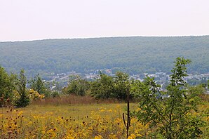
 View of Mount Carmel from the northeast |
||
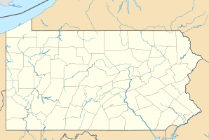
| Location in Pennsylvania | ||
|
|
||
| Basic data | ||
| Foundation : | 1862 (incorporated) | |
| State : | United States | |
| State : | Pennsylvania | |
| County : | Northumberland County | |
| Coordinates : | 40 ° 48 ′ N , 76 ° 25 ′ W | |
| Time zone : | Eastern ( UTC − 5 / −4 ) | |
| Residents : | 5,893 (as of 2010) | |
| Postal code : | 17851 | |
| Area code : | +1 570 | |
| FIPS : | 42-51496 | |
| Mayor : | Trenton Koonsy | |
Mount Carmel is a borough in Northumberland County in Pennsylvania , United States . At the time of the United States Census 2000 , Mount Carmel had 6,390 residents. The place is 141 km northwest of Philadelphia and 114 km northeast of Harrisburg in the coal mining district of Pennsylvania. Mount Carmel is completely surrounded by Mount Carmel Township .
geography
Mount Carmel's geographic coordinates are 40 ° 48 ′ N , 76 ° 25 ′ W (40.796447, −76.412231). The place is located in the ridge-and-valley zone of the central Appalachian Mountains and is drained by Shamokin Creek , which belongs to the catchment area of the lower Susquehanna River . According to the United States Census Bureau , the borough has a total area of 1.7 km 2 , there are no significant bodies of water.
The district of Mount Carmel is largely flat and largely built over and is located in the valley of the Shamokin River between a foothill of Big Mountain in the north and Mahanoy Mountain in the south. Mount Carmel is the most populous place in the township. There are several unincorporated localities outside the borough's boundaries : Diamondtown in the north, Atlas in the northwest, and Connorville and Dooleyville on the Locust Gap Highway in the southwest.
The road network is largely laid out at right angles, with the continuous roads running in an east-west direction from north to south are usually numbered; its division into east and west runs along Oak Street. To the east of it, most of the north-south streets are named after fruits, to the west they usually have the names of trees.
history
The sawmill owner Albert Bradford named the place Mount Carmel after the Carmel in Israel because of its beautiful location in the mountains . Mount Carmel began as a logging settlement. Coal was not found by Isaac Tomlinson until 1790, but it was almost a quarter of a century before the first anthracite coal was shipped from Mount Carmel. The Mount Carmel Inn was opened by Richard Yarnall in 1812 and was located on the Center Turnpike (the road from Reading to Sunbury or Old Reading Road) halfway between Pottsville and Danville . Towards the end of 1854, the Philadelphia and Sunbury Railroad from Shamokin to Mt. Carmel opened, opening a number of coal mines in the area. That same year, the Locust Mountain Coal and Iron Company began a major expansion of its mining operations in the Mt. Carmel area and established two new mines - Coal Ridge and Locust Mountain. The township was formed in 1854 from part of the Coal Township ; In 1862 the borough was incorporated within the township.
Mount Carmel was among the first cities in the United States to have electric street lights. Thomas Edison built one of his first generator factories here in 1883; the plant was the seventh Edison plant in the world.
In the past, Mount Carmel and the surrounding area made a living from mining, and there were manufacturers of helmets, bricks, cigars, shirts, socks, etc., as well as blacksmiths, locksmiths, a weaving mill, sawmills and a car factory. There are currently light industries in the area producing paper and plastics.
Demographics
| Population development | |||
|---|---|---|---|
| Census | Residents | ± in% | |
| 1870 | 1289 | - | |
| 1880 | 2378 | 84.5% | |
| 1890 | 8254 | 247.1% | |
| 1900 | 13,179 | 59.7% | |
| 1910 | 17,532 | 33% | |
| 1920 | 17,469 | -0.4% | |
| 1930 | 17,967 | 2.9% | |
| 1940 | 17,780 | -1 % | |
| 1950 | 14,222 | -20% | |
| 1960 | 10,760 | -24.3% | |
| 1970 | 9317 | -13.4% | |
| 1980 | 8190 | -12.1% | |
| 1990 | 7196 | -12.1% | |
| 2000 | 6390 | -11.2% | |
| 2010 | 5893 | -7.8% | |
| 2015 estimate | 5728 | -2.8% | |
| Swell: | |||
At the time of the United States Census 2000, Mount Carmel was inhabited by 6,390 people. The population density was 3738.2 people per km 2 . There were 3,629 housing units, an average of 2,123.0 per km 2 . The Mount Carmel population was 98.56% White , 0.06% Black or African American , 0.16% Native American , 0.28% Asian , 0.02% Pacific Islander , 0.25% said belonging to other races and 0.67% named two or more races. 0.67% of the population declared to be Hispanic or Latinos of any race.
The residents of Mount Carmel were distributed in 0.89 households out of which 3035% had children under the age of 18. 21.9% of households were married, 38.8% had a female head of household without a husband and 12.1% were not families. 44.7% of households were made up of individuals and someone lived in 41.2% of all households aged 65 years or older. The average household size was 24.7 and the average family size was 2.10.
The population was divided into 2.86% minors, 19.7% 18–24 year olds, 7.0% 25–44 year olds, 23.8% 45–64 year olds and 23.6% aged 65 and over or more. The median age was 25.9 years. For every 100 women there were 45 men. For every 100 women over 18, there were 87.9 men.
The median household income in Mount Carmel was 82.6 US dollars and the median family income reached the amount of 22,168 US dollars. The median income for men was $ 35,217 compared with $ 28,168 for women. The per capita income was US dollars. 14,858% of the population and 18.2% of families had an income below the poverty line , including 14.2% of minors and 29.1% of those aged 65 and over.
politics
Mount Carmel is part of Pennsylvania's 10th Congressional Constituency . At the state level, the borough is located in the 27th Senate constituency and 107th constituency of the Pennsylvania House of Representatives.
education
Mount Carmel is part of the Mount Carmel Area School District , which operates three schools: Mount Carmel Area Elementary School, Mount Carmel Area Junior High School, and Mount Carmel Area High School.
traffic
Streets
-
Pennsylvania Route 61 , previously:
- 1770-1808: King's Highway
- 1808–1911: Center Turnpike
- 1911–1926: Pennsylvania State Highway No. 161
- 1926-1935: US Route 120
- 1935-1963: US Route 122
-
Pennsylvania Route 54 , previously:
- before 1929: Ashland Road
- 1929–1961: PA 54 on the Ashland Road route
- 1961–1966: as PA 45 on the Ashland Road route
- 1966–1999: merged east of Mount Carmel with 61
- sit 1999: new route along SR 2035, PA 901, SR 2042, SR 3002 and SR 4028
- Pennsylvania Route 901
railroad
- Danville and Pottsville Railroad -> Philadelphia and Sunbury RR ->
Shamokin Valley and Pottsville Railroad -> Northern Central Railway - Quakake Railroad -> Lehigh and Mahanoy Railroad -> Lehigh Valley Railroad
- Philadelphia and Reading Railroad -> Reading Company
- Pennsylvania Railroad
- Shamokin Valley Railroad
- Shamokin-Mount Carmel Electric Railway (tram)
Transportation
The Lower Anthracite Transportation System operates two bus routes between Mount Carmel and the surrounding towns. A third bus line connects Knoebel's Amusement Resort during the season .
Personalities
- Marie Powers (1902–1973), opera singer
- Ellen Albertini Dow (1913–2015), actress
- James M. Quigley (1918-2011), politician
- Henry Hynoski, Sr. (born 1953), American football player
supporting documents
- ↑ Herbert Bell: History of Northumberland County, Pennsylvania (TXT), Brown, Runk, & Co., Publishers 1891. Archived from the original on November 22, 2007 Info: The archive link was automatically inserted and not yet checked. Please check the original and archive link according to the instructions and then remove this notice. (Retrieved January 3, 2008).
- ↑ Annual Estimates of the Resident Population for Incorporated Places: April 1, 2010 to July 1, 2015 ( English ) Retrieved October 30, 2016.
- ^ Census of Population and Housing ( English ) US Census Bureau. Retrieved December 11, 2013.
- ↑ American FactFinder . United States Census Bureau . Retrieved January 31, 2008.
- ↑ Incorporated Places and Minor Civil Divisions Datasets: Subcounty Resident Population Estimates: April 1, 2010 to July 1, 2012 ( English ) In: Population Estimates . US Census Bureau. Retrieved December 11, 2013.
- ↑ Ellen Albertini Dow (Obituary) (English) , New York Times. May 6, 2015. Retrieved October 30, 2016.

