
Muttseehütte
| Muttseehütte SAC hut |
||
|---|---|---|
 |
||
| location | Northwest of the Muttenstock ; Canton of Glarus , Switzerland ; Valley location: Linthal | |
| Mountain range | Glarus Alps | |
| Geographical location: | 720 521 / 190810 | |
| Altitude | 2501 m above sea level M. | |
|
||
| owner | SAC Winterthur | |
| Construction type | hut | |
| Usual opening times | Late June to mid October | |
| accommodation | 0 beds, 65 camps | |
| Winter room | 15 bearings | |
| Web link | Muttseehütte | |
| Hut directory | SAC | |

The Muttseehütte is a mountain hut of the Winterthur section of the Swiss Alpine Club (SAC) in the canton of Glarus in Switzerland . It is located on the Kistenpass in the Glarus Alps , south of Linthal on the Mutten plateau above the eponymous Muttsee at 2501 m above sea level. M. .
The hut offers 69 beds and is manned from around mid-June to around mid-October. The rest of the time it is open as a refuge with a winter room and 8 beds.
history
The hut was built in 1887 and expanded for the first time in 1902; In the 1930s the hut offered 35 beds.
The Muttsee was dammed higher for the first time in 1959 with an earth dam to generate energy, and since 2014 the lake has offered a new sight with a concrete dam wall up to 30 meters high.
Approaches

Access to the Muttseehütte via Limmernboden (reservoir) is no longer possible.
From Linthal
- Starting point: Linthal ( 662 m ), Tierfehd ( 805 m ) or Kalktrittli ( 1860 m )
- Via: Pantenbrugg, Baumgarten, Nüschegg, Muttenwändli
- Difficulty: B than trail white-red-white marks
- Time required: 6½ hours from Linthal, 5 hours from Tierfehd or 2½ hours from Kalktrittli
- Alternative: Linthal, Auengüeter, Bodenberg, Obbortberg ( EB )
- Note: Until Kalktrittli can take the cable car Linth-Limmern be driven
From Breil / Brigels
- Starting point: Breil / Brigels ( 1280 m )
- Via: Alp da Stiarls, Rubi Sut, Rubi Sura, Kistenpass ( 2640 m )
- Difficulty: B than trail white-red-white marks
- Time required: 6 hours
- Alternative: Alp Quader ( 1906 m , end of the road from Breil / Brigels), Cuolm da Rubi, Rubi Sura (-1½ hour)
From Elm
- Starting point: Elm ( 977 m ) or Wichlenberg ( 1297 m )
- Via: Panixer Pass ( 2407 m ), Fuorcla da Gaviolas ( 2528 m ), Falla Lenn ( 2578 m ), Kistenpass ( 2640 m )
- Difficulty: B than trail white-red-white marks
- Time required: 11 hours from Elm, 9½ hours from Wichlenberg
From Linthal over the Vorstegstock
- Starting point: Linthal ( 662 m )
- Via: Vorstegstock ( 2678 m ), west past Scheidstöckli on the ridge ( 2742 m ), west past Muttsee
- Difficulty: EB
- Time required: 6 hours
- Alternative: from the ridge ( 2742 m ) cross Rüchi ( 2850 m ) and Nüschenstock ( 2893 m ) (+1 hour, BG )
Adjacent huts
Crate pass hut
- Destination: Kistenpasshütte ( 2714 m )
- Difficulty: B than trail white-red-white marks
- Time required: 1½ hours
Bifertenhütte
- Destination: Bifertenhütte ( 2482 m )
- Route: Kistenpasshütte ( 2714 m ), Kistenpass ( 2640 m )
- Difficulty: B than trail white-red-white marks
- Time required: 2¼ hours
Panixerpasshütte
- Destination: Panixerpasshütte ( 2407 m )
- Route: Kistenpasshütte ( 2714 m ), Kistenpass ( 2640 m ), Fuorcla da Gaviolas ( 2528 m ), Falla Lenn ( 2578 m ), Panixer Pass ( 2407 m )
- Difficulty: B than trail white-red-white marks
- Time required: 5¾ hours
Claridenhütte
- Destination: Claridenhütte ( 2457 m )
- Route: Muttenwändli, Nüschegg, Baumgarten, Pantenbrugg ( 988 m ), Schwämmliwald
- Difficulty: B than trail white-red-white marks
- Time required: 8 hours
- Alternatives: From Kalktrittli to Tierfehd you can take the cable car from the Linth-Limmern power station.
Camona da Punteglias
- End: Camona da Punteglias ( 2311 m )
- Route: Kistenpasshütte ( 2714 m ), Kistenpass ( 2640 m ), Rubi Sura, Rubi Sut ( 1626 m ), Frisal, Barcun Frisal Sut ( 2804 m )
- Difficulty: WS
- Time required: 8½ hours
- Remarks: The west side of the Barcun Frisal Sut is secured with wire ropes. Debris-filled steep throat is not suitable for groups.
Summit goals
- Nüschenstock ( 2893 m ), BG , 1 hour
- Rüchi ( 2850 m ), BG , via the ridge between Rüchi and Scheidstöckli, 1½ hours
- Scheidstöckli ( 2809 m ), WS , via Locherligrat, 2 hours
- Hintersulzhorn ( 2738 m ), BG to WS , 1 hours
- Ruchi ( 3107 m ), EB , 2½ hours
- Hausstock ( 3158 m ), WS , via Ruchi, 4 hours
- Muttenstock ( 3089 m ), EB , via Kistenpasshütte, 4 hours
- Muttenbergen ( 2956 m ), B , via Kistenpasshütte, 3¼ hours
gallery

The hut from the south.

Dining room of the Muttseehütte.

A bedroom in the Muttsee hut.
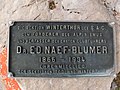
Sign near the Muttseehütte.


literature
- Werner Luchsinger: Club guide, Glarus Alps. 9th edition. Verlag des SAC, 1992, ISBN 3-85902-119-2 , pp. 44-46.
- National map of Switzerland, sheet 1193 Tödi, 1: 25000, Federal Office for Topography, edition 2001.
Web links
Individual evidence
- ↑ SAC Club hut album 1928/1931 , 1937/1946 supplemented, graphic arts institution Brunner & Cie. A.-G., Zurich
- ↑ Tierfehd – Kalktrittli aerial cableway , accessed on August 20, 2020