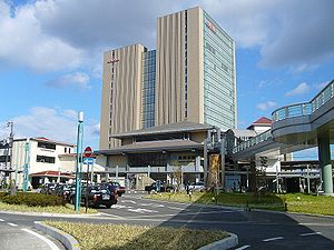
Nagaokakyō
| Nagaokakyō-shi 長 岡 京 市 |
||
|---|---|---|
| Geographical location in Japan | ||
|
|
||
| Region : | Kinki | |
| Prefecture : | Kyoto | |
| Coordinates : | 34 ° 56 ' N , 135 ° 42' E | |
| Basic data | ||
| Surface: | 19.18 km² | |
| Residents : | 80,514 (October 1, 2019) |
|
| Population density : | 4198 inhabitants per km² | |
| Community key : | 26214-5 | |
| Symbols | ||
| Flag / coat of arms: | ||
| Tree : | maple | |
| Flower : | Rhododendron obtusum var. Sakamotoi | |
| Bird : | Zosterops japonicus | |
| town hall | ||
| Address : |
Nagaokakyō City Hall 1 - 1 - 1 , Kaiden Nagaokakyō -shi Kyōto 617-8501 |
|
| Website URL: | http://www.city.nagaokakyo.lg.jp/ | |
| Location Nagaokakyōs in Kyōto Prefecture | ||
Nagaokakyō ( Japanese 長 岡 京 市 , - shi ) is a Japanese city in the north of Kyoto prefecture .
history
From 784 to 794, Nagaoka-kyō was the capital of Japan in today's urban area, as well as the neighboring city of Mukō and the Kyoto district of Nishikyō-ku . Due to its short lifetime, it was later considered a "phantom capital" until the excavations of the high school teacher Shuichi Nakayama ( 中山 修 一 ) in 1954.
On 1 October 1949 the municipality of Nagaoka ( 長岡町 , - chō ) from the union of three villages Shinkōtari ( 新神足村 , - mura ) Kaiinji ( 海印寺村 , -mura ) and Otokuni ( 乙訓村 , mura ) of the district of Otokuni .
On October 1, 1972, the Chō Nagaoka was appointed Shi. But since there was already a Shi Nagaoka , the community was renamed Nagaokakyō.
Attractions
traffic
- Street:
- National road 171
- Train:
- JR Kyōto Line : to Kyōto and Osaka
- Hankyū Kyōto main line
Neighboring cities and communities
- Kyoto Prefecture
- Osaka prefecture
sons and daughters of the town
- Akihiro Ienaga (born 1986), football player
- Ayumi Kaihori (* 1986), soccer player
- Takashi Usami (* 1992), soccer player


