Islas Atlánticas de Galicia National Park
|
Islas Atlánticas de Galicia National Park
|
||
|
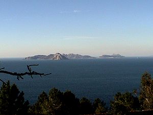
Cíes archipelago |
||
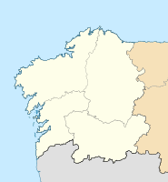
| location | Galicia , Spain | |
| surface | 85.43 km² | |
| WDPA ID | 348806 | |
| Geographical location | 42 ° 23 ′ N , 8 ° 56 ′ W | |
|
|
||
| Sea level | from 0 m to 193 m | |
| Setup date | 2002 | |
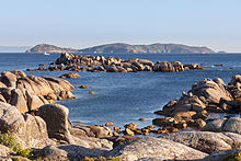
The National Park Islas Atlánticas de Galicia (in Galician language Parque Nacional das Illas Atlánticas de Galicia = "Atlantic Islands of Galicia") is a Spanish national park , which is located on the Atlantic coast in the north-west of the country, the Galician archipelagos of the Illas Cíes , Illas Ons , the islands of Sálvora and Cortegada as well as various smaller islands. It includes 12 km² of land and 72 km² of sea. It is the only national park in Galicia and was established as the thirteenth of its kind in Spain in 2002.
nature
The maritime-terrestrial ecosystem of the national park is characterized by the largest Spanish colonies of herring gulls , Mediterranean seagulls and shags (a species of cormorant). Rock pigeons , northern gannets and alpine swifts also occur there. The seabeds in the area of the park have a high biodiversity . In addition to a wide variety of fish, molluscs and crustaceans, there are algae forests and the presence of several species of dolphins . From a botanical point of view, 200 types of algae and 400 different land plants can be identified. A special feature is the largest laurel forest in Europe on the island of Cortegada.
history
There are traces of human settlement on the islands that go back to the Iron Age . Ceramics from Roman times have also been found. In the Middle Ages, the islands were inhabited by members of various monastic orders . They belonged to the Catholic Church and were given to nobles as a fief . Invaders used it as a base for their forays to the coast. In modern times, the islands were inhabited until the 18th century, when they were abandoned by the population due to pirate attacks.
The Illas Cies were declared a European bird sanctuary in 1988, the Illa de Ons in 2001. On July 1, 2002, the area was designated a national park. Just six months later, its coasts were affected by an oil spill following the wreck of the tanker Prestige . Since July 1st, 2008 the national park has been administered by the Comunidade Autónoma de Galicia .
The national park could be expanded to include the Sisargas and Lobeiras archipelagos in the future .
Islands and archipelagos

peninsula in the north, which extends far into the Atlantic .
- The Arquipélago de Ons forms a group of islands in the Ría de Pontevedra bay . It contains the main island of Illa de Ons , the Illa de Onza (also called Onzeta ) and other small rocky islands , especially O Corveiro . In the summer season Ons is approached daily by boats from the ports of Marín, Cangas, Bueu, Sanxenxo and Portonovo.
- The Arquipélago de Cíes is a group of islands in the Ría de Vigo , which is part of the Rías Baixas in the province of Pontevedra . The archipelago belongs to the city of Vigo (district of San Francisco de Afora) and is located at 42 ° 15 'north latitude and 8 ° 54' west longitude. In February 2007 the British newspaper The Guardian named Praia de Rodas on the island of Monteagudo the “most beautiful beach in the world”.
- The Illa de Cortegada is an island located in the interior of the Ría de Arousa in the province of Pontevedra. It is the largest island in an archipelago that also includes other archipelagos such as Islas Malveiras and Islas Briñas .
- The Illa de Sálvora is located at the entrance to the Ría de Arousa, about 3 km from the mainland to the north. It covers an area of 190 hectares and at its highest point rises 71 m above the sea. The island is rocky practically all around, with the exception of three small beaches of fine white sand.
Web links
- Ministerio de Agricultura y Pesca, Alimentación y Medio Ambiente: Parque Nacional Marítimo-Terrestre de las Islas Atlánticas de Galicia (span.)
Individual evidence
- ↑ Juanjo Alonso: Rutas por los Parques Nacionales de España y Portugal . Pp. 188-197, Santillana Ediciones Generales, Madrid, 2009, ISBN 978-84-03-50841-5
- ^ A b Ministerio de Agricultura y Pesca, Alimentación y Medio Ambiente: Islas Atlánticas de Galicia: Ficha técnica , accessed on January 5, 2018.

