Landseer Berge Nature Park
Coordinates: 47 ° 32 ′ 38.7 " N , 16 ° 20 ′ 2.1" E
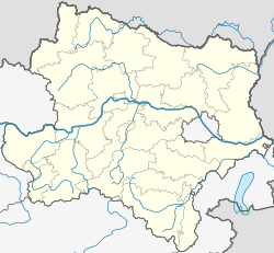
The Landseer Berge Nature Park is located in the western part of the Oberpullendorf district ( Burgenland ) and in the eastern part of the Wiener Neustadt Land district ( Lower Austria ). It lies in the transition area of the Alps - as the foothills in this region known as the Buckligen Welt - to the Pannonian lowlands . In addition to the “nature park” rating, the entire area is also protected as a landscape conservation area . The Lower Austrian nature park municipality is Schwarzenbach , Burgenland is Draßmarkt , Kaisersdorf , Kobersdorf , Markt Sankt Martin and Weingraben .
Natural sights
In the transition between two floral provinces ( Alpinum and Pannonicum) and two types of landscape, the altitude of this nature park ranges from approx. 330 m to approx. 760 m. The area includes a closed forest area ( oak - pine forest) in the central area, and has a great variety of flora and fauna . Geologically, the area is particularly interesting because of its basalt deposits, which originate from eruptions of a volcano that has been extinct since prehistoric times (today's Pauliberg ).
Built sights
In the area of the nature park there are several sights from different time periods:
- Celtic hilltop settlement castle and observation tower in Schwarzenbach : On the so-called Burgberg near Schwarzenbach there was a larger settlement in the Celtic times . Today the ramparts to secure the settlement can be visited, an entrance gate and a piece of the prehistoric "city wall" have been reconstructed. In addition, some wooden huts were reconstructed, which were only built with the tools available at the time. Thus it could be proven that these buildings could actually be built in the same way at the time of the Celts. A Celtic festival is held at the solstice .
- Schwarzenbach ruins on Schlossberg
- Place of pilgrimage Maria Bründl on Burgberg
- Museum tower ( observation tower ) in Schwarzenbach ,
- Forest nature trail Schwarzenbach,
- Schwarzenbach bird trail,
- Prehistoric hiking trail in Schwarzenbach,
- Landsee castle ruins : Medieval fortress, see there,
- Kobersdorf Castle : Renaissance castle, see there,
- Kobersdorf local history museum , furnishings and costumes from the 19th century
- Muba Museum for Building Culture in Neutal ,
- Museum "on the trail of nature" in Lackenbach ,
- Mida Huber -Haus, Landsee Residence of the Burgenland native poet
- Pressenlehner mill in Schwarzenbach,
- Burgenland Stone Museum in Landsee .

