Neudeck (Mohlsdorf-Teichwolframsdorf)
|
New deck
Rural community of Mohlsdorf-Teichwolframsdorf
Coordinates: 50 ° 41 ′ 2 ″ N , 12 ° 17 ′ 28 ″ E
|
|
|---|---|
| Height : | 350 m above sea level NN |
| Postal code : | 07987 |
| Area code : | 03661 |
|
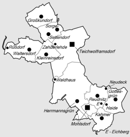
Location of Neudeck in the rural community of Mohlsdorf-Teichwolframsdorf
|
|
|
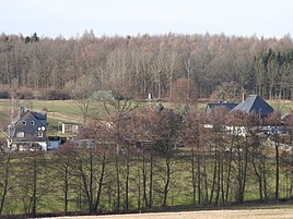
View of the place
|
|
Neudeck is a collection of several homesteads northeast of the Reudnitz district of the rural community Mohlsdorf-Teichwolframsdorf in the Greiz district in Thuringia .
location
Neudeck is located northeast of Greiz and Mohlsdorf directly on the state border with Saxony . The settlement is connected to Landesstraße 1086 with farm roads. The farms are located on the eastern edge of the forests around Greiz and Werdau .
history
The settlement was first mentioned in a document on March 23, 1438. The settlement of the homesteads served for land cultivation.
Web links
Commons : Neudeck - collection of images, videos and audio files
Individual evidence
- ^ Wolfgang Kahl : First mention of Thuringian towns and villages. A manual. Rockstuhl Verlag, Bad Langensalza, 2010, ISBN 978-3-86777-202-0 , p. 191

