Nonnendorf (Harth-Pöllnitz)
|
Nun village
Harth-Pöllnitz municipality
Coordinates: 50 ° 47 ′ 46 ″ N , 12 ° 0 ′ 58 ″ E
|
|
|---|---|
| Height : | 330 m above sea level NN |
| Postal code : | 07570 |
| Area code : | 036603 |
|
Location of Nonnendorf in Harth-Pöllnitz
|
|
|
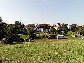
View of the place from the north
|
|
Nonnendorf is a district of Burkersdorf , municipality of Harth-Pöllnitz in the district of Greiz in Thuringia .
geography
Nonnendorf is connected to traffic by a local road via Burkersdorf from Weida . The town is surrounded by the Weidas urban forest. Neighboring villages are Burkersdorf, Frießnitz , Seifersdorf, Köfeln and Köckeritz.
history
The hamlet was first mentioned in documents in 1608. At this time there were eight houses built in Jakob Grünthal's hamlet. They are said to have been a branch of Burkersdorf. At that time the village was called Naudorf. From 1616 the current name appeared. The quiet and beautiful location has recently prompted citizens to build houses in the village.
economy
The place is still dominated by agriculture and forestry. The land is managed by the area's agrarian association.
Individual evidence
- ^ Wolfgang Kahl : First mention of Thuringian towns and villages. A manual. Rockstuhl Verlag, Bad-Langensalza, 2010, ISBN 978-3-86777-202-0 , p. 200
- ^ Community of Harth-Pöllnitz: Nonnendorf. Retrieved June 10, 2017 .

