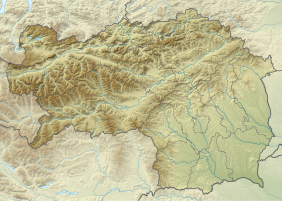
North-western part of the municipality of Ramsau am Dachstein
|
Nature reserve north-western part of the municipality of Ramsau am Dachstein
|
||
| location | Ramsau , Upper Styria , Austria | |
| Area / extent | 12.875 km² / 4.58 km | |
| Identifier | NSG c 2 | |
| WDPA ID | 103308 | |
| Geographical location | 47 ° 27 ' N , 13 ° 37' E | |
|
|
||
| Sea level | from 1147 m to 2995 m | |
| Setup date | 1972 | |
| administration | State of Styria | |
| particularities | Plant protection area | |
The nature reserve north-western part of the municipality of Ramsau am Dachstein is a protected area on the Dachstein massif in Styria , in the municipality of Ramsau .
Location and landscape
The area is in the triangle of Styria, Upper Austria and Salzburg . It covers 1287.5 hectares , which is about ⅙ of the municipal area (7533 hectares). The protected area extends from the Salzburg state border in the source area of the Kalten Mandling (Mühlehneralm, 1147 m above sea level ) across the Türlwaldhütte - Austriahütte area to the Dachsteinhauptkamm (Upper Austrian border) from Torstein over the Dachstein summit ( 2995 m ) and Hunerkogel to Koppenkarstein , and as an east point on the Hohe Gamsfeldspitze .
History and scope of protection
The area was designated in 1972 (LGBl. 140/1972), in the category of "Locations and demarcated habitats of plants or animal species that are worthy of protection or endangered" (NSG c, according to § 5 Z. 2 lit. c Nature Conservation Act 1976 - NschG) . It is declared as a conservation area for plants ( plant protection area , which is not a separate class in Styria) that “all actions are to be avoided which are likely to damage or endanger the plant population ; In particular, it is forbidden to remove plants or parts of plants and to change the design or the nature of the soil. ”(§ 2).
The area also belongs to the Dachstein – Salzkammergut landscape protection area ( Salzkammergut-Ost , LS 14a ), and is therefore protected against all adverse effects on the landscape, and also falls into the buffer zone of the UNESCO World Heritage Site of the Hallstatt – Dachstein / Salzkammergut Cultural Landscape ( WHS 806 ). The entire northern half of the protected area is also designated as natural monuments , namely the Dachstein south wall in the west and the Dachstein south slope and Edelgrieß glacier in the east ( NDM No. 783, 784 ).
In Upper Austria, the Dachstein Europe and nature reserve ( bird protection and FFH area , AT3101000 / EU02 , N098 ) borders, and Salzburg has not yet placed it under protection.
Development
The area can be reached via the Dachsteinstraße toll road. The Dachstein-Südwandbahn cable car runs through the protected area, which is also a landmark of the Ennstal today . At the summit station on the Hunerkogel, the Dachstein Skywalk was built in 2005 , a viewing platform that protrudes into the south walls and thus offers an extraordinary overview of the protected area.

media
- Universum: Schladminger Bergwelten , ORF, 2013, Part 1 Of peaks and chamois ; Part 2 Between centuries and hundredths of a second ( weblink shop.orf.at ; on flora and fauna as well as skiing and climbing).
Web links
- NSG-c02 north-west. Part of the municipality of Ramsau am Dachstein, district of Liezen , administration.steiermark.at → A13 Environment and spatial planning | Nature Conservation Unit | Styrian protected areas | Landscape protection areas
- Plan , appendix to LGBl. 140/1972 (as amended, pdf, ris.bka ).
Individual evidence
- ↑ a b Ordinance of the Styrian regional government of October 9, 1972 on the declaration of the north-western part of the municipality of Ramsau am Dachstein as a nature reserve (protected area for plants) Stf. LGBl. 140/1972 (as amended online, ris.bka - there also more precise area delimitation).

