List of nature reserves in Upper Austria
In Upper Austria , the following areas are designated as nature reserves :
list
| photo | Surname | ID | district | Location | description
|
surface | date |
|---|---|---|---|---|---|---|---|

|
Alpine meadows | n125 | Catfish Land |
Bad Wimsbach-Neydharting , Steinerkirchen an der Traun location |
The nature reserve includes the hardwood forests and pine meadows as well as the alpine pasture itself. | 100 ha | 1978 |

|
Almsee and surroundings | n149 | Gmunden |
Grünau im Almtal location |
Nutrient-poor alpine lake in a wonderful location and almost everywhere near-natural banks, with island-like bogs and extensive alder forests on the north and south banks | 83.34 hectares | 1965 |

|
Aschachtal in the municipality of Stroheim | n116 | Eferding |
Stroheim KG: Mayrhof GrStNr: 2485/1 location |
The Aschachtal is home to an ash-maple-rock rubble slope forest. | 8.37 hectares | 2003 |
| Atzmoos | n086 | Gmunden |
Bad Ischl KG: Perneck GrStNr: 735/1 location |
The Atzmoos is a small, almost circular high moor with pine felt. | 1998 | ||
| At the riverside forest | n050 | Vöcklabruck |
Attersee am Attersee KG: Attersee GrStNr: 745/2, 750/2, 772/2, 773, 776/2, 778/2 location |
The Aufhammer Uferwald is a long and narrow, natural beech forest on the west bank of the Attersee between Aufham and Altenberg. | 1.8 ha | 1987 | |

|
Bosruck-Dead Mountains | n055 | Steyr-Land , Kirchdorf |
Weyer , Rosenau am Hengstpaß , Spital am Pyhrn location |
The approximately 190 hectare area includes high mountain habitats and mountain forest area. | 190 ha | 1988 |
| Bruckangerlau | n046 | Free City |
St. Oswald bei Freistadt KG: Amesreith GrStNr: 741/2 location |
The Bruckangerlau is an arched swamp high moor in a depression. | 2.27 ha | 1984 | |

|
Buchenwald Ranshofen | n136 | Braunau am Inn |
Braunau am Inn KG: Ranshofen location |
The nature reserve is located on both sides of the Enknach . It is a closed forest with near-natural oak and ash. | 10.6 ha | 2008 |

|
Bumau | n101 | Free City |
Liebenau KG: Liebenau GrStNr: 2165, 2176 location |
Bumau is a drained bog area with central unforested bog regeneration and spruce forests. After the clearing of the land, the area is again accepted by black grouse. | 14.63 ha | 2001 |
|
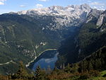
Dachstein in the communities of Gosau, Hallstatt and Obertraun | n098 | Gmunden |
Gosau , Hallstatt , Obertraun location |
The Dachstein is the highest karst mountain range and carries the only glacier in Upper Austria. In the west, the reserve also includes the Gosau lakes. | 136 km² | 2001 |

|
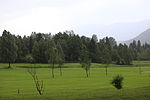
Sweet chestnut forest | n057 | Vöcklabruck |
Unterach am Attersee KG: Unterach GrStNr: 258/1, 258/2, 281/2, 283/1, 283/2, 285 location |
The sweet chestnut forest is located on the slope of the Mondsee Flysch Mountains near the Attersee. The sweet chestnuts are located in a red beech forest. | 3.75 ha | 1989 |
|
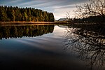
Edlbacher Moor | n064 | Church Village |
Edlbach KG: Edlbach GrStNr: 228, 232/1, 229 (tw) location |
The Edlbacher Moor is a partially drained and mostly peated high moor with regeneration vegetation. Today it is mainly planted with secondary bog forest, although there are also wet, scarring, unforested areas in small areas. | 12.86 ha | 1989 |
|
Egelsee in Unterach | n019 | Vöcklabruck |
Unterach am Attersee KG: Unterach location |
The Egelsee was created in a dead ice hole without drainage. Around the Egelsee there are silting stages with vibrating turf. | 1965 | |

|
Egelsee and the adjacent fen areas | n059 | Vöcklabruck |
Sankt Lorenz KG: St. Lorenz GrStNr: 2277, 2278/1, 2278/3, 2280, 2281/1, 2488 location |
The Egelsee is close to the Mondsee , but only half belongs to Upper Austria. It is a small lake with an adjacent, species-rich fen. | 5.15 hectares | 1992 |
| Egelseemoor | n070 | Vöcklabruck |
Unterach am Attersee location |
3 ha | 1995 | ||
| Yew forest | n147 | Steyr-Land |
Laussa KG: Lausa GrStNr: 607/3, 606/1 location |
The protected area is located southwest of the village of Laussa directly on the Wolfsberg goods route. | 2.37 ha | 2011 | |

|
Ettenau | n128 | Braunau am Inn |
St. Radegund , Ostermiething location |
The Ettenau is a hard and soft wood area with a wide variety of water habitats on the Salzach . | 537 ha | 2005 |

|
Ettenau II | n146 | Braunau am Inn |
St. Radegund , Ostermiething location |
The near-natural wet meadows of this protected area border on the Ettenau nature reserve . The Schwaigwiesen is of particular importance. | 89.1 ha | 2011 |
| Teichstätt wetland | n118 | Braunau am Inn |
Lengau KG: Heiligenstadt location |
The Teichstätt wetland is a natural flood retention basin on the Schwemmbach between Munderfing and Friedburg. | 26.86 ha | 2004 | |

|
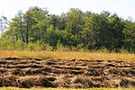
Fischlhamerau | n020 | Catfish Land |
Fischlham , Steinhaus KG: Forstberg, Oberschauersberg location |
The Fischlhamerau is an area on the right bank of the Traun. In addition to ash and willow meadows, many natural still waters have been preserved here. | 90 ha | 1963 |
|
Frankinger Moos | n123 | Braunau am Inn |
Franking , Moosdorf location |
35.24 ha | 1963 | |

|
Gerlhamer Moor | n061 | Vöcklabruck |
Seewalchen am Attersee KG: Litzlberg GrStNr: 1206/1, 1206/2 location |
The Gerlhamer Moor is a small-scale transition and low moor area, whereby litter meadows, a moor forest and uncultivated Bult-Schlenken vegetation are also under protection. | 11.9 ha | 1993 |

|
Gierer litter meadow | n069 | Church Village |
Roßleithen KG: Rading GrStNr: 654/1, 655/1 location |
The Gierer litter meadow is a species-rich litter meadow. A large population of the Siberian iris is found here . | 1.57 ha | 1995 |

|
Gleinkersee in Spital am Pyhrn | n017 | Church Village |
Spital am Pyhrn KG: Gleinkerau GrStNr: 1800 location |
The Gleinkersee, a karst water lake, has formed in a basin-like depression at the foot of the Warscheneckstock. The nature reserve Warscheneck Nord connects to the south . | 13.93 hectares | 1965 |

|
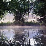
Glöckl pond | n056 | Church Village |
Roßleithen KG: Roßleithen GrStNr: 807, 812/1 u. a. Location |
The Glöcklteich moor consists of a silting moor with a low- growing Davallseggen moor that turns into marsh grass meadows. Around the pond there are reeds but also extensive populations of the rare thread sedge ( Carex lasiocarpa ) and a narrow strip of swinging lawn. The pond itself has occurrences of the pond rose. | 3.91 ha | 1988 |
|
Gmöser Moor | n049 | Gmunden |
Laakirchen KG: Laakirchen GrStNr: 1287 location |
The Gmöser Moor is an almost completely forested fen. It is also home to a large and several small ponds. | 3.39 hectares | 1987 |

|
Great wasteland | n012 | Gmunden |
Grünau im Almtal KG: Grünau GrStNr: 2898 location |
The Großer Ödsee nature reserve encompasses the entire area of the Großer Ödsee, a mountain lake that is surrounded by a hiking trail. | 8.09 ha | 1965 |
| Great Langmoos | n083 | Gmunden |
Bad Ischl KG: Rettenbach GrStNr: 514/15 location |
The Großer Langmoos is an elliptical, strongly arched mountain pine raised bog with a distinct slope. It is in the immediate vicinity of the Kleiner Langmoos and the Radriedlmoos . | 4 ha | 1998 | |

|
Big Löckenmoos and Grubenalmmoor | n088 | Gmunden |
Gosau KG: Gosau GrStNr: 932, 933 location |
The Großer Löckenmoos and the Grubenalmmoor are classically developed ceiling moors on the summit plateau of the Leckenmoosberg. The nature reserves Kleines Löckenmoos and Dachstein are in the immediate vicinity . | 26.65 ha | 1998 |

|
Grünberg in the municipality of Frankenburg | n099 | Vöcklabruck |
Frankenburg am Hausruck KG: Hintersteining GrStNr: 538/5, 538/6, 1636/2 Location |
The Grünberg nature reserve is home to an acidic pine forest with dry raw humus soil and raised bog-like ground vegetation. | 1.02 ha | 03/02/2001 |

|
Haller Walls (A5) - Dead Mountains | n054 | Church Village |
Rosenau am Hengstpaß , Spital am Pyhrn location |
The Haller Mauern nature reserve is one of the largest nature reserves in Upper Austria, including high mountain habitats and mountain forest areas. | 820 ha | 03/04/1988 |

|
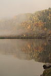
Hangwald Puckinger Leiten | n071 | Linz Land |
Pucking KG: Pucking GrStNr: 445/1 location |
The Puckinger Leiten hillside forest is a warm, steep-slope ash forest with a high proportion of summer linden trees. | 4 ha | 06/29/1995 |
|
Slope forests in the valley of the Große Mühl | n077 | Rohrbach |
Kirchberg ob der Donau , Kleinzell im Mühlkreis KG: Grub, Kleinzell location |
The hillside forests in the valley of the Große Mühl are east-exposed steep slope forests, which are composed of red beech forests, ravine forests and unforested log heaps. | 23.14 ha | 1996 |
| Haslauer Moor | n115 | Vöcklabruck |
Oberwang KG: Oberwang GrStNr: 1538/6 location |
The Haslauer Moor is an upland moor that is now mostly cultivated as a cultivated moor meadow and is only home to remnants of pine and birch trees. | 1.12 ha | 12/19/2003 | |

|
Heratingersee in Eggelsberg | n001 | Braunau am Inn |
Eggelsberg KG: Ibm GrStNr: 185/1 location |
The Heratinger See extends into a moor in the south, where it has formed a near-natural, reed-rich bank zone and an extensive pond rose belt. | 31.63 hectares | 1965 |

|
Hinterer Langbathsee | n011 | Gmunden |
Ebensee am Traunsee KG: Oberlangbath GrStNr: 227 location |
The Hintere Langbathsee is an alpine lake at the foot of the Höllengebirge. | 12.47 hectares | 2000 |

|
Hobelsberg-Riesn | n143 | Vöcklabruck |
Frankenburg am Hausruck KG: Hörgersteig GrStNr: 2895/3; 2898/4 location |
The Hobelsberg-Riesn nature reserve comprises a large ash-maple scree slope forest with a moon viole . | 4.15 ha | 2010 |
| Hollereck | n145 | Gmunden |
Altmünster KG: Aftersee GrStNr: 46/2 (tw), 88/1, 89/12, 88/2, 500/1 (tw), 509, 515/1 location |
The Hollereck is a near-natural silting area on the west bank of the Traunsee . | 10.15 hectares | 2010 | |

|
Höllerersee | n002 | Braunau am Inn |
Haigermoos , St. Pantaleon KG: Haigermoos location |
The Höllerersee is a small lake in the Braunau district and part of the so-called Südinnviertler Seenplatte . Due to the high level of recreational use, however, only small areas of near-natural riparian zones have been preserved at the Höllerersee. | 20.5 ha | 1965 |
|
|
Holzösterersee | n003 | Braunau am Inn |
Franking KG: Holzöster GrStNr: 84/1 location |
The Holzöstersee is part of the Südinnviertler Seenplatte, whereby the eastern bank area has been heavily modified by swimming. In the west, on the other hand, there are near-natural bank areas and adjacent moor areas. | 10.89 ha | 1965 |
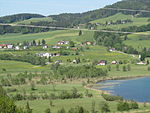
| In the lake | n131 | Braunau am Inn |
Palting KG: Palting GrStNr: 524/2, 532/2, 1840 location |
The Imsee lies in a flat hollow in the terrain. | 5.79 hectares | 2007 | |
|
Irrsee Moore | n109 | Vöcklabruck |
Oberhofen am Irrsee , Tiefgraben , Zell am Moos location |
The Irrsee moors represent silting moors in the adjacent nature reserve Irrsee . The nature reserve is north, east and south of the Irrsee and also includes litter meadows and stages of succession. | 52 ha | 2002 |
| Jackenmoos on the Mühlberg | n117 | Braunau am Inn |
Geretsberg KG: Lehrsberg GrStNr: 598/1; 598/2 location |
The jacket moss on the Mühlberg is a raised and transitional moor that has formed in a dead ice hole . | 1.53 ha | 2004 | |
| Laussa limestone wall | n139 | Steyr-Land |
Laussa KG: Lausa location |
The Laussa limestone wall is an elongated area in the Laussa Valley interspersed with limestone rocks. The nature reserve includes species-rich semi-arid grasslands, poor pastures and near-natural beech forests, as well as an extensive dry willow fallow with juniper stands. | 97.28 ha | 2009 | |

|
Kammerschlager Flachmoorwiese | n065 | Urfahr environment |
Kirchschlag near Linz KG: Kirchschlag GrStNr: 1348; 1349 location |
The Kammerschlager Flachmoorwiese is a small, species-rich litter meadow. It is a spring moor with a two-meter-thick layer of fen peat. | 1.43 ha | 1994 |

|
Katrin | n140 | Gmunden |
Bad Goisern am Hallstättersee , Bad Ischl KG: Lindau, Ramsau, Kaltenbach location |
The Katrin is a striking karst mountain range in the Osterhorn group. The protected area encompasses a rugged mountain landscape with rocky vegetation, alpine lawn and pine bushes. | 280 ha | 2009 |

|
Small barren lake | n013 | Gmunden |
Grünau im Almtal KG: Grünau GrStNr: 2889 location |
The Kleine Ödsee is a mountain lake in the Gmunden district. The neighboring Great Ödsee is also under nature protection . | 3.26 ha | 1965 |
| Little Langmoos | n084 | Gmunden |
Bad Ischl KG: Rettenbach GrStNr: 514/14 location |
The Kleine Langmoos is a raised bog with an almost circular area that is surrounded by forest. | 1.9 ha | 1998 | |
| Little Löckenmoos | n087 | Gmunden |
Gosau KG: Gosau GrStNr: 924; 969/155 location |
The Kleine Löckenmoos is a ceiling moor with a small layer of peat and pine felt. | 9.92 ha | 1998 | |

|
Coaserine | n121 | Grieskirchen |
Heiligenberg , Neukirchen am Walde , Peuerbach location |
The Koaserin is a wet meadow area periodically flooded by the Leitenbach , which is an important breeding area for meadow birds. | 28.26 hectares | 2005 |

|
Kremsauen | n111 | Church Village |
Nussbach , Schlierbach location |
The Krems meadows are an wetland area of the Krems with natural streams, alluvial forests and wet meadows, which represent an important habitat for rare animal and plant species. | 23.5 ha | 2002 |

|
Kreuzbauernmoor | n060 | Vöcklabruck |
Pfaffing location |
10.54 ha | 1992 | |
| Kreuzberg in Weyer | n040 | Steyr-Land |
Weyer location |
47.95 ha | 1981 | ||

|
Kuhschellenrasen host on the mountain | n045 | Catfish Land |
Gunskirchen location |
Species-rich dry grassland with a population of pasque flowers and other endangered plants. Relic site of the Welser Heide . | 4.6 ha | 1983 |
| Langmoos in St. Lorenz | n141 | Vöcklabruck |
Sankt Lorenz location |
22.44 hectares | 2010 | ||

|
Laudachsee and Laudachmoor | n095 | Gmunden |
Gmunden , St. Konrad location |
25.9 ha | 2000 | |
| Licking moss | n081 | Gmunden |
Bad Ischl location |
4.86 ha | 1998 | ||
| Meager meadow Fuchsgraben | n144 | Urfahr environment |
Oberneukirchen location |
The Magerwiese Fuchsgraben includes a species-rich red fescue meadow, a smooth oat meadow and a fen with numerous rare plant species. | 1.14 ha | 2010 | |
| Moor near Vorderweißbach | n126 | Urfahr environment |
Vorderweißbach location |
1.58 ha | 2005 | ||
| Moor meadows in the municipality of Waldhausen | n102 | Perg |
Waldhausen im Strudengau location |
3.48 ha | 2001 | ||

|
Moosalm | n130 | Gmunden |
St. Wolfgang in the Salzkammergut location |
The moor and alpine pasture area is around 1 km northwest of the Schwarzensee and is traversed by the Moosbach. | 70 ha | 2006 |

|
Moss meadows near Rading | n067 | Church Village |
Roßleithen location |
3.44 ha | 1994 | |

|
Mösl in Ebenthal | n079 | Church Village |
Rosenau am Hengstpaß location |
2.51 ha | 1997 | |

|
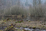
The mouth of the Fuschler Ache | n073 | Vöcklabruck |
Sankt Lorenz location |
In the area where the Fuschler Ache flows into the Mondsee , a silting zone with litter meadows , reed beds and broken forest has formed. | 10.75 ha | 1996 |
|
Neydhartinger Moor | n124 | Catfish Land |
Bad Wimsbach-Neydharting location |
16 ha | 2005 | |
| North moor at Grabensee | n106 | Braunau am Inn |
Palting , Perwang am Grabensee location |
20.44 ha | 2001 | ||

|
North moor at Mattsee | n137 | Braunau am Inn |
Punch at the lake location |
6.34 hectares | 2009 | |

|
Nussensee in Bad Ischl | n015 | Gmunden |
Bad Ischl location |
10.25 ha | 1965 | |

|
Offensee in Ebensee | n142 | Gmunden |
Ebensee at the Traunsee location |
58.8 ha | 2010 | |
| Orchid meadow in the pitch pit | n090 | Steyr-Land |
Laussa location |
4.07 ha | 1999 | ||
| Orchid meadow in Freundorf | n066 | Rohrbach |
Klaffer at the Hochficht location |
1994 | |||

|
Orter bay | n072 | Gmunden |
Gmunden KG: Ort-Gmunden location |
1.43 ha | 1996 | |

|
Pesenbachtal | n022 | Rohrbach , Urfahr area |
St. Martin im Mühlkreis , Feldkirchen an der Donau , Herzogsdorf location |
250 ha | 1963 | |

|
Piper ranger | n048 | Braunau am Inn |
Eggelsberg , Moosdorf location |
76.1 ha | 1987 | |
| Pichlwald near Loibichl | n062 | Vöcklabruck |
Innerschwand at the Mondsee location |
2.75 ha | 1993 | ||
| Pitzingmoos | n085 | Gmunden |
Bad Ischl KG: Rettenbach location |
11.8 ha | 1998 | ||

|
Planwiesengebiet | n104 | Church Village |
Grünburg KG: Leonstein location |
116.05 ha | 2001 | |

|
Pleschinger oyster bank | n089 | Urfahr environment |
Steyregg KG: Lachstadt location |
8.22 hectares | 1998 | |
| Sermon chair | n103 | Eferding |
Hartkirchen KG: Oed in Bergen location |
25.66 ha | 2001 | ||
| Source corridor at Grueb | n113 | Vöcklabruck |
Tiefgraben KG: Hof location |
4.32 ha | 2003 | ||
| Radriedlmoos | n082 | Gmunden |
Bad Ischl KG: Rettenbach location |
1998 | |||

|
Rannatal | n108 | Rohrbach |
Neustift im Mühlkreis , Pfarrkirchen im Mühlkreis location |
140.34 hectares | 2002 | |
| Reinthalermoos | n058 | Vöcklabruck |
Attersee am Attersee KG: Attersee location |
12 ha | 1991 | ||
| Richterbergau | n094 | Free City |
Liebenau KG: Liebenau GrStNr: 2252/1 location |
2.09 ha | 2000 | ||
| Red floodplains | n074 | Free City |
Weitersfelden KG: Weitersfelden GrStNr: 5293; 5294; 5298/2; 5299/2 location |
9.94 hectares | 1996 | ||

|
Schlossberg Neuhaus | n122 | Rohrbach |
St. Martin im Mühlkreis KG: Neuhaus location |
83 ha | 2004 | |
| Schwarzenbergwiese | n127 | Church Village |
Grünburg KG: Leonstein location |
1 ha | 2005 | ||

|
Schwarzensee in St.Wolfgang | n016 | Gmunden |
St. Wolfgang im Salzkammergut KG: St. Wolfgang location |
48.77 hectares | 1965 | |

|
Seeleithensee and adjoining litter meadows | n105 | Braunau am Inn |
Eggelsberg , Moosdorf location |
The nature reserve includes the lake with the surrounding reed belt as well as a spacious meadow area . | 67 ha | 2001 |

|
Spitmojer | n047 | Braunau am Inn |
St. Johann am Walde location |
1.55 ha | 1985 | |
| Stadlau | n114 | Rohrbach |
Klaffer at the Hochficht location |
21.36 hectares | 2003 | ||
| Stadlerwiese | n078 | Urfahr environment |
Ottenschlag in the Mühlkreis location |
3.4 ha | 1997 | ||
| Staninger conduct | n076 | Steyr , Steyr-Land |
Steyr , Dietach KG: Gleink, Unterdietach location |
The Staninger Leiten nature reserve has an area of approx. 2 hectares and extends on the left bank of the Enns over the communities of Steyr and Dietach. It includes a small remnant of semi-dry grass on the edge of the low terrace of the Enns and a red beech forest of particular importance. | 2 ha | 1996 | |

|
Steyr Gorge | n154 | Church Village |
Molln , Grünburg , Steinbach an der Steyr KG: Molln, Leonstein, Auserbreitenau, Obergrünburg location |
The Steyrschlucht nature reserve has an area of approx. 102 ha and stretches over a length of almost 10 km from the Agonitz power plant in Molln to the Haunoldmühle in Grünburg. In this scenic section of the Steyr Valley is the natural monument " Rinnende Mauer " and a 1.2 km long section of the Krumme Steyrling . | 102.6 ha | 2016 |
| Walleiten swamp meadow | n063 | Schärding |
Sankt Aegidi KG: St. Aegidi location |
2.6 ha | 1994 | ||

|
Taferlklaussee | n039 | Gmunden |
Altmünster KG: Neukirchen location |
8.51 hectares | 1981 | |

|
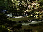
Valley of the Little Gusen | n092 | Urfahr environment |
Alberndorf in der Riedmark KG: Unterweitersdorf location |
15 ha | 2000 | |
|
Valley of the Kleiner Kösslbach | n075 | Schärding |
Engelhartszell , Sankt Aegidi , Waldkirchen at the Wesen site |
67.24 ha | 1996 | |

|
Tanner Moor | n044 | Free City |
Liebenau KG: Neustift location |
122.33 hectares | 1983 | |
| Torfau | n129 | Rohrbach |
Ulrichsberg KG: Berdetschlag, Ulrichsberg location |
24 ha | 2006 | ||

|
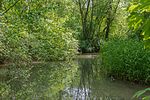
Traun-Donau-Auen | n119 | Linz |
Linz KG: Ufer, Posch location |
315 hectares | 2004 | |
|
Traunauen near St. Martin | n107 | Linz Land |
Traun location |
19.42 ha | 2001 | |

|
Traunstein | n148 | Gmunden |
Gmunden , St. Konrad location |
792.5 ha | 1963 | |

|
Lower Steyr | n133 | Steyr , Steyr-Land |
Steyr , Garsten , Sierning location |
The Untere Steyr nature reserve has an area of approx. 210 ha and extends over the communities of Steyr, Garsten and Sierning. The Steyr is the fifth longest river in Upper Austria and is located in this area in the transition zone between the molasse of the central area and the flysch zone of the Alpine foothills. Here the river is largely natural except for a few weirs. The dynamic bed load management of the river ensures constant changes to the gravel banks. The protection zone also includes the conglomerate walls bordering the valley, the extensively used agricultural land, the alluvial forests and two rough meadows with populations of the endangered Bavarian pasque flower ( Pulsatilla vulgaris ). | 210 ha | 2007 |

|
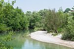
Lower Inn | n112 | Braunau am Inn , Ried im Innkreis |
Antiesenhofen , Braunau am Inn , Kirchdorf am Inn , Mining , Mühlheim am Inn , Obernberg am Inn , Reichersberg , St. Peter am Hart , Überackern location |
982 ha | 2002 | |
|
Unterhimmler Au | n132 | Steyr |
Steyr KG: Christkindl location |
30.5 ha | 2007 | |

|
Urfahrwänd | n135 | Urfahr environment |
Puchenau location |
8.9 ha | 2008 | |
|
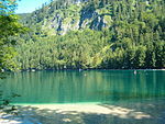
Vorderer Langbathsee | n010 | Gmunden |
Ebensee am Traunsee KG: Oberlangbath GrStNr: 224 location |
36.55 hectares | 1965 | |

|
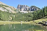
Warscheneck North | n134 | Church Village |
Hinterstoder , Roßleithen , Spital am Pyhrn , Vorderstoder KG: Hinterstoder; Vorderstoder; Rossleithen; Gleikerau; Spital am Pyhrn location |
27 km² | 2008 | |
|
Warscheneck Süd-Purgstall-Brunnsteiner Kar | n110 | Church Village |
Spital am Pyhrn location |
12 km² | 2002 | |

|
Warscheneck-Süd-Wurzeralm | n093 | Church Village |
Spital am Pyhrn KG: Spital am Pyhrn location |
Note: The Stubwieswipfel is in NSG n096 , not in NSG n093. |
50.09 hectares | 2000 |

|
Warscheneck-Süd-Stubwies | n096 | Church Village |
Spital am Pyhrn KG: Gleinkerau location |
767.6 ha | 2000 | |
| Wild moss | n036 | Vöcklabruck |
Tiefgraben KG: Tiefgraben location |
17 ha | 1979 | ||

|
Zellersee (Irrsee) | n018 | Vöcklabruck |
Zell am Moos location |
349.19 ha | 1965 |
Web links
Commons : Nature reserves in Upper Austria - collection of images, videos and audio files