
Sierning
|
market community Sierning
|
||
|---|---|---|
| coat of arms | Austria map | |
 |
|
|
| Basic data | ||
| Country: | Austria | |
| State : | Upper Austria | |
| Political District : | Steyr-Land | |
| License plate : | SE | |
| Main town : | Sierning | |
| Surface: | 38.28 km² | |
| Coordinates : | 48 ° 3 ' N , 14 ° 19' E | |
| Height : | 367 m above sea level A. | |
| Residents : | 9,375 (January 1, 2020) | |
| Population density : | 245 inhabitants per km² | |
| Postcodes : | 4522, 4523 | |
| Area code : | 07259 | |
| Community code : | 4 15 16 | |
| NUTS region | AT314 | |
| Address of the municipal administration: |
Kirchenplatz 1 4522 Sierning |
|
| Website: | ||
| politics | ||
| Mayor : | Manfred Kalchmair ( SPÖ ) | |
|
Municipal Council : (2015) (37 members) |
||
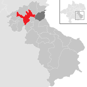
| Location of Sierning in the Steyr-Land district | ||
  |
||
| Source: Municipal data from Statistics Austria | ||

Sierning is a market town with 9,375 inhabitants (as of January 1, 2020) in the Steyr-Land district in the eastern part of Upper Austria .
geography

Sierning is located on the southern edge of the Traun-Enns-Platte on several terraces between the Eisenstadt Steyr and the spa town Bad Hall on the lower Steyr River .
Neighboring communities
| Schiedlberg | Wolfern | |
|
Rohr in the Kremstal Bad Hall |
.svg)
|
Steyr (statutory city) |
| Waldneukirchen | Cooked |
Community structure
The community consists of the cadastral communities Gründberg , Hilbern , Neuzeug , Oberbrunnern , Pichlern , Sierning and Sierninghofen .
The municipal area comprises the following two localities (population in brackets January 1, 2020):
Until 2010 the localities were: Gründberg , Hilbern , Neuzeug , Niederbrunnern , Oberbrunnern , Pichlern , Schwaming , Sierning and Sierninghofen .
The municipality has the following localities (parts of the municipality): Gründberg , Hilbern , Neuzeug , Steinfeld , Pichlern , Sierninghofen , Letten , Pachschallern , Oberbrunnern and Niederbrunnern , Hausleiten , Paichberg , Oberwallern , Frauenhofen .
Counting areas are Sierning-Süd and -Nord for the main town Sierning / Frauenhofen, Sierninghofen-Nord and -Süd for Sierninghofen and Untergründberg, Neuzeug town centers and settlements for newcomers with Steinfeld and Schwaming, Pichlern with Wallern and Letten, and Hilbern - Brunnern - Gründbg for the remaining peripheral areas of the municipality in the hill country.
history
Some litter finds show that the area was already settled by the Romans . The place names Wallern and Pachschallern go back to this time. A connecting road between Krems- and Steyrtal could have passed here.

At the end of the Great Migration, Slavic settlers settled down and lived and hunted in the vast forests. Duke Tassilo III. reports about them in the deed of foundation for the nearby Kremsmünster monastery (777) and mentioned for the first time the place name Sirnicha (Slavic Crnica, probably 'Wiesen-' or 'Schwarzbach' for the Sierninger Bach ). Sierning will initially have been the field name, the two old farms from the early 9th century are Frauenhofen and Sierninghofen , later Pachschallern Gründberg , Neidberg and Paichberg were added.
The area then formed the Slavic Decan . Before 985/991 (mentioned in the Synod of Mistelbach ) the diocese of Passau founded its own parish . From this mother parish 27 independent daughter parishes have emerged, including such important ones as the former Garsten and Gleink monasteries .
Originally located in the eastern part of the Duchy of Bavaria , the place belonged to the Duchy of Austria from the 12th century . From 1490 it was added to the principality, then crown land Austria ob der Enns .

From an economic point of view, the municipality of Sierning - with the Neuzeug district mentioned in a document as early as 1451 - was one of the most important centers of iron processing in today's Upper Austria. Edged weapons, knives, awls and many other iron products have been produced here for centuries. Letten was the location of the main Werndl factory. The industrial pioneer Josef Werndl used the water power of the Steyr and set up the Austrian Arms Factory Company (later called Steyr Works) in Steyr and Sierning . The last major cutlery production plant, the Neuzeughammer , closed - after massive over-indebtedness - in 1976. An important salt trade route, the "Salt Road" from Gmunden in the Salzkammergut, ran eastwards here.
Sierning shaped the history of Upper Austria in 1588 when one of the first uprisings of the Second Upper Austrian Peasant Uprising (1594–1597) started here and extended to the entire Eisenwurzen area ( Sierninger Handel ) . The tumult could ultimately only be ended by an imperial decree. In 1611 the place was taken by the Passau soldiers under their commandant Ramée. During the Peasants' War in 1626 , Stefan Fadinger had his seat in Sierning Castle , the rectory that was expanded in 1588.
The parish remained Passau until the secularization in 1805. With the creation of the local parishes in 1848/49 Sierning became an independent political municipality in 1851.
In 1891 the Pergern – Bad Hall wing line of the Steyrtalbahn was built here, a narrow-gauge line that connected the Rudolfsbahn in Ennstal and the Kremstalbahn . In 1933 it was reduced to the branch line to Sierning and finally shut down in 1967. The actual Steyrtalbahn on the other side of the Steyrufer has also only been operated as a museum railway since the 1980s.
With the development of industry in Steyr, Sierning also began to grow increasingly. Today Sierning – Frauenhofen and neighboring villages such as Sierninghofen – Neuzeug, Pichlern – Steinfeld and Untergründberg are largely overgrown settlement areas.
After Austria was annexed to the German Reich in March 1938, the municipality was on May 10th. J. Part of the city district of Steyr in the Gau Oberdonau and was subordinate to the Lord Mayor of Steyr from 1938–45. After the end of the war , the community became independent again on May 8, 1945, but the eastern part of Gründberg remained urban area. In return , Sierning received the Brunnern area of the Thanstetten municipality (which was then continued as the Schiedlberg).
In 1977, on the occasion of the 1000th anniversary of the community, the survey was carried out on the market (market survey document of March 21, 1977).
1973-88 the bypasses Sierninghofen and Sierning were created, with which the through traffic of the B122 Voralpen Straße and B140 Steyrtal Straße was led past the town centers.
Population development
- In 1857 5539 inhabitants were counted.
- Around 1900 there were 6,484 residents, making Sierning the seventh largest municipality in Upper Austria.
- 1934, after the Great Depression , the Steyr was particularly hard hit, the number had dropped to 6236th
- In 1951 there were 7,035 inhabitants.
- In 1971 8183 inhabitants were registered.
- In 1991 a decrease in population was reported in the village, 7845 inhabitants were counted.
- As of January 1, 2004: main residences: 8,738 and secondary residences: 415 (total: 9,153)
Culture and sights
- Parish church Sierning hl. Stephan : built in Gothic style, already mentioned in a document in 985/991 (Synod of Mistelbach), thus one of the oldest in the Steyr-Land district. The altarpiece stoning of St. Stephanus painted Michael Rauscher (1904)
- Parish church Sierninghofen-Neuzeug hl. Berthold : Church building of the modern age
- Maria-Lourdes-Kirche Neuzeug : first Lourdes church in Upper Austria
- Sierning Castle : built around 1600, massive Renaissance building with arcades in the open courtyard
- The house at Bahnhofstrasse 6 is a listed building. The design is likely to come from the Steyr town builder and baroque architect Johann Gotthard Hayberger .
- Free seat Wahlmühle
- Kuhschellen slope : slope in Sierninghofen-Neuzeug. The common pasque flower is the main plant of the area.

Bahnhofstrasse 6

Arcades in the castle

graveyard

Rectory

In the parish church

New stuff - old industrial property Messerergasse


societies
There are around 120 clubs in Sierning.
Regular events
- Rudenkirtag : The Rudenkirta or Rudenkirtag has been an annual carnival event in Sierningsince 1732,on the occasion of which the so-called Rudentanz is performed by the Ruden, smaller groups of men from different regions of Austria. Originally the Ruden were the local village fraternities - today it is their successor organizations who often travel to Sierning from all over Austria to celebrate Rudenkirtag. At the Kirtag traditionally the Traunviertler Landler is performed together with the dancers. The Gstanzln presented on this occasion are of particular importance: These are eight-line rhymes with which topics from politics, economics or local topics are treated with humor. Before the event, there is regular speculation in the federal state newspapers about which people a Gstanzl will be dedicated to this year, with which they - as it is called colloquially - will be “sung”. In 2007 it was the then Vice Chancellor Wilhelm Molterer who was present at the Rudenkirtag. Since 2013 this event has been included in the list of intangible world cultural heritage by UNESCO.
Economy and Infrastructure
The market town of Sierning is the largest municipality in the Steyr-Land district. Its importance in the Pyhrn-Eisenwurzen region results from its traditional history and its location on important traffic routes. Agriculture and cattle breeding in the surrounding area as well as numerous commercial enterprises also made their contribution to ensuring that the population achieved prosperity and reputation early on.
traffic


- Train and bus
Sierning was accessible from Bad Hall until 1933 and directly by train from Garsten via a branch of the Steyrtalbahn until 1967 . Today public transport is handled by post buses . There are direct connections to Steyr , Wels and Linz, among others . The nearest train stations are in Steyr (around 12 km from Sierning, connection to the Rudolfsbahn ) and Rohr im Kremstal (Rohr-Bad Hall train station, around 10 km from Sierning, connection to the Pyhrnbahn ).
- Street
Sierning is located on the Voralpen Straße B122 from Amstetten via Steyr to Sattledt . The next motorway connection is in Sattledt, around 25 km from Sierning, where there is a connection to the West motorway A1, the Innkreis motorway A8 and the Pyhrn motorway A9 at the Voralpenkreuz node .
- Walking and cycling
The place has well-developed footpaths and bike paths.
Established businesses
Today there are around 300 businesses in the community.
politics
The community belongs to the judicial district of Steyr .
Municipal council
Distribution of seats since the 2015 municipal council election (37 seats):
- 20 seats in the Social Democratic Party of Austria (SPÖ)
- 9 mandates of the Austrian People's Party (ÖVP)
- 6 mandates for the Freedom Party of Austria (FPÖ)
- 2 Mandate The Greens - The Green Alternative (GREEN)
Group chairmen are Bernhard Bräuer (SPÖ), Georg Platzer (ÖVP) and Hannelore Fellner (FPÖ).
mayor
Manfred Kalchmair (SPÖ)
coat of arms
|
|
Blazon : "Over a green shield foot in silver a red, slightly erect wolf ."
Community colors: red-white-green. |
|
Reasons for the coat of arms: The heraldic animal of the Diocese of Passau - the red wolf - indicates that the Sierning parish has grown from its beginnings at the turn of the 9th / 10th Century until the secularization of the bishopric in 1803 in its possession. The bailiwick was under the rule of Steyr , hence the green and white shield division of the municipal coat of arms.
Award of the municipal coat of arms and approval of the municipal colors determined by the municipal council on March 27, 1973 by resolution of the Upper Austrian provincial government of June 18, 1973. |
Personalities
Sons and daughters of the church
- Theresia Helm (1801–1860), mother of Anton Bruckner , came to Nz on April 6, 1801 . 1 (= new item no. 1). on the world.
- August Edlbacher (1833–1916), judge and politician, member of the House of Representatives 1888–1895
- Max Edlbacher (1836–1893), lawyer and politician, member of the House of Representatives 1871–1882
- Paul Fürst (1856–1941), confectioner, inventor of the Mozartkugel
- Johann Schmirl (1882–1923), politician
- Alfred Engleder (1920–1993) went down in Austrian criminal history as a murderer with the mason fist
- Heinrich Gattermeyer (1923–2018), Austrian composer
- Oswald Pöstinger (1929–1997), composer, arranger and conductor
- Hermann Leithenmayr (1941–2010), politician
- Karl Wörister (1946–2016), sociologist
- Josef Aussermair (* 1948), theologian
- Hedwig Saxenhuber , exhibition curator, author and editor of the art magazine Springerin
- Ernst Theis (* 1961), Austrian conductor
People related to the community
- Helmut Köglberger (* 1946 in Steyr, † 2018), soccer player, grew up in Sierning
- Wilhelm Molterer (* 1955 in Steyr), politician, former vice chancellor and finance minister as well as federal party leader of the ÖVP, grew up in Sierning
- Sabine M. Gruber (* 1960 in Linz), writer, grew up in Sierning
- Gerald Nigl (* 1966 in Graz), writer and painter, grew up in Sierning
- Gerda Rogers (* 1942 in Mährisch Schönberg), astrologer and radio presenter, grew up in Sierning
- Austrofred (* 1976 in Steyr), singer and writer, grew up in Sierning
The community kindergarten in Sierning-Letten, inaugurated in 2000, is named after Sidonie Adlersburg. The girl was abandoned as an infant by her biological mother, a Roma , in front of the hospital in Steyr in 1933 and grew up with foster parents in Letten. Under the pretext of bringing her back to her birth mother, the girl was taken away from her foster parents in 1943 and shortly afterwards deported to Auschwitz , where she died a few weeks later. Gerald Brandstötter created a memorial that was erected in front of the kindergarten. It shows a mother bending over her child protectively. Erich Hackl processed the story of the girl into a book called Farewell to Sidonie , which was also made into a film.
literature
- Max Danner: Sierning. History of an emerging community. Vereindruckerei Steyr, 1985, OCLC 499901093 .
- Reinhold Kräter (Red.): Sierning. Sirnicha, Crnica. Home register of the market town of Sierning. 2003, OCLC 165009916 .
Web links
- Website of the municipality (sierning.at)
- 41516 - Sierning. Community data, Statistics Austria .
- Entry on Sierning in the Austria Forum (in the AEIOU Austria Lexicon )
- Map in the Digital Upper Austrian Room Information System ( DORIS )
- Further information about the municipality of Sierning on the geo-information system of the federal state of Upper Austria .
Individual evidence
- ↑ place directory 2001; Change via list of places Statistics Austria; November 4, 2010.
- ↑ a b Information from Sierning. sierning.at > Community & Politics> Worth knowing , accessed July 10, 2018.
- ↑ a b A stretch of road pointing SW – NE is in Bannholz near Stadlkirchen; the salt road led eastwards to Steyr and via Haidershofen (“Steyrer Flözerweg”) - Werner Lugs: The Roman connection between Steyr and Enns. In: Yearbook of the Upper Austria. Museum association. 149a (2004), p. 218 and map p. 215, full article p. 213–221, PDF on ZOBODAT there p. 6, map p. 3.
- ↑ For details see Sierning: Geschichte .
- ^ Hans Krawarik: settlement history of Austria: the beginnings of settlement, settlement types, settlement genesis . (= Geography. Volume 19). Verlag Lit, Vienna / Berlin 2006, ISBN 3-8258-9040-6 , p. 136.
- ^ Ref. Danner 1985, p. 286.
- ^ Benedikt Pillwein (Ed.): History, geography and statistics of the Archduchy of Austria on the Enns and the Duchy of Salzburg . With a register, which is also the topographical and genealogical lexicon and the district map. Geographical-historical-statistical detail according to district commissariats. 1st edition. Third part: the Hausruckkreis . Joh. Christ. Quandt, Linz 1830, p. 419 ff ( Google eBook ). 2nd edition 1843 ( Google Book ) - in particular p. 420 on the question of parish rule under Joseph II.
- ↑ a b c d e f Sierning: especially mayor . land-oberoesterreich.gv.at > History and Geography. > National history. > Communities .
- ↑ Gerlinde Haid : Rudenkirtag. In: Oesterreichisches Musiklexikon . Online edition, Vienna 2002 ff., ISBN 3-7001-3077-5 ; Print edition: Volume 4, Verlag der Österreichischen Akademie der Wissenschaften, Vienna 2005, ISBN 3-7001-3046-5 .
- ↑ Entry on Rudenkirtag in the Austria Forum (in the AEIOU Austria Lexicon )
- ↑ See for example Upper Austrian News . February 22, 2007, p. 29 or Oberösterreichische Rundschau . March 2, 2006, p. 38.
- ↑ Sierning parish archives, baptismal register 05, 1785–1812. In: ICARUS4all, Matricula, data.matricula.info , picture number S61XXX05_00038.
- ↑ https://www.parlament.gv.at/WWER/PARL/J1848/Edlbacher_1.shtml , accessed on July 13, 2020.
- ↑ https://www.parlament.gv.at/WWER/PARL/J1848/Edlbacher_2.shtml , accessed on July 13, 2020.
- ^ Harry Slapnicka: Upper Austria - The political leadership 1918–1938. (= Contributions to the contemporary history of Upper Austria. 3). Linz 1976, p. 236.

Adlwang | Aschach an der Steyr | Bad Hall | Dietach | Gaflenz | Garsten | Großraming | Laussa | Losenstein | Maria Neustift | Parish churches near Bad Hall | Rich raming | Rohr im Kremstal | Schiedlberg | Sierning | Ortisei near Steyr | Ternberg | Waldneukirchen | Weyer | Wolfern
Cadastral communities: Gründberg | Hilbern | New item | Oberbrunnern | Pichlern | Sierning | Sierninghofen
Localities (statistical) : Neuzeug | Sierning
Localities (municipality structure) : Frauenhofen | Gründberg | Hausleiten | Hilbern | Latvians | New item | Oberbrunnern and Niederbrunnern | Oberwallern | Pachschallern | Paichberg | Pichlern | Sierninghofen | Steinfeld
Market place: Sierning | Villages: Kammerhub • Loibersdorf • Neuzeug • Niederbrunnern • Oberbrunnern • Obergründberg • Pachschallern • Paichberg • Pichlern • Sierninghofen • Steinfeld • Untergründberg • Weiler: Neidberg • Rath | Rotten: Enzengarn • Hausleiten • Kamberg • Oberwallern • Schwaming • Unterwallern | Scattered Houses: Hilbern | Other local documents: Frauenhofen • Latvians • Upper Hilbern • Under Hilbern
Counting district: Sierning-Süd | Sierning-Nord | Sierninghofen-North | Sierninghofen-South | Neuzeug town center | Neuzeug settlements | Pichlern | Hilbern - Brunnern - Gründbg