Rohr in the Kremstal
|
Rohr in the Kremstal
|
||
|---|---|---|
| coat of arms | Austria map | |
|
|
||
| Basic data | ||
| Country: | Austria | |
| State : | Upper Austria | |
| Political District : | Steyr-Land | |
| License plate : | SE | |
| Surface: | 13.59 km² | |
| Coordinates : | 48 ° 4 ' N , 14 ° 11' E | |
| Height : | 346 m above sea level A. | |
| Residents : | 1,422 (January 1, 2020) | |
| Population density : | 105 inhabitants per km² | |
| Postal code : | 4532 | |
| Area code : | 07258 | |
| Community code : | 4 15 13 | |
| NUTS region | AT314 | |
| Address of the municipal administration: |
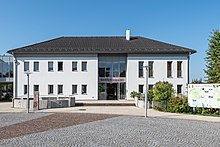
Ortsplatz 1 4532 Rohr im Kremstal |
|
| Website: | ||
| politics | ||
| Mayor : | Ulrich Flotzinger ( ÖVP ) | |
|
Municipal Council : (2015) (19 members) |
||
| Location of Rohr in the Kremstal in the Steyr-Land district | ||

|
||
| Source: Municipal data from Statistics Austria | ||
Rohr im Kremstal is a municipality with 1422 inhabitants (as of January 1, 2020) in Upper Austria in the Steyr-Land district in the Traunviertel . The place has long been considered a railway junction . The responsible judicial district is Steyr-Land.
geography
Rohr im Kremstal is 346 m above sea level in the Traunviertel in the middle of the fertile Kremstal, where the Sulzbach flows into the Krems. It is the westernmost municipality in the Steyr-Land district and borders the Kirchdorf and Linz-Land districts. The extension is 6.6 km from north to south and 4.9 km from west to east. The total area is 13.6 km². 5.9% of the area is forested, 83.1% of the area is used for agriculture.
Community structure
The municipality includes the following seven localities (population in brackets as of January 1, 2020):
- Brandstatt (22)
- Fierling (26)
- Furtberg (4)
- Haselberg (52)
- Krottendorf (34)
- Top tube (95)
- Rohr im Kremstal (1189)
The community consists of the cadastral communities Fierling and Rohr.
Neighboring communities
| Kematen an der Krems , Piberbach | Schiedlberg | |
| Kremsmünster |

|
Sierning |
| Bad Hall |
structure
Mixture of housing development, trade and agriculture
Population development
In 1991 the municipality had 1,022 inhabitants according to the census. As both the birth balance and the migration balance were positive, the population increased to 1,128 in 2001, to 1,205 in 2011 and further to 1,374 in 2018.
coat of arms
Blazon: Shield split from red and silver with two and a half battlements. The community colors are green and white.
history
Originally located in the eastern part of the Duchy of Bavaria, the place belonged to the Duchy of Austria since the 12th century. Towards the end of the 11th century, the Lords of Rohr, who came from Bavaria, built a castle on today's church hill, which, however, fell into disrepair by the 16th century. The Lords of Rohr had emigrated to the Mark Brandenburg as early as 1300.
Since 1490 the place has been assigned to the Principality of Austria ob der Enns .
It was occupied several times during the Napoleonic Wars .
Since 1918 the place belongs to the federal state of Upper Austria. After the annexation of Austria to the German Reich on March 13, 1938, the place belonged to the Gau Oberdonau . After 1945 the restoration of Upper Austria took place.
The parish Rohr in the Kremstal is a Josephine foundation from 1785.
traffic
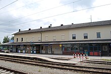
Rohr was once an important railway junction - the lines Linz - Klaus - Selzthal , Bad Hall - Rohr and Rohr - Wels met . The latter two have now been discontinued and removed except for the Sattledt - Wels section (today part of the Grünau im Almtal - Wels line). The connection between Rohr and Wels was discontinued in March 1965 and the railway equipment was dismantled in the winter of 1966/67. Passenger transport on the Rohr - Bad Hall route was discontinued in December 1989. In the summer of 2007, the railway tracks were removed. Until 2001, the Rohr station was an express train stop; in the 1970s the D 498/499 (Hamburg - Zagreb) only stopped in Rohr on the entire Linz - Selzthal route. The rebuilt station with a central platform (now called Rohr-Bad Hall) continues to fulfill important functions as an operating switch on the single-track section, as well as a commuter station and an interface with regional bus services, etc. a. with line 450 via the spa town of Bad Hall to Steyr . Rohr-Bad Hall is still one of the most important stations of the Pyhrnbahn and has been a regular stop on the Linz - Selzthal - Graz intercity line again since December 2013 .
politics
Mayor is Ulrich Flotzinger, Vice Mayor Ingrid Schuler-Knapp (both ÖVP).
Culture and sights
- The Rohr im Kremstal parish church , built in 1660, with a high altar painting by Martin Johann Schmidt , known as Kremser Schmidt, and a valuable monstrance. The parish church of Rohr in the Kremstal is located on the former castle hill. As early as 1330, "Ober- and Niederrohr" were mentioned as side churches of the old mother parish in Kirchberg. Abbot Plazidus Buchauer had the originally Romanesque castle chapel in Unterrohr removed in 1660 and the parish church that still exists today was built. The bell tower dates from 1674. Under Josef II, Rohr became an independent parish. The rectory was built in 1785 from the stones of the Hehenberg Castle and until 1950 also housed the elementary school. The high altar picture, created by Kremser Schmidt, shows Maria with the child. The parish is consecrated to Mary and celebrates her patronage on August 15th on the Assumption Day with a herbal blessing. The most valuable piece is the monstrance, a light and pretty work of the 17th century. On the side altar is a magnificent Queen of Heaven, a work of baroque carving.
- Oberrohr branch church: built in 1476, part of the Rohr parish. The branch church was built by Abbot Ulrich Schoppenzaun for the VII secular celebration of the Kremsmünster Abbey in 1476 and is one of the most beautiful and best-preserved Gothic churches in the region above the Enns. The three altars and the pulpit - kept in the old cartilage style - come from the Kremsmünster master carpenter Sebastian Grundler. The most valuable in the Oberrohr church is a Romanesque statue of St. Peter - only a copy, of course, the original is in Kremsmünster Abbey for safety reasons.
Sports
- To go biking
- hike
- Soccer
- tennis
- Stick shooters
- do gymnastics
economy
- Farms
- Chimney production
- Toolmaking
- Small businesses
education
- kindergarten
- Elementary school
societies
- Gold hood group
- Hunting party
- Hunting horn group
- Musikverein Rohr im Kremstal
- Sportunion Rohr in the Kremstal
Individual evidence
- ↑ Statistics Austria: Population on January 1st, 2020 by locality (area status on January 1st, 2020) , ( CSV )
- ↑ Statistics Austria, A look at the municipality of Rohr im Kremstal, population development. Retrieved March 23, 2019 .
- ^ State of Upper Austria, coat of arms of the municipality of Rohr im Kremstal. Retrieved March 23, 2019 .
Web links
- Map in the Digital Upper Austrian Room Information System ( DORIS )
- Further information about the municipality of Rohr im Kremstal can be found on the geographic information system of the federal state of Upper Austria .
- Homepage of the community


