
Laussa
|
Laussa
|
||
|---|---|---|
| coat of arms | Austria map | |
 |
|
|
| Basic data | ||
| Country: | Austria | |
| State : | Upper Austria | |
| Political District : | Steyr-Land | |
| License plate : | SE | |
| Main town : | Laussa | |
| Surface: | 34.48 km² | |
| Coordinates : | 47 ° 57 ' N , 14 ° 27' E | |
| Height : | 431 m above sea level A. | |
| Residents : | 1,232 (January 1, 2020) | |
| Population density : | 36 inhabitants per km² | |
| Postal code : | 4461 | |
| Area code : | 07255 | |
| Community code : | 4 15 08 | |
| NUTS region | AT314 | |
| Address of the municipal administration: |
Kirchenplatz 1 4461 Laussa |
|
| Website: | ||
| politics | ||
| Mayor : | Josef Gsöllpointner ( ÖVP ) | |
|
Municipal Council : (2015) (19 members) |
||
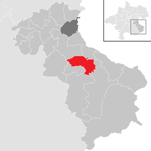
| Location of Laussa in the Steyr-Land district | ||
  |
||
| Source: Municipal data from Statistics Austria | ||

Laussa is an Austrian municipality with 1232 inhabitants (as of January 1, 2020) in the Steyr-Land district in Upper Austria .
geography

Laussa is located in the Traunviertel . The extension is 9.9 km from north to south and 6.7 km from west to east. 36.4% of the area is forested, 58% is used for agriculture.
The municipal area includes the majority of the Laussabach valley , which changes to the Losenstein municipality just before it flows into the Enns , and its side ditches. Behind the Schöfftaler Höhe ( 666 m above sea level ) it stretches to the east to the upper Pechgrabenbach , which then leads to the Enns at Großraming . In the south the upper Hölleitenbach , its side valley, belongs to it, it is only an alpine area.
To the northeast rises the Spadenberg ( 1000 m above sea level ), its summit. The Sonnberg ( 777 m above sea level ) in the north is its branch. In the very south the Schieferstein rises , whose summit is 1206 m above sea level. A. The highest point in the parish is. The south-western boundary of the municipality runs over its gentle side ridge towards the Losensteiner Stiedelbachtal. The surrounding mountains are included in the Upper Austrian Pre-Alps . The Spadenberg massif belongs to the Enns and Steyrtaler Flysch Mountains , the southern and western ridges to the Enns and Steyrtal Pre-Alps as part of the Limestone Alps.
Neighboring communities
| Cooked | Ortisei near Steyr | |
| Ternberg |
.svg)
|
∗ |
| Losenstein | Rich raming | Large framing |
- ∗ Maria Neustift does not border on the border between St. Ulrich and Großraming am Spadenberg with a small piece of it.
Community structure
The municipality has only one place ( Laussa ) and cadastral municipality ( Lausa written).
|
Mühlbach (KG)
Oberdambach (O)
Mühlbachgraben (O) ∗
(all Gem. Garsten) |
Unterdambach (KG)
Unterlaussa (O)
∗∗
(both by Garsten) |
Kleinraming (KG)
Kohlergraben (O)
(both in St. Ulrich b.St.) |
|
Ternberg (O, KG and Gem.)
|
|
Pitch pit (O) ∗∗∗
Neustiftgraben (KG) |
|
Losenstein (O and KG, Gem. Losenstein) |
Stiedelsbach (KG, Gem. Losenstein)
|
- ∗ The Ternberger shares in Mühlbachgraben do not form a village.
- ∗∗∗ The Laussaer parts of Pechgraben do not form a village.
history
.JPG)
Originally located in the eastern part of the Duchy of Bavaria , the place belonged to the Duchy of Austria since the 12th century . Since 1490 it has been assigned to the Principality of Austria ob der Enns .
During the Napoleonic Wars , the place was occupied several times.
Since 1918 the place belongs to the federal state of Upper Austria . After the annexation of Austria to the German Reich on March 13, 1938, the place belonged to the Gau Oberdonau . In 1945 Upper Austria was restored.
Population development
In 1991 the municipality had 1,317 inhabitants according to the census, in 2001 it had 1,367 inhabitants. Since then, despite the positive birth balance, the population has declined due to strong emigration, to 1,278 in 2011 and to 1,227 in 2018.
politics
.jpg)
The community belongs to the judicial district of Steyr . Before January 1, 2014, it was part of the Weyer judicial district .
Community representation
- Municipal council
The municipal council has a total of 19 members. With the municipal council and mayoral elections in Upper Austria in 2015 , the municipal council has the following distribution:
- 11 mandates of the Austrian People's Party (ÖVP)
- 8 seats in the Social Democratic Party of Austria (SPÖ)
- mayor
- since 2003 Josef Gsöllpointner (ÖVP)
coat of arms
|
|
Blazon : “In green, two silver , diagonally crossed scythe leaves ; In the base of the shield there is a golden paw cross , raised by two similar St. Andrew's cross and a golden, sighted and fallen crescent moon . "
The community colors are green-yellow-green. |
Capital of the municipality
| Laussa ( Rotte ) | |
|---|---|
| Basic data | |
| Pole. District , state | Steyr-Land (SE), Upper Austria |
| Judicial district | Steyr |
| Pole. local community | Laussa ( KG Lausa ) |
| Locality | Laussa |
| Coordinates | 47 ° 57 ′ 7 ″ N , 14 ° 27 ′ 18 ″ E |
| height | 431 m above sea level A. |
| Post Code | 4461 Laussa |
| Statistical identification | |
| Counting district / district | Laussa (41508 000) |
| Source: STAT : index of places ; BEV : GEONAM ; DORIS | |
The main town of the municipality is the Laussa Rotte . It is located 11 kilometers south of Steyr and lies in the middle Laussabach valley . The place extends as a street village for a good 1½ kilometers along the L1342 Laussaer Straße. The center of the village is the church square at the Ascension Church .
| Sonnberg | Stodergraben | |
| Fuchstalsiedlung |
|
|
|
Döllergraben |
Schindlthal |
Economy and Infrastructure

traffic
The main traffic axis is the L1342 Laussaer Straße . It branches off the Eisenstraße (B115) on the Enns at Losenstein , leads through the community via Laussabach - Laussa - Schöfftaler Höhe - Pechgraben , and then back to the B115 at Großraming .
The next train stop is the Losenstein train station ( left side of the Enns) on the Rudolfsbahn's Ennstal route (St. Valentin - Steyr - Kleinreifling - Selzthal).
leisure
- Laussa outdoor pool: the solar-heated outdoor pool has two stainless steel pools with a water surface of 350 m²
- The Sauzahn (natural monument) is a climbing area
- Weekend house settlement Almbauernsiedlung am Spadenberg
Culture and sights

Kogl Castle in Laussa

Grain box at the Großmitterberger

Prücklerstein at the Schöfftaler Höhe (natural monument)

Thalstein wall at the Fatima chapel

.JPG)
.JPG)


Web links
- Website of the municipality (laussa.at)
- More information about the municipality of Laussa on the geo-information system of the federal state of Upper Austria .
- Map in the Digital Upper Austrian Room Information System ( DORIS )
Individual evidence
- ^ Statistics Austria, A look at the community of Laussa, population development. Retrieved March 23, 2019 .
- ^ State of Upper Austria, coat of arms of the Laussa community. Retrieved March 23, 2019 .
- ↑ Statistics Austria defines localities as the capital of the municipality (in this case the only locality in the municipality); this information follows DORIS: Layer administrative boundaries: municipal capitals .

Adlwang | Aschach an der Steyr | Bad Hall | Dietach | Gaflenz | Garsten | Großraming | Laussa | Losenstein | Maria Neustift | Parish churches near Bad Hall | Rich raming | Rohr im Kremstal | Schiedlberg | Sierning | Ortisei near Steyr | Ternberg | Waldneukirchen | Weyer | Wolfern
Cadastral municipality: Lausa • Location: Laussa
Rotten: Brunngraben • Laussa • Laussabach • Schindlthal | Settlements: Almbauernsiedlung • Fuchstalsiedlung • Hölleiten • Hollnbuchneriedlung • Sonnleithnersiedlung | Scattered houses: Brandgraben • Döllergraben • Halbhnen • Oberdambach • Pechgraben • Plattenberg • Sonnberg • Stodergraben | Other local documents: Brettertal • Camp Sibley • Dandl digging • Fatima Chapel • Grüntal • Gspörr • Castle Kogl • Riesenberger settlement • Schöfftalerkapelle • Seng sealed forger Chapel
Counting district: Laussa