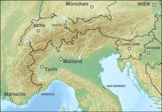
Enns and Steyrtal Pre-Alps
| Enns and Steyrtal Pre-Alps | ||
|---|---|---|
|
ESV , in the southeast corner |
||
| Highest peak | Stump wall ( 1770 m above sea level ) | |
| location | Upper Austria | |
| part of | Upper Austrian Pre-Alps / Ybbstal Alps (AVE) | |
| Classification according to | Upper Austria spatial planning | |
|
|
||
| Coordinates | 47 ° 45 ′ N , 14 ° 45 ′ E | |
| Type | Promontory | |
| rock | Limes | |
| surface | 139 km² | |
The Enns and Steyrtaler Voralpen are a mountain area of the Northern Alps in Upper Austria and are located in the Eisenwurzen region . They form one of 41 Upper Austrian spatial units .
Location and landscape
The spatial unit comprises four spatially isolated sub-areas that are separated by the rivers Enns and Steyr and are located in the districts of Kirchdorf and Steyr-Land . The spatial unit is divided into two sub-units, on the one hand the forest landscape and on the other hand the side valleys including disbanded clearing islands.
The area of the Enns and Steyrtal Pre-Alps is around 139 km². The deepest area is around 360 m above sea level. A. near Ternberg . The highest point in the area is the stump wall (Voralpe) at 1770 m above sea level. A.
The following municipal areas are mostly in the Enns and Steyrtal Pre-Alps (starting in the north): Gaflenz , Molln , Reichraming , Großraming , Weyer and Rosenau on the Hengstpass .
The room unit is surrounded by the following Upper Austria room units (clockwise, starting in the north): Enns and Steyrtaler Flysch Mountains , Kalk-Hochalpen , Windischgarstner Basin , Sengsengebirge , Salzkammergut-Voralpen , Almtaler and Kirchdorfer Flyschberge and Traun-Enns-Riedelland . The spatial units Steyr and Teichltal as well as Ennstal divide this spatial unit into the four sub-areas.
Characteristic
- Low mountain ranges, peaks between 800 and 1400 m above sea level, moderate to strong relief energy , strongly structured in areas by striking rock formations. The foothills of the Alps are a dolomite landscape with very near-natural (to natural) notch valleys , sub-areas with pronounced rock change and small-scale, richly shaped biotope structures.
- High proportion of forest (approx. 85%), dense forest road network and predominantly commercial forest with spruce and larch , varying proportions of beech . In inaccessible (steep) locations there are also very natural spruce, fir and beech forests.
- Some of the larger streams ( Krumme Steyrling , Reichramingbach and Dambach ) with brown trout stocks in the upper reaches are largely unobstructed right up to the source areas. Large karst springs only in the vicinity of the Sengsengebirge . In the lower reaches of the creek there are sometimes massive gravel coverings in the valley areas. Small basin landscapes exist. Streams in settlement areas and along paths have been straightened in places and developed hard.
- The Borsee as the only larger still water, in addition several ponds scattered in the area.
- The proportion of grassland in the northern areas close to the Enns and in the larger valley areas is significantly higher. Cultivation takes place predominantly on slopes and valleys. Fertilized greasy meadows can be found in the valley floors and in flatter areas. Lime semi-dry lawns and poor pastures, more rarely whistle grass meadows , are still common . Locally on pastures Bürstlingsrasen .
- Massive tendency towards abandoning agricultural use with subsequent afforestation. Several alpine pastures, some of them high up, with mountain meadows full of flowers and alpine pastures, livestock is declining, increased tourist use. Generally high structure with orchards , border hedges and bushes.
- Habitat and migration area of many rare animal species such as lynx , brown bear , capercaillie and three-toed woodpecker
- Many scattered settlements in the wide, gravel-filled valleys and sloping side valleys
- Relatively rich in precipitation, northern congestion
literature
- Office of the Upper Austrian Provincial Government, Nature Conservation Department (Ed.): Nature and Landscape / Guiding Principles for Upper Austria. Volume 13: Enns and Steyrtal Prealps spatial unit . Linz 2007 ( land-oberoesterreich.gv.at [PDF; accessed on December 1, 2014]).
- Gerald Radinger: Hiking experience in the Kalkalpen National Park. The most beautiful tours between Enns and Steyr. Kral Verlag, 2012, ISBN 978-3-99024-066-3
Web links
- Map of the Enns and Steyrtal Prealps spatial unit. In: DORIS . Retrieved December 1, 2014 .
- Enns and Steyrtal Pre-Alps. In: Nature and Landscape in Upper Austria. Retrieved December 1, 2014 .

