List of nature reserves in Styria
In Styria , the following areas are designated as nature reserves :
Legal basis
Section 5 (1) of the Steiermärkisches Naturschutzgesetz ( Styrian Nature Conservation Act 1976) clarified the term, and then (2) three express natural forms:
- lit. a) "Alpine landscapes, mountains, lakes and rivers;" ( Protected biotopes as defined by the IUCN)
- lit. b) "Remnants of primeval forest, moors, boggy areas or swamps;" ( Forest protection and wetland protection )
- lit. c) “Locations and demarcated habitats of plants or animal species that are worthy of protection or endangered ( plants or animal protection areas )”.
Letter a areas are under state protection, letter b and letter c areas are either within the competence of the state (in the case of European protected areas ) or the district administrative authority . The category is always included in the protected area numbers.
There are a total of 123 Styrian nature reserves (19 lit.a., 8 lit.b., 96 lit.c .; as of 2014)
list
| photo | Surname | ID | district | Location | description
|
surface | date |
|---|---|---|---|---|---|---|---|

|
Gesäuse and subsequent Ennstal to the state border |
NSG 01 a WDPA |
Liezen , Leoben |
Admont , Altenmarkt , Sankt Gallen , Landl KG: Hieflau, Johnsbach, Krumau, Landl, Weng location |
137 km² | 07/08/1958 | |

|
Wildalpener Salzatal |
NSG 02 a WDPA |
Liezen , Bruck-Mürzzuschlag |
Landl , Altenmarkt , Wildalpen , Mariazell , Thörl , Turnau KG: Aschbach, Essling, Gams, Palfau, Seewiesen, St. Ilgen, St. Sebastian, Weichselboden, Wildalpen location |
515 km² | 07/08/1958 | |

|
Altausseer See |
NSG 03 a WDPA |
Liezen |
Altaussee KG: Altaussee location |
10 km² | 1959 | |

|
Ödensee |
NSG 05 a WDPA |
Liezen |
Bad Aussee , Bad Mitterndorf KG: Pichl, Strasse location |
300 ha | 1959 | |

|
Pfaffenkogel - Gsollerkogel |
NSG 06 a WDPA |
Graz area |
Deutschfeistritz , Gratwein-Straßengel KG: Hörgas, Kleinstübing, Stübinggraben location |
727 ha | 02/03/1964 | |

|
Raabklamm |
NSG 07 a WDPA |
Wheat |
Mortantsch , Gutenberg-Stenzengreith , Passail , Naas KG: Arzberg, Dürnthal, Garrach, Haselbach, Mortantsch location |
400 ha | 1970 | |

|
Wet grain |
NSG 08 a WDPA |
Bruck-Mürzzuschlag |
Neuberg an der Mürz KG: Krampen GrStNr: 541/1; 544; 545 location |
The Naßkör is a hollow karst form, located at 1250 m, in the form of a basin with an area of around five square kilometers and the largest bog complex in the eastern limestone Alps. The Naßkörbach flowing through the Naßkör disappears in the so-called upper diarrhea and emerges again in the Mürz valley (Tyrol at Krampen and Totes Weib) | 10 km² | 04.10.1971 |

|
Eisenerzer Reichenstein , Krumpensee |
NSG 09 a WDPA |
Leoben |
Eisenerz , Trofaiach , Vordernberg KG: Gößgraben-Freienstein, Krumpen, Trofeng, Vordernberg location |
10 km² | 02/12/1973 | |

|
Seekar Bear Valley |
NSG 10 a WDPA |
Deutschlandsberg |
Bad Schwanberg KG: Garanas, Gressenberg location |
11 km² | 05/04/1981 | |

|
Klafferkessel in the Schladminger Tauern region |
NSG 11 a WDPA |
Liezen |
Schladming KG: Untertal GrStNr: 944/1; 944/4; 945; 946; 947; 948/4; 948/5; 949; 950/1; 950/3 location |
12 km² | 02/01/1980 | |

|
Lake Constance Sattenbachtal in the Schladminger Tauern |
NSG 12 a WDPA |
Liezen |
Aich , Michaelerberg-Pruggern KG: Gössenberg, Pruggern location |
14 km² | 03/29/1982 | |

|
Riesach Valley in the Schladminger Tauern |
NSG 14 a WDPA |
Liezen |
House , Schladming KG: Ennsling, Untertal location |
13 km² | 12/14/1987 | |

|
Krakow - Schöder | NSG 15 a | Murau |
Krakau , Schöder KG: Krakaudorf, Krakauhintermühlen, Schöderberg location |
62 km² | 07/07/1987 | |
|
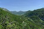
Dead Mountains West |
NSG 16 a WDPA |
Liezen |
Altaussee , Grundlsee KG: Altaussee, Grundlsee location |
155 km² | 05/27/1991 | |

|
Dead Mountains East |
NSG 17 a WDPA |
Liezen |
Bad Mitterndorf , Stainach-Pürgg , Wörschach , Liezen KG: Liezen, Tauplitz, Weißenbach bei Liezen, Wörschach, Ziem location |
78 km² | 05/27/1991 | |

|
Styrian Dachstein plateau | NSG 18 a | Liezen |
Bad Aussee , Bad Mitterndorf , Gröbming KG: Gröbming, Mitterndorf, Pichl, street location |
74 km² | 05/27/1991 | |

|
Green lake | NSG 19 a | Bruck-Mürzzuschlag |
Tragöß-Sankt Katharein KG: Oberort GrStNr: 354; 355; 360/2; 360/27; 360/28 location |
6.8 ha | 10/30/2006 | |
|
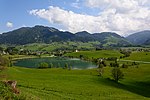
Putterersee with its surroundings |
NSG 20 a WDPA |
Liezen |
Aigen im Ennstal KG: Aigen, Lantschern location |
71.92 ha | 10/30/2006 | |

|
Lower Tauern, eastern foothills | NSG 21 a | Leoben , Murtal |
Sankt Stefan ob Leoben , Sankt Marein-Feistritz , Kraubath an der Mur , chambers in Liesingtal , Mautern in Steiermark KG: Leims, Rannach, Greuth, Wasserleith, Kaisersberg, Kraubathgraben location |
619.72 ha | 02/14/2015 | |

|
Mountain pine moss in the Paal | NSG 01 b | Murau |
Stadl-Predlitz KG: Stadl GrStNr: 2021/1 location |
The Paaler Latschenmoos is a sour-oligotrophic rain moor in good condition (2017). Occurrence of Betula nana (dwarf birch). Moor protection catalog no. 57057401 | 5.9 ha | 02/16/1981 |

|
Summer good moor | NSG 02 b | Hartberg-Fürstenfeld |
Wenigzell KG: Sommersgut GrStNr: 72/5; 185/1; 185/4 location |
The Sommersguter Moor (moor protection catalog no. 67040201) is an acidic, oligotropic rain moor with heavy vegetation (Pinus x rotunda). | 2.75 ha | 04/01/1983 |
|
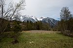
Ramsau peat | NSG 03 b | Liezen |
Ramsau am Dachstein KG: Leiten GrStNr: 630/1; 630/4; 633; 634/1 location |
The Ramsau peat, also called Filzmoos am Kulm, is an acidic oligotrophic rain bog. Moor protection catalog no. 47040101 | 1.64 ha | 1985 |

|
Listening field | NSG 04 b | Murau |
Mühlen KG: Mühlen location |
The hearing field is a calcareous-mesotrophic flow moor. Natura 2000 area. (Moor protection number 57070801) Note: The Hörfeld (moor) extends over the state border to Carinthia. In Carinthia it is protected under NSG.028 . |
20.99 ha | 1987 |
|
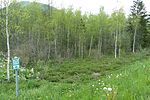
Wet biotope between Pichl-Großdorf and Tragöß-Oberort |
NSG 05 b WDPA |
Bruck-Mürzzuschlag |
Tragöß-Sankt Katharein KG: Schattenberg; Sonnberg location |
17.97 ha | 1987 | |

|
Oppenberger moss | NSG 06 b | Liezen |
Rottenmann KG: Oppenberg GrStNr: 542; 543; 545; 550 location |
The Oppenberger Moos (moor protection number 57020101 to 04) consists of four moors, two sour-oligotrophic rain bogs, one sub-neutral-mesotrophic flow-through bog and one sour-mesotrophic overflow bog. The rain bogs are mountain pine raised bogs. | 8.01 hectares | 2011 |

|
Zellerbrunn - High Marcheck | NSG 07 b | Bruck-Mürzzuschlag |
Mariazell KG: Weichselboden GrStNr: 374/6 location |
49.6 ha | 1989 | |
|
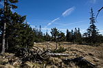
Black bar moss | NSG 08 b | Bruck-Mürzzuschlag , Weiz |
Mürzzuschlag , Rettenegg KG: Schöneben-Ganz; Rettenegg GrStNr: 236/1; 442 location |
The moor is divided into Schwarzriegelmoos 1 (moor protection number 68160101) on the south slope and Schwarzriegelmoos 2 (moor protection number 68160102) on the northwest slope. Both are sour oligotrophic rain bogs. | 5.82 hectares | 1992 |

|
Lichtenwalder Moor | NSG 09 b | Hartberg-Fürstenfeld |
Bad Waltersdorf KG: Hohenbrugg GrStNr: 1915/9, 1915/10; 1915/17 location |
The Lichtenwalder Moor is an acid-oligotrophic transition moor. | 1.59 ha | 2008 |

|
Filzmoos outdoors | NSG 10 b | Deutschlandsberg |
Deutschlandsberg KG: Klosterwinkel GrStNr: 169/2 location |
12.74 ha | 2009 | |

|
Moor on the lake level | NSG 11 b | Deutschlandsberg |
Deutschlandsberg KG: Osterwitz GrStNr: 33/1; 34 location |
5.71 ha | 2005 | |

|
Parts of the Edlacher Moor | NSG 12 b | Liezen |
Rottenmann KG: Edlach GrStNr: 237/2; 239/2; 240/2; 244/8; 244/9; 244/10; 244/11; 245/10; 245/14; 245/15; 245/16; 245/17; 245/18 location |
The Edlacher Moor (moor protection number 58150401) is a sub-neutral-eutrophic flood moor. Endangered occurrence of Pedicularis sceptrum-carolinum. | 17.19 ha | 2011 |

|
West u. Eastern slopes of the Zirbitzkogel | NSG 01 c | Murau , Murtal |
Neumarkt in der Steiermark , Mühlen , Obdach KG: St. Georgen, Kuln, Noreia, Granitzen, Lavantegg location |
23 km² | 1966 | |

|
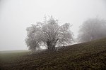
North-western part of the municipality of Ramsau am Dachstein | NSG 02 c | Liezen |
Ramsau am Dachstein KG: Ramsau location |
The nature reserve is part of the Dachstein – Salzkammergut landscape conservation area . It includes the southern slopes of the Dachstein massif . The area is a protected area for plants, in which all actions that damage or endanger the condition of plants are prohibited. Agricultural and forestry use in the previous extent as well as maintenance measures are excluded. | 13 km² | 1972 |
|
Pleschkogel, Walzkogel, Mühlbachgraben | NSG 03 c | Graz area |
Gratwein-Straßengel KG: Gschnaidt, Hörgas, Kehr and Plesch, location |
657.41 ha | 1972 | |

|
Area around the Sölker Pass | NSG 04 c | Murau , Liezen |
Sölk , Schöder KG: St. Nikolai, Schöderberg location |
472.07 hectares | 1973 | |

|
Attems Moor | NSG 05 c | Leibnitz |
Straß in Steiermark KG: Straß GrStNr: 262/2; 262/3; 262/4; 262/5; 262/6; 262/7; 262/14; 262/15 location |
15.95 ha | 1973 | |

|
Pichlermoos in the Gaal | NSG 06 c | Murtal |
Gaal KG: Gaal GrStNr: 385 location |
The Pichler Moos (moor protection number 57040301) is an acid-oligotrophic rain moor with pines and low spruce vegetation that is endangered by drainage. | 3.82 ha | 1974 |

|
Dead arm area of the Gleinzbach | NSG 07 c | Deutschlandsberg |
Wettmannstätten KG: Wettmannstätten GrStNr: 297; 298 location |
0.95 ha | 1990 | |

|
Hard pond | NSG 10 c | Hartberg-Fürstenfeld |
Hartl KG: Hart GrStNr: 180; 181; 182 location |
16.1 ha | 1975 | |
|
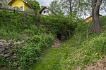
Cave with bat population KG Aflenz | NSG 11 c | Leibnitz |
Wagna KG: Aflenz GrStNr: 318 location |
Small sanctuary for a colony of long-winged bat in the Roman quarry Aflenz. | 0.15 ha | 1977 |

|
Area between the Mur bridge in Bachsdorf and the Mur power station Gralla | NSG 12 c | Leibnitz |
Lebring-Sankt Margarethen , Gralla KG: Lebring, Obergralla GrStNr: 825/2; 833/39; 887/4; 887/5; 887/6; 1054/1; 1054/2; 1054/3; 1708; 1709/1 location |
37.67 ha | 1978 | |

|
Altarm of the Raab in the area of the municipality Edelsbach | NSG 13 c | Southeast Styria |
Edelsbach bei Feldbach KG: Rohr GrStNr: 268; 272/1; 537/3 location |
2.48 hectares | 1981 | |

|
Old arms of the Raab in the area of KG Leitersdorf and Lödersdorf | NSG 14 c | Southeast Styria |
Feldbach , Riegersburg KG: Leitersdorf, Lödersdorf GrStNr: 53/1; 56/1; 620/4; 1964/1; 1964/2 location |
3.16 ha | 1980 | |

|
Rödschitz or Laasenmoor | NSG 15 c | Liezen |
Bad Mitterndorf KG: Mitterndorf GrStNr: 3520; 3521 location |
The Rödschitzmoos (moor protection number 58131701) is an acidic oligotrophic rain moor. The raised bog is endangered by peat cutting on the northern edge. | 13.84 ha | 1981 |

|
Old arms of the Raab in the area of KG Raabau and Leitersdorf | NSG 16 c | Southeast Styria |
Feldbach KG: Leitersdorf, Raabau GrStNr: 620/1; 1154 location |
1.15 ha | 1982 | |
|
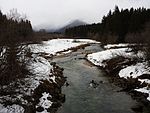
The area where the Salza flows into the Stein Pass reservoir | NSG 17 c | Liezen |
Bad Mitterndorf KG: Mitterndorf location |
27.85 hectares | 1981 | |

|
Gamperlacke in the municipality of Liezen |
NSG 18 c WDPA |
Liezen |
Liezen KG: Liezen; Reithal location |
24.6 ha | 1981 | |

|
Deutschlandsberger Klause | NSG 19 c | Deutschlandsberg |
Deutschlandsberg KG: Burgegg, Trahütten, Warnblick GrStNr: 66; 235/1; 243/1; 243/2; 243/6; 243/7; 243/13; 307/1; 327/3; 327/4; 328; 405; 408; 581 location |
29.2 ha | 1976 | |

|
Grieshoflacke | NSG 20 c | Liezen |
Admont KG: Unterhall GrStNr: 693/1; 693/2; 694 location |
2.66 ha | 1982 | |

|
Alluvial forest rest in the KG Herbersdorf | NSG 21 c | Deutschlandsberg |
Stainz KG: Herbersdorf GrStNr: 104/2; 104/5 location |
0.69 ha | 1982 | |

|
North-eastern part of the Wörschacher Moor | NSG 22 c | Liezen |
Wörschach KG: Wörschach location |
The Wörschacher Moos (moor protection catalog no. 58140701) is defined as an acidic oligotrophic rain moor. | 43.99 ha | 1982 |

|
Puxer Auwald | NSG 23 c | Murau |
Teufenbach-Katsch KG: Frojach GrStNr: 814/4; 814/5; 814/6 location |
3.12 ha | 1983 | |

|
Location of the Carniolan rabid in Dürnstein | NSG 24 c | Murau |
Neumarkt in der Steiermark KG: Dürnstein GrStNr: 21/8 location |
The plant protection area, the location of the Carniolan rabid ( Scopolia carniolica ), is located in Wildbad Einöd near Dürnstein in Styria at around 740 m above sea level in the Neumarkt pass landscape . The characteristic round hump landscape is drained by the Olsa , the water balance of the swampy soils and the surrounding round humps is threatened by amelioration . The Olsabachwiesen are an inner alpine valley and drain zone, the low-nutrient sour humus soils by increasing Versumpfung anmoorig were. The nature reserve is part of the Olsa-Au, an oxbow lake of the regulated brook runs through the area, the Carniolan rabid is in the undergrowth of the original gray alder population . Near the stream, white willow and black willow now dominate . Sustainable changes in the species structure are caused by clear-cutting management and intensive spruce reforestation. | 0.81 ha | 1983 |

|
Murinsel Triebendorf | NSG 25 c | Murau |
Murau KG: Triebendorf GrStNr: 442/1 location |
0.41 ha | 1983 | |

|
Semi-dry grassland on the Schartnerkogel, massive deposits of yellow flax | NSG 26 c | Graz area |
Deutschfeistritz KG: Königgraben GrStNr: 303/1 location |
The small-scale nature reserve was created around an extensively used cultivated area created by clearing the original beech forest, which was reforested on the edge. The occurrence of yellow linen (calcareous and light-loving sub-Mediterranean-continental flora element) is limited to this semi-arid grassland (mesobromion). | 0.32 ha | 1994 |

|
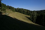
Demmerkogelwiesen in St. Andrä / Höch | NSG 27 c | Leibnitz |
Sankt Andrä-Höch KG: Höch GrStNr: 457; 458; 512/3; 512/6; 512/7; 547/2; 569; 570; 571; 572/1; 572/2; 589; 590/2; 591; 605; 606; 607; 616; 610; 628/3; 757/5 location |
6.45 ha | 1988 | |
|
Dry meadow in the Klein-Kleingraben | NSG 28 c | Leibnitz |
Leutschach an der Weinstrasse KG: Eichberg-Trautenburg GrStNr: 371/3; 380; 383; 384/1 location |
1.94 ha | 1989 | |

|
Dry meadow in Aigen "Höll" | NSG 29 c | Southeast Styria |
Sankt Anna am Aigen KG: Aigen GrStNr: .145; 686/1; 687/1; 687/2; 687/3; 687/5; 687/6; 687/7; 688; 690; 691; 978; 979; 985; 986; 987; 993, 994; 1056/4 location |
7.66 ha | 1983 | |

|
Area of the Kirchkogel near Kirchdorf | NSG 30 c | Bruck-Mürzzuschlag |
Pernegg an der Mur KG: Traföß, Kirchdorf GrStNr: 1/43; 104/1; 769; 814; 815; 816/1; 816/2; 816/3; 816/4; 816/5 location |
36.55 hectares | 1983 | |

|
Chess flower meadows in Großsteinbach | NSG 32 c | Hartberg-Fürstenfeld |
Großsteinbach KG: Großsteinbach GrStNr: 2103; 2104; 2115; 2116; 2118/1; 2119; 2166 location |
6.59 ha | 1983 | |
|
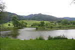
Rattenberger pond in Fohnsdorf |
NSG 33 c WDPA |
Murtal |
Fohnsdorf KG: Rattenberg, Sillweg GrStNr: 29; 1637; 1638; 1639; 1739 location |
3.35 hectares | 1983 | |

|
Quarry forest of gray alder and bog birch on the western edge of the Packer reservoir | NSG 34 c | Voitsberg |
Hirschegg-Pack KG: Pack GrStNr: 655/2; 655/3; 963/1 location |
2.08 ha | 1984 | |

|
Karlschütt in St. Ilgen |
NSG 36 c WDPA |
Bruck-Mürzzuschlag |
Thörl KG: Sankt Ilgen GrStNr: 851/1; 852/1; 922/1 location |
26.27 ha | 1985 | |

|
Iris sibirica meadows in Wörschach | NSG 37 c | Liezen |
Wörschach KG: Wörschach GrStNr: 1383; 1384; 1385; 1386; 1387; 1394; 1395 location |
4.87 ha | 1985 | |

|
Former clay mining area in KG Kalsdorf | NSG 38 c | Hartberg-Fürstenfeld |
Ilz KG: Kalsdorf GrStNr: 63/2 location |
2.92 ha | 1987 | |

|
Raab alarms "Schiefer - Hohenbrug" | NSG 39 c | Southeast Styria |
Fehring KG: Hohenbrugg, Schiefer GrStNr: 202/1; 202/7; 1466/3; 1466/4; 1468 location |
3.2 ha | 1985 | |

|
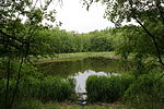
Stürghk pond | NSG 40 c | Southeast Styria |
Halbenrain KG: Halbenrain GrStNr: 564 location |
7.43 ha | 1986 | |
|
Clarification ponds in Fohnsdorf |
NSG 41 c WDPA |
Murtal |
Fohnsdorf KG: Fohnsdorf GrStNr: 340; 853/8 location |
16.18 ha | 1986 | |

|
Alluvial forest and moorland in Greith | NSG 42 c | Bruck-Mürzzuschlag |
Mariazell KG: Aschbach GrStNr: 1572/7; 1572/9; 1575; 1579; 1585/3 location |
10.12 hectares | 1986 | |

|
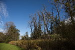
Zigöllerkogel in Köflach | NSG 43 c | Voitsberg |
Köflach KG: Gradenberg GrStNr: 87/1; 88; 89; 90; 91; 92; 93; 94/1; 94/2; 135/1; 135/2 location |
30.19 ha | 1986 | |
|
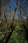
Gersdorfer Ennsaltarm | NSG 44 c | Liezen |
Öblarn , Mitterberg-Sankt Martin KG: Öblarn, Mitterberg GrStNr: 518; 519; 520; 521; 524/1; 524/2; 564; 2643; 2646; 2647 location |
8.55 ha | 1986 | |
|
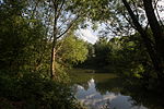
Ennsaltarm Klausner | NSG 45 c | Liezen |
Admont KG: Aigen GrStNr: 1212/39; 1212/40 location |
1.15 ha | 1986 | |
|
Schwöbing floodplain | NSG 46 c | Bruck-Mürzzuschlag |
Langenwang KG: Langenwang-Schwöbing, Feistritzberg GrStNr: 38/1; 38/2; 39/2; 40; 83/10; 477; 478; 479/1; 479/4; 600/2; 602/3; 602/5; 604 location |
68.3 ha | 1987 | |

|
Three Sulm altar arms in the Heimschuh | NSG 47 c | Leibnitz |
Heimschuh KG: Heimschuh GrStNr: 296; 335; 517 location |
Note: The coordinates given refer to the middle of the three oxbow branches |
4.53 ha | |

|
Former clay mining area in the KG Gleisdorf "Stroblböden" | NSG 48 c | Wheat |
Gleisdorf KG: Gleisdorf GrStNr: 103/1; 104/1; 105/1; 105/4 location |
2.16 ha | 1987 | |

|
Maierbrugger Moor | NSG 49 c | Murau |
Stadl-Predlitz KG: Predlitz GrStNr: 1399/62 location |
Dystrophic lake with small sour-mesotrophic silting bog. Occurrence of Betula nana. | 0.94 ha | 1987 |

|
Mooshuben wetlands in Halltal | NSG 50 c | Bruck-Mürzzuschlag |
Mariazell KG: Halltal GrStNr: 872/6; 872/7; 872/8; 891/2 location |
1.85 ha | 1987 | |

|
Kettischgrund in Lannach | NSG 51 c | Deutschlandsberg |
Lannach KG: Lannach GrStNr: 467/1; 473; 478; 484/2; 491; 493/2; 523/1; 548 location |
3.44 ha | 1991 | |

|
Sulmaltarm in the municipality of Pistorf | NSG 52 c | Leibnitz |
Gleinstätten KG: Mayerhof GrStNr: 520/1 location |
0.49 ha | 1987 | |

|
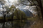
Parts of the Styrian Nockberge | NSG 53 c | Murau |
Stadl-Predlitz KG: Predlitz GrStNr: 1248/2; 1314; 1318; 1328; 1329; 1332; 1338; 1403; 1405 location |
20 km² | 1988 | |
|
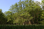
Both Ennstalarms from Niederstuttern | NSG 54 c | Liezen |
Stainach-Pürgg KG: Neuhaus location |
57.72 hectares | 1988 | |
|
Thal-Eben wetland biotope | NSG 56 c | Graz area |
Thal KG: Thal GrStNr: 932; 933/1; 933/2; 934/1 location |
1.54 ha | 1991 | |

|
Forest ditch or disc moss | NSG 57 c | Liezen |
Altaussee KG: Altaussee GrStNr: 1216; 1219/1; 1219/2 location |
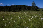
The Scheibenmoos (moor protection number 48161803) is part of a moor complex of three moors through which the Waldgrabenbach flows. The disk moss is an acidic, oligotrophic rain moor and high mountain pine moor. The other bogs are an overflow bog (bog protection number 48161802) and a transition bog (bog protection number 48161801). | 14.63 ha | 1988 |
|
Obersdorf moss | NSG 58 c | Liezen |
Bad Mitterndorf KG: Mitterndorf GrStNr: 2960/4 location |
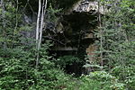
The Obersdorfer Moos high moor (moor protection number 58131601) is an acidic, oligotrophic rain moor accompanied by a flow moor in the east. | 6.32 ha | 1988 |
|
Gallery IX in the Peggauer Wand |
NSG 59 c WDPA |
Graz area |
Peggau KG: Peggau GrStNr: 501/3 location |
0.28 ha | 1988 | |

|
West flank of the Niesenbacher Kogel | NSG 60 c | Graz area |
Deutschfeistritz KG: Stübinggraben GrStNr: 432; 433; 434/1; 434/2 location |
11.36 hectares | 1989 | |

|
Occurrence of spring knot flowers in St. Lorenzen | NSG 61 c | Bruck-Mürzzuschlag |
Sankt Lorenzen im Mürz valley KG: Rumpelmühle GrStNr: 450/2 location |
0.36 ha | 02/20/1989 | |

|
Parts of the Lustbühel | NSG 62 c | Graz |
Graz KG: Waltendorf, St. Peter GrStNr: 388; 390/4; 1141/1; 1141/2 location |
2.72 ha | 1989 | |

|
Wetland in the KG Weinitzen | NSG 63 c | Graz area |
Weinitzen KG: Weinitzen GrStNr: 426/1; 428/5; 430; 431; 432; 433; 442; 443; 444; 452/1 location |
2.88 ha | 1989 | |

|
Krottendorfer Kainachinsel | NSG 64 c | Voitsberg |
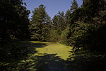
Krottendorf-Gaisfeld KG: Gaisfeld GrStNr: 531/1; 531/2; 531/3; 531/4; 531/9; 531/11; 531/12; 531/13; 531/16; 546/3; 548; 551; 555/2 location |
6.5 ha | 1989 | |
|
Sections of the former clay mining site in Unterpremstätten | NSG 65 c | Graz area |
Premstätten KG: Unterpremstätten GrStNr: 402/5; 402/6; 402/10 location |
3.21 ha | 1997 | |

|
Altarm and alluvial forest between the Altenmarkter Bridge and the Silberwald | NSG 66 c | Leibnitz |
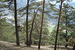
Leibnitz KG: Altenmarkt, Seggauberg GrStNr: 123/1; 129/1; 134/2; 134/3; 134/23; 277/15; 277/16; 277/21; 277/22; 277/27 location |
7.6 ha | 1989 | |
|
Parts of the Gulsenberg | NSG 67 c | Murtal |
Sankt Marein-Feistritz KG: Feistritz GrStNr: 725/9; 734/1; 735; 736; 737/1; 737/2; 739/1 location |
12.87 ha | 1990 | |
|
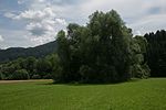
Murauen in the area of Gries in St. Michael |
NSG 68 c WDPA |
Leoben |
Sankt Michael in Obersteiermark KG: Brunn GrStNr: 211; 655/3; 655/5; 660; 690 location |
2.23 ha | 1990 | |

|
Adendorf wetland | NSG 69 c | Murau |
Neumarkt in der Steiermark KG: Adendorf GrStNr: 732/2 location |
The wet biotope near Mariahof includes a flat moor (moor protection number 57070301), a sub-neutral, eutrophic overflow moor. Occurrence of Carex hostiana (Saumsegge) | 1.92 ha | 1990 |
|
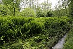
Ostrich fern deposits on Schönwiesenbach in Mooskirchen | NSG 70 c | Voitsberg |
Mooskirchen KG: Stögersdorf GrStNr: 1783; 1795; 1797 location |
0.39 ha | 1990 | |

|
Slope forest biotope Fischerwand | NSG 71 c | Bruck-Mürzzuschlag |
Kapfenberg KG: Einöd, St. Martin GrStNr: 1; 256/1; 256/3; 257; 258/1; 259 location |
32.75 hectares | 1990 | |

|
Wegscheider pond | NSG 72 c | Liezen |
Sankt Gallen KG: Weißenbach an der Enns GrStNr: 714; 716 location |
0.87 ha | 1990 | |

|
Werndorf reed belt | NSG 73 c | Graz area |
Werndorf KG: Werndorf GrStNr: 91; 229; 230; 231; 233; 235; 272/1; 272/2; 273/1; 273/2; 278/2; 279; 284/2; 285/2; 285/3 location |
3.03 hectares | 2006 | |

|
Wetland "Nasco Meadow" in Bruck | NSG 74 c | Bruck-Mürzzuschlag |
Bruck an der Mur KG: Bruck an der Mur GrStNr: 695/2 location |
2.04 ha | 1991 | |

|
Brick pond area in Weinzettl | NSG 75 c | Graz area |
Dobl-Zwaring KG: Muttendorf GrStNr: 1186/1 location |
0.33 ha | 1991 | |

|
Landscape lake Laafeld | NSG 76 c | Southeast Styria |
Bad Radkersburg KG: Laafeld GrStNr: 385/27; 386/28; 386/31; 386/32; 386/33; 825/78 location |
6.69 ha | 1992 | |

|
Meadow landscape along the Laßnitz and Sulm | NSG 77 c | Leibnitz |
Leibnitz , Wagna KG: Aflenz, Altenmarkt, Grottenhofen, Kaindorf an der Sulm, Kogelberg, Leibnitz, Seggauberg, Wagna location |
218.15 ha | 1992 | |

|
Doblwiesen wetland | NSG 78 c | Graz area |
Dobl-Zwaring KG: Dobl GrStNr: 1076 location |
1.2 ha | 1998 | |

|
"Latschen-Hochmoor" in Fladnitz | NSG 79 c | Wheat |
Fladnitz an der Teichalm KG: Fladnitz an der Teichalpe GrStNr: 831/1; 831/3 location |
0.7 ha | 1993 | |

|
Arid biotope at the "Klausen" quarry | NSG 80 c | Southeast Styria |
Bad Gleichenberg KG: Gleichenberg Dorf GrStNr: 282/1; 282/4 location |
1.38 ha | 1993 | |

|
Alluvial forest and wet meadows in the Grünau | NSG 81 c | Bruck-Mürzzuschlag |
Mariazell KG: St. Sebastian GrStNr: 362; 363/1; 363/2; 366/2; 380; 382/2; 382/3; 382/4; 383/1; 383/3; 384/3; 448/5; 448/8; 449; 450/4; 623; 658; 659 location |
9.14 ha | 1994 | |

|
Narzissen- und Ohrwiese KG Halltal | NSG 82 c | Bruck-Mürzzuschlag |
Mariazell KG: Halltal GrStNr: 553/1; 619/1 location |
7.58 ha | 1994 | |

|
Alluvial forest and wetland meadows "Hubertusseezufluss" | NSG 83 c | Bruck-Mürzzuschlag |
Mariazell KG: Halltal GrStNr: 189/1; 241/4; 241/5; 259/5; 1717; 1730/4 location |
6.81 ha | 1994 | |

|
Silting zone at the east end of the Packer reservoir | NSG 84 c | Voitsberg |
Edelschrott , Hirschegg-Pack KG: Edelschrott, Pack GrStNr: 956/1; 962; 964/1; 1165/1; 1178; 1179 location |
2.86 ha | 1994 | |
|
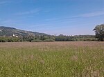
Hartberger Gmoos | NSG 85 c | Hartberg-Fürstenfeld |
Hartberg Umgebung KG: Ungarvorstadt location |
The Hartberger Gmoos (moor protection catalog no .: without number) is a sub-neutral-eutrophic silting moor, created by silting up the Edelsee. | 46.11 hectares | 1996 |

|
"Jahnwald" and "Trattenwiesen" | NSG 86 c | Southeast Styria |
Mureck KG: Diepersdorf GrStNr: 4; 5; 8/2; 9/2; 11/1; 11/2; 12/1; 12/2; 13/1; 13/2; 14/1; 14/2; 15; 16; 18/1; 18/2; 19/2; 22/2; 23/2; 26/2; 27/1; 27/3; 30/1; 30/2; 32; 33/1; 33/2; 36/1; 36/2; 37; 38; 39/2; 42/1; 42/2; 43/1; 43/3; 46/1; 46/2; 46/3; 47/1; 47/2; 48/1; 48/2; 49/1; 49/2; 49/3; 52/1; 52/2; 52/3; 52/4; 53/1; 53/2; 53/3; 55/2; 56/3; 62/1; 62/2; 572/3; 606; 610; 626; 627; 628; 706; 709; 710; 711; 712; 713; 714; 715; 716; 717; 718; 719; 720; 721; 722 location |
35 ha | 1994 | |
|
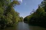
Alluvial landscape along the Laßnitz and Sulm rivers | NSG 87 c | Leibnitz |
Ehrenhausen an der Weinstrasse , Wagna KG: Aflenz, Unterlupitscheni, Wagna location |
54.33 ha | 1995 | |
|
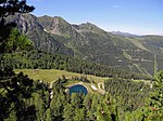
Kaiblingalm - Kaiblingloch | NSG 88 c | Liezen |
House KG: House GrStNr: 526/1; 526/27; 526/28; 531 location |
102.21 ha | 1996 | |

|
Three moor areas in the KG Bad Mitterndorf "Moor near Oberst Schmid Ruhe", "Nagelmoos" and "Borzen" | NSG 89 c | Liezen |
Bad Mitterndorf KG: Mitterndorf GrStNr: 2135/2; 2163/1; 2163/3 location |
8.27 hectares | 1996 | |

|
Sections of the "Häuselberg" | NSG 90 c | Leoben |
Leoben KG: Leitendorf GrStNr: 142/1; 143; 147/4; 182/1; 182/2 location |
6.34 hectares | 1997 | |

|
Quarry site in the KG Stein | NSG 91 c | Hartberg-Fürstenfeld |
Bad Loipersdorf KG: Stein GrStNr: 506/1; 506/2; 509/2; 509/3 location |
2.17 ha | 1996 | |

|
Zigeunerloch in the local mountain Gratkorn | NSG 92 c | Graz area |
Gratkorn KG: Kirchenviertel, Friesach-St. Stefan GrStNr: 673/1; 697/2 location |
0.8 ha | 1998 | |

|
Dry rock grass at the "Neusiedler Ofen" KG Lassing | NSG 93 c | Liezen |
Lassing KG: Lassing Sonnseite GrStNr: 591/1; 597 location |
0.41 ha | 1999 | |

|
"Enzianwiese" in the area of the Masenberg |
NSG 94 c WDPA |
Hartberg-Fürstenfeld |
Pöllauberg KG: Oberneuberg GrStNr: 17; 18 location |
0.91 ha | 2000 | |

|
Peggauer Wall | NSG 95 c | Graz area |
Peggau KG: Peggau GrStNr: 483/1; 501/1; 501/3; 501/6; 501/7 location |
38.76 hectares | 2000 | |

|
Alpine pastures in the Trenchtling area | NSG 96 c | Bruck-Mürzzuschlag |
Tragöß-Sankt Katharein KG: Schattenberg GrStNr: 970/1; 970/2; 970/3; 970/4; 966/2; 967; 968 location |
154.28 ha | 2003 | |

|
Feuchtwiese Niedermoor in KG Haselsdorf | NSG 97 c | Graz area |
Haselsdorf-Tobelbad KG: Haselsdorf GrStNr: 569/1 location |
0.63 ha | 2004 | |

|
Plant protection area KG Staudach | NSG 98 c | Hartberg-Fürstenfeld |
Greinbach KG: Staudach GrStNr: 150; 151 location |
1.72 ha | ||

|
Migratory bird sanctuary KG Leitersdorf | NSG 99 c | Hartberg-Fürstenfeld |
Bad Waltersdorf KG: Leitersdorf GrStNr: 3932; 3933; 3949; 3950; 3951; 3952; 3956; 3957: 3958; 3959; 3960 location |
6.13 ha | 2006 | |

|
Riel pond | NSG 100 c | Graz |
Graz KG: Andritz GrStNr: 134/12; 134/13; 145/15; 145/16; 148/1; 148/2 location |
1.49 ha | 1979 | |

|
Spring knot flowers from parts of the Fronius floodplains | NSG 101 c | Hartberg-Fürstenfeld |
Fürstenfeld KG: Fürstenfeld GrStNr: 1437/2; 1439/3 location |
1.56 ha | 2008 | |

|
Mariatrost tunnel system | NSG 102 c | Graz |
Graz KG: Graz Stadt-Fölling GrStNr: 12; 13 location |
Tunnel system under the staircase to the Mariatrosterkirche. The northern entrance is walled up, the southwestern one is on private property. Occurrence of lesser horseshoe bat , greater horseshoe nose , Daubenton's bat , Big Bart bat , Geoffroy's bat , greater mouse-eared , pipistrelle , Pipistrelle , Barbastelle . | 0.53 ha | 2009 |

|
Parts of the Saubach including the banks | NSG 103 c | Deutschlandsberg |
Wettmannstätten KG: Wohlsdorf GrStNr: 333 location |
0.86 ha | 2009 | |

|
Friesacher Au | NSG 104 c | Liezen |
Aich , Michaelerberg-Pruggern KG: Aich, Gössenberg, Pruggern GrStNr: 715/6; 1192/1; 1192/2; 1197; 1198; 1585/1; 1588; 2076/1; 2076/3; 2089/1 location |
21.72 hectares | 2010 | |

|
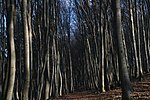
Bullmanngrund biotope reserve | NSG 105 c | Graz |
Graz KG: Wenisbuch GrStNr: 948/1; 948/4; 950/1 location |
0.75 ha | 2013 | |
|
Wildoner Buchkogel | NSG 106 c | Leibnitz |
Hengsberg , Lang , Lebring-Sankt Margarethen , Wildon KG: St. Margareten, Stangersdorf, Schönberg, Unterhaus location |
329.52 hectares | 2013 | |
| Meadow landscape between Weißenbach and Aich-Assach | NSG 107 c | Liezen |
House , Aigen im Ennstal KG: Aich, Ennsling, Weißenbach location |
Note: NSG 107 c adjoins NSG 104 c immediately to the west . |
20.18 ha | 2015 | |

|
Weinzödl bird sanctuary | NSG 108 c | Graz |
Graz KG: Graz City-St. Veit ob Graz, Andritz location |
73.03 hectares | 2017 |
swell
- Nature reserves lit. a (Styrian Nature Conservation Act § 5 Paragraph 2 lit. a). Alpine landscapes, mountains, lakes and rivers. Retrieved on August 13, 2017 (ogd ec99cc80-3559-11e2-81c1-0800200c9a66 . Data source: CC-BY-3.0-AT: Land Steiermark - data.steiermark.gv.at).
- Nature reserves lit. b (Styrian Nature Conservation Act § 5 Paragraph 2 lit.b) Remnants of primeval forest, moors, boggy areas or swamps. Retrieved on August 13, 2017 (ogd 79a097c0-355b-11e2-81c1-0800200c9a66 . Data source: CC-BY-3.0-AT: Land Steiermark - data.steiermark.gv.at).
- Nature reserves lit. c (Styrian Nature Conservation Act § 5 Paragraph 2 lit. c). Locations and demarcated habitats of plants or animal species that are worthy of protection or endangered (plants or animal protection area). Retrieved on August 13, 2017 (ogd fc2b6b60-3561-11e2-81c1-0800200c9a66 . Data source: CC-BY-3.0-AT: Land Steiermark - data.steiermark.gv.at).
Web links
Commons : Nature reserves in Styria - collection of images, videos and audio files
Individual evidence
- ↑ Law of 30 June 1976 on the protection of nature and the care of the landscape (Styrian Nature Conservation Act 1976 - NschG 1976) LGBl. No. 65/1976
- ↑ Nature reserves in general. In: Administration of Styria ›Steir. Protected Areas ›Nature Reserves. Office of the Styrian Provincial Government, FA13C-Naturschutz, accessed on May 30, 2010 .
- ↑ Biogeophysical reserves , Digital Atlas Styria: NSGA, NSGB, NSGC
- ↑ NSG-a01 Gesäuse and subsequent Ennstal to the state border. In: Administration of the State of Styria. Retrieved May 9, 2014 .
- ↑ NSG-a02 Wildalpener Salzatal. In: Administration of the State of Styria. Retrieved May 9, 2014 .
- ↑ NSG a03 Altausseersee. In: Administration of the State of Styria. Retrieved May 9, 2014 .
- ↑ NSG a05 Ödensee. In: Administration of the State of Styria. Retrieved May 9, 2014 .
- ↑ Styria, rich in bog; H. Matz and J. Gepp 2008; ISBN 978-3-9501292-6-7
- ↑ Styria, rich in bog; H. Matz and J. Gepp 2008; ISBN 978-3-9501292-6-7
- ↑ Styria, rich in bog; H. Matz and J. Gepp 2008; ISBN 978-3-9501292-6-7
- ↑ NSG-c02 north-west. Part of the municipality of Ramsau am Dachstein. In: Administration of the State of Styria. Retrieved August 13, 2017 .
- ↑ NSG c24 location of the Krainer Toll herb in Dürnstein. In: Administration of the State of Styria. Retrieved August 14, 2017 .