| photo
|
|
Surname
|
ID
|
district
|
Location
|
description
|
surface
|
date
|
1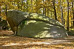
|


|
Blockheide-Eibenstein
|
011
|
Gmuend
|
Gmünd
location
|
f1
|
106 ha
|
|
1
|

|
Braunsberg-Hundsheimerberg
|
022
|
Bruck an der Leitha
|
Hainburg an der Donau , Hundsheim
location
|
f1
|
192 ha
|
|
1
|


|
Eichkogel
|
033
|
Mödling
|
Guntramsdorf , Mödling
location
|
f1
|
68 ha
|
|
1
|

|
Falkenstein
|
044th
|
Neunkirchen
|
Schwarzau in the mountains
location
|
NPK 3 (same area); in ESG AT1212A00 (FFH) Randalpen and LSG 12 Rax – Schneeberg
|
16.9 ha
|
|
|
0BW
|

|
Geras
|
055
|
horn
|
Drosendorf-Zissersdorf , Geras
location
|
|
126.6 ha
|
|
1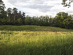
|


|
Lassee
|
066th
|
Gänserndorf
|
Lassee
location
|
|
1.39 ha
|
|
1
|


|
Lechnergraben
|
077th
|
Scheibbs
|
Lunz am See
location
|
|
247.63 ha
|
|
1
|


|
Lower Marchauen
|
088th
|
Gänserndorf
|
Marchegg
location
|
f1
|
12 km²
|
|
1
|


|
Muhlberg
|
099
|
Hollabrunn
|
Sitzendorf at the Schmida
location
|
f1
|
1.01 ha
|
|
1
|


|
Pischelsdorf meadows
|
1010
|
Bruck an der Leitha
|
Götzendorf an der Leitha
location
|
f1
|
10.39 hectares
|
|
1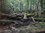
|


|
Rothwald I
|
1111
|
Scheibbs
|
Gaming
location
|
|
271.16 hectares
|
|
1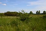
|


|
Salt steppe Baumgarten on the March
|
1212
|
Gänserndorf
|
Willows at the March
site
|
|
11.6 ha
|
|
1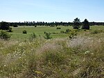
|


|
Sand mountains Oberweiden
|
1313
|
Gänserndorf
|
Willows at the March
site
|
f1
|
117 ha
|
|
1
|

|
Stockgrund-Kothbergtal
|
14th14th
|
Scheibbs
|
Lunz am See
location
|
|
57.8 ha
|
|
1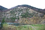
|


|
Teufelstein fishing meadows
|
15th15th
|
Mödling
|
Kaltenleutbaren , Perchtoldsdorf
location
|
f1
|
46.22 ha
|
|
1
|


|
Weikendorfer Remise
|
1616
|
Gänserndorf
|
Weikendorf
location
|
f1
|
192 ha
|
|
1
|


|
Wörth Island
|
17th17th
|
Amstetten
|
Neustadtl an der Donau
location
|
f1
|
17.7 ha
|
|
1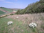
|


|
Zeiserlberg
|
18th18th
|
Mistelbach
|
Falkenstein
location
|
f1
|
2.6 ha
|
|
1
|


|
Glaslauterriegel-Heferlberg
|
19th19th
|
to bathe
|
Pfaffstätten
location
|
|
29.3 ha
|
|
1
|


|
Lobau-Schüttelau-Schönauer heap
|
20th20th
|
Gänserndorf
|
Groß-Enzersdorf
location
|
f1
|
530 hectares
|
|
1
|


|
Gurhofgraben
|
21st21st
|
Melk
|
Dunkelsteinerwald
location
|
|
7 ha
|
|
1
|


|
Obersiebenbrunn Palace Park
|
22nd22nd
|
Gänserndorf
|
Obersiebenbrunn
location
|
also park and garden facility No. 17 DMSG , list of monuments 6407 Obersiebenbrunn Castle Park (formerly Baroque hunting park)
|
45.46 ha
|
|
1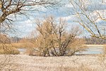
|


|
Little Breitensee
|
2323
|
Gänserndorf
|
Marchegg
location
|
|
13 ha
|
|
1
|


|
Schönau pond
|
2424
|
to bathe
|
Schönau an der Triesting
location
|
|
59.45 ha
|
|
1
|


|
Mandatory Glauber's salt soils
|
25th25th
|
Mistelbach
|
Grossharra's
location
|
f1
|
4.73 ha
|
|
1
|


|
Bruneiteich
|
26th26th
|
Gmuend
|
Heidenreichstein
location
|
|
60.4 ha
|
|
1
|


|
Gebhartsteich
|
2727
|
Gmuend
|
Schrems
location
|
|
65 ha
|
|
|
0BW
|

|
Limestone cliff Oberpiesting
|
2828
|
Wiener Neustadt
|
Waldegg
location
|
|
4.2 ha
|
|
|
0BW
|

|
Lime gravel steppe Obereggendorf
|
2929
|
Wiener Neustadt
|
Eggendorf
location
|
|
10.1 ha
|
|
1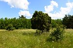
|


|
Juniper heather Obersiebenbrunn
|
30th30th
|
Gänserndorf
|
Obersiebenbrunn
location
|
|
37 ha
|
|
1
|


|
Community office
|
3131
|
Gmuend
|
Heidenreichstein
location
|
f1
|
30 ha
|
|
1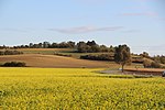
|


|
Goldberg
|
3232
|
to bathe
|
Reisenberg
location
|
|
4.12 hectares
|
|
1
|


|
Karl donors Moore
|
3333
|
Gmuend
|
Bad Großpertholz
location
|
|
61.1 ha
|
|
|
0BW
|

|
Wieselthaler stone wall
|
3434
|
to bathe
|
Furth an der Triesting
location
|
|
60.2 ha
|
|
1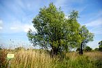
|


|
Schleinitzbach lowlands
|
3535
|
Hollabrunn
|
Maissau
location
|
f1
|
14.4 ha
|
|
1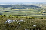
|

|
Spitzerberg
|
3636
|
Bruck an der Leitha
|
Hundsheim
location
|
f1
|
227.4 ha
|
|
|
0BW
|

|
Rabensburg Thaya floodplains
|
3737
|
Mistelbach
|
Rabensburg
location
|
|
365 hectares
|
|
1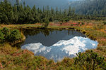
|


|
Sweet moss
|
3838
|
Scheibbs
|
Göstling at the Ybbs
location
|
|
25.03 hectares
|
|
1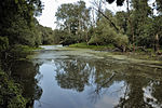
|


|
Angerner and Dürnkruter Marchschlingen
|
3939
|
Gänserndorf
|
Angern an der March , Dürnkrut
location
|
|
80 ha
|
|
1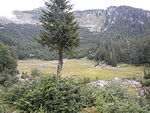
|


|
Rothwald II
|
4040
|
Scheibbs
|
Gaming
location
|
|
271.16 hectares
|
|
1
|

|
Thayatal
|
4141
|
Hollabrunn
|
Hardegg
location
|
|
820.2 ha
|
|
|
0BW
|

|
Hochau
|
4242
|
Amstetten
|
Ardagger
location
|
|
3.7 ha
|
|
1
|


|
Melon Au
|
4343
|
Zwettl
|
Altmelon
location
|
|
163.2 ha
|
|
|
0BW
|

|
Rothwald III
|
4444
|
Scheibbs
|
Gaming , Lunz am See
location
|
|
567 ha
|
|
1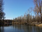
|


|
Stockerau Au
|
4545
|
Korneuburg
|
Location
|
f1
|
408.5 ha
|
|
1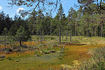
|


|
Rottalmoss
|
4646
|
Gmuend
|
Litschau
location
|
f1
|
10.96 ha
|
|
1
|


|
Schremser Hochmoor
|
4747
|
Gmuend
|
Schrems
location
|
f1
|
107 ha
|
|
1
|


|
Lainsitz valley
|
4848
|
Gmuend
|
Gmünd
location
|
|
134.9 ha
|
|
|
0BW
|

|
Hound
|
4949
|
Scheibbs
|
Göstling at the Ybbs
location
|
|
12 km²
|
|
1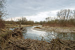
|


|
Pielach-Mühlau
|
5050
|
Sankt Pölten
|
Markersdorf-Haindorf
location
|
|
35.55 hectares
|
|
1
|


|
Pielach-Ofenloch-Neubacher Au
|
5151
|
Melk
|
Dunkelsteinerwald , Loosdorf , Melk
location
|
|
73.17 ha
|
|
1
|


|
Höhereck
|
5252
|
Krems
|
Dürnstein
location
|
|
10.5 ha
|
|
1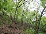
|

|
Gochelberg - Dead Mountain
|
5353
|
Krems
|
Rossatz-Arnsdorf
location
|
|
63.8 ha
|
|
|
0BW
|

|
Stony ream
|
5454
|
Krems
|
Rossatz-Arnsdorf
location
|
|
74.38 ha
|
|
1
|


|
Altenberg
|
5555
|
Tulln
|
St. Andrä-Wölker
location
|
|
106 ha
|
|
1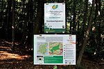
|

|
Mauerbach-Dombachgraben
|
5656
|
St. Pölten , Tulln
|
Klosterneuburg , Mauerbach
location
|
|
325.3 ha
|
|
1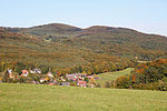
|


|
Troppberg
|
5757
|
St. Polten
|
Gablitz , Pressbaum
location
|
f1
|
564.5 ha
|
|
1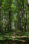
|


|
Saddle buns
|
5858
|
St. Polten
|
Pressbaum , Purkersdorf , Wolfsgraben
location
|
The nature reserve includes both the Speichberg and the Feuersteinberg between Neu-Purkersdorf and Baunzen (325 hectares) as well as the rear saddle near Pressbaum. The two areas belong to the 37 core zones of the Vienna Woods Biosphere Reserve.
|
508.32 ha
|
|
1
|

|
Schwarzlacken-Festenberg-Dorotheerwald
|
5959
|
Mödling
|
Breitenfurt near Vienna , Wienerwald (municipality)
location
|
|
475.93 ha
|
|
|
0BW
|

|
Hainbach-Hengstlberg
|
6060
|
Baden , Mödling , St. Pölten
|
Klausen-Leopoldsdorf , Wienerwald (municipality) , Wolfsgraben
location
|
|
441 ha
|
|
|
0BW
|

|
Gießhübl-Kiental East and West-Wassergspreng-Anninger Tieftal
|
6161
|
Mödling
|
Gaaden , Gießhübl , Hinterbrühl , Kaltenleutgabe
location
|
The areas listed are not contiguous and belong to the core zone of the Vienna Woods Biosphere Reserve ,
|
429 ha
|
|
1
|


|
High Lindkogel-Helenental
|
6262
|
to bathe
|
Alland , Bad Vöslau , Heiligenkreuz , Sooss
location
|
|
15 km²
|
|
1
|

|
Vineyard Höherberg
|
6363
|
to bathe
|
Alland
location
|
|
83 ha
|
|
|
0BW
|

|
Mitterschöpfl-Hirschenstein
|
6464
|
to bathe
|
Altenmarkt an der Triesting , Klausen-Leopoldsdorf
location
|
|
383.6 ha
|
|
|
0BW
|

|
Rauchbuchberg
|
6565
|
Tulln
|
Tulbing
location
|
|
22.1 ha
|
|
|
0BW
|

|
Grimsinger Au
|
6666
|
Melk
|
Emmersdorf an der Donau
location
|
|
21.98 ha
|
|
|
0BW
|

|
Buchberg
|
6767
|
Krems
|
Spitz an der Donau
location
|
|
19 ha
|
|
1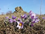
|


|
Fehhaube Kogelstein
|
6868
|
horn
|
Eggenburg , Straning-Grafenberg
location
|
f1
|
2.5 ha
|
|
|
0BW
|

|
Judgment Hill
|
6969
|
Marchegg
|
Gänserndorf
KG: Marchegg
GrStNr: 1666, 1668/1
location
|
|
6 ha
|
|
1
|


|
Earth press height
|
7070
|
Gänserndorf
|
Lassee
location
|
|
5.07 ha
|
|
|
0BW
|

|
In the sand mountains
|
7171
|
Gänserndorf
|
Any
location
|
|
5.08 ha
|
|
1
|


|
Windmill
|
7272
|
Gänserndorf
|
Lassee
location
|
|
3.39 hectares
|
|
1
|

|
Pielach estuary stone wall
|
7373
|
Melk
|
Emmersdorf an der Donau , Schönbühel-Aggsbach , Melk
location
|
|
27.67 hectares
|
|


