
Willows on the March
|
Willows on the March
|
||
|---|---|---|
| coat of arms | Austria map | |
 |
|
|
| Basic data | ||
| Country: | Austria | |
| State : | Lower Austria | |
| Political District : | Gänserndorf | |
| License plate : | GF | |
| Main town : | Oberweiden | |
| Surface: | 55.87 km² | |
| Coordinates : | 48 ° 18 ' N , 16 ° 49' E | |
| Height : | 162 m above sea level A. | |
| Residents : | 996 (January 1, 2020) | |
| Population density : | 18 inhabitants per km² | |
| Postal code : | 2295 | |
| Area code : | 02284 | |
| Community code : | 3 08 65 | |
| NUTS region | AT126 | |
| Address of the municipal administration: |
Oberweiden 25 2295 Weiden an der March |
|
| Website: | ||
| politics | ||
| Mayor : | Markus Lang ( ÖVP ) | |
|
Municipal Council : ( 2020 ) (15 members) |
||
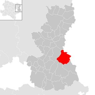
| Location of Weiden an der March in the Gänserndorf district | ||
  |
||
| Source: Municipal data from Statistics Austria | ||

Weiden an der March is a municipality in the Gänserndorf district in Lower Austria with 996 inhabitants (as of January 1, 2020).
geography

Weiden an der March is located in the Weinviertel in Lower Austria . The area of the municipality covers 55.8 square kilometers. 19.63 percent of the area is forested.
Community structure
The municipality includes the following three localities (population in brackets as of January 1, 2020):
- Baumgarten an der March (188), (Croatian Pangort na Moravi)
- Oberweiden (439)
- Zwerndorf (369), (Croatian Cvendrof)
The community consists of the cadastral communities Baumgarten an der March, Oberweiden and Zwerndorf. The large community of Weiden an der March was founded on January 1, 1975, when the three towns of Baumgarten, Oberweiden and Zwerndorf merged.
Neighboring communities
| Angern on the March | ||
| Weikendorf |
.svg)
|
Malacky (Slovakia) |
| Untersiebenbrunn | Lassee | Marchegg |
history
In this area, finds from the early Paleolithic were made, about 800,000 years old rubble tools of Homo erectus.
Population development
| census | Residents |
|---|---|
| 2011 | 985 |
| 2001 | 904 |
| 1991 | 822 |
| 1981 | 854 |
| 1971 | 921 |
| 1939 | 1484 |
| 1869 | 1184 |
Source: Population development of Weiden an der March. (PDF) Statistics Austria
In the Popreg database for the year 2009 942 inhabitants were determined. According to the results of the 2001 census, there were 904 inhabitants. Since the 1991 census, the number of inhabitants in the municipality and in the district of Gänserndorf has increased.
Religions
About 96% of the residents of Weiden are Roman Catholic . The churches of Weiden are among the oldest in the Gänserndorf district .
politics
The municipal council has 15 members.
- With the municipal council elections in Lower Austria in 1990, the municipal council had the following distribution: 13 ÖVP and 2 SPÖ.
- With the municipal council elections in Lower Austria in 1995, the municipal council had the following distribution: 11 ÖVP, 2 SPÖ and 2 FPÖ.
- With the municipal council elections in Lower Austria in 2000, the municipal council had the following distribution: 12 ÖVP, 2 SPÖ and 1 FPÖ.
- With the municipal council elections in Lower Austria in 2005 , the municipal council had the following distribution: 12 ÖVP and 3 SPÖ.
- With the municipal council elections in Lower Austria 2010 , the municipal council had the following distribution: 11 ÖVP and 4 SPÖ.
- With the municipal council elections in Lower Austria in 2015 , the municipal council had the following distribution: 12 ÖVP and 3 SPÖ.
- With the municipal council elections in Lower Austria 2020 , the municipal council has the following distribution: 13 ÖVP and 2 SPÖ.
- mayor
- 1975–1980 Josef Schultes
- 1980–1995 Walter Hansi (ÖVP)
- 1995–1999 Franz Denk (ÖVP)
- 1999–2005 Josef Bubenicek (ÖVP)
- 2005–2010 Josef Dienst (ÖVP)
- 2010–2019 Franz Neduchal (ÖVP)
- since 2019 Markus Lang (ÖVP)
Culture and sights


- Catholic branch church Baumgarten an der March hl. Markus
- Catholic parish church Oberweiden hl. Leopold
- Catholic parish church Zwerndorf hl. Pancras
Nature and conservation
The sand mountains of Oberweiden extend over an area of around 117 hectares, where rare species, some of which are threatened with extinction in Austria, such as the sand straw flower ( Helichrysum arenarium ), the sand radmelde ( Bassia laniflora ), the late carnation ( Dianthus serotinus ) and the sand plantain ( Plantago arenaria ) grow.
In Zwerndorf and Baumgarten there are alluvial forests with the Marchauen nature reserve for hiking. The Kamp-Thaya-March cycle route and the March panorama path lead through the municipality. There is a swimming pond in Zwerndorf.
- FFH area Pannonian sand dunes
- Sandboden bird sanctuary and Prater terrace
- March-Thaya-Auen European Protected Areas
- March-Thaya-Auen bird sanctuary
- Sandberge Oberweiden nature reserve
- Salzsteppe nature reserve Baumgarten an der March
economy
In 2001 there were 26 non-agricultural workplaces, agricultural and forestry operations 90 according to the 1999 survey. According to the 2001 census, the number of people in employment at home was 403. The 2001 participation rate was 45.79 percent.
- Natural gas storage facility: In 1952 the largest natural gas storage facility in Austria was developed here. During the first drilling, a gas eruption occurred on March 15, 1952, as a result of which the entire drilling rig was destroyed and sank into a crater that was forming. As a result, the outbreak could no longer be brought under control with conventional means. By three to the eruption site of Soviet Turbinenbohrbrigaden down placed directional drilling , of which m in 1295 depth encountered misfortune well and then Totpumpen so-called natural gas outburst after 11 months, in which an estimated one billion cubic meters of natural gas flowed from uncontrolled, could be completed. This application represents the first application of turbine drilling technology outside of the Soviet Union. The natural gas-bearing layers of the Zwerndorf gas field are located at depths of 650 to 2753 m. Most of the gas, however, is in a sandstone layer at a depth of 1410 to 1500 m. By 1992, 12.3 billion cubic meters of natural gas had been produced from the Zwerndorf-Baumgarten storage complex. The extracted natural gas reaches the central distribution point in the Baumgarten district , into which several natural gas pipelines also flow, making it one of the most important European distribution centers for natural gas.
traffic
- Train: The Oberweiden train station is in the village of Oberweiden, where the regional trains on the Gänserndorf – Marchegg line stop .

Web links
- 30865 - Weiden an der March. Community data, Statistics Austria .
Individual evidence
- ↑ Statistics Austria: Population on January 1st, 2020 by locality (area status on January 1st, 2020) , ( CSV )
- ↑ a b Nikolaus Wilhelm-Stempin: The settlement area of the Burgenland Croats . Ed .: Books on Demand GmbH, Norderstedt.
- ↑ Scientific Mitt. Niederösterr. Landesmuseum - 9 - 231-245 Vienna 1996
- ^ Result of the municipal council election 1995 in Weiden an der March. Office of the Lower Austrian State Government, March 30, 2000, accessed on March 2, 2020 .
- ^ Election result of the municipal council election 2000 in Weiden an der March. Office of the Lower Austrian State Government, February 4, 2005, accessed on March 2, 2020 .
- ^ Election result of the municipal council election 2005 in Weiden an der March. Office of the Lower Austrian State Government, March 4, 2005, accessed on March 2, 2020 .
- ^ Election result of the municipal council election 2010 in Weiden an der March. Office of the Lower Austrian State Government, October 8, 2010, accessed on March 2, 2020 .
- ^ Election results for the 2015 municipal council election in Weiden an der March. Office of the Lower Austrian State Government, December 1, 2015, accessed on March 2, 2020 .
- ↑ Results of the municipal council election 2020 in Weiden an der March. Office of the Lower Austrian State Government, January 26, 2020, accessed on March 2, 2020 .
- ↑ Area description of the Pannonian sand dunes / sandy soil and Praterterrasse ( Memento from January 8, 2016 in the Internet Archive ) (PDF)
- ↑ Area description March-Thaya-Auen ( page no longer available , search in web archives ) Info: The link was automatically marked as defective. Please check the link according to the instructions and then remove this notice. (PDF)
- ↑ Ordinance on nature reserves ( Memento from February 19, 2014 in the Internet Archive )

Aderklaa | Andlersdorf | Angern an der March | Auersthal | Bad Pirawarth | Deutsch-Wagram | Drösing | Dürnkrut | Ebenthal | Eckartsau | Engelhartstetten | Gänserndorf | Glinzendorf | Groß-Enzersdorf | Groß-Schweinbarth | Großhofen | Haringsee | House churches | Hohenau an der March | Hohenruppersdorf | Jedenspeigen | Lassee | Leopoldsdorf im Marchfelde | Mannsdorf on the Danube | Marchegg | Markgrafneusiedl | Matzen-Raggendorf | Neusiedl an der Zaya | Obersiebenbrunn | Orth on the Danube | Palterndorf-Dobermannsdorf | Parbasdorf | Prottes | Raasdorf | Ringelsdorf-Niederabsdorf | Schönkirchen-Reyersdorf | Spannberg | Strasshof an der Nordbahn | Sulz in the Weinviertel | Untersiebenbrunn | Velm-Götzendorf | Willows on the March | Weikendorf | Zistersdorf
Cadastral communities: Baumgarten an der March | Oberweiden | Zwerndorf
Locations: Baumgarten an der March | Oberweiden | Zwerndorf
Villages: Baumgarten an der March | Oberweiden | Zwerndorf Settlements: Heuparz | Rohrwiese | Sandparz Other locations: gas collecting station
Counting district: Oberweiden | Zwerndorf | Baumgarten on the March