
Parbasdorf
|
Parbasdorf
|
||
|---|---|---|
| coat of arms | Austria map | |
 |
|
|
| Basic data | ||
| Country: | Austria | |
| State : | Lower Austria | |
| Political District : | Gänserndorf | |
| License plate : | GF | |
| Surface: | 10.23 km² | |
| Coordinates : | 48 ° 17 ' N , 16 ° 35' E | |
| Height : | 156 m above sea level A. | |
| Residents : | 163 (January 1, 2020) | |
| Postal code : | 2232 | |
| Area code : | 02247 | |
| Community code : | 3 08 46 | |
| NUTS region | AT126 | |
| Address of the municipal administration: |
Parbasdorf 32 2232 Parbasdorf |
|
| Website: | ||
| politics | ||
| Mayor : | Gregor Iser ( ÖVP ) | |
|
Municipal Council : ( 2020 ) (13 members) |
||
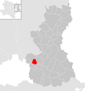
| Location of Parbasdorf in the Gänserndorf district | ||
  |
||
| Source: Municipal data from Statistics Austria | ||

Parbasdorf is a municipality with 163 inhabitants (as of January 1, 2020) in Marchfeld ( Gänserndorf district in Lower Austria ).
geography

Parbasdorf is located in the Weinviertel in Lower Austria. The area of the municipality covers 10.23 square kilometers. 1.74% of the area is forested.
The place is laid out as an anger village, through which the Rußbach flows and in the middle of which there is a small church. This form and the rural structure has been preserved to this day due to the seclusion.
Community structure
There is only the cadastral parish Parbasdorf.
Neighboring communities
.svg)
history
The name of the place changed over time: Perwolfesdorf (1180), Perwarsdorf (1250), Parwolfsdorf (1307), Perwolfdorf, Parweinsdorf (1324), Paerboltzdorf (1345), Perbleinsdorf (1431), Baumersdorf (1809)
Parbasdorf was sovereign , from the end of the 15th century it was desolate and the grounds broke. It was only re-donated towards the end of the 17th century. After that, the Wolkersdorf rulership was able to take over the jurisdiction .
In the battle of Wagram the place was badly affected. At noon on July 5, 1809, Napoleon ordered an advance against Parbasdorf. After a short time the place was in bright flames due to the use of 40 guns. The local brigade, under the command of Major General Ignaz Graf zu Hardegg , heroically defended itself against the attack led by General Oudinot , so that Hardegg was granted the recognition of Napoleon and the award of the Military Maria Theresa Order .
The historian Franz Xaver Schweickhardt describes the place in 1833 as follows: “A place in Marchfelde , which has 31 houses, is three hours away from the capital Vienna and of which the town of Enzersdorf is the mail and branch post office. The parish and school are referred to the parish in Markgrafneusiedl and with the advertising circle to the line infantry regiment No. 4. Regional court, land, local and conscription authority is the rule Wolkersdorf . "
In 1854 the benediction of the branch church belonging to the parish Markgrafneusiedl was approved. Since 1838 school lessons were held in the five winter months, a single-class schoolhouse was built in 1894 and closed in 1941.
The community archive was lost in 1945 when the retreating German troops of the Red Army invading from Markgrafneusiedl offered resistance. Most of the housing stock was preserved, even if it was badly damaged.
- Local judge
- Simon Iser 1751-1766
- Lorenz Iser 1787
- Mathhias Hahn 1813
- Community leader
- Johann Iser 1854
- mayor
- Andreas Tröster 1876
- Johann Iser 1884
- Lorenz Iser 1900
- Franz Wieland in 1925
- Wilhelm Iser 1929–1945
- Josef Kuttler 1945–1950
- Anton Mayer 1950–
- Josef Pregesbauer
- Johann Gössinger
Population development
According to the results of the 2001 census, there were 135 inhabitants. In 1991 the community had 110 inhabitants, in 1981 130 and in 1971 130 inhabitants.
politics
The municipal council has 13 members.
- With the municipal council elections in Lower Austria in 1990, the municipal council had the following distribution: 13 ÖVP.
- With the municipal council elections in Lower Austria in 1995, the municipal council had the following distribution: 13 ÖVP.
- With the municipal council elections in Lower Austria in 2000, the municipal council had the following distribution: 13 ÖVP.
- With the municipal council elections in Lower Austria in 2005 , the municipal council had the following distribution: 13 ÖVP.
- With the municipal council elections in Lower Austria 2010 , the municipal council had the following distribution: 13 ÖVP.
- With the municipal council elections in Lower Austria in 2015 , the municipal council had the following distribution: 13 ÖVP.
- With the municipal council elections in Lower Austria 2020 , the municipal council has the following distribution: 13 ÖVP.
- mayor
- until 2012 Wilhelm Iser (ÖVP)
- since 2012 Gregor Iser (ÖVP)
Culture and sights

- Catholic branch church Parbasdorf Hll. Trinity
economy
In 2001 there was only one (1) non-agricultural place of work, agricultural and forestry operations according to the 1999 survey 19. The number of people in employment at the place of residence was 64 according to the 2001 census. The 2001 activity rate was 51.85%.
literature
- Franz Xaver Schweickhardt : Representation of the Archduchy under the Enns. Vienna 1833
Web links
- 30846 - Parbasdorf. Community data, Statistics Austria .

Aderklaa | Andlersdorf | Angern an der March | Auersthal | Bad Pirawarth | Deutsch-Wagram | Drösing | Dürnkrut | Ebenthal | Eckartsau | Engelhartstetten | Gänserndorf | Glinzendorf | Groß-Enzersdorf | Groß-Schweinbarth | Großhofen | Haringsee | House churches | Hohenau an der March | Hohenruppersdorf | Jedenspeigen | Lassee | Leopoldsdorf im Marchfelde | Mannsdorf on the Danube | Marchegg | Markgrafneusiedl | Matzen-Raggendorf | Neusiedl an der Zaya | Obersiebenbrunn | Orth on the Danube | Palterndorf-Dobermannsdorf | Parbasdorf | Prottes | Raasdorf | Ringelsdorf-Niederabsdorf | Schönkirchen-Reyersdorf | Spannberg | Strasshof an der Nordbahn | Sulz in the Weinviertel | Untersiebenbrunn | Velm-Götzendorf | Willows on the March | Weikendorf | Zistersdorf
- ^ Result of the local council election 1995 in Parbasdorf. Office of the Lower Austrian State Government, March 30, 2000, accessed on February 28, 2020 .
- ^ Election result of the municipal council election 2000 in Parbasdorf. Office of the Lower Austrian State Government, February 4, 2005, accessed on February 28, 2020 .
- ^ Election result of the municipal council election 2005 in Parbasdorf. Office of the Lower Austrian State Government, March 4, 2005, accessed on February 28, 2020 .
- ^ Election result of the municipal council election 2010 in Parbasdorf. Office of the Lower Austrian State Government, October 8, 2010, accessed on February 28, 2020 .
- ↑ Election result of the municipal council election 2015 in Parbasdorf. Office of the Lower Austrian State Government, December 1, 2015, accessed on February 28, 2020 .
- ↑ Results of the municipal council election 2020 in Parbasdorf. Office of the Lower Austrian State Government, January 26, 2020, accessed on February 28, 2020 .