
Andlersdorf
|
Andlersdorf
|
||
|---|---|---|
| coat of arms | Austria map | |
 |
|
|
| Basic data | ||
| Country: | Austria | |
| State : | Lower Austria | |
| Political District : | Gänserndorf | |
| License plate : | GF | |
| Surface: | 5.9 km² | |
| Coordinates : | 48 ° 11 ′ N , 16 ° 40 ′ E | |
| Height : | 152 m above sea level A. | |
| Residents : | 141 (January 1, 2020) | |
| Population density : | 24 inhabitants per km² | |
| Postal code : | 2301 | |
| Area code : | 02215 | |
| Community code : | 3 08 02 | |
| NUTS region | AT126 | |
| Address of the municipal administration: |
Andlersdorf 22 2301 Andlersdorf |
|
| politics | ||
| Mayor : | Gerhard Paier (We for Andlersdorf) | |
|
Municipal Council : ( 2020 ) (13 members) |
||
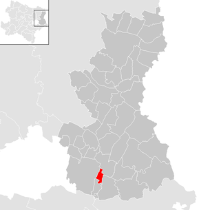
| Location of Andlersdorf in the Gänserndorf district | ||
  |
||
| Source: Municipal data from Statistics Austria | ||

Andlersdorf (Croatian Rozvrtnjak also: Stjevo) is a municipality with 141 inhabitants (as of January 1, 2020) in the Gänserndorf district in Lower Austria .
geography
The Breitstrasse village of Andlersdorf is located in the southern Marchfeld . The area of the municipality covers 5.9 square kilometers. 3.55 percent of the area is forested.
Community structure
There is only the cadastral community of Andlersdorf.
Neighboring communities
.svg)
history
Andlersdorf was first mentioned in a document in 1324.
From June 1944, the Andlershof estate administration used Hungarian Jews , including women and children, for forced labor on the farm.
Population development
The population in 2010 was 123 people. According to the results of the 2001 census, there were 118 inhabitants. In 1991 the community had 128 inhabitants, in 1981 131 and in 1971 119 inhabitants.
politics
The municipal council has 13 members.
- With the municipal council elections in Lower Austria in 1990, the municipal council had the following distribution: 7 ÖVP and 6 SPÖ.
- With the municipal council elections in Lower Austria in 1995, the municipal council had the following distribution: 7 ÖVP, 3 SPÖ and 3 WIR - We for Andlersdorf.
- With the municipal council elections in Lower Austria in 2000, the municipal council had the following distribution: 7 ÖVP, 4 WIR – We for Andlersdorf and 2 SPÖ.
- With the municipal council elections in Lower Austria in 2005 , the municipal council had the following distribution: 7 ÖVP, 4 WIR – We for Andlersdorf and 2 SPÖ.
- With the municipal council elections in Lower Austria in 2010 , the municipal council had the following distribution: 7 WIR - We for Andlersdorf, 5 ÖVP and 1 SPÖ.
- With the municipal elections in Lower Austria in 2015 , the municipal council had the following distribution: 7 WIR – We for Andlersdorf, 5 ÖVP and 1 SPÖ.
- With the municipal council elections in Lower Austria 2020 , the municipal council has the following distribution: 7 WIR – We for Andlersdorf, 5 ÖVP and 1 SPÖ.
- mayor
- until 2008 Johann Greiner (ÖVP)
- since 2008 Gerhard Paier (WIR)
Culture and sights

- Catholic branch church Andlersdorf Mariä Birth: The late Baroque church is in the northeast of the village. There is a large manor near the church, the main building of which has a facade from the first half of the 19th century.
economy
In 2001 there were two non-agricultural workplaces, agricultural and forestry operations according to the 1999 survey 14. The number of people in work at the place of residence was 54 according to the 2001 census. The activity rate was 45.76 percent.
literature
- Evelyn Benesch, Bernd Euler-Rolle , Claudia Haas, Renate Holzschuh-Hofer, Wolfgang Huber, Katharina Packpfeifer, Eva Maria Vancsa-Tironiek, Wolfgang Vogg: Lower Austria north of the Danube (= Dehio-Handbuch . Die Kunstdenkmäler Österreichs ). Anton Schroll & Co, Vienna et al. 1990, ISBN 3-7031-0652-2 , p. 44 .
Web links
- 30802 - Andlersdorf. Community data, Statistics Austria .
Individual evidence
- ^ Nikolaus Wilhelm-Stempin: The settlement area of the Burgenland Croats . Ed .: Books on Demand GmbH, Norderstedt.
- ↑ Forced Labor Camp Good Andlershof on tenhumbergreinhard.de
- ^ Result of the local council election 1995 in Andlersdorf. Office of the Lower Austrian State Government, March 30, 2000, accessed on February 12, 2020 .
- ^ Election result of the municipal council election 2000 in Andlersdorf. Office of the Lower Austrian State Government, February 4, 2005, accessed on February 12, 2020 .
- ^ Election result of the local council election 2005 in Andlersdorf. Office of the Lower Austrian State Government, March 4, 2005, accessed on February 12, 2020 .
- ^ Election result of the municipal council election 2010 in Andlersdorf. Office of the Lower Austrian State Government, October 8, 2010, accessed on February 12, 2020 .
- ^ Election results for the 2015 municipal council elections in Andlersdorf. Office of the Lower Austrian State Government, December 1, 2015, accessed on February 12, 2020 .
- ↑ Results of the municipal council election 2020 in Andlersdorf. Office of the Lower Austrian State Government, January 26, 2020, accessed on February 12, 2020 .

Aderklaa | Andlersdorf | Angern an der March | Auersthal | Bad Pirawarth | Deutsch-Wagram | Drösing | Dürnkrut | Ebenthal | Eckartsau | Engelhartstetten | Gänserndorf | Glinzendorf | Groß-Enzersdorf | Groß-Schweinbarth | Großhofen | Haringsee | House churches | Hohenau an der March | Hohenruppersdorf | Jedenspeigen | Lassee | Leopoldsdorf im Marchfelde | Mannsdorf on the Danube | Marchegg | Markgrafneusiedl | Matzen-Raggendorf | Neusiedl an der Zaya | Obersiebenbrunn | Orth on the Danube | Palterndorf-Dobermannsdorf | Parbasdorf | Prottes | Raasdorf | Ringelsdorf-Niederabsdorf | Schönkirchen-Reyersdorf | Spannberg | Strasshof an der Nordbahn | Sulz in the Weinviertel | Untersiebenbrunn | Velm-Götzendorf | Willows on the March | Weikendorf | Zistersdorf