
Passail
|
market community Passail
|
||
|---|---|---|
| coat of arms | Austria map | |
 |
|
|
| Basic data | ||
| Country: | Austria | |
| State : | Styria | |
| Political District : | Wheat | |
| License plate : | WZ | |
| Surface: | 84.91 km² | |
| Coordinates : | 47 ° 17 ' N , 15 ° 31' E | |
| Height : | 653 m above sea level A. | |
| Residents : | 4,414 (January 1, 2020) | |
| Postal code : | 8162 | |
| Area code : | 03179 | |
| Community code : | 6 17 63 | |
| NUTS region | AT224 | |
| Address of the municipal administration: |
Markt 1 8162 Passail |
|
| Website: | ||
| politics | ||
| Mayoress : | Eva Karrer ( SPÖ ) | |
|
Municipal Council : (2020) (21 members) |
||
| Location of Passail in the district of Weiz | ||
  |
||
| Source: Municipal data from Statistics Austria | ||

The market town of Passail with 4414 inhabitants (as of January 1, 2020) is located around 30 kilometers northeast of Graz in Styria ( Austria ). Passail is located in the judicial district and district of Weiz .
geography
Geographical location
Passail is part of the Almenland region and is located in the core of the Passail Basin in the Grazer Bergland at an altitude of 653 meters.
The Raab rises in the community. After leaving Austria, it flows into the Danube in Hungary . In the east, the municipality is partially bounded by the Weizbach , which leaves it in the south through the Weizklamm .
Community structure
The municipality is divided into twelve localities (population as of January 1, 2020):
- Amstein (80)
- Arzberg (502)
- Floodplains (229)
- Hard (206)
- Haufenreith (297)
- Back (12)
- Hohenau an der Raab (481)
- Krammersdorf (273)
- Oberneudorf (232)
- Passail (1493)
- Tober (287)
- Untereudorf (155)
The community consists of seven cadastral communities (area as of 2015):
- Arzberg (1,589.75 ha)
- Haufenreith (800.98 ha)
- Hohenau (2,312.70 ha)
- Kramersdorf (659.20 ha)
- Neudorf near Semriach (1,271.17 ha)
- Passail (724.15 ha)
- Tober (656.86 ha)
Incorporation and name changes
- On September 1, 1951, the community name was changed from Neudorf bei Semriach to " Neudorf bei Passail ".
- On January 1, 1952, the former community of Tober was incorporated into Fladnitz an der Teichalm .
- On January 1, 1968, the former communities of Haufenreith and Krammersdorf were incorporated into Hohenau an der Raab .
- On January 1, 2015, the former municipalities of Arzberg , Hohenau an der Raab and Neudorf bei Passail were incorporated as part of the municipal structural reform in Styria ,
- On January 1, 2020, the cadastral municipality of Plenzengreith will be separated from the municipality of Gutenberg-Stenzengreith and incorporated into the market municipality of Passail.
Neighboring communities
Two of the six neighboring communities are in the Graz-Umgebung district (GU).
| Fladnitz at the Teichalm | Sankt Kathrein am Offenegg | |
.svg)
|
Naas | |
| Semriach (GU) | Sankt Radegund near Graz (GU) | Gutenberg-Stenzengreith |
history
The discovery of a stone ax in the Tober reveals an early settlement in the Passail area on 3000 BC. Begin.
A Roman manor southwest of today's Passail market is believed to have existed in Roman times and five Roman stones are known for this area. One is walled in on the south side of the rectory.
After the Romans , Slavs settled in the Passail area . Passail is supposed to be derived from the Slavic basic word “Se (d) lo” with the preposition “Po” and means something like “near, next to, behind the settlement”, since the Slavic settlers already found a Roman court.
Different spellings of Passail were: Pozile, Pozeil, Puzeil, Possel, Poseyle, Posel, Bosaeil, Posewl, Puseyl, Passayl (13th to 16th century). The Slavic settlement is also reflected in the patronage of the parish church dedicated to St. Vitus , the patron saint of the Slavs. In Styria, such St. Vitus churches show a strong Slavic naming, so also in Liezen , Leoben , Veitsch , Paldau , Söchau or Pöllau .
Tober, on the other hand, was first called “Dobre” in 1240 and translated from Slavic means: “Gutwasser” as the river name and “fertile region” as the place name.
Finally, in the 12th century, Bavarian settlement began in the Passail area, from which the German names Hart (for wooded area) and Unter-Pircha (based on the birch trees) can be derived. Ultimately, the Stubenbergs inherited most of the Passailer kettle , which around 1200 sent peasant settlers and knightly clearing leaders here. Planned villages were created, first regular village settlements, then elongated forest hoof settlements and finally also remote individual farms. The later market town of Passail already played a central role because of the favorable settlement area.
The place Passail was first mentioned in a document on August 30, 1230. In a Stubenberg deed of donation, “Herbort von Pozile”, the steward and deputy of the Stubenberger in the Passail market, was named as a witness.
Passail Castle , which was the seat of the Lords of Passail, was located near today's Passail House . The market itself, around a rectangular square with small houses and properties, around 25 to 30 farmsteads, was founded between 1220 and 1240. The 120 m long and 40 m wide market square was one of the largest squares in Styrian markets and was not crossed by any cross streets along its entire length. Commercial life developed in the courtyards that surrounded the square. But the first documentary mention as "Markt Passail" was only in 1328.
In addition to the secular possessions, the diocese of Seckau , with the parish of Passail, had some possessions in Passail that were donated by Stubenbergers or their knightly people. In addition, other dominions had also acquired possessions:
- Stubenberg partial rule (Stubegg, Ober- and Unterkapfenberg)
- Non-Stubenberg gentlemen ( Freiberg , Stadl, Gösting )
- Ecclesiastical manors (parish Passail, parish Sankt Lorenzen im Mürzal , Bischofshof Seckau , monastery Rein )
In 1420 the market was divided. Ulrich von Stubenberg at Stubegg Castle near Arzberg got the western part of the market (today's Obergasse, Hauptplatz, Friedhofsweg) and Friedrich von Stubenberg got the eastern part on the newly built Sacher / Hechtlturm residence (former municipality of Hohenau an der Raab ).
In modern times, the properties became more fragmented, as Passail market citizens became owners. In 1328 there were 38 citizens in Passail, in 1527 there were already 70 town houses. In the 16th century there was a loss of population, which led to property concentrations (a citizen had several farms). The resurgence of the population is marked by the construction of the Annenkapelle on the Lindenberg, which was built in 1510 as thanks for the danger of the plague.
After the citizens had used up all natural reserves in the Passail area, the remote, manorial Wulkersbachwald in Bärental on the upper Raab (in the former municipality of Hohenau) was purchased in 1648 . In 1731/32 the Hundsberg was bought by the Stubegg lordship in order to obtain enough basic reserves for management. Until 1800 the market was only expanded by a few houses, in the 19th century the settlement area in the Lindenberg-Büchläcker area finally began. After 1945 the somewhat more distant Josefin settlement was built.
Since 1849 Passail, like every other political municipality, had its own mayor and an elected municipal council and also had its own market rights, i.e. the right to hold markets. In the 19th century there were always five annual markets ("Kirtage"), on Mathias Day (February 24), Maundy Thursday, St. Vitus's Day (June 15), St. Michael’s Day (September 29) and St. Thomas (December 21). From 1328 to 1848 there was also a market court in Passail.
The abolition of the manorial lords took place in 1848. The local community as an autonomous body was established in 1850. After the annexation of Austria in 1938, the community came to the Reichsgau Steiermark, 1945 to 1955 it was part of the British zone of occupation in Austria .
Population development

Religions

| religion | people | percentage |
|---|---|---|
| Roman Catholic Church | 1949 | 96.5% |
| Protestant church | 25th | 1.2% |
| Orthodox Church | 14th | 0.7% |
| Islam | 9 | 0.4% |
| no religious creed | 21st | 1.0% |
Culture and sights
- Parish Church of St. Vitus
- Rectory with Roman inscription stone
- Palm chapel, built in 1653, now a war memorial
- Filial church St. Anna am Lindenberg
- Marian column on the market square
- So-called nail smithy at No. 45, formerly a poor house, now a library
Economy and Infrastructure
The transport connection is provided by Rechbergstrasse B 64.
Together with Fladnitz an der Teichalm, Gasen, Breitenau am Hochlantsch, Pernegg an der Mur and St. Kathrein am Offenegg, the tourist association “ Naturpark Almenland Teichalm-Sommeralm ” forms. Its seat is in Fladnitz an der Teichalm.

Public facilities
- Passail has a kindergarten, an elementary school, a secondary school, a new middle school (NMS) and a polytechnic school.
- Leisure center with an 18-hole golf course together with the municipality of Fladnitz an der Teichalm .
- Retirement and nursing home with 38 beds.

Passail

New middle school
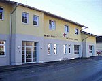
Red Cross, Passail branch

Passail fire station


politics
mayor
Mayor is Eva Karrer (SPÖ), who prevailed over the previous mayor and interim government commissioner Günter Linzberger (ÖVP) in the constituent meeting of the municipal council on April 27, 2015 with 11:10 votes.
The community board also includes the first vice mayor Günter Linzberger (ÖVP), the second vice mayor Johann Schrei (FPÖ), the community treasurer Peter Schinnerl (ÖVP) and board member Franz Kappmaier (ÖVP).
Municipal council
| The result of 2010 is a calculated value from the sum of the individual results of the merged municipalities. |
The municipal council consists of 21 members and is composed as follows after the 2015 municipal council elections:
The last municipal council elections brought the following results:
| Political party | Large community | Passail | ||||||||||
|---|---|---|---|---|---|---|---|---|---|---|---|---|
| 2015 | 2010 | 2005 | 2000 | |||||||||
| be right | % | M. | St. | % | M. | St. | % | M. | St. | % | M. | |
| ÖVP | 1381 | 46 | 10 | 930 | 68 | 11 | 804 | 58 | 9 | 883 | 66 | 11 |
| SPÖ | 912 | 30th | 6th | 321 | 23 | 3 | 452 | 33 | 5 | 231 | 17th | 2 |
| FPÖ | 710 | 24 | 5 | 81 | 6th | 1 | 129 | 9 | 1 | 142 | 11 | 1 |
| Passailer Citizen List | not running | 35 | 3 | 0 | not running | not running | ||||||
| The Green Passail | not running | not running | not running | 80 | 6th | 1 | ||||||
| voter turnout | 83% | 83% | 88% | 88% | ||||||||
coat of arms
- Coats of arms of the previous municipalities

Arzberg

Hohenau an der Raab

Neudorf near Passail


The coat of arms was awarded on December 15, 1639 by Emperor Ferdinand III.
The coat of arms description read:
- "Ainen Blaw, or glaze paints Schildt, in the bottom of which a white river, in between two high-rising rugged stone cliffs on the Schildts Rants sides, a particularly well-trained deer, of its natural color, with two open threads, each above with two identical, and next to down three Zinckhen, between the threads a white or silver-colored anchors placed upright, the ring turning around, through the same ain yellow, or gold-colored braids against which Linckhen makes appear more pervaded. "
Due to the amalgamation of municipalities, the coat of arms lost its official validity. The former communities of Arzberg , Hohenau an der Raab and Neudorf bei Passail had their own coat of arms until the end of 2014, for all descriptions see Wikipedia Commons .
The reassignment of the municipal coat of arms for the merged municipality Passail took place with effect from June 30, 2016.
The blazon reads:
- "Standing in a blue shield on a silver-flooded shield foot between silver shield flanks made of rugged, upwardly tapering rock walls is a golden stag, whose ten-pointed antlers enclose a silver fallen anchor with a golden braid pulled through the ring."
Personalities
Honorary citizen
- 1889: Andreas Volk, pastor
- 1912: Bernhard von Uechtritz
- 1932: Jakob Reisinger
- 1971: Johann Greimel, Mayor of Passail 1946–1970
- 1971: Franz Schinnerl, Vice Mayor
- 1978: Friedrich Niederl (1920–2012), Governor of Styria 1971–1980
- 1978: Anton Hable, local councilor
- 1979: Johann Sorger, community treasurer
- 1987: Josef Krainer (1930–2016), Governor of Styria 1980–1996
- 1997: Hans Freyka, principal school director
Personalities associated with Passail
- Franz Arnfelser (1846–1898), school director and composer
literature
- Bundesdenkmalamt (Ed.): Dehio manual. The art monuments of Austria: Styria (excluding Graz). Passail. Verlag Berger, Horn / Vienna 1982/2006, 2nd unchanged edition, pp. 351–354, ISBN 3-85028-422-0 .
- Gottfried Allmer , Gertrud Neurath , Eduard Weidl : Market community Passail. Publisher Marktgemeinde Passail, Passail 1994, 433 pages.
Web links
- 61763 - Passail. Community data, Statistics Austria .
- passail.at Website of the market town of Passail
- Passail main square as an interactive 360 ° panorama (Flash / Quicktime)
Individual evidence
- ↑ Statistics Austria: Population on January 1st, 2020 by locality (area status on January 1st, 2020) , ( CSV )
- ↑ cadastral communities Styria. 2015 (Excel file, 128 kB); Retrieved July 29, 2015
- ↑ LGBL. STMK. No. 045/1951
- ↑ LGBL. STMK. No. 065/1951
- ↑ LGBL. STMK. No. 150/1967
- ^ Styrian municipal structural reform . The basis for this is the Styrian Municipal Structural Reform Act - StGsrG of December 17, 2013 on the reorganization of the municipalities of the State of Styria, Section 3, Paragraph 11, 2nd State Law Gazette for Styria of April 2, 2014, No. 31, year 2014, ZDB -ID 705127-x , p. 4.
- ↑ 89. Announcement of the Styrian state government of November 7, 2019 on the change of the border between the community of Gutenberg-Stenzengreith and the market community of Passail, both political district of Weiz. ris.bka.gv.at, accessed on November 14, 2019.
- ^ Grazer Zeitung , Official Gazette for Styria. December 30, 2014, Volume 210, Issue 52, No. 313, ZDB -ID 1291268-2 , p. 628.
- ^ NMS Passail , accessed April 27, 2020
- ↑ Golfclub Almenland , accessed on April 27, 2020
- ↑ Kamillusheim , accessed on April 27, 2020
- ↑ a b Marktgemeinde Passail: New municipal council constituted , accessed on April 29, 2015.
- ↑ Communications from the Styrian State Archives 13, 1963, p. 81 f.
- ↑ 69. Announcement of the Styrian state government of June 16, 2016 on the granting of the right to use a municipal coat of arms to the market town of Passail (political district of Weiz) , accessed on June 30, 2016.
- ↑ Gottfried Allmer, Gertrud Neurath, Eduard Weidl: Marktgemeinde Passail. Passail 1994, pp. 237, 243.
- ^ Weizer Zeitung (May 13, 1997), p. 35.

Albersdorf-Prebuch | Anger | Birkfeld | Fischbach | Fladnitz an der Teichalm | Floing | Gases | Gersdorf an der Feistritz | Gleisdorf | Gutenberg-Stenzengreith | Hofstätten an der Raab | Ilztal | Ludersdorf-Wilfersdorf | Hartmannsdorf market | Miesenbach near Birkfeld | Mitterdorf an der Raab | Mortantsch | Naas | Passail | Pischelsdorf am Kulm | Puch near Weiz | Rats | Rettenegg | St. Kathrein am Hauenstein | Sankt Kathrein am Offenegg | St. Margarethen an der Raab | Sankt Ruprecht an der Raab | Sinabelkirchen | Strallegg | Thannhausen | Wheat