
Grobming
|
market community Grobming
|
||
|---|---|---|
| coat of arms | Austria map | |
 |
|
|
| Basic data | ||
| Country: | Austria | |
| State : | Styria | |
| Political District : | Liezen | |
| License plate : | GB | |
| Surface: | 66.48 km² | |
| Coordinates : | 47 ° 27 ' N , 13 ° 54' E | |
| Height : | 770 m above sea level A. | |
| Residents : | 3,085 (January 1, 2020) | |
| Postal code : | 8962 | |
| Area code : | 03685 | |
| Community code : | 6 12 13 | |
| NUTS region | AT222 | |
| UN / LOCODE | AT GBG | |
| Address of the municipal administration: |
Hauptstrasse 200 8962 Gröbming |
|
| Website: | ||
| politics | ||
| Mayor : | Thomas Reingruber ( SPÖ ) | |
|
Municipal Council : ( 2020 ) (21 members) |
||
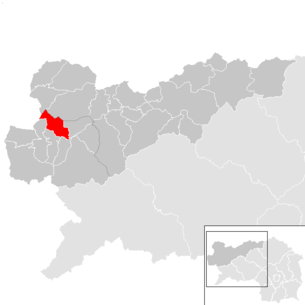
| Location of Gröbming in the Liezen district | ||
  |
||
| Source: Municipal data from Statistics Austria | ||

Gröbming is a market town with 3085 inhabitants (as of January 1, 2020) and the administrative seat of the Gröbming branch in the Liezen district ( Schladming judicial district ), in the Austrian state of Styria .
Gröbming is part of the Hallstatt – Dachstein / Salzkammergut cultural landscape UNESCO World Heritage Site .
geography

Gröbming is located on a hill in Ennstal , on the southeastern Dachsteinmassiv , the Kemet mountains , left the Enns .
The municipality extends along the Gröbmingbach up to the Dachstein plateau and up to the Upper Austrian border.
At 811 m, the Kulmleiten is a hill that connects directly to the settlement core .
climate
|
Average monthly temperatures and rainfall for Gröbming
|
|||||||||||||||||||||||||||||||||||||||||||||||||||||||||||||||||||||||||||||||||||||||||||||||||||||||||||||||||||||||||||||||||||||||||||||||||||||||||||||||||||||||||
Community structure

The only cadastral community and locality is Gröbming .
Counting districts are the Gröbming center for the main town and the Gröbming area, which includes the villages of Hofmanning, Klazenberg, Krahbergsiedlung, Oberwinkl, Thalhamm, Weyern and Winkl . Since the Liezen district is the largest in Austria in terms of area, a political exposition was set up in Gröbming for the upper Ennstal ( Politische Expositur Gröbming ). The responsible judicial district is Schladming .
Villages and hamlets are Beihügel , Hofmanning , Klazenberg (village), toll Dörfl , Upper Hill Village , Oberwinkl , furnaces , Stoderzinken village , Thal Hamm , Tischlmühle , Weyern and Winkl .
Neighboring communities
|
Obertraun ( District Gmunden , Upper Austria ) |
Bad Aussee | Bad Mitterndorf |
| House |
.svg)
|
Mitterberg-Sankt Martin |
| Aich | Michaelerberg-Pruggern |
history

A tombstone that is kept in the Catholic parish church has been preserved as evidence of Roman settlement .
From 700 to 1000 Slavs and Bavarians settled the region. Several farms were first mentioned in documents in the 11th century. During the Reformation , Grobming was evangelical.
The earliest written document is from 1139 and is "Grebin". The name goes back to the Slovenian greben (comb, ridge).
When Gröbming became an independent market town in the course of the abolition of the manors in 1848/49, it had had an unsecuritized market right for a long time .
Thousands of refugees stayed in Gröbming during the Second World War .
In 1947 the pastor Leopold Achberger from Gröbming was elected as the first superintendent of the newly founded Evangelical Superintendent of A. B. Styria . Until it was moved to Graz in 1951, his official seat was in Gröbming.
In 1979 a bypass was created.
coat of arms
- "Under blue shield main in dentil in silver field pole as two red lilies rods whose shanks bar-shaped twelve red Apostle crosses accompanied in two rows."
A Gröbming coat of arms can already be found in Schmutz 1822, where it shows a landscape image of a rock group with isolated spruce trees, in front of it a meadow with a brook flowing across the shield and two houses in the foreground. In Widimsky 1864 it shows white (silver) tombstones and grave crosses (instead of rocks and spruce trees), a white path (instead of the stream), chapel and tower-high building, white with red roofs, all on a green meadow under a blue sky.
Today's coat of arms shows two lilies rods as a sign of legal violence , twelve crosses for the apostle altar of the Catholic Church , the sky and the field separating dentil documents the Slavic language roots greben of the place name and the mountains .
The market town received today's coat of arms on July 11, 1994.
Capital of the municipality
|
Gröbming ( Main place a market town ) location gröbming Katastralgemeinde gröbming |
|
|---|---|
| Basic data | |
| Pole. District , state | Liezen , Styria |
| Pole. local community | Grobming |
| Coordinates | 47 ° 26 '43 " N , 13 ° 54' 4" E |
| height | 770 m above sea level A. |
| Residents of the village | 3085 (January 1, 2020) |
| Building status | 378 (2001 ) |
| Area d. KG | 66.48 |
| Statistical identification | |
| Locality code | 15772 |
| Cadastral parish number | 67202 |
| Counting district / district | Gröbming Center (61 213 000) |
 Gröbming from north to south, Michaelerberg in the background |
|
| Source: STAT : index of places ; BEV : GEONAM ; GIS-Stmk | |
The main town of the community is Markt Gröbming
The place is located on a plateau above the Enns , bounded by the Kammspitze in the north and the Stoderzinken with its Vorberg Kulm in the west, at around 770 m above sea level. A. Height. The Gröbmingbach turns north-east and forms a small side valley of the Enns, which leads to the Salza near St. Martin. The local mountain of the place is the Klapf Kulmleiten ( 811 m above sea level ) to the southeast. A steep step drops about 100 meters towards the Enns, so that there is a pass at the southern end of the village.
The B 320 Ennstal Straße bypasses the town in the south.
The place comprises almost 400 buildings with over 1,500 inhabitants (counting district Gröbming center ), i.e. half of the community population.
| Hofmanning | Krahbergsiedlung |
Neuhäusl (Gem. Mitterberg-Sankt Martin ) |
| Angle |
|
(both Gem. Mitterberg-Sankt Martin ) |
| Desolate | Thalhamm |
Culture and sights


- Catholic parish church Gröbming : The Roman Catholic parish church of the Assumption of Mary has a Gothic winged altar from the workshop of Lienhart Astl .
- Evangelical parish church in Gröbming: built in 1850, the oldest Evangelical church in Styria
- Stoderkircherl : (also Friedenskirche ), the Stoderkircherl is located on the Stoderzinken
- Stoderzinken Alpine Road : the Stoderzinken Alpine Road is the highest scenic road in Styria
- Kurpark Gröbming: Park with graduation system, barefoot path, mini golf course, restaurant, small pond and memorial of the Kneipp club Gröbming
- Small old town of Gröbming with market town houses and shops
- Local history museum Gröbming: The museum shows the settlement and church history, the way of the farmers in freedom, the establishment of the cheese dairy, the development of the school system as well as the history of the craft life and the market citizenship.

- Franz Wamprechtsamer monument
Regular events

- Ennstal-Classic : The Ennstal-Classic is one of the most famous vintage car rallies in Austria and takes place every summer.
- Planai-Classic: Annual subsidiary event of the Ennstal-Classic for vintage cars in winter.
- Day of Silent Freedom: Electric vehicle event, takes place every summer.
- Altsteirer Kirtag
- Soap box Grand Prix of Grobming
Economy and Infrastructure
Gröbming is a climatic health resort in the Schladming-Dachstein holiday region . The region consists of seven holiday centers, to which the Gröbminger Land belongs.
There was a small ski area on the Stoderzinken until 2018.
Together with Michaelerberg-Pruggern and Mitterberg-St. Martin the Gröbminger Land tourist office . Its seat is in Gröbming.
politics

The municipal council has 15 members.
- With the municipal elections in Styria in 2000, the municipal council had the following distribution: 9 ÖVP, 3 FPÖ and 3 SPÖ. (15 members)
- With the municipal elections in Styria in 2005 , the municipal council had the following distribution: 7 ÖVP, 4 SPÖ and 4 FPÖ. (15 members)
- With the municipal elections in 2010 , the municipal council had the following distribution: 6 ÖVP, 5 FPÖ and 4 SPÖ. (15 members)
- With the 2015 municipal council elections , the municipal council had the following distribution: 8 SPÖ, 6 ÖVP and 1 FPÖ. (15 members)
- With the 2020 municipal council elections , the municipal council has the following distribution: 13 SPÖ, 6 ÖVP and 2 FPÖ.
mayor
- 1849–1858: Martin Mayr
- 1859–1867: Ignaz Koller
- 1868-1870: Johann Miller
- 1871–1876: Josef Fournier
- 1877–1879: Franz Mandl
- 1880–1883: Josef Fournier
- 1884–1892: Heinrich Maller
- 1893-1897: Karl Rappl
- 1898–1906: Alexander Winkler
- 1907–1911: Josef Schlömicher
- 1912–1916: Franz Thoma
- 1916–1938: Irimbert Putz
- 1938–1938: Josef Mölzer and Notary Wilhelm Sassarek (both administrators)
- 1939–1945: Hans Peyrer
- 1945–1946: Karl Rappl
- 1946–1949: Max Reiter
- 1949–1955: Julius Steiner
- 1955–1972: Josef Rosian
- 1973–1987: Alois Mandl
- 1987–1992: Hartwig Steiner
- 1992–2005: Johanna Gruber (ÖVP)
- 2005–2007: Manfred Pichler (FPÖ)
- 2007-2018: Alois Guggi (SPÖ)
- since 2018: Thomas Reingruber (SPÖ)
Personalities
Honorary citizen of the community
- 1962: Hans Pirchegger (1875–1973), historian
Sons and daughters of the church
- Franz Xaver Mayr (1875–1965), spa doctor
- Rudolf Forster (1884–1968), stage and film actor
- Otto Chmel (1885–1964), music teacher and music critic
- Franz Thoma (1886–1966), politician (Landbund, later ÖVP), 1952–59 Federal Minister for Agriculture and Forestry
- Hildegunde Piza-Katzer (* 1941), surgeon
- Walter Thorwartl (* 1947), writer
People related to the community
- Leopold Achberger (1903–1994), Superintendent of the Evangelical Superintendent of AB Styria 1947–1969
- Constantin Keller (1778–1864), religious, teacher and pomologist
- Josef Pommer (1845–1918), folk song researcher
- Franz Wamprechtsamer (1873–1956), co-founder of the 1st farming school in Austria, senior teacher at the Gröbming elementary school
literature
Books about Grobming
- Hans Pirchegger: History of the Gröbming district / Herrschaft, Bürger und Bauer EAN 9005591980060
- Johann Lipp: The history of the Gröbming music association up to 1938
- Pascal N. Burda: Leisurely bike tours in all parts of Gröbming (single item, privately owned)
- Hubert Pleninger: Sportwelten Gröbminger Land (only a few books printed, privately owned)
Books about the Gröbminger " Ennstal-Classic "
- Michael Glöckner, Helmut Zwickl : 10 years of the Ennstal Classic. Driving in the Last Paradise ISBN 3950169415
Crime novels that take place in Gröbming (Gröbmingkrimis)
- Michael Stradal: Weidfraus death . A Gröbming thriller
- Michael Stradal: No fire at the Freienstein . A Gröbming thriller
- Gröbming is mentioned in these books
- Herta Mandl-Neumann, Franz Mandl: Dachstein-Tauern-Region: Views in the past and present ISBN 3852260957 ; (and several books on eurobuch.at)
- Hubert Pleninger: Forays - Gröbminger Land and Sölktäler Nature Park
Web links
- 61213 - Grobming. Community data, Statistics Austria .
- Entry on Gröbming in the Austria Forum (in the AEIOU Austria Lexicon )
- Web presence of the market town of Gröbming
- Steiermark360, 360 ° panorama Gröbming (aerial view)
Individual evidence
- ↑ Fritz Frhr. Lochner von Hüttenbach: On the name property of the early Middle Ages in Styria (= magazine of the Historical Association for Styria . Volume 99 ). Böhlau Verlag, Vienna 2008, p. 39 ( historerverein-stmk.at [PDF; 16.9 MB ]).
- ↑ a b History of the market town of Gröbming . Website of the market town of Gröbming, accessed on December 22, 2010.
- ↑ Ordinance of the Styrian state government of July 11, 1994 on the granting of the right to use a municipal coat of arms to the market town of Gröbming (political district Liezen) , LGBl. 57/1994, item 12, issued on July 26, 1994, p. 137 (item pdf, ris.bka , p. 3 there).
- ↑ a b c Josef Kraßler: Heraldic defects in the new town coat of arms of Kobel / Pirchegger . In: Mitteilungen des Steiermärkisches Landesarchivs , part 6, 1956, p. 42 (full article p. 33–61, pdf , landesarchiv.steiermark.at).
- ^ Carl Schmutz: Historisch-topographisches Lexikon , 1822, title page of the 1st volume and table additions to the 2nd volume.
- ↑ Vincenz Robert Widimsky: City coat of arms of the Austrian Empire , the 1864th
-
↑ Evangelical Parish of Gröbming (evang-groebming.at)
Parish of Gröbming / Christ Church , Evangelical Church in Styria
Christ Church (Gröbming) , in the EnnstalWiki - ↑ E.-Werk Gröbming www.das-ewerk.at: Day of the silent freedom Gröbming. Retrieved July 19, 2020 .
- ↑ 110. Altsteirer Kirtag and Kirtagsnacht. Retrieved July 19, 2020 .
- ↑ Marktgemeinde Gröbming www.groebming.at: 1st Gröbminger soap box Grand Prix. Retrieved July 19, 2020 .
- ↑ Gröbming, A flourishing market town. Brochure, onA ( PDF, 4.3 MB ; istsuper.com, accessed April 14, 2013)
- ^ Grazer Zeitung , Official Gazette for Styria. December 30, 2014, 210th year, 52nd piece. No. 304. ZDB -ID 1291268-2 p. 625.
- ^ Election result of the local council election 2005 in Gröbming. State of Styria, March 13, 2005, accessed on July 26, 2020 .
- ^ Election result of the local council election 2010 in Gröbming. State of Styria, March 21, 2010, accessed on July 26, 2020 .
- ^ Election result of the 2015 municipal council election in Gröbming. State of Styria, March 22, 2015, accessed on July 26, 2020 .
- ↑ Results of the 2020 municipal council elections in Gröbming. State of Styria, June 28, 2020, accessed on July 26, 2020 .
- ↑ Der Ennstaler (October 5, 1962), p. 5.

Liezen area: Admont | Aigen im Ennstal | Altaussee | Altenmarkt near Sankt Gallen | Ardning | Bad Aussee | Bad Mitterndorf | Gaishorn am See | Grundlsee | Irdning-Donnersbachtal | Landl | Lassing | Liezen | Rottenmann | Sankt Gallen | Selzthal | Stainach-Pürgg | Shoots | Wild Alps | Wörschach
Area Expositur Gröbming : Aich | Grobming | House | Michaelerberg-Pruggern | Mitterberg-Sankt Martin | Öblarn | Ramsau am Dachstein | Schladming | Sölk
Upper Austria: Gosau • Bad Goisern • Hallstatt • Obertraun
Styria: Altaussee • Bad Aussee • Bad Mitterndorf • Gröbming • Aich • House • Ramsau
Salzburg: Filzmoos • Annaberg-Lungötz • Abtenau • Rußbach *
(clockwise; * ... only adjacent)
Cadastral municipality and locality: Gröbming
Market place: Gröbming | Villages: Hofmanning • Weyern • Winkl | Rotte: Oberwinkl | Settlement: Krahbergsiedlung | Scattered houses: Klazenberg • Thalhamm
Other locations: Brünnerhütte
Counting district: Gröbming-Zentrum | Grobming area