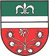
Ardning
|
Ardning
|
||
|---|---|---|
| coat of arms | Austria map | |
|
|
||
| Basic data | ||
| Country: | Austria | |
| State : | Styria | |
| Political District : | Liezen | |
| License plate : | LI | |
| Surface: | 34.16 km² | |
| Coordinates : | 47 ° 35 ' N , 14 ° 22' E | |
| Height : | 696 m above sea level A. | |
| Residents : | 1,212 (January 1, 2020) | |
| Postal code : | 8904 | |
| Area code : | 03612 | |
| Community code : | 6 12 06 | |
| NUTS region | AT222 | |
| Address of the municipal administration: |
Ardning 250 8904 Ardning |
|
| Website: | ||
| politics | ||
| Mayor : | Reinhard Metschitzer ( SPÖ ) | |
|
Municipal Council : ( 2020 ) (15 members) |
||
| Location of Ardning in the Liezen district | ||
| Source: Municipal data from Statistics Austria | ||
Ardning is a municipality with 1212 inhabitants (as of January 1, 2020) in Upper Styria in the judicial district or district of Liezen .
geography
Ardning is located in the Liezen district. The altitude is 696 meters. The total area is 34.16 km². This puts the municipality of Ardning in 39th place among the 51 municipalities in the Liezen district. The Pürgschachen moor , which stretches over a kilometer through the Ennstal, is located in the municipality .
Community structure
The municipality includes the following three localities (residents as of January 1, 2020):
- Ardning (798) including Haindlgraben, Harsbach, Hinterstatt, Lainken, Oberdorf and Unterdorf
- Frauenberg (271) including Forchner and Kulm (with pilgrimage church on the hilltop)
- Pürgschachen (143)
- Ardningalm including the Ardningalm cottage settlement
The municipality consists of the only cadastral municipality Ardning.
Neighboring communities
history
The origin of the community name is disputed. It is not unlikely that “Ardning” is derived from the Slavic word “jar” for “ditch” or “gorge”, which is supported by the geographical location. Ardning was first mentioned in 1077 as "Arnich".
Culture and sights
- Catholic parish and pilgrimage church Frauenberg an der Enns
- Catholic branch church Ardning
economy
- Together with Altenmarkt near St. Gallen , Admont , Landl and St. Gallen, the municipality forms the “Alpenregion Nationalpark Gesäuse ” tourism association . Its seat is in Admont.
politics
The municipal council has 15 members.
- With the municipal elections in Styria in 2000, the municipal council had the following distribution: 10 ÖVP, 4 SPÖ and 1 FPÖ.
- With the municipal council elections in 2005 , the municipal council had the following distribution: 8 SPÖ and 7 ÖVP.
- With the municipal council elections in 2010 , the municipal council had the following distribution: 8 SPÖ, 6 ÖVP and 1 FPÖ.
- With the 2015 municipal council elections , the municipal council had the following distribution: 10 SPÖ, 3 ÖVP and 2 FPÖ.
- With the 2020 municipal council elections , the municipal council has the following distribution: 10 SPÖ and 5 ÖVP.
- mayor
- until 2005 Adolf Koinigg
- 2005-2017 Johann Egger (SPÖ)
- since 2017 Reinhard Metschitzer (SPÖ)
Personalities
Sons and daughters of the church
- Günter Brus (* 1938), action artist and painter
Web links
- 61206 - Ardning. Community data, Statistics Austria .
- Steiermark360, 360 ° panorama Ardning (aerial view)
Individual evidence
- ↑ Statistics Austria: Population on January 1st, 2020 by locality (area status on January 1st, 2020) , ( CSV )
- ^ Grazer Zeitung , Official Gazette for Styria. December 30, 2014, 210th year, 52nd piece. No. 297. ZDB -ID 1291268-2 p. 623.
- ^ Election result of the local council election 2005 in Ardning. State of Styria, March 13, 2005, accessed on July 26, 2020 .
- ^ Election result of the local council election 2010 in Ardning. State of Styria, March 21, 2010, accessed on July 26, 2020 .
- ^ Election result of the 2015 municipal council election in Ardning. State of Styria, March 22, 2015, accessed on July 26, 2020 .
- ↑ Results of the municipal council election 2020 in Ardning. State of Styria, June 28, 2020, accessed on July 26, 2020 .
- ^ Johann Egger (Ardning) Ennstalwiki
- ↑ Reinhard Metschitzer Ennstalwiki


