
Kirchdorf am Inn (Upper Austria)
|
Kirchdorf am Inn
|
||
|---|---|---|
| coat of arms | Austria map | |
 |
|
|
| Basic data | ||
| Country: | Austria | |
| State : | Upper Austria | |
| Political District : | Ried im Innkreis | |
| License plate : | RI | |
| Surface: | 13.49 km² | |
| Coordinates : | 48 ° 18 ' N , 13 ° 17' E | |
| Height : | 335 m above sea level A. | |
| Residents : | 639 (January 1, 2020) | |
| Population density : | 47 inhabitants per km² | |
| Postal code : | 4982 | |
| Area code : | 07758 | |
| Community code : | 4 12 10 | |
| NUTS region | AT311 | |
| Address of the municipal administration: |
Kirchdorf aI 9 4982 Kirchdorf am Inn |
|
| Website: | ||
| politics | ||
| Mayor : | Josef Schöppl ( ÖVP ) | |
|
Municipal Council : (2015) (13 members) |
||
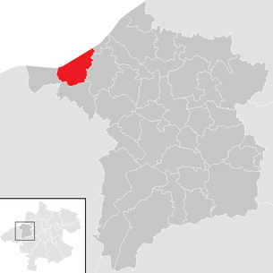
| Location of Kirchdorf am Inn in the Ried im Innkreis district | ||
  |
||
| Source: Municipal data from Statistics Austria | ||

Kirchdorf am Inn is a municipality in Upper Austria in the district of Ried im Innkreis in the Innviertel with 639 inhabitants (as of January 1, 2020). The community is located in the judicial district of Ried im Innkreis .
geography
Kirchdorf am Inn is located at an altitude of 335 m in the Innviertel. The extension is 5.1 km from north to south and 5.1 km from west to east. The total area is 14 km². 7.1% of the area is forested, 61.4% of the area is used for agriculture.
Community structure
The municipality includes the following localities (population in brackets as of January 1, 2020):
- Trench (67)
- Katzenberg (130)
- Katzenbergleithen (35)
- Kirchdorf am Inn (238)
- Pirath (58)
- Simetsham (38)
- Shore (73)
history
Since the founding of the Duchy of Bavaria , the place was Bavarian until 1779 and came to Austria after the Treaty of Teschen with the Innviertel (then 'Innbaiern') . Briefly Bavarian again during the Napoleonic Wars , since 1814 it has finally belonged to Upper Austria.
After the annexation of Austria to the German Reich on March 13, 1938, the place belonged to the Gau Oberdonau . After 1945 the restoration of Upper Austria took place.
coat of arms
Official description of the municipal coat of arms : divided by a blue wavy bar lined with silver wavy strips; Above in silver in the left half of the shield, three green steps, accompanied by three red heraldic roses, two in a row, green below. The community colors are green-white-red.
The three red roses come from the coat of arms of the noble family of Taufkirchen, who resided in Katzenberg. The blue wavy band represents the Inn , the three green steps symbolize the geographic character of the step landscape.
politics
The municipal council has a total of 13 members. Since the municipal council and mayoral elections in Upper Austria in 2015 , all municipal councils in Kirchdorf am Inn have belonged to the ÖVP.
- mayor
- since 2009 Josef Schöppl (ÖVP)
- Since January 1st Mitterbucher Jakob (FPÖ)
Population development
In 1991 the community had 620 inhabitants according to the census, in 2001 it had 630 inhabitants. The increase occurred because the birth balance (+17) made up for the negative balance of migration (−7). From 2001 to 2011, the population decreased to 606 people, as emigration increased and could no longer be offset by the birth balance.
_-_Kirche.JPG)
Culture and sights
- Katzenberg Castle with a bookbinding museum
- Parish Church of the Assumption of Mary : A Gothic tuff stone building with a mighty tower in the southern corner of the choir, a single-nave , three-bay nave and a slightly recessed, two-bay choir (dated 1486). The high altar from the beginning of the 18th century depicts the coronation of Mary and the left side altar from the third quarter of the 17th century depicts the birth of Christ. In the nave there are several tombstones from the 16th and early 17th centuries. The Gothic building was converted to baroque style.
Regular events
- Aufest: since 1984
Web links
- Further information about the municipality of Kirchdorf am Inn (Upper Austria) on the geo-information system of the federal state of Upper Austria .
Individual evidence
- ↑ Statistics Austria: Population on January 1st, 2020 by locality (area status on January 1st, 2020) , ( CSV )
- ^ State of Upper Austria, history and geography, coat of arms. Retrieved April 9, 2019 .
- ^ Province of Upper Austria, results of the 2015 elections. Accessed April 9, 2019 .
- ^ Statistics Austria, A look at the community of Kirchdorf am Inn, population development. Retrieved April 9, 2019 .

Andrichsfurt | Antiesenhofen | Aurolzmünster | Eberschwang | Eitzing | Geiersberg | Geinberg | Belts | Hohenzell | Kirchdorf am Inn | Kirchheim im Innkreis | Lamb rights | Lohnsburg am Kobernaußerwald | Mehrnbach | Mettmach | Mörschwang | Mühlheim am Inn | Neuhofen im Innkreis | Obernberg am Inn | Place in the Innkreis | Pattigham | Peterskirchen | Pramet | Reichersberg | Ried im Innkreis | St. Georgen near Obernberg am Inn | St. Marienkirchen am Hausruck | St. Martin im Innkreis | Schildorn | Senftenbach | Taiskirchen im Innkreis | Tumeltsham | Utzenaich | Waldzell | Weilbach | Wippenham