
St. Martin im Innkreis
|
market community St. Martin im Innkreis
|
||
|---|---|---|
| coat of arms | Austria map | |
 |
|
|
| Basic data | ||
| Country: | Austria | |
| State : | Upper Austria | |
| Political District : | Ried im Innkreis | |
| License plate : | RI | |
| Main town : | This side | |
| Surface: | 8.86 km² | |
| Coordinates : | 48 ° 18 ' N , 13 ° 26' E | |
| Height : | 372 m above sea level A. | |
| Residents : | 2,080 (January 1, 2020) | |
| Population density : | 235 inhabitants per km² | |
| Postal code : | 4973 | |
| Area code : | 07751 | |
| Community code : | 4 12 28 | |
| NUTS region | AT311 | |
| Address of the municipal administration: |
This side 184 4973 St. Martin im Innkreis |
|
| Website: | ||
| politics | ||
| Mayor : | Hans Peter Hochhold ( ÖVP ) | |
|
Municipal Council : (2015) (19 members) |
||
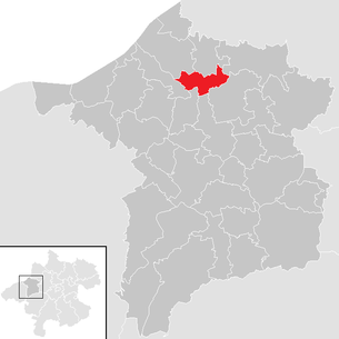
| Location of St. Martin im Innkreis in the Ried im Innkreis district | ||
  |
||
 Parish church hl. Martin and on the left the regional music school |
||
| Source: Municipal data from Statistics Austria | ||

St. Martin im Innkreis (also Sankt Martin im Innkreis ) is a market town in Upper Austria in the Ried im Innkreis district in the Innviertel with 2080 inhabitants (as of January 1, 2020).
geography
The community of St. Martin im Innkreis is around 370 m above sea level. A. in the Innviertel on the western slope of the Troßkolmwald in the Antiesental , approx. 10 km north of the district town of Ried im Innkreis on the Hausruck federal road (B143).
The extension is 3.4 km from north to south and 6 km from west to east. The total area is 8.9 km². 13.5% of the area is forested, 69.7% of the area is used for agriculture.
Districts of the municipality
The municipality includes the following localities (population in brackets as of January 1, 2020):
- Breitenaich (250)
- This side (1235)
- Hofing (8)
- Hoetzlarn (38)
- Beyond (342)
- Karchham (59)
- Koblstadt (91)
- Sindhoring (342)
Cadastral communities are this world (457 ha) and the hereafter (433 ha).
Neighboring communities
| Reichersberg | Place in the Innkreis | Lamb rights |
| Mörschwang |
.svg)
|
|
| Senftenbach | Aurolzmünster | Utzenaich |
Capital of the municipality
| Sankt Martin im Innkreis (place) | |
|---|---|
| Basic data | |
| Pole. District , state | Ried im Innkreis (RI), Upper Austria |
| Judicial district | Ried im Innkreis |
| Pole. local community | St. Martin im Innkreis ( KG St. Martin im Innkreis Diesseits , St. Martin im Innkreis Jenseits ) |
| Locality | This side , the hereafter |
| Coordinates | 48 ° 17 ′ 37 " N , 13 ° 26 ′ 21" E |
| height | 372 m above sea level A. |
| Residents of the stat. An H. | 1271 (2001) |
| Building status | 377 (2001) |
| Post Code | 4973 Sankt Martin im Innkreis |
| Statistical identification | |
| Counting district / district | St.Martin im Innkreis (41 228 000) |
| consists of the parts of this world and the hereafter Source: STAT : Ortverzeichnis ; BEV : GEONAM ; DORIS |
|
The place Sankt Martin im Innkreis consists of the two components this side (the nominal capital) and the hereafter . The place names are to be taken literally, the two parts are - viewed from the castle - on this side and on the other side of the Antiesen .
Today the place has grown together with Breitenaich in the north and Hofing in the south (local parts also municipality Aurolzmünster ) to a street village along the former main road. Breitenaich begins at the Senftenbach near the castle pond, Hofing at the power station, near the train station.
The main town has almost 400 buildings with about 1,300 inhabitants, that is about 2 ⁄ 3 of the community.
history
In 1084 St. Martin was first mentioned as a fief of the Passau bishopric . Around 1150 it was called Ainwicus de sancti Martino 'Village of St. Martin'. The lords of Schwent appear as feudal bearers of St. Martin in 1166.
After the Treaty of Teschen in 1779, the place with the Innviertel (then Innbaiern ) became part of Austria . Briefly Bavarian during the Napoleonic Wars , since 1814 it has finally belonged to Austria ob der Enns . In 1821, the Imperial Counts of Arco-Valley, succeeding the extinct Imperial Counts of Tattenbach, became owners of the dominion of St. Martin, which had already been established in the Middle Ages.
The place became a political municipality in 1850 .
After the annexation of Austria to the German Reich on March 13, 1938, the place belonged to the Gau Oberdonau . Between February and May 1945 the community became a refuge for the world-famous Lipizzaner stallions of the Spanish Riding School . On May 7, 1945, Colonel Alois Podhajsky presented the stallions to the American General George S. Patton in St. Martin to request his protection. After 1945 the restoration of Upper Austria took place.
Population development
In 1991 the community had 1,595 inhabitants according to the census, in 2001 it had 1,693 inhabitants. The increase occurred because both the birth balance and the migration balance were positive. With both remaining positive over the next decade, the population increased to 1,776 in 2011 and further to 2,055 in 2018.
religion
Martinskirche is mentioned for the first time in 1084, but it presumably existed earlier. 1491 is the first mention of a priest in St. Martin. In 1781 the Catholic parish church was made Baroque and the tower was raised. On July 17, 1963 the church tower collapsed, in 1964/1965 the church tower was rebuilt and the main nave was lengthened.
Economy and Infrastructure
traffic
St. Martin is on the Ried-Schärding bus line, has a train station St. Martin in the Innkreis of the (extended) Salzkammergutbahn (Attnang-Puchheim - Schärding) . The Ort im Innkreis motorway junction of the A 8 Innkreis motorway is around 2 kilometers away
Culture and sights
_02.jpg)
- Parish church of St. Martin im Innkreis
- Judenstein on the southern church wall (dated April 17, 1294)
- Baroque castle of the Arco-Zinneberg family with a large park
politics
The community is located in the judicial district of Ried im Innkreis .
Mayor is Hans Peter Hochhold from the ÖVP.
coat of arms
Blazon :
- In gold, a red, semicircular cloak split open by a silver overturned sword with a black handle, with curled ends pointing upwards.
The community colors are white-green.
The coat of arms shows the saint's attribute of St. Martin of Tours .
Sons and daughters of the church
- Urban von Trennbach (1525–1598), Prince-Bishop
- Anton Johann Lipowsky (1723–1780), lawyer and historian
- Thaddäus Ferdinand Lipowsky (1738–1767), civil servant and musician
- Anton Graf von Arco-Valley (1897–1945), Kurt Eisner's murderer
- Matthias Spanlang (1887–1940) Feldkurat, brigade pastor of the 4th Brigade in Linz, pastor of St. Martin im Innkreis, anti-Nazi opponent, murdered on June 5, 1940 in Buchenwald concentration camp
- Gerhard Marschall (* 1952), journalist
- Franz Danksagmüller (* 1969), organist and composer
Web links
- Website of the market town of St. Martin im Innkreis
- Further information about the municipality of St. Martin im Innkreis on the geographic information system of the federal state of Upper Austria .
- Entry on St. Martin im Innkreis in the Austria Forum (in the AEIOU Austria Lexicon )
Individual evidence
- ↑ The official spelling is specified or shown in the list of the municipalities of the Upper Austrian provincial government on the Internet and on Statistics Austria: A look at the municipality . In BEV: Austrian map / Geonam and Labd Upper Austria: DORIS becomes the municipality under St. Martin im Innkreis , the place under Sankt Martin im Innkreis . However, the official place directory of Statistics Austria (2001) lists the municipality under Sankt Martin im Innkreis , only the two cadastral municipalities and the census district are St. Martin (a place of the name is not listed there)
- ^ Province of Upper Austria - Geographical data for the municipality of St. Martin im Innkreis .
- ↑ Statistics Austria: Population on January 1st, 2020 by locality (area status on January 1st, 2020) , ( CSV )
- ^ Norbert Grabherr: Historical-topographical manual of the fortifications and mansions of Upper Austria. Series of publications by the Austrian Working Group on Prehistory and Early History. 1975, p. 102, col. 2
- ^ Statistics Austria, A look at the community of St. Martin im Innkreis, population development. Retrieved April 10, 2019 .
- ^ Province of Upper Austria, results of the 2015 elections. Accessed April 10, 2019 .
- ^ State of Upper Austria, history and geography, coat of arms. Retrieved April 10, 2019 .

Andrichsfurt | Antiesenhofen | Aurolzmünster | Eberschwang | Eitzing | Geiersberg | Geinberg | Belts | Hohenzell | Kirchdorf am Inn | Kirchheim im Innkreis | Lamb rights | Lohnsburg am Kobernaußerwald | Mehrnbach | Mettmach | Mörschwang | Mühlheim am Inn | Neuhofen im Innkreis | Obernberg am Inn | Place in the Innkreis | Pattigham | Peterskirchen | Pramet | Reichersberg | Ried im Innkreis | St. Georgen near Obernberg am Inn | St. Marienkirchen am Hausruck | St. Martin im Innkreis | Schildorn | Senftenbach | Taiskirchen im Innkreis | Tumeltsham | Utzenaich | Waldzell | Weilbach | Wippenham
Cadastral communities: St. Martin im Innkreis Diesseits | St. Martin im Innkreis Beyond
Locations: Breitenaich | This side | Hofing | Hötzlarn | Beyond | Karchham | Koblstadt | Sindhoring
Market place: This side | Village: Beyond | Rotten: Breitenaich • Hofing • Karchham • Sindhöring | Scattered houses: Hötzlarn • Koblstadt | Other locations: Arco-Zinneberg Castle
Counting district: St.Martin im Innkreis