
Pramet
|
Pramet
|
||
|---|---|---|
| coat of arms | Austria map | |
 |
|
|
| Basic data | ||
| Country: | Austria | |
| State : | Upper Austria | |
| Political District : | Ried im Innkreis | |
| License plate : | RI | |
| Main town : | Pramet | |
| Surface: | 13.9 km² | |
| Coordinates : | 48 ° 9 ' N , 13 ° 29' E | |
| Height : | 512 m above sea level A. | |
| Residents : | 1,023 (January 1, 2020) | |
| Population density : | 74 inhabitants per km² | |
| Postal code : | 4925 | |
| Area code : | 0 77 54 | |
| Community code : | 4 12 23 | |
| NUTS region | AT311 | |
| Address of the municipal administration: |
Pramet 35 4925 Pramet |
|
| Website: | ||
| politics | ||
| Mayor : | Eduard Seib ( ÖVP ) | |
|
Municipal Council : (2015) (13 members) |
||
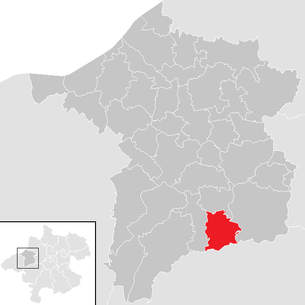
| Location of Pramet in the Ried im Innkreis district | ||
  |
||
| Source: Municipal data from Statistics Austria | ||

Pramet is a municipality in Upper Austria in the district of Ried im Innkreis in the Innviertel with 1023 inhabitants (as of January 1, 2020).
geography
Pramet is located about 7 kilometers south of Ried im Innkreis . It is located on the northern edge of the Hausruck , in the southern Innviertel hill country . The municipality includes the headwaters of the Oberach , a tributary of the Antiesen near Ried.
The extension is 4.5 kilometers from north to south and 5 kilometers from west to east. The total area is 13.95 km². 30.7% of the area is forested and 59.3% of the area is used for agriculture.
Neighboring communities
| Pattigham | ||
| Schildorn |
.svg)
|
Eberschwang |
| Frankenburg am Hausruck ( District Vöcklabruck ) |
Community structure
The cadastral communities are Hartlhof and Pramet .
The municipality includes the following localities (population in brackets as of January 1, 2020):
- Altsommerau (34)
- Ecklham (5)
- Feitzing (20)
- Grosspiesenham (126)
- Guggenberg (11)
- Gumpling (45)
- Gutensham (75)
- Hartlhof (41) including Schwandt
- Kleinpiesenham (34)
- Knirzing (7)
- Kronawitten (6) (also Gem. Schildorn )
- Lungdorf (43)
- Noxberg (52)
- Pramet (423) (main town)
- Rödt (42) (also Gem. Schildorn)
- Blacksmithing (19)
- Windshield lift (40)
The only counting cluster is Pramet .
history
In the municipality, the Noric Roman main road ran from Wels ( Ovilava ) to Burghausen ( Bedaium / Bedacum? ) , The castle stables should originally have been a guard post.
The place name Pramet is mentioned for the first time in writing in a (lost) document, in which King Ludwig the child on August 12, 903 transferred several goods to the cathedral chapter of Passau . At that time there was already a mill and a sawmill in Pramet, as well as all the settlements with the exception of Schwandt, Rödt and Feitzing, which were likely to have emerged later.
According to the oldest Rieder land register from 1446, there was also a bakery, a tavern, a brewery and large fish ponds north of the church from the 15th century. On the way from Ried im Innkreis to Frankenburg am Hausruck , Pramet had, in addition to St. Thomas, the privilege of selling and serving. Bread, meat, beer, wine and schnapps could only be bought in the tavern. Festivities such as weddings or baptisms but also funeral meals should be held there if possible. At the time of the Thirty Years' War (1618–1648) there were no battles here, but the billeting of troops, the evacuation of recruits and the delivery of almost all foodstuffs hit the rural population hard. The events surrounding the Frankenburger dice game , however, hardly affected the local (Bavarian) population. The oldest wooden houses in the community come from the reconstruction after the war around 1650. The community's first documented elementary school was built in 1792, but it was not until 1869 that a general 6-year schooling was enforced in the country.
Since the founding of the Duchy of Bavaria , the place was Bavarian until 1779 and came to Austria after the Treaty of Teschen with the Innviertel (then Innbaiern ) . During the Napoleonic Wars briefly Bavarian again, since 1812 it has finally belonged to the Crown Land of Austria above the Enns. Until 1884, the area of today's municipality of Pramet was integrated into the administrative area of Schildorn . After long and difficult negotiations, the parishes were separated and on June 21, 1884, the first election of the Pramet parish committee was made. The first mayor was Josef Zweimüller.
.jpg)
Around 1920 electricity found its way into Pramet - initially through small private power stations on the streams. In 1929 the post office received its first telephone connection. After the annexation of Austria to the German Reich on March 13, 1938, the place belonged to the Gau Oberdonau . After 1945 the restoration of Upper Austria took place.
In 1968 a new school building (Franz Stelzhamer School) was built and in 1976 a swimming lake was created in Windischhub.
Population development
In 1991 the municipality had 992 inhabitants according to the census, then 986 in 2001 and finally 1008 in 2008. The 2011 census counted 1034 inhabitants.
politics
The community is located in the judicial district of Ried im Innkreis .
Community representation
The distribution of seats since the 2015 municipal council elections :
- 6 mandates of the Austrian People's Party (ÖVP)
- 5 mandates for the Freedom Party of Austria (FPÖ)
- 2 mandates of the Social Democratic Party of Austria (SPÖ)
Mayor is Eduard Seib from the ÖVP.
coat of arms
Blazon :
- In silver a green, rooted linden tree .
The community colors are white-green-yellow .
The representation goes back to the knight's coat of arms of the Pabenschwandter , who were resident in today's municipality. The linden tree as a symbol of the village community and rural culture is also intended to commemorate the dialect poet Franz Stelzhamer , who was born in Großpiesenham . The coat of arms was awarded to the municipality in 1973 after efforts by the then mayor Josef Rohringer. It was designed by Martin Stachl.
Bathing lake parameters
The bathing lake in Windischhub is an approximately 3 hectare reservoir created especially for bathing. It is fed from a few smaller streams. The slight brown coloration of the water is caused by humic substances and is of natural origin.

Culture and sights
- Parish Church of Pramet
- Kulturhaus Stelzhamermuseum Pramet (listed old elementary school)
- Stelzhamerhaus (birthplace) in Großpiesenham
traffic
Street
In the north-south direction, the municipality is traversed by the Frankenburger Landesstraße (L509) , which runs from Ried im Innkreis over the Hausruck to Vöcklamarkt . In the main town of Pramet, Gutenshamer Landesstraße (L1070) branches off to the east and finally ends in Eberschwang , while Schildorner Landesstraße (L1070) leads westwards to Schildorn and on towards Waldzell.
Public transport
(Frankenburg am Hausruck Ried im Innkreis - Neuhofen im Innkreis - Pattigham - Pramet - Schildorn - - Pramet) Pramet is the Monday to Friday by the Postbus-line 851 OÖVV to the district capital of Ried im Innkreis linked.
Personalities
- Franz Stelzhamer (1802–1874), poet and novelist, born in Großpiesenham
- Vinzenz Freiherr von Fox (1859–1931), kuk general of the infantry , died in Pramet No. 5
- Hans Schatzdorfer (1897–1969), dialect poet, born and died in Großpiesenham
literature
- Ferdinand Binder: Pramet. Ünsa Gögnd and from us. Self-published by the municipality of Pramet, 1983.
Web links
- Web portal of the municipality (pramet.at)
- Entry on Pramet in the Austria Forum (in the AEIOU Austria Lexicon )
- 41223 - Pramet. Community data, Statistics Austria .
- More information about the municipality of Pramet on the geographic information system of the federal state of Upper Austria .
- Map in the Digital Upper Austrian Room Information System ( DORIS )
Individual evidence
- ↑ Statistics Austria: Population on January 1st, 2020 by locality (area status on January 1st, 2020) , ( CSV )
- ↑ Lit. 1100 years of Schildorn . Homeland book. 2003, 2 From the story of Schildorn , p. 10 ff . ( eReader ).
- ^ Document Book II, p. 47/48, in O.Ö. State Archives.
- ^ Herbert Erich Baumert: The coats of arms of the cities, markets and communities of Upper Austria (4th supplement 1973–1976). In: Oberösterreichische Heimatblätter, Heft 1/2, 1977, p. 22, online (PDF; 3.5 MB) in the forum OoeGeschichte.at
- ↑ Kulturhaus Stelzhamermuseum Pramet (stelzhamermuseum.com)
- ^ Road map of Upper Austria with coloring of the road maintenance depots. (PDF) Retrieved February 3, 2019 .
- ↑ Timetable for line 851 of the Upper Austrian Transport Association. (PDF) Retrieved February 3, 2019 .

Andrichsfurt | Antiesenhofen | Aurolzmünster | Eberschwang | Eitzing | Geiersberg | Geinberg | Belts | Hohenzell | Kirchdorf am Inn | Kirchheim im Innkreis | Lamb rights | Lohnsburg am Kobernaußerwald | Mehrnbach | Mettmach | Mörschwang | Mühlheim am Inn | Neuhofen im Innkreis | Obernberg am Inn | Place in the Innkreis | Pattigham | Peterskirchen | Pramet | Reichersberg | Ried im Innkreis | St. Georgen near Obernberg am Inn | St. Marienkirchen am Hausruck | St. Martin im Innkreis | Schildorn | Senftenbach | Taiskirchen im Innkreis | Tumeltsham | Utzenaich | Waldzell | Weilbach | Wippenham
Cadastral communities: Hartlhof | Pramet
Locations: Altsommerau | Ecklham | Feitzing | Großpiesenham | Guggenberg | Gumpling | Gutensham | Hartlhof | Kleinpiesenham | Knirzing | Kronawitten | Lungdorf | Noxberg | Pramet | Rödt | Schmieding | Windischhub
Villages: Großpiesenham • Gutensham • Pramet | Hamlet: Feitzing | Rotten: Altsommerau • Guggenberg • Gumpling • Kleinpiesenham • Knirzing • Lungdorf • Noxberg • Schwandt • Windischhub | Scattered houses: Hartlhof • Rödt • Schmieding | Other locations: Ecklham • Kronawitten
Counting district: Pramet
